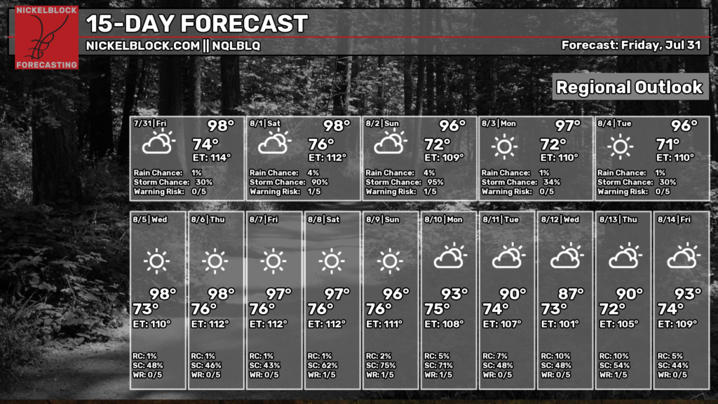
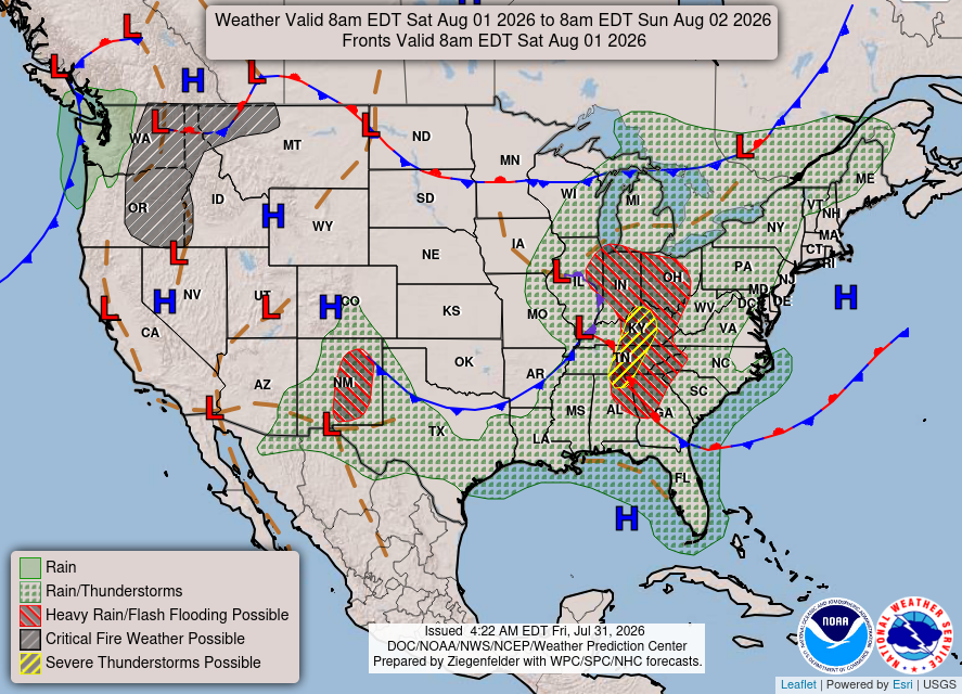
From tomorrow through Sunday, we will have a cold front passing through our area. Hopefully, the front will bring us some relief from the extremely warm temperatures we’ve been experiencing. Unfortunately for us, the relief won’t last long. Looks like the future holds more warmth for us, as we will see a ridging pattern in the south next week. As for now, let’s enjoy the last couple of weeks of summer!


Today
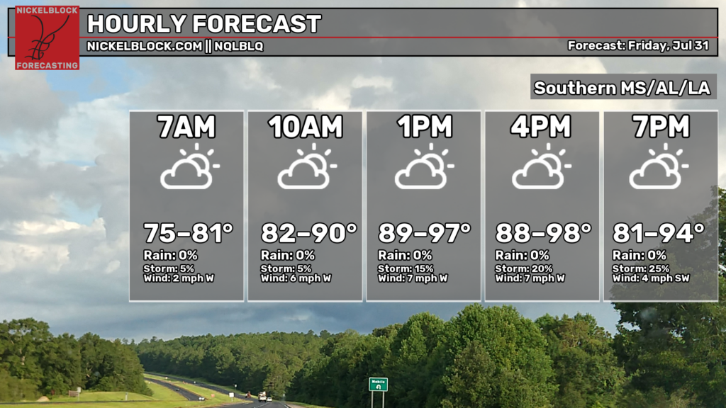
It’s going to be warm and feel muggy out, with highs in the upper 90s around late afternoon. The chances of thunderstorms will increase throughout today. Relatively calm winds are coming out of the west-southwest, ranging from 2 to 7 mph.
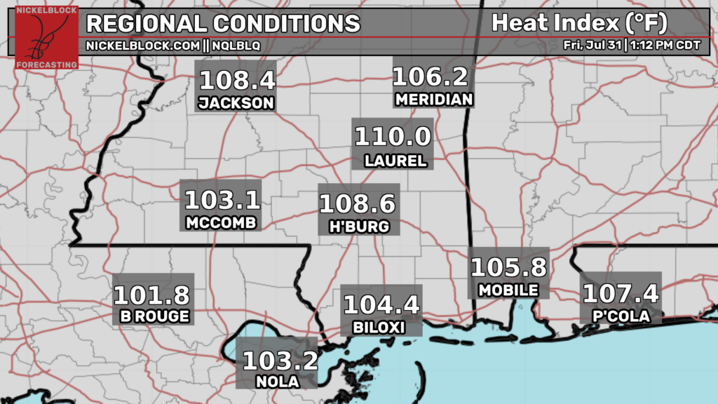
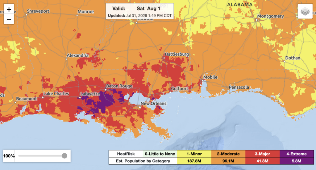
Temperatures outside already feel like the triple digits across our entire area. Make sure to stay hydrated, have somewhere to cool down (preferably A/C), take breaks from outdoor activities, and look out for your peers and pets!
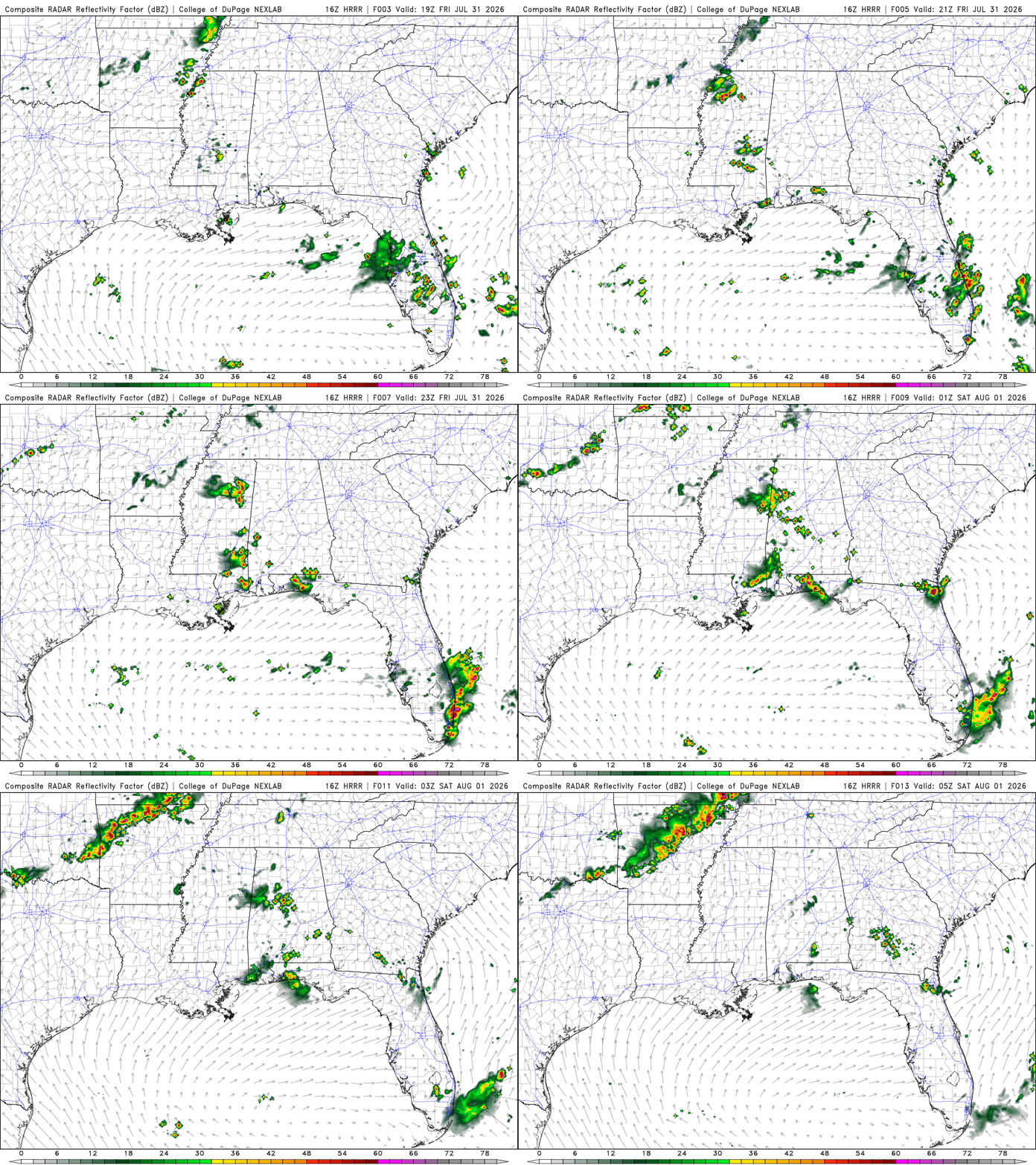
Looking at our precipitation, southeastern LA could see isolated showers and thunderstorms. Scattered showers and thunderstorms will move into southern MS and AL from the northwest around late evening into the nighttime hours. Localized flash flooding is possible tonight.
Tomorrow
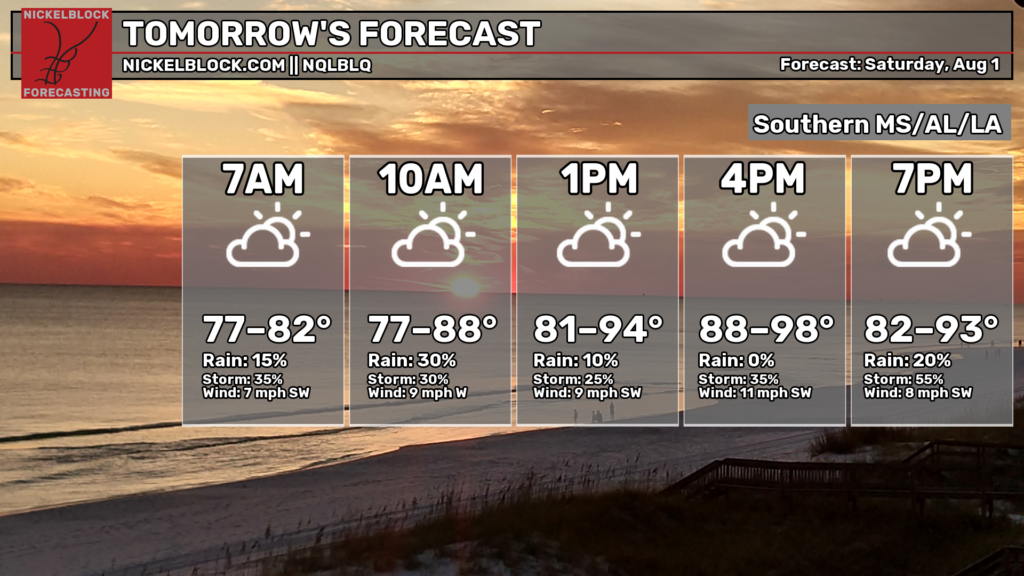
More warmth and mugginess, with highs in the upper 90s around late afternoon. The chances of thunderstorms will fluctuate throughout the day. Breezy winds are coming out of the south-southwest, ranging from 7 to 11 mph.
The heat is still a concern for our area, especially in southeastern LA. Take care of yourselves, your peers, and your pets while outside in the summer sun!
Isolated to scattered showers and thunderstorms are possible. As the cold front in AR and northern TX moves into our area, showers and thunderstorms will form along the boundary. Isolated flash flooding is possible.

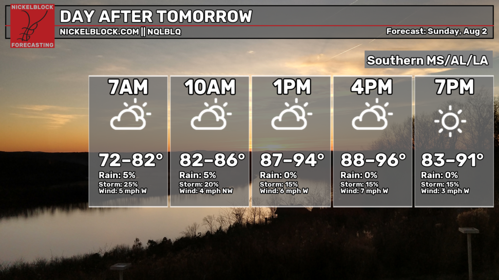
Sunday
While it will still be warm and muggy, the cold front will bring some relief into the area. Highs will be in the mid-90s around late afternoon. The chances of showers and thunderstorms remain relatively low. Calm winds are coming out of the west-northwest, ranging from 3 to 7 mph. We see that change of wind direction once a cold front passes through from SE/ SW to NE/NW.

Extended Forecast
The CPC outlook indicated that our area would experience above-average temperatures and near-normal to slightly below-average precipitation.


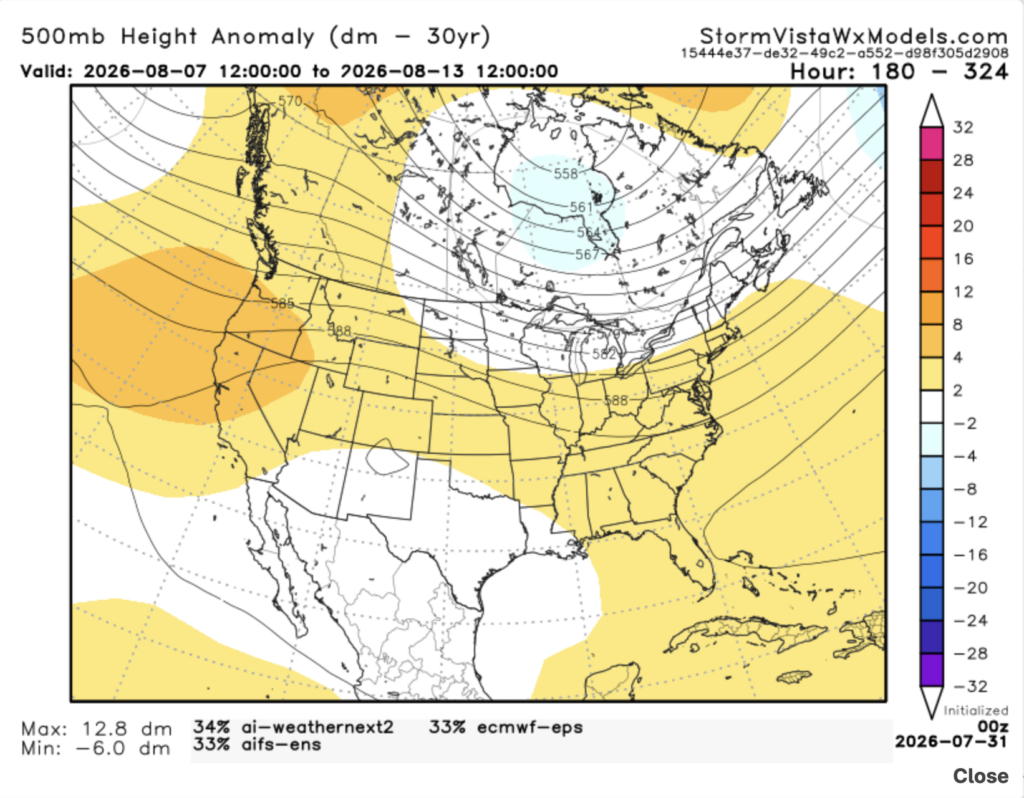
This 500mb height anomaly model has a blend of the 3 most accurate models over the past 7 days. The model runs from August 7, 7 am to August 13, 7 am. Based on the blend, I would probably agree with CPC. There is a large area of positive anomalies that stretches across the country. This indicates a ridging pattern. For our area, we will experience heat dome conditions, which will bring very warm, humid air. The reason for the humidity is the Gulf feeding our area with moist air. The moist Gulf air could lead to isolated showers and storms, especially during the afternoon and evening hours.