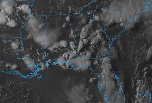
Invest 92L is very disorganized and still over land so development isn’t anticipated during the next 24 hours // Courtesy: College of DuPage MEteorology
That’s right, Invest 92L, the piece of tropical riff-raff finally has a designation. Invest 92L is what the National Hurricane Center will refer to this little thing until it organizes itself into a Tropical Depression or Tropical Storm.
Unless they NHC decides to go with the Potential Tropical Cyclone designation.
Before we begin, I do want to put out a disclaimer that computer weather models don’t tend to do well with specifics when a tropical system hasn’t even formed yet. So, if you are reading this hoping to find out exactly how much rain will fall at your house, where the storm will go exactly, or how strong this thing will eventually become.. You may want to find another site that is willing to lie to you.
Because no one can know those things at this point.
If you want to get a general idea about what is in the realm of possibility, how to prepare, and the explanations behind why certain things are happening in certain ways…. READ ON!
Model data continues to come in and now that the NHC has designated the area of interested as an Invest, that means even more data will start to come in as we move through tonight.
The Models
Model guidance continues to waffle between the models. Forecast track is starting to come into agreement, but there are still little discrepancies between the “big three” global models. And the ‘spaghetties’, as I call them, have different outcomes, too
Spaghetti model guidance for Invest 92L // Courtesy: Tropical Tidbits
Notice that the Spaghetti models keep the system close to shore. A cluster of the spaghetties go toward Houston. Another toward the Louisiana coast.
The European is still adamant that this system is going to be nudged father west by a stout ridge off the coast of Florida. The Euro takes Invest 92L all the way to Texas.
The GFS (the upgraded FV3) has the system hug the coast while drifting west along the northern Gulf. The GFS takes it as far as Louisiana before it turns north.
The Canadian model – which doesn’t handle tropical systems well, historically, but recently got a big upgrade, so I’m including it to see how it fairs – shows the system moving to the west like the GFS and then sliding north in Mississippi.
Canadian model shows loosely-organized system south of the Mississippi / Louisiana coast Friday morning // Courtesy: Pivotal Weather
Each model shows the system organize itself and strengthen to a low-end Tropical Storm – the name would be Barry – before moving it ashore.
Why the differences?!
It boils down to the strength of the ridge of high pressure in the Atlantic. You may have heard of the Bermuda High over the years, that is the ridge we, as meteorologists, are watching.
Invest 92L versus the 1016-Line from the ridge of high pressure to the east // Blank map Courtesy: Pivotal Weather
The crudely-drawn map above highlights the quick difference (in general) between the European model (Euro), the Canadian model (CMC), and the American model (GFS). The lines mark how far to the west the 1016 surface pressure isobar is located. The farther to the west the line is located, the stronger and larger the ridge of higher pressure is to the east.
Notice that the European line is the farthest west. And the GFS is the farthest east.
That is going to dictate how far to the west that Invest 92L goes. Think of the 1016 line as the ‘guide’ for where Invest 92L will follow. Line more west? Invest 92L goes more west! Line more east? Invest 92L stays more east.
It isn’t just that one thing that will dictate where Invest 92L goes, but it is one of the bigger deciders.
So which model is right?
At this point? None of them. I don’t know that any model has a ‘good’ handle on what will happen with Invest 92L. However, I think some of the models are more ‘believable’ than others.
I think the Euro is the least believable in this situation. If the ridge is to grow that strong, I don’t think that Invest 92L will be able to make it that far south into the Gulf given the relative strength of the ridge to the west (we haven’t talked about this one in this write-up, but it has been mentioned previously). And if the ridge to the west is strong enough to kick it that far south into the Gulf, the likelihood of the ridge to the east is strong enough to kick Invest 92L all the way to Texas isn’t as likely.
Keeping up? I know this stuff can get hard to follow. I totally recognize that sometimes you are reading this going, “I’m sorry, what now?!”
The GFS seems believable to me and I think the spaghetties are also on-board with a similar outcome. Invest 92L is nudged west, along the coast, riding a weakness between the two ridges. I actually think this is the most likely scenario, even though it may not be the most believable. Counter-intuitive, I know.
The Canadian, honestly, seems the most believable… and, possibly, the most unlikely. This may sound crazy to read, because “most believable” and “most likely” are often interchangeable, but this time I don’t think so.
The Canadian highlights the most believable outcome with Invest 92L drifting into the Gulf – between the two ridges – and waffling around until a mid-level front swings through and pulls it back north across parts of Louisiana and Mississippi.
And while this is the most believable, I think it is the least likely option because I don’t think any model is honed in on the actual track yet. Because there is one variable that will play out as a big driver of track in this storm: strength.
And the eventual strength of Invest 92L is going to be a function of a lot of different factors, but leading that list will be the Gulf of Mexico water temperatures. And none of the models handl that well at all.
The Canadian develops it into a decent Tropical Storm. Other model guidance disagrees with that.
Invest 92L intensity model guidance // Courtesy: Tropical Tidbits
And because track – in my opinion – is going to be heavily dictated by strength, I am currently not in the boat of ‘this model knows where Invest 92L is going to go’ yet.
The ‘I don’t want to read all that stuff’ forecast
We don’t really know that much about specifics at this time. The National Hurricane Center is feeling pretty confident that there will be some sort of development in the Gulf, but beyond that, the door is still open for multiple possibilities.
Could it become a Tropical Storm? Sure. A hurricane? that’s possible, but not likely. A major hurricane? That is unlikely but not impossible.
impacts
Rain? A lot of rain. As this thing meanders around in the Gulf it is likely going to fling showers and storms north and along the Gulf Coast states. So even if it moves ashore near Texas, places from the Florida panhandle to Texas are likely to see rain associated with Invest 92L.
How much rain? That is one of those specifics we can’t know quite yet. But anywhere from two to six inches of rain will be possible between Tuesday and Sunday along the Gulf Coast. Some places will likely see much more, others not as much. We just don’t know more than that right now.
Wind? Sure. For the areas that are the absolute closest to the center of Invest 92L. But for everyone else, not really.
Storm Surge? This is one of those ‘we can’t know this yet’ things.
How strong will it be?
We can’t know that yet. Sadly our ability to place a storm exceeds our ability to know how strong it will be when it gets there.
Timeline
Between Wednesday morning and Sunday night, depending on your location. That is the best we can do right now with any sort of confidence.
From the NHC
Tropical Weather Outlook
NWS National Hurricane Center Miami FL
800 PM EDT Mon Jul 8 2019
For the North Atlantic…Caribbean Sea and the Gulf of Mexico:
7/8/19 8PM forecast from the NHC // Courtesy: nhc.noaa.gov
1. A trough of low pressure located over south-central Georgia is producing disorganized showers. This disturbance is expected to move southward or southwestward during the next day or two, and a broad area of low pressure is forecast to form over the northeastern Gulf of Mexico on Wednesday. Environmental conditions are expected
to be conducive for development and a tropical depression is likely to form by the end of the week while the low moves slowly westward across the northern Gulf of Mexico. Regardless of whether or not a tropical cyclone develops, this system has the potential to produce heavy rainfall along portions of the northern and eastern U.S. Gulf Coast later this week. For more information about the rainfall threat, please see products issued by your local weather forecast office and the NOAA Weather Prediction Center. Interests along the Gulf Coast from the Upper Texas coast to the western Florida peninsula should monitor the progress of this system.
* Formation chance through 48 hours…low…30 percent.
* Formation chance through 5 days…high…80 percent.
What should I do now?
Check your Hurricane Preparedness Kit. That’s about it. Make sure you have enough supplies to last a few days without power and water.
Not because this system is anticipated to wipe out power and water to an area, but rather, you should always have enough supplies to last a few days without power and water during Hurricane season.
Author of the article:
Nick Lilja
Nick is former television meteorologist with stints in Amarillo and Hattiesburg. During his time in Hattiesburg, he was also an adjunct professor at the University of Southern Mississippi. He is a graduate of both Oregon State and Syracuse University that now calls Houston home. Now that he is retired from TV, he runs this site and its app in his spare time.