As we settle back into a typical summertime pattern, we will have one or two hiccups to that pattern during the next seven days.
I know the big question is: “Will rain ruin my Fourth of July?”
The short answer is, “Maybe.” The longer answer is, “Probably not, but defintiely have a back-up plan to hang inside while storms pass.”
The complete answer is….
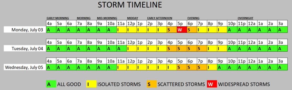
Because “A picture is worth a thousand words.”
The even bigger picture? Well, it needs some further explanation.
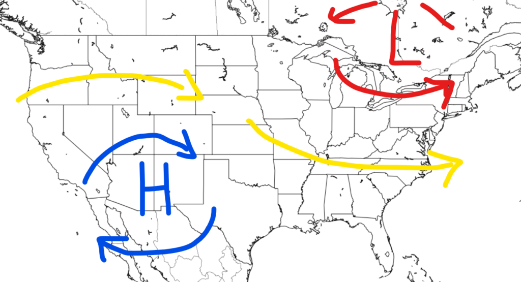
As ridging builds in across the West, we will be left with some low-key troughing in the Great LAkes and Northeast. This will leave our area – while under a weak ridge to our southeast – in a bit of a northwest flow (the yellow line on the map above)
Between October and May that is a dry pattern. But in June, July, August and September, that often means a better chance for storms because we are closer to the storm track.
And the days we will see a better shot for rain – after today – are likely Wednesday and Thursday.
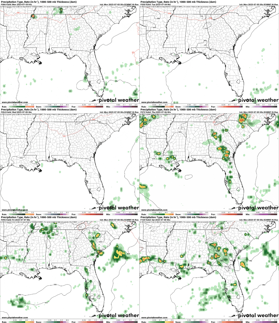
And then we may get another shot for rain in here over the weekend.
REGIONAL WEATHER MAPS
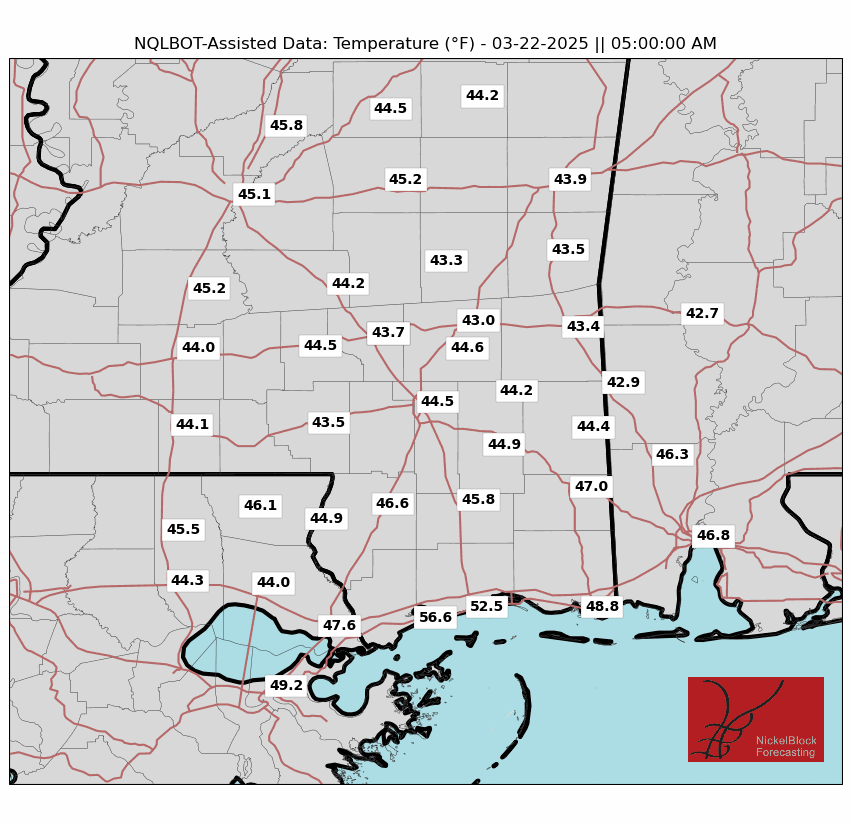
We continue to work on these regional weather maps. If there is any data you’d like to see, let us know!
Select Data Set:
REGIONAL DAY TO DAY FORECAST
Today: Mostly sunny. A chance of showers and thunderstorms this afternoon. Highs in the mid 90s. Southwest winds 5 to 10 mph. Chance of rain 40 percent. Heat index values up to 105.
Tonight: Mostly cloudy with a stray shower or storm possible. Humid with lows in the mid 70s. South winds 5 to 10 mph. Chance for rain around 10 percent.
Independence Day: Partly sunny with storms possible. Humid with highs in the lower 90s. Southwest winds 5 to 10 mph. Chance of rain 40 percent. Heat index values up to 105.
Tuesday Night: Mostly cloudy. A chance of showers and thunderstorms in the evening. Lows in the mid 70s. Southwest winds 5 to 10 mph. Chance of rain 30 percent.
Wednesday: Partly sunny with afternoon storms possible. Humid with highs in the lower 90s. West winds around 5 mph. Chance of rain 60 percent.
Wednesday Night: Mostly cloudy with overnight storms possible.. Lows in the mid 70s. Chance of rain 20 percent.
Thursday: Mostly sunny with a few storms possible. Highs in the lower 90s. Chance of rain 40 percent. Heat index values up to 105.
Thursday Night: Mostly cloudy. A chance of showers and thunderstorms, mainly in the evening. Lows in the lower 70s. Chance of rain 20 percent.
Friday: Partly sunny with storms possible. Highs in the lower 90s. Chance of rain 30 percent. Heat index values up to 105.
Friday Night: Mostly cloudy. Lows in the lower 70s.
Saturday: Mostly sunny with storms possible. Highs in the mid 90s. Chance of rain 30 percent. Heat index values up to 110.


