With hope most of us will stay dry for the Fourth of July this year. Scattered showers and thunderstorms will be possible across much of our area, with one or two potentially being severe. Overall, pretty seasonal conditions with average temperatures and the potential for scattered thunderstorms across much of the Southeast and Gulf Coast. Kind of a plain forecast today with overall consistent conditions in the short and long term.
Today and Tomorrow
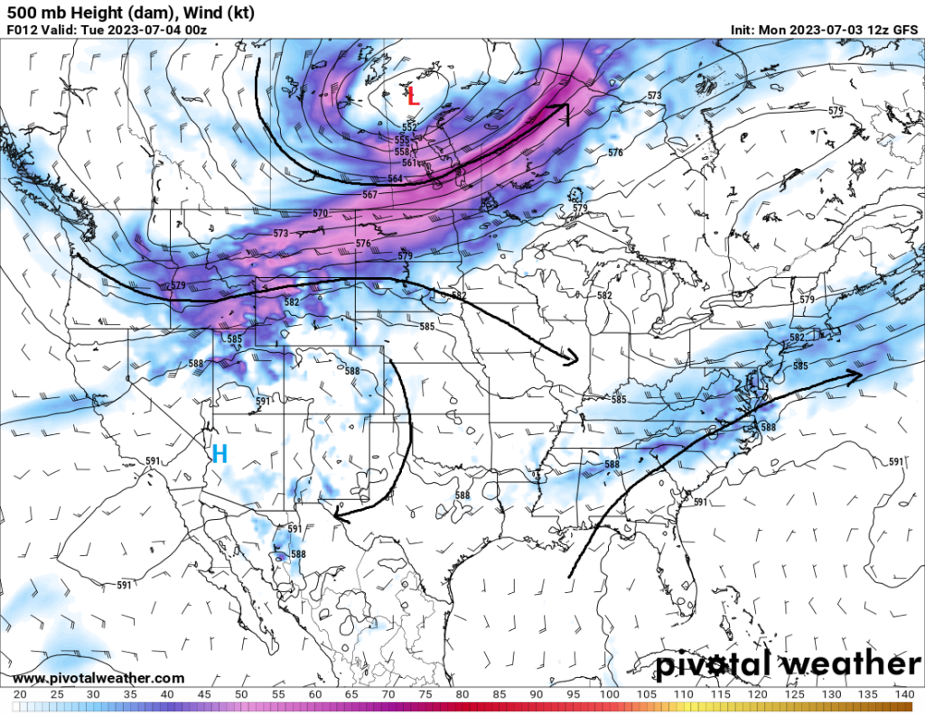
Bit of a different setup synoptically this go-around in the upper levels, with really weak movement up aloft. For us down at the surface, what this means is the placement and development of showers and thunderstorms will largely depend on mesoscale factors (i.e. sea-breeze boundary placement, existing outflow boundary placement, etc.) as well as general height falls. Interestingly enough, some of these storms may be triggered (if not for the aforementioned processes) by reaching a parcel’s convective temperature. Quite literally just the sun heating the ground enough that the parcel will rise unabated and develop into a pulse storm. Some of these storms may become severe, with the main risk being large hail and damaging downburst winds, but the overall chance is low. Otherwise today, as well as tomorrow, temperatures across the area will average in the upper 80s to low 90s.


Extended Outlook
Getting into the back half of the week and early next week, conditions will largely remain the same. Not a lot of movement will occur in the upper-levels to really change a whole lot on a large scale. High pressure off to the west over Texas will slowly try to build and creep eastward towards our area by Sunday, but not enough to really make any significant changes to what we will experience in the coming days. One noticeable change may be a slight increase in the temperature by early next week, but not strong enough to get us roasting or suppress storm development.
REGIONAL DAY-TO-DAY FORECAST
Today: Mostly cloudy, with a slight chance of showers and thunderstorms. High temperatures in the upper 80s to low 90s. Chance of rain 40%
Tonight: Mostly cloudy, with a slight chance of showers and thunderstorms. Low temperatures in the upper 70s to low 80s. Chance of rain 30%.
Wednesday: Partly cloudy skies, with a slight chance of showers and thunderstorms. High temperatures in the upper 80s to low 90s. Chance of rain 30%.
Wednesday night: Partly cloudy skies, with a thunderstorm or two possible. Low temperatures in the upper 70s to low 80s. Chance of rain 20%.
Thursday: Partly cloudy skies, with a slight chance of showers and thunderstorms. High temperatures in the upper 80s to low 90s. Chance of rain 40%.
Thursday night: Partly cloudy skies, with a slight chance of showers and thunderstorms. Low temperatures in the upper 70s to low 80s. Chance of rain 30%.
Friday: Partly cloudy skies, with a slight chance of showers and thunderstorms. High temperatures in the upper 80s to low 90s. Chance of rain 30%.
Friday night: Partly cloudy skies, with a slight chance of showers and thunderstorms. Low temperatures in the upper 70s to low 80s. Chance of rain 30%.
Saturday: Partly cloudy skies, with a slight chance of showers and thunderstorms. High temperatures in the upper 80s to mid 90s. Chance of rain 30%.
Saturday night: Mostly clear skies, with a thunderstorm or two possible. Low temperatures in the upper 70s to low 80s. Chance of rain 20%.
Sunday: Sunny skies, with a thunderstorm or two possible. High temperatures in the lower 90s to upper 90s. Chance of rain 20%.
Sunday night: Mostly clear skies, with a thunderstorm or two possible. Low temperatures in the upper 70s to low 80s. Chance of rain 20%.
Monday: Sunny skies, with a thunderstorm or two possible. High temperatures in the lower 90s to upper 90s. Chance of rain 20%.


