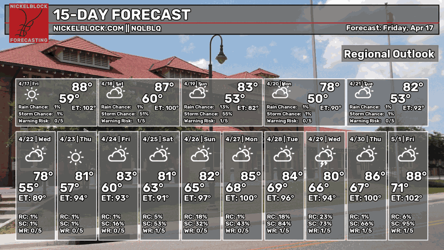
We’re going to reach record highs in some areas this weekend as the high pressure dome rears its ugly head one more time before a low pressure system moves it out. We won’t expect a lot of rain, but it’ll be beneficial nonetheless. Afterwards, we’ll cool down a bit! We’ll fall back into the 70s and eventually the low 80s next week, so it’ll feel a little more like Spring.

Today
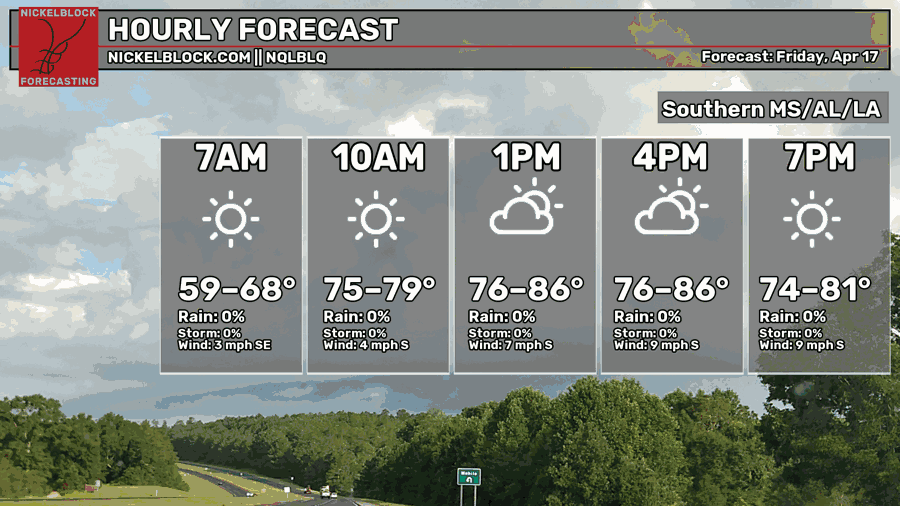
We’ll have a warm day ahead with highs in the mid to upper 80s. A few clouds are likely in the afternoon, however overall conditions will be warm and humid. Winds will pull out of the south around 5-10mph. Overnight, temperatures will fall into the mid 60s.

Tomorrow
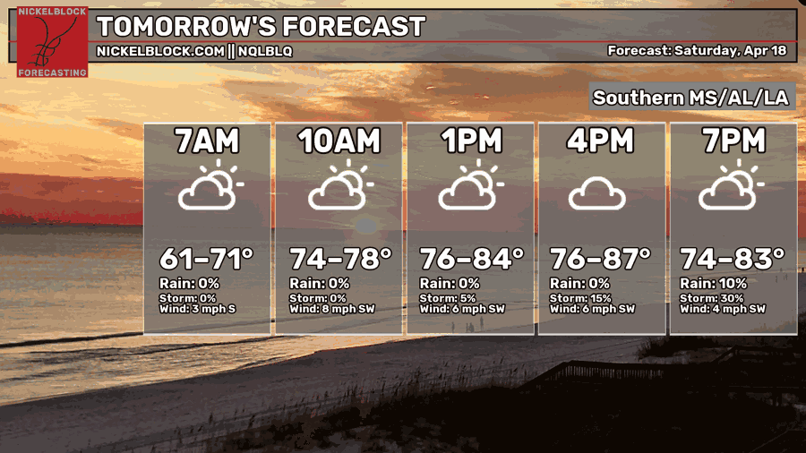
Increasing clouds are coming in with the cold front tomorrow evening. It’ll be another warm day ahead with a high in the mid to upper 80s. We won’t expect the rain until the evening hours, and it will continue on overnight. The developing cells ahead of the front don’t look promising for severe weather, however I believe we’ll see some thunderstorms develop ahead of the main front. Afterwards, it’ll be scattered rain showers and thunderstorms.
Sunday

Expect a rainy and blustery morning with the rain lingering into the mid-morning hours. If you’re headed to church in the morning, grab your rain jacket! Afterwards, it’s going to be a partly cloudy and cooler day with a high in the low 70s. The winds will persist, however, so keep a jacket on you. Overnight, the temperatures will dip into the upper 40s, so there might be one more night you have to run the heater.
Next Week
Temperatures will float between the upper 70s and low 80s next week after the high pressure system builds in. Lows will stay in the low 50s and eventually climb towards the upper 50s by the end of the week. We’ll see a quick dip in temperatures towards the upper 70s by Wednesday with an incoming dry front.
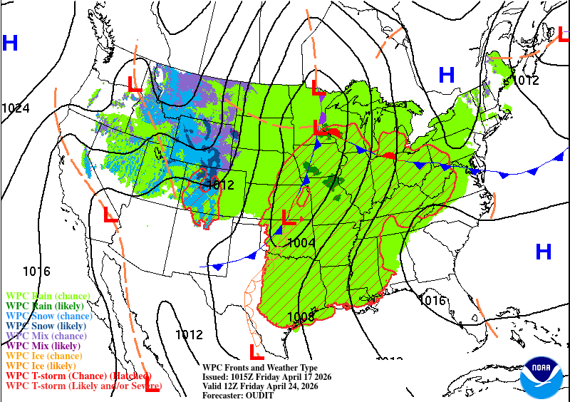
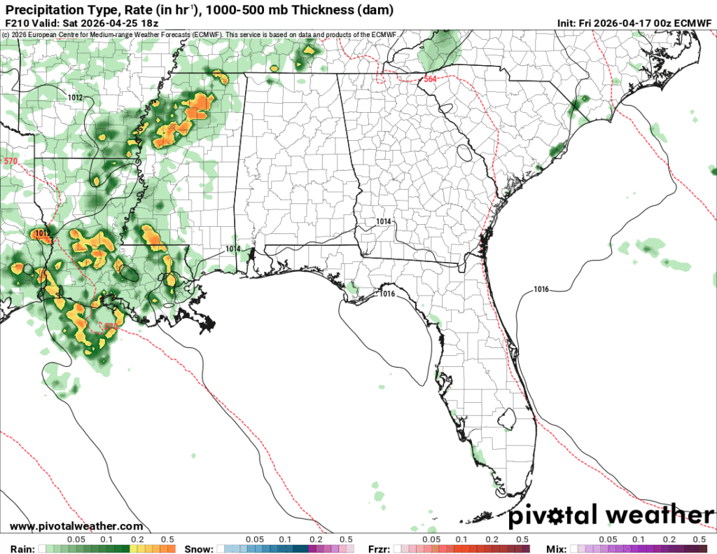
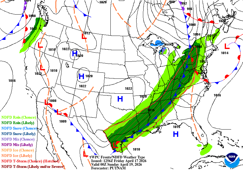
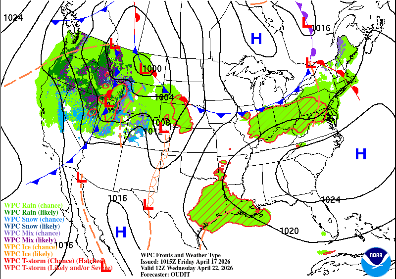
Looking at the maps above, a large two-piece low will move in towards the Gulf South by Saturday allowing more rain to move in. Hooray! Right now, the GFS and ECMWF models differ on timing, but do agree that rain will be moving in Saturday into Sunday. Temperatures and dewpoints will increase indicating that there could be some thunderstorm development along with this. Another chance for rain is possible into the early part of the next week as well, so we may see more frequent rain in the next few weeks.