The heat and humidity will continue to rise as the front that’s bringing us the rain stalls out over us! It’ll contribute to a few strong thunderstorms overnight into Saturday and some lingering storms by next week. Overall, it’s going to be warm and humid as the front hangs around until it moves out by late next week. Let’s take a look!

Friday and Saturday’s Setup
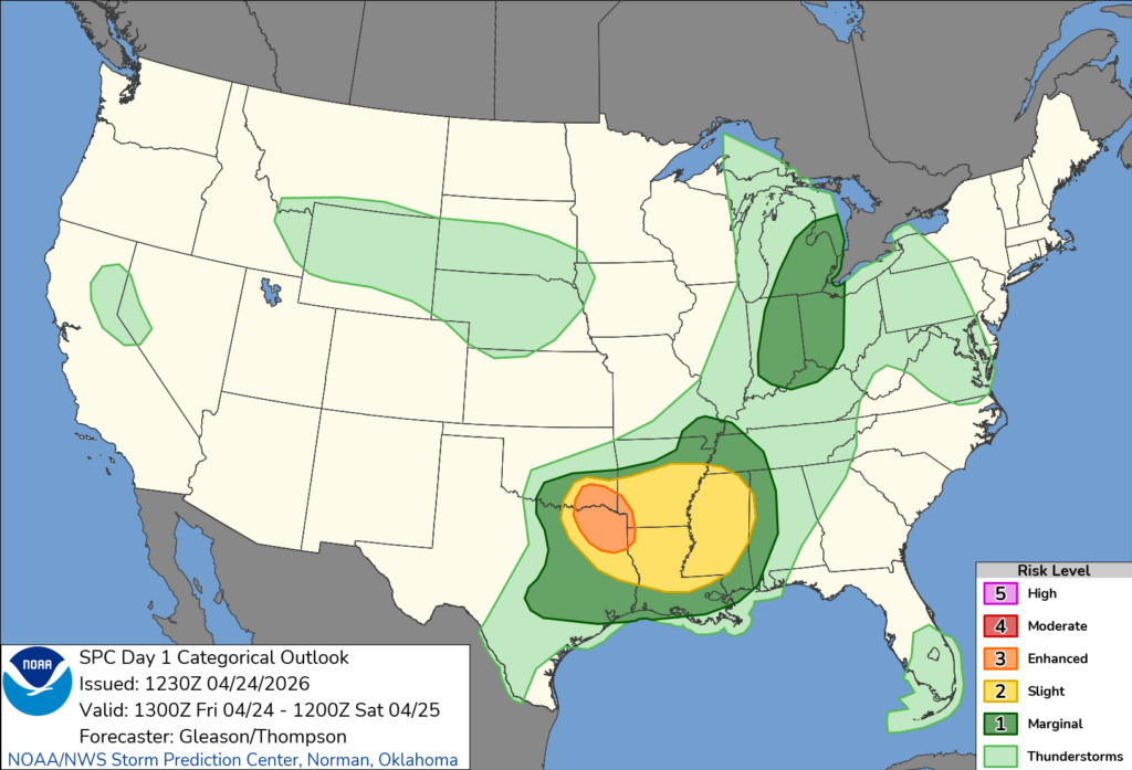
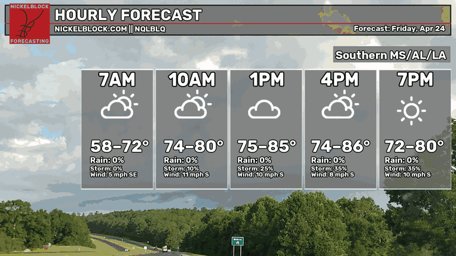
Starting off today, the fog has lifted in most areas, however the cloud cover will remain as more low level clouds move in from the Gulf stream and mid-level clouds move in. The good news is that if you have Friday evening plans, most of us will be in the clear. For some of you in northern Mississippi, the line of thunderstorms will move in during the evening hours. The Storm Prediction Center and Weather Prediction Center maps show the highest risk for severe weather around the ArkLaTex area with a slight risk (2/5) across most of MS/LA/AR.
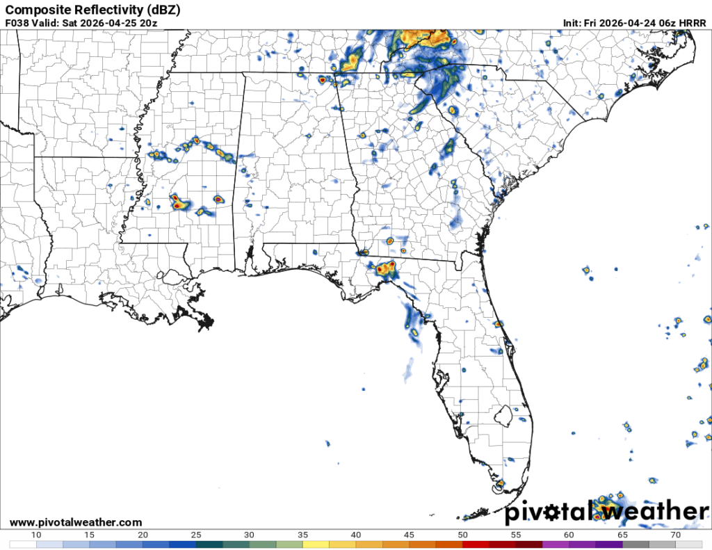
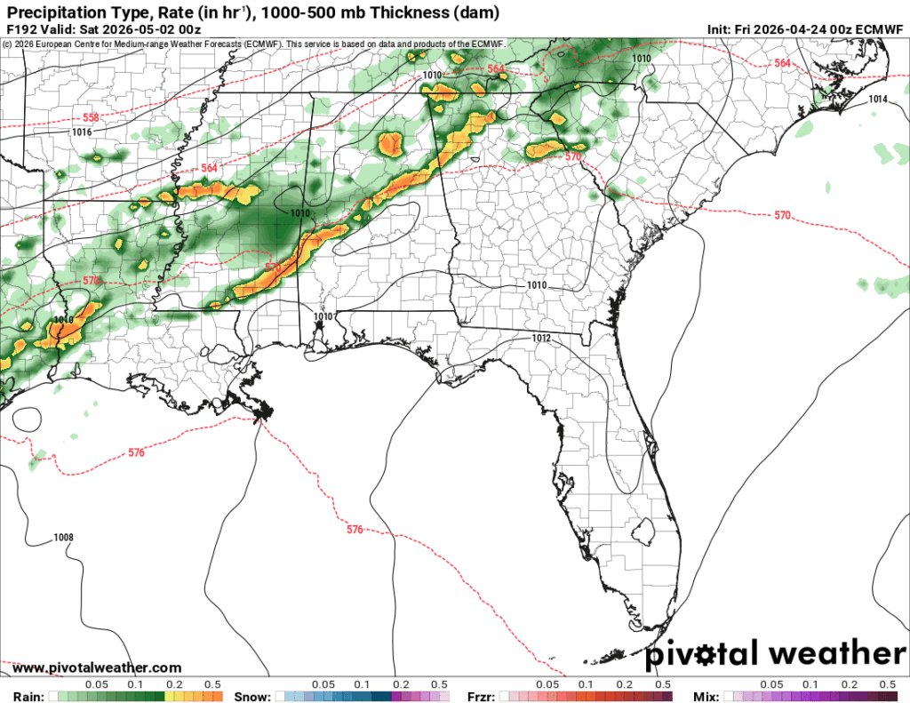
Looking at the composite reflectivity from the HRRR model, the storms will move into the Memphis and north Mississippi Delta in the late evening and central MS before midnight. Two separate segments of storms will move in bowing out allowing for strong winds, hail and a possible tornado to develop. The first segment begins to weaken and the second one behind it moves in allowing for a few more storms to develop in the early morning hours. While the system itself is weakening, we may still see some strong storms as it moves into the Pine Belt. The first round of rain for us in the Pine Belt and Gulf Coast will move out by mid-morning, however we’ll see some on and off showers move in by the afternoon.
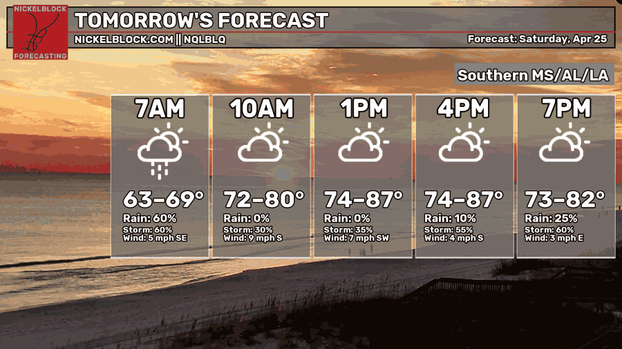
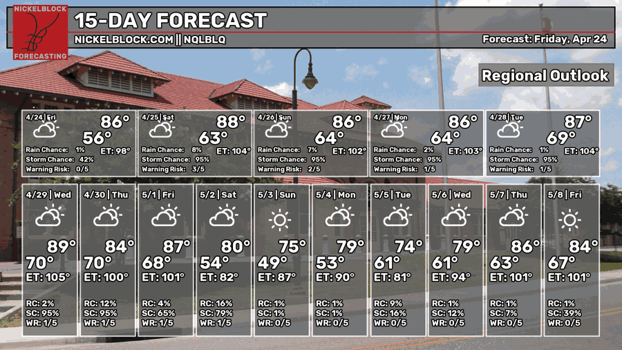
A few scattered showers and thunderstorms are possible across much of Mississippi and Alabama Saturday afternoon. None of these cells look to be severe, however they might ruin your outdoor plans. It’ll be a very warm one with highs in the mid to upper 80s, so dress accordingly as the humidity will keep things muggy during the day.

Sunday
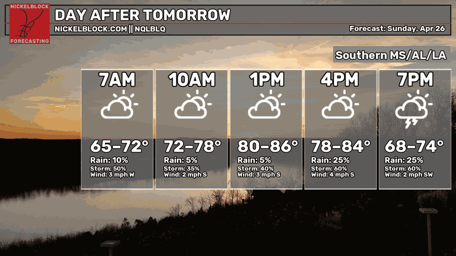
It’s going to be another on/off rain chance for Sunday as another round of showers moves in during the afternoon and evening. A few thunderstorms are possible. It’s going to be another warm and humid day with a high in the upper 80s and a low in the mid 60s.
A Taste of Summer Next Week

^ That’s my current mood about next week’s conditions.
Warm, sticky, and rainy. Highs in the upper 80s and lows creeping into the 70s.

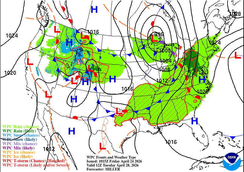
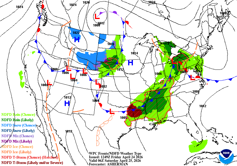
Alright, alright, let me get the forecast going before I post more memes. Looking at the WPC map above, we’re a bit stuck between a large high pressure system and several lows trying to move eastward into the Southeast. The largest contributing factor to next week’s storms is the constant inflow of Gulf moisture. As the fronts move closer, it’ll allow for very warm and humid air to move in and the low will have plenty to feed off to send more showers and thunderstorms our way. Afternoon showers will be prevalent Monday through Thursday before the main system moves in Friday and Saturday. Some other good news is that this will add more rain to start busting the drought.
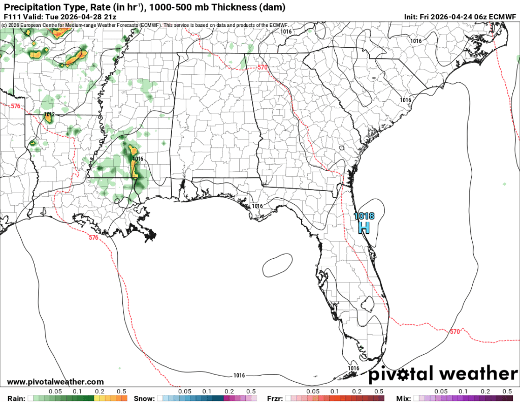
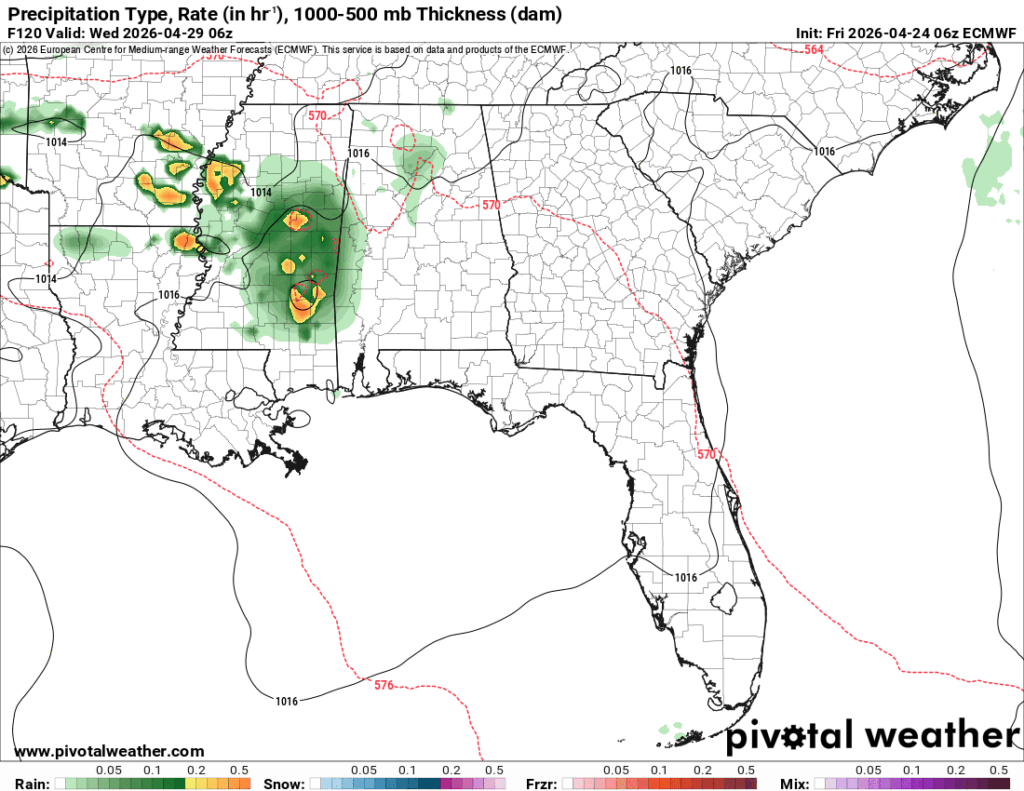
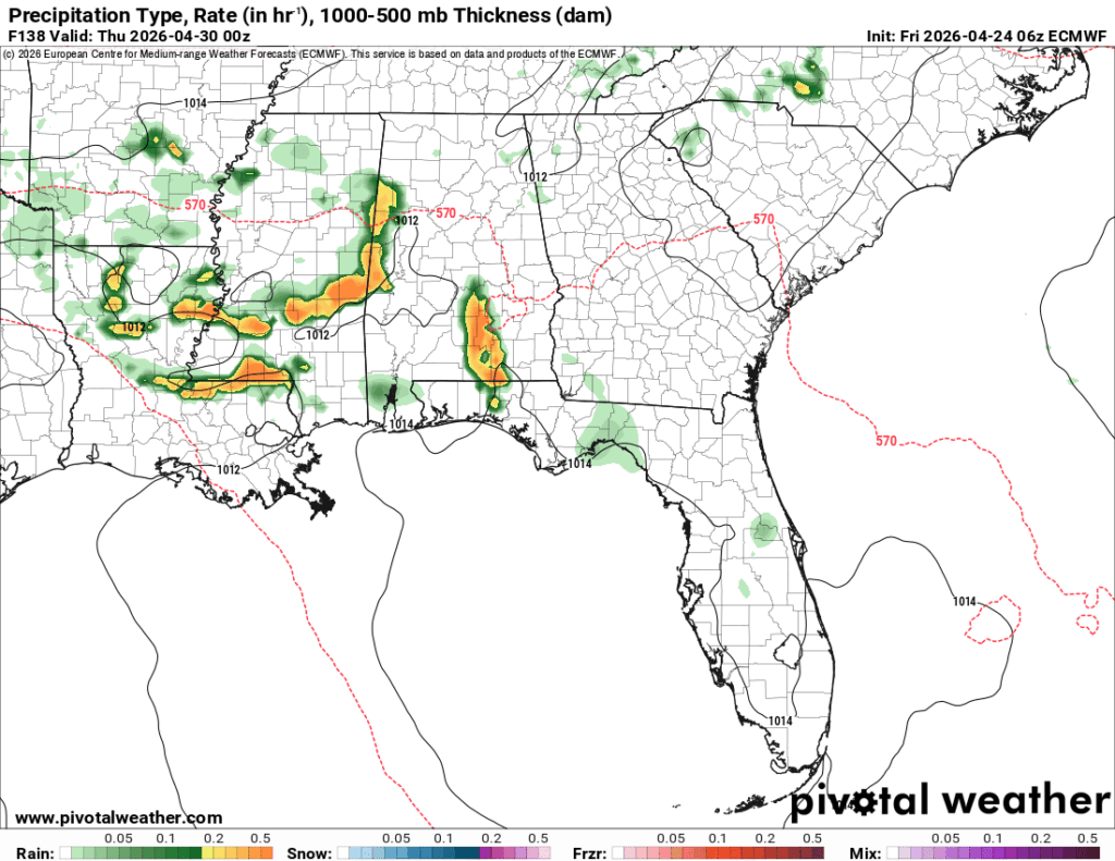
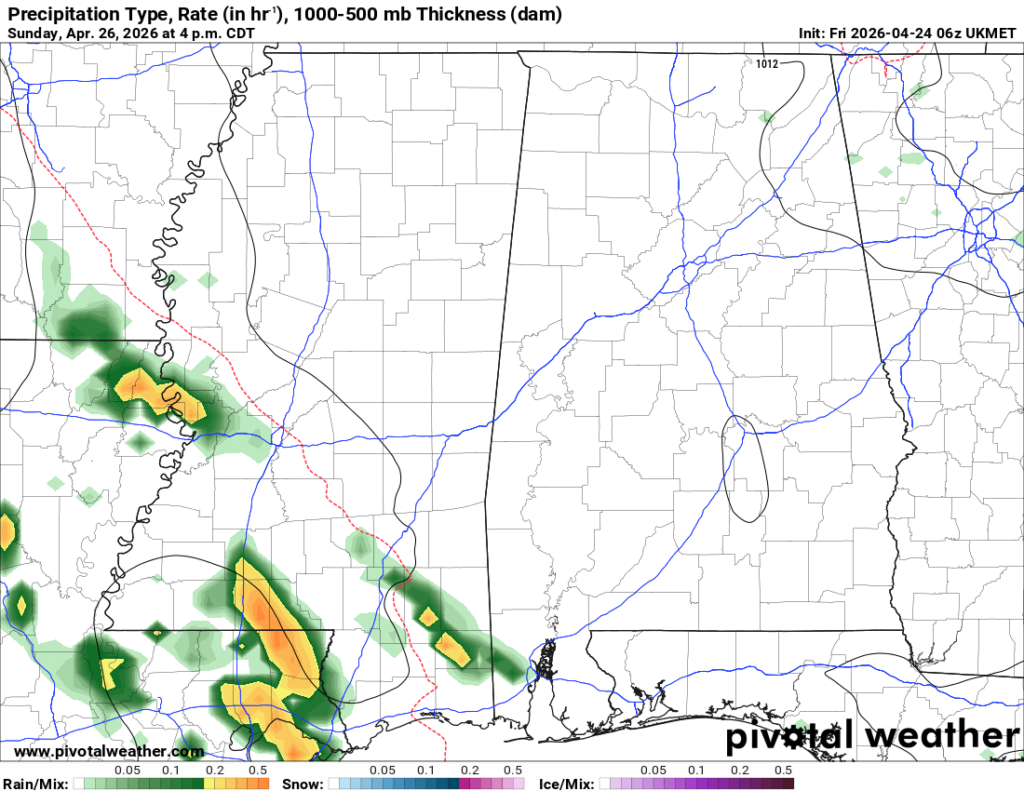
If you look at the bottom two images, you’ll notice a difference in orientation of the storms. The storms on Friday indicate a frontal passage which is good news for us. After all the humidity and on/off showers, we’ll have much more pleasant conditions by Saturday and Sunday. Temperatures will dip 10 degrees, but when your mean high temperature is 84 degrees, that means it’s only going to fall into the mid 70s, which is still nice for May! We’ll have to watch out for any SPC severe outlooks, but for now, none have been posted for next week.