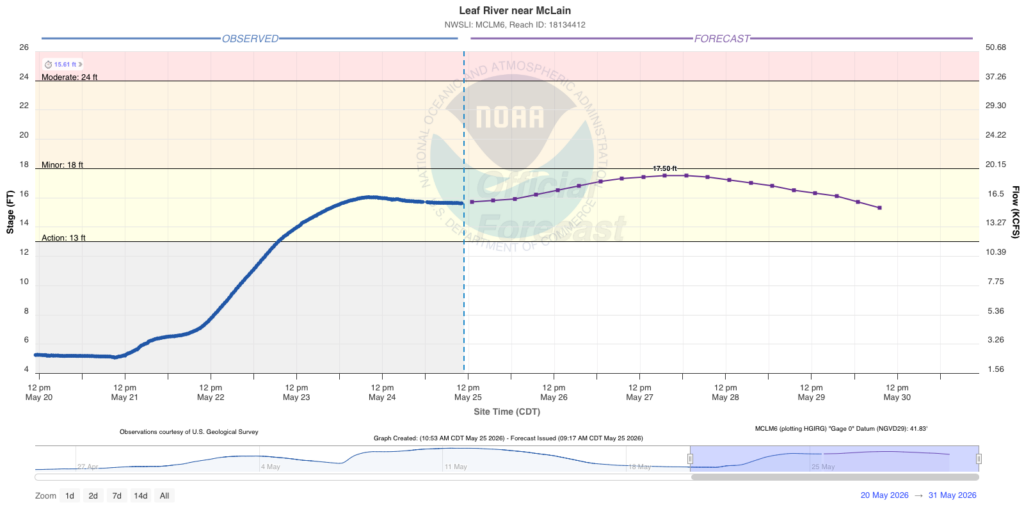
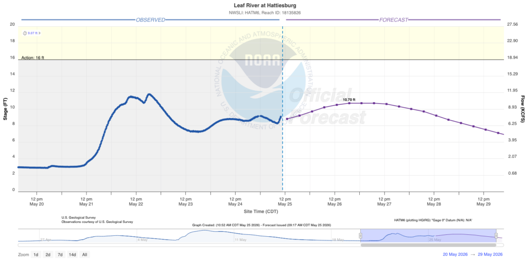
The upper atmosphere keeps fueling us with more moisture as there’s nothing really to drive it out of here anytime soon. That leaves us with a chance of rain every day for the foreseeable future since the front will take a while to get any sort of movement behind it.

Today
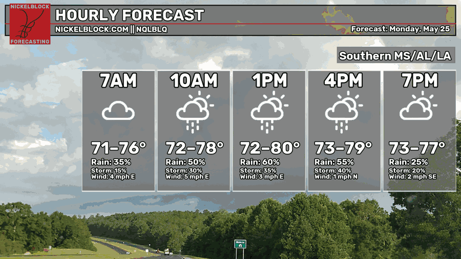
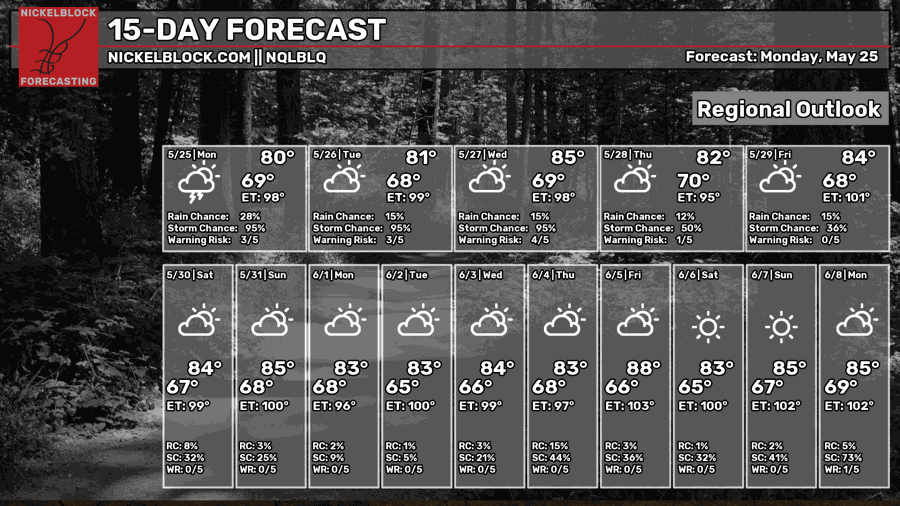
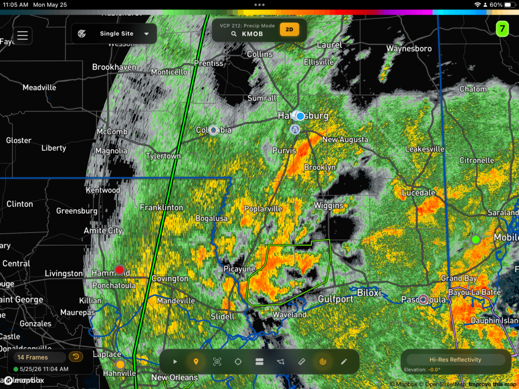
Even after a flash flood warning this morning, more rain is headed our way from the coast this afternoon and evening. Expect some low-lying roads to be flooded and soggy yards. Sorry to say, but grilling outside is going to be tough today. Highs will be in the upper 70s and lows in the upper 60s.

Tomorrow
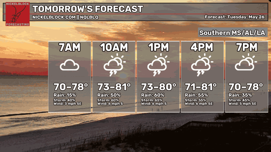
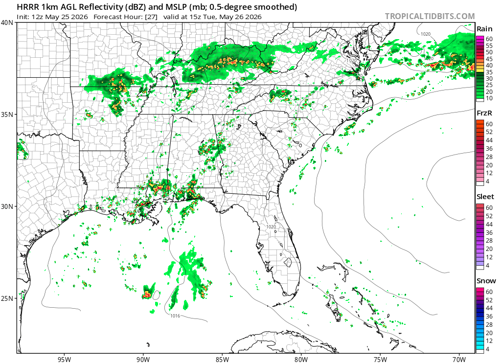
Scattered thunderstorms are likely tomorrow starting in the morning and lingering until the late afternoon. Highs will be in the low 80s and lows in the upper 60s to low 70s.
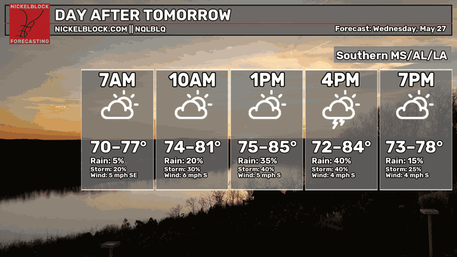
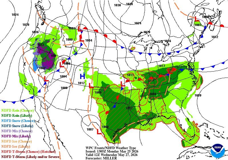
Wednesday is looking more split for rain as the Gulf moisture pulls to the west a bit. The chance for rain will dip a bit with mainly afternoon thunderstorms possible. Not a huge chance in the forecast, but we’ll at least be dry for a little bit. Highs will be in the mid 80s and lows in the low 70s.
End of the Week
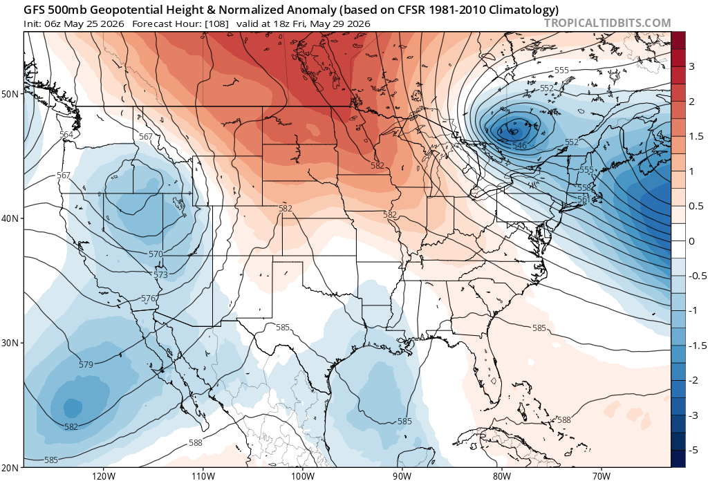
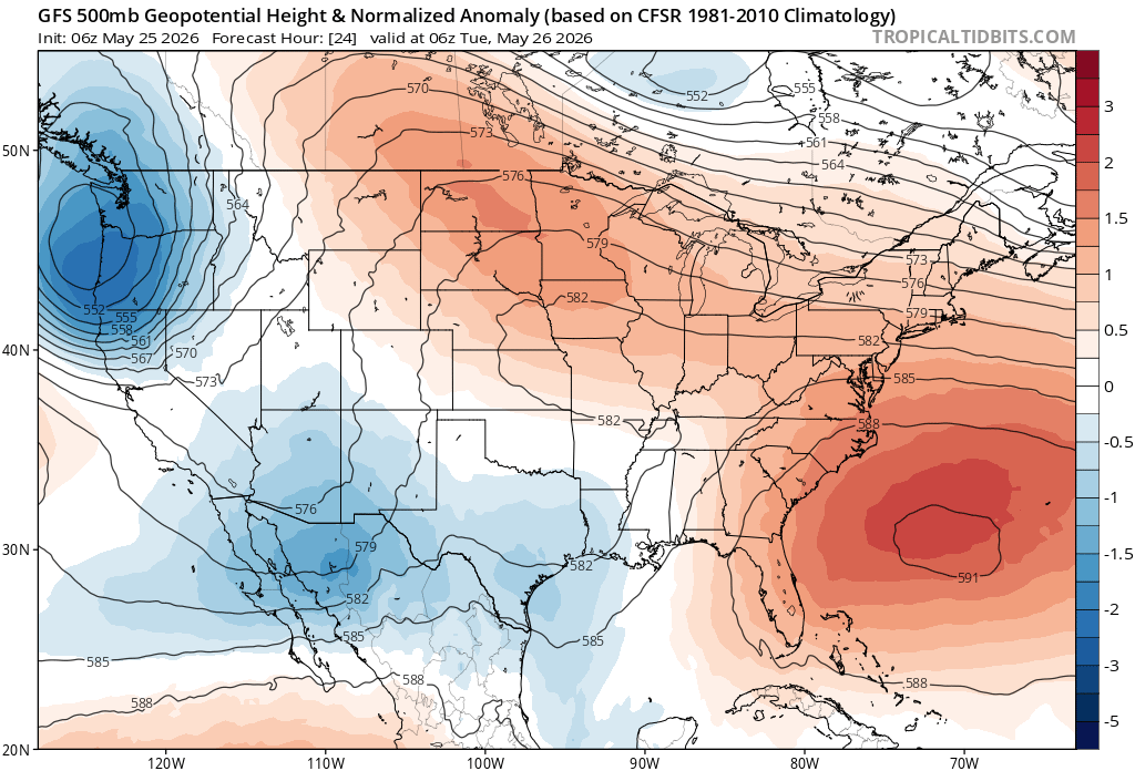
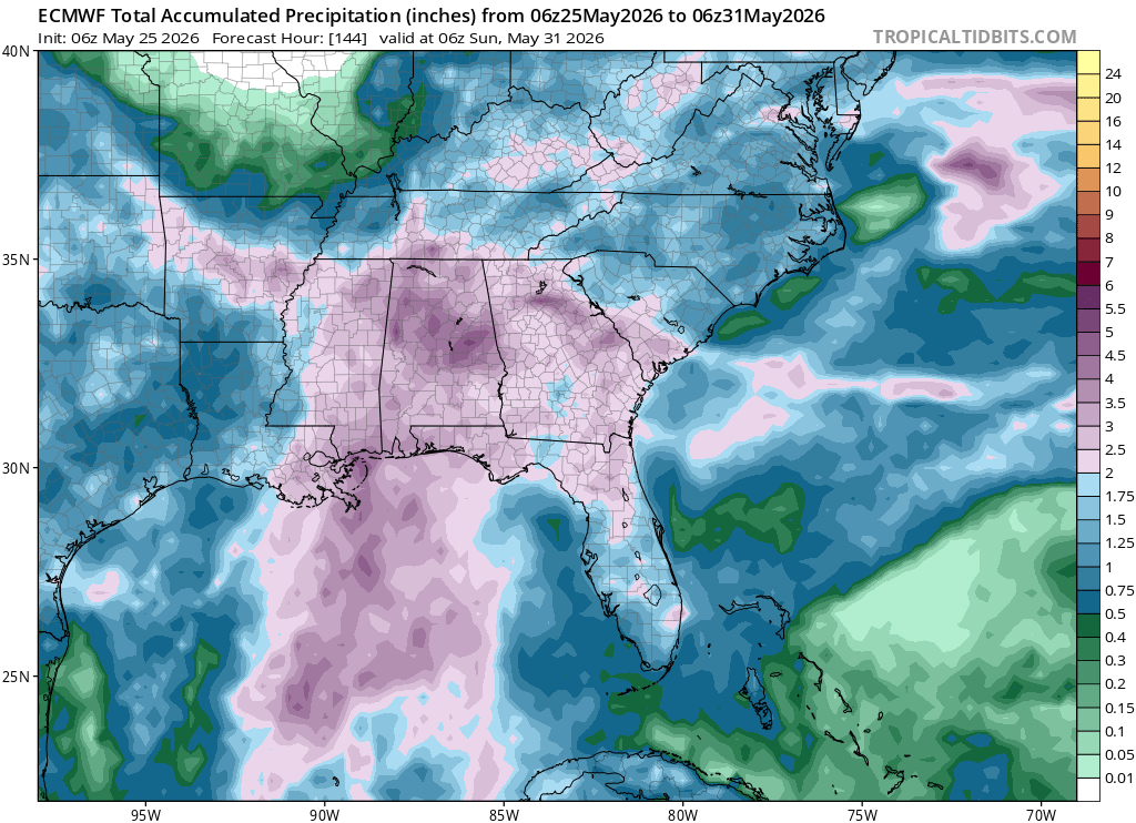
Looking at the upper atmosphere again, we still have significant troughing in the Deep South adding to the upper and lower moisture flow. Our biggest chance of rain looks like Thursday through Saturday, so this adds up. Many models are suggesting the front is moving out by Monday which would be great news for us, but we’ll see if they still agree in a few days. Otherwise, it’s going to be soggy with thunderstorms possible each day. Expect the highest chance on Thursday with more rain and thunderstorms on Friday and Saturday.
The front basically dissolves until it gets a push from another developing low pressure system in the Rockies by the weekend. This will still take a few days for the front to move out, but it may be a good sign for us who are tired of all the rain.
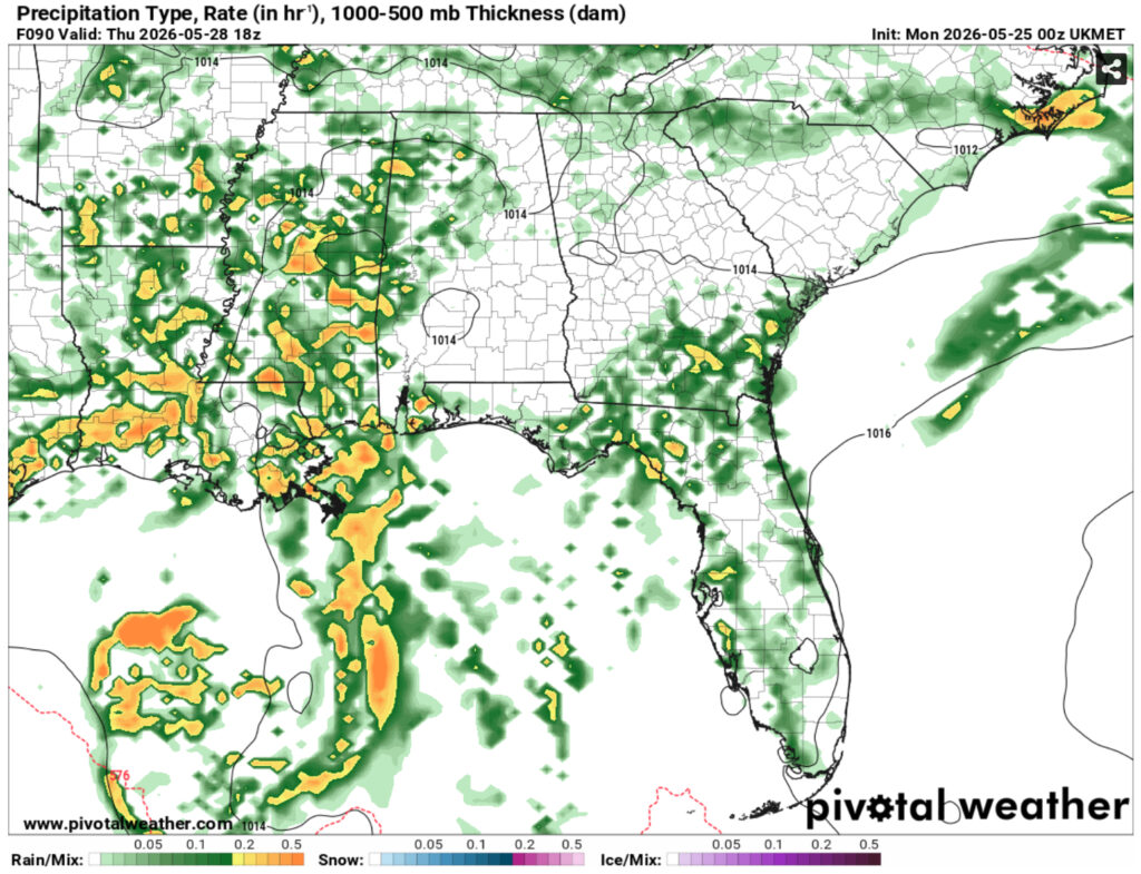
//Courtesy: Pivotal Weather
Leaf River Forecast