After a mostly dry start to your Tuesday, expect scattered thunderstorms heading into the evening hours. Tonight’s storm system shows unique stalling over “The Boot” region, which could lead to localized flooding across Southern MS/LA.

Today
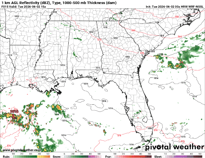
As we can see on the radar above, there is a bit of stalling over the Southeastern Louisiana area around 22z (6pm CDT). This is because of a stationary front, which is the red and blue boundary we see in the graphic to the right. A stationary front is a boundary line where a warm air mass and a cold air mass meet, but neither is powerful enough to overtake the other. This will lead to prolonged storms that could produce flooding rain for the lower Louisiana area tonight.
Looking into our afternoon, rain chances increase later in the day, which is normal for this time of year. The storms accompanying the stationary front are our biggest threat this evening, impacting towns along the I-12 corridor. The storms are projected to stall over the Livingston, Hammond, Covington, and Denham Springs areas, extending as far as Picayune. Folks in those areas should be on the lookout for slow-moving storms delivering heavy rainfall throughout the rest of the evening.
Tomorrow
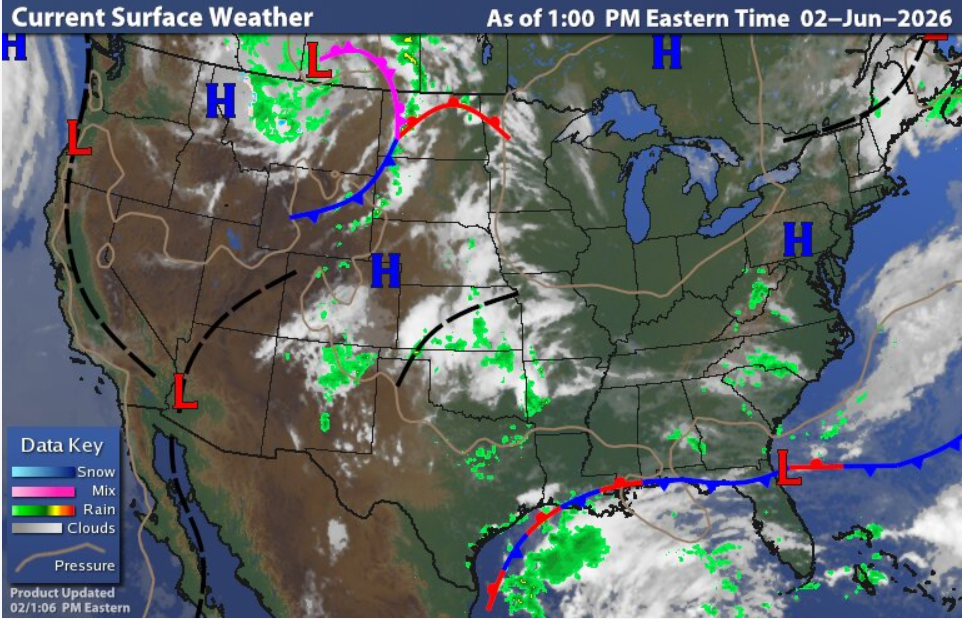
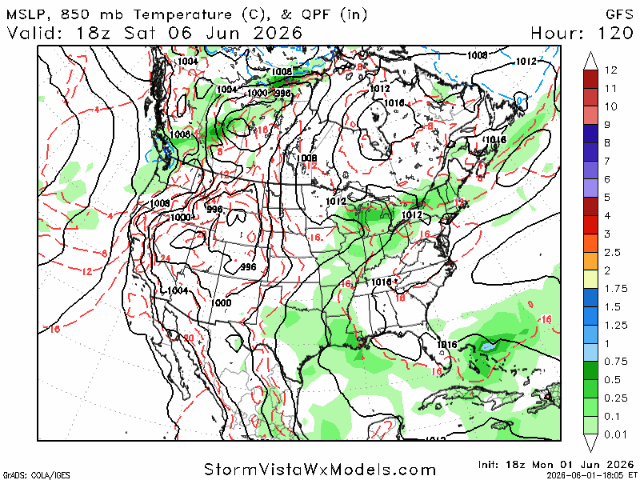
The big picture for tomorrow is a messy Gulf system, bringing disorganized storms to the region; thankfully, most of it will stay offshore. Although tropical development is unlikely with this storm, a majority of June’s early-season tropical treats are so-called “homegrown” storms like the one in the radar above. We see some low-level spin in this area due to the frontal boundary that is fueling today’s storms which is moving down into the Gulf tomorrow, keeping meteorologists on their toes if a weak storm system does develop on the tail end of this boundary.
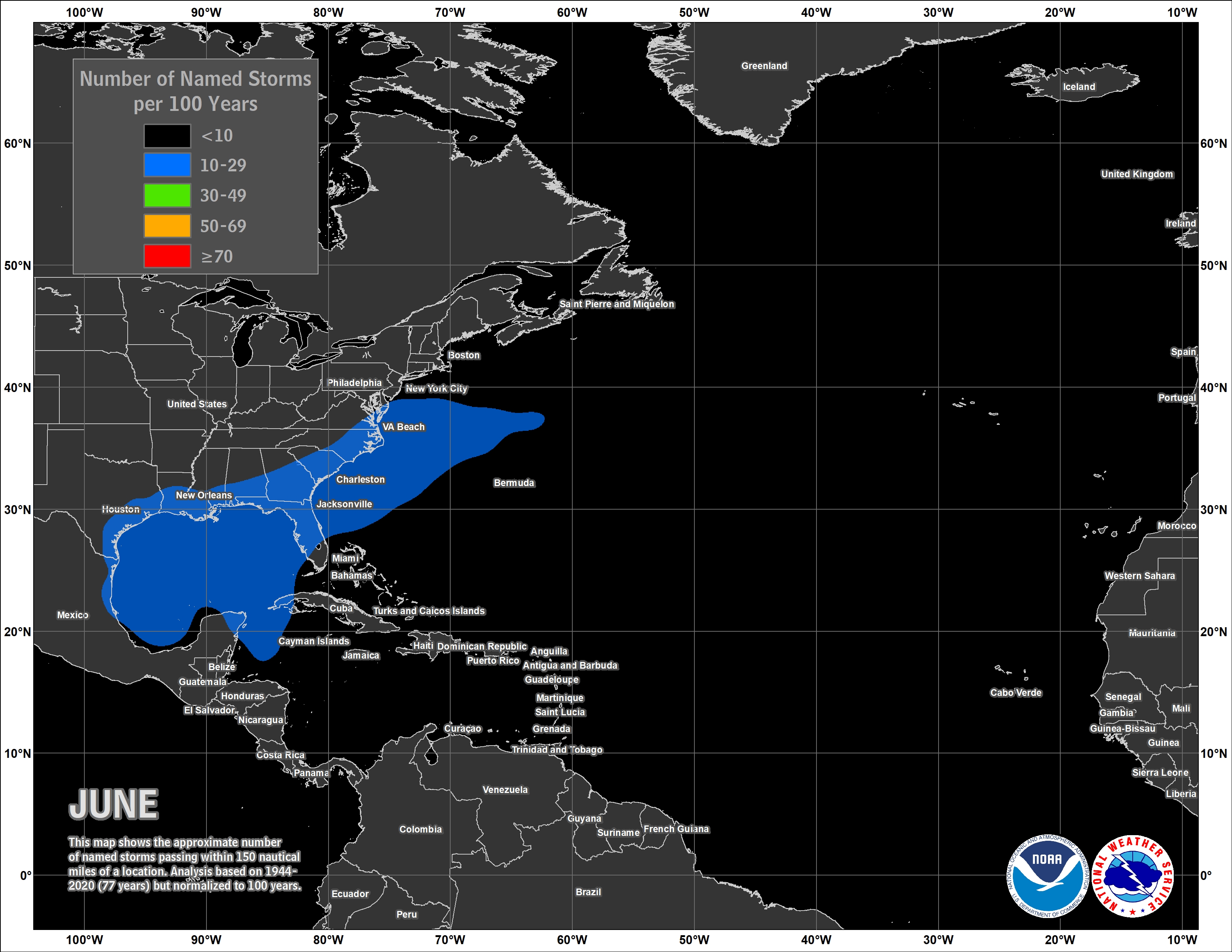
As mentioned earlier, here is a graphic showing the prevailing tracks for a potential June “homegrown” storm. With warm Gulf waters and the Jet Stream dipping South, we could have a recipe for our first tropical threat of the 2026 hurricane season if things go right with this storm.
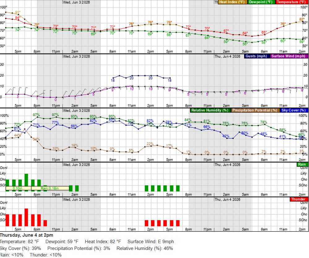
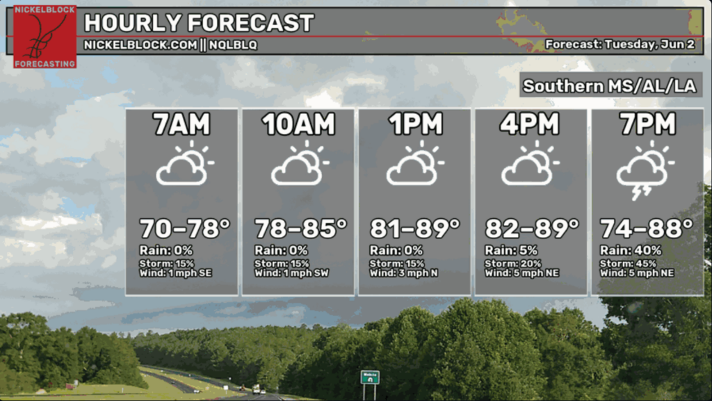
For our Wednesday hourly forecast, we can expect an afternoon storm pretty much everywhere from the offshore Gulf system. This graph is for the Hattiesburg, MS, region, where residents can expect a humid day with the potential for wind gusts in the mid-morning hours before the rain moves in. Overall, it’s looking like a cooler day for Southern Mississippi!

Thursday
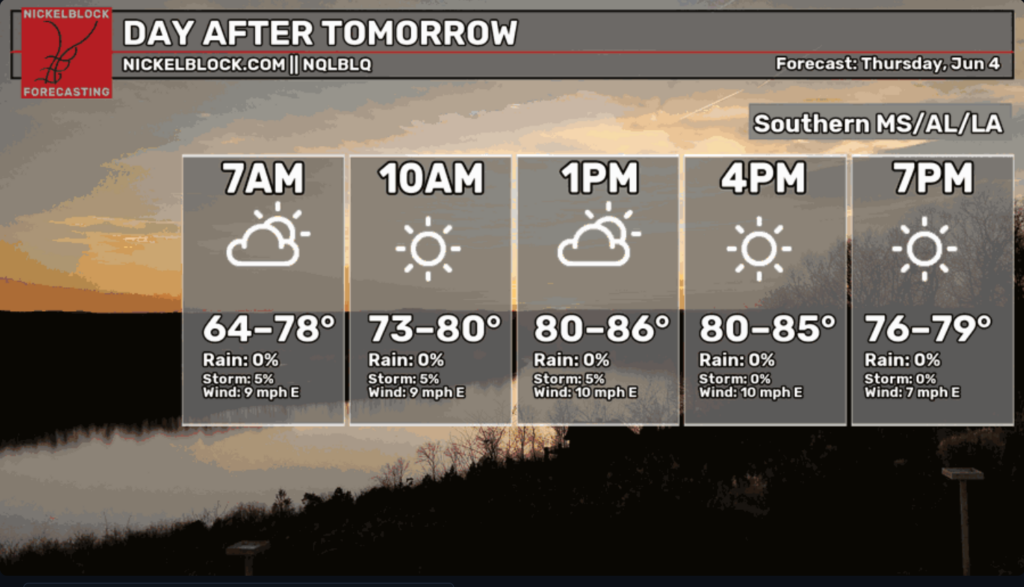
Thursday is looking like a warm, quiet day with low storm chances and a bit of a breeze to cool things off across Southern MS/AL/LA. All we have to do on Thursday is keep eyes on the Gulf storm to see if there is any potential for tropical development. It is very early in the season, and chances are unlikely, but you really never know!

Extended Forecast
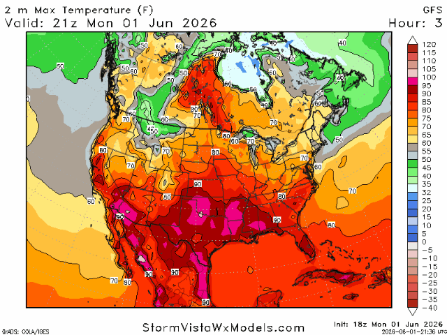
Looking ahead, we’re seeing a few different temperature trends over the next five days. The good news is that today, Tuesday, appears to be the hottest day in the forecast period, with some locations climbing all the way to the 100-degree mark shown in pink. After that, temperatures gradually ease back closer to seasonal levels as rain chances begin to increase. Beyond today, increasing cloud cover and rain chances should help knock temperatures down a few degrees.
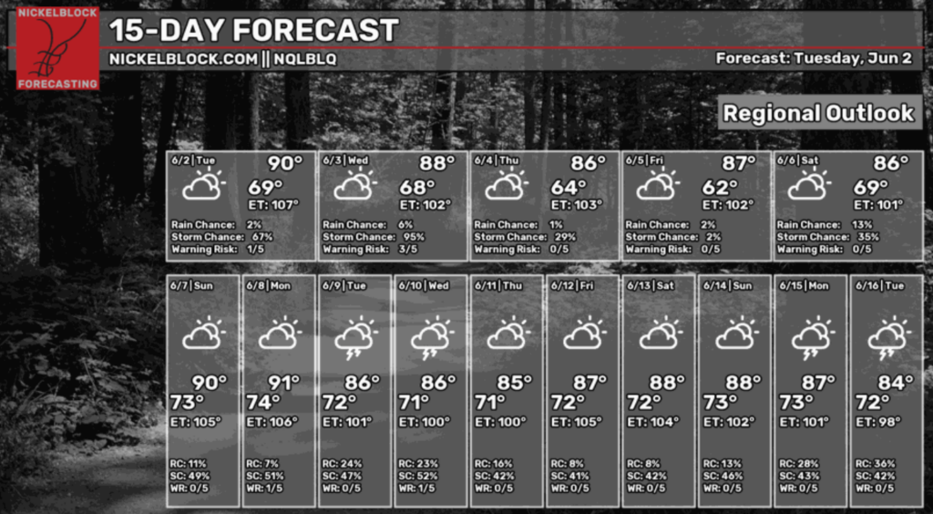
Taking a look at the NickelBlock’s 15-day forecast, a more active pattern appears to be setting up with periodic storm chances and plenty of cloud cover. While daytime temperatures stay warm, overnight lows will be noticeably cooler this week, especially by Friday morning when temperatures may fall to around 62 degrees!
Looking ahead in the 6–15 day outlook, we’re trending wet across the board. Not every day is a soaker, but we’re getting into that classic summer pattern where heat builds during the day and sparks afternoon storms. The pressure stays fairly steady for now, but by late next week we’re watching a couple of stronger systems trying to pop up that could boost our rain chances.


