Early June is the climatological peak of severe weather season and today is no exception. Thankfully the risk will be for the upper Midwest into the central Great Plains. For our area, there is no severe weather expected.
As of 4:30, cumulus are slowly bubbling across southern Mississippi and southeast Louisiana. Temperatures are in the mid 80s with dew points around 70. Some of these have become mature enough to cause precipitation to fall. As they continue to grow, these storms will contain the usual hazards of heavy rain, lightning, and maybe some strong downbursts.
Tomorrow will likely be a repeat of today with an even higher chance of storms across the region. Again, no severe weather is anticipated.

Tonight
The good news: showers and thunderstorms should rapidly diminish around sunset with the loss of daytime heating.
The bad news: There maybe some fog (but not everywhere).
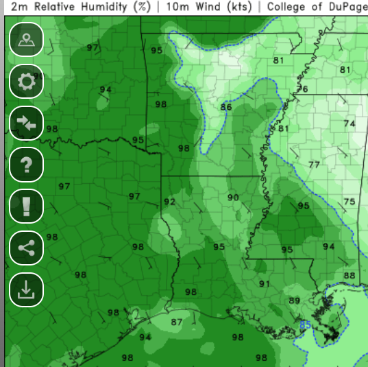
Areas such as Fayette Mississippi, are at the highest risk. Fog is common in this area and often happens when there are light winds and high relative humidity.
There will be a lot of moisture and the winds will be fairly weak but this does not appear to be a set up that will produce widespread dense fog.
Temperatures will bottom out around 70.
Tomorrow
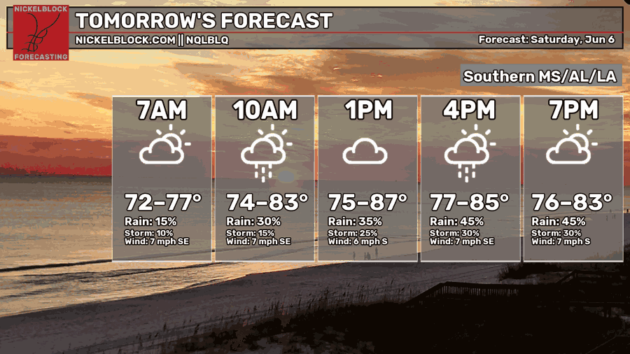
Rain. Rain. Rain.
Yes, it’s probably gonna rain.
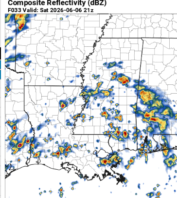
The HRRR shows widespread afternoon convection drifting slowly north.
Not everyone will get hit but most folks will at least be able to see a thunderstorm. These storms will be fairly benign, with little more than heavy rain and lightning (and maybe some gusty winds).
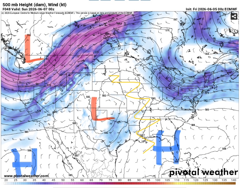
This is due to the position of the jet stream. Our local area is under the influence of ridging. Therefore, we do not have enough wind shear to allow thunderstorms to organize.
Highs will be in the low to mid 80s due to the excessive cloud cover. Despite the lower temperatures, it will still feel very unpleasant since the dew points will be in the 70s.

The Day After Tomorrow
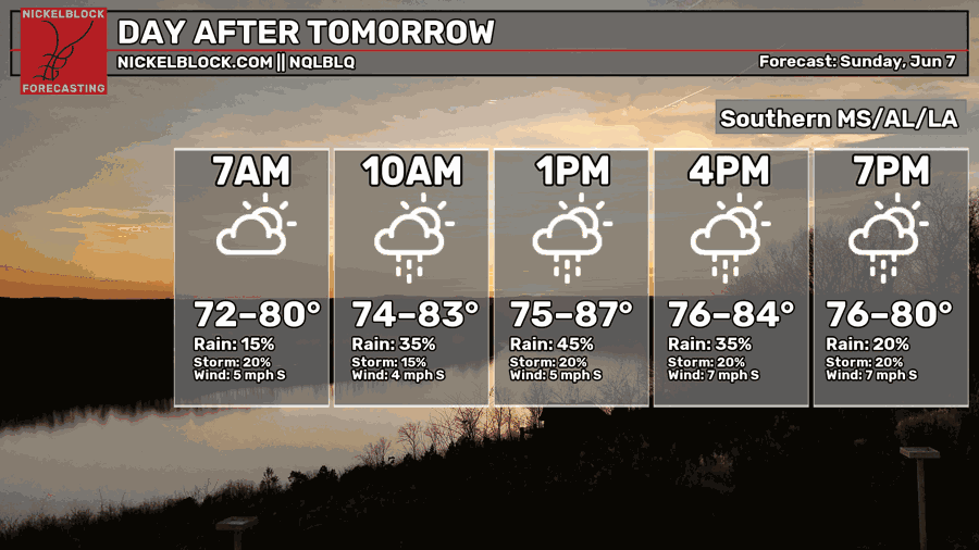
Yup. You got it.
More rain.
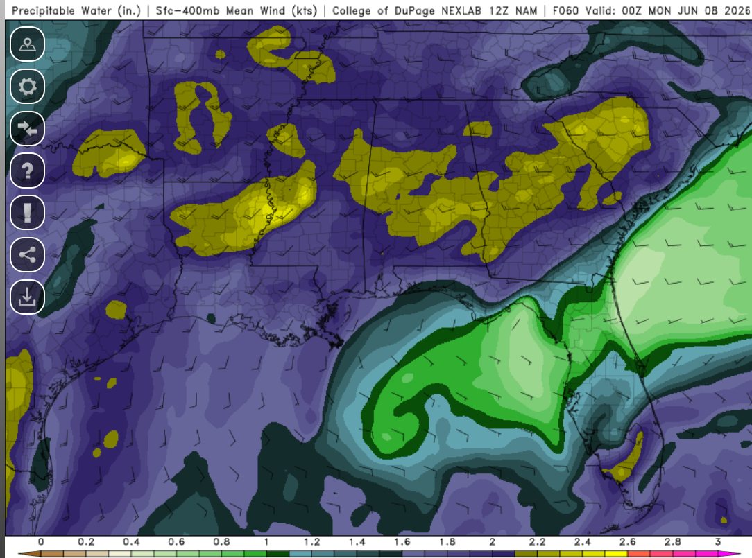
Sunday will likely be very similar to Saturday. Deep Gulf moisture will continue to be pulled into the region on the southerly flow. Despite the lack of shear, moisture convergence and a lack of capping will allow for widespread afternoon convection to form and slowly meander northward.
The storms will be of the typical summertime pulse variety meaning there will be little in the way of severe weather potential. The bigger threat will be for flash flooding. Given repeated rounds of convection occurring on saturated soils, areas that normally flood likely will this time. Make sure to never drive through water.
Highs will be in the mid 80s with the humidity leading to a sharp mugginess (not uncommon for this time of year). Clouds will build through the morning as thunderstorms slowly develop.

Extended Outlook
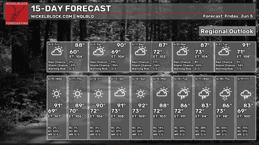
A typical summertime pattern will embed itself into the deep south. You all know what this means. Humid all the time, clouds build throughout the morning, afternoon thunderstorms, foggy nights, repeat.
This pattern may end up being that on steroids though. Highs will likely get well into the 90s and precipitation may be more widespread that average.
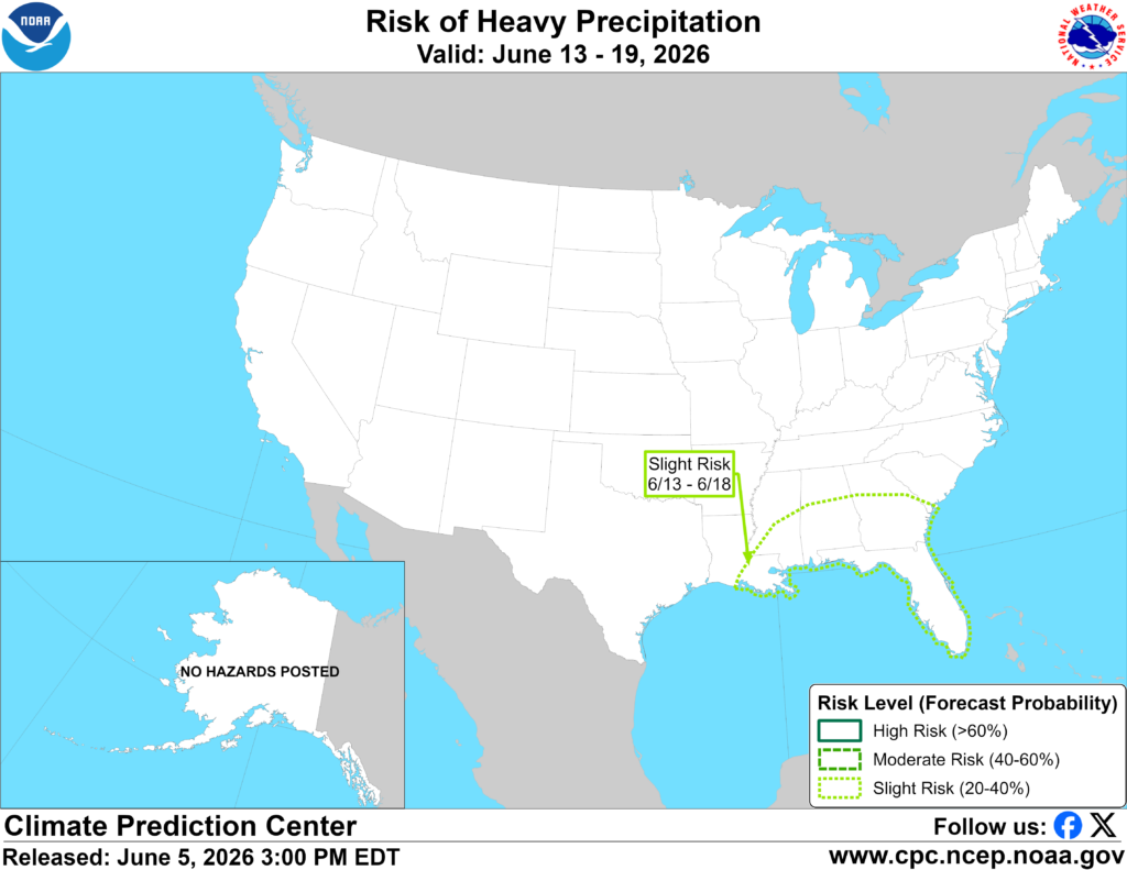
The CPC has outlined parts of the southeast for potentially hazardous precipitation. This means that lots of rain is likely along an increased for flooding (both river and flash).
The jet stream will likely stay far to the north, keeping our area under a weak flow regime leading to disorganized convection with little severe weather threat. This could result in a tropical disturbance forming in the Caribbean or the Gulf but that is far from certain. We will keep you posted here at NickelBlock.
Day-By-Day Forecast
Tonight- Thunderstorms die out by mid-evening. Partly cloudy with a low around 70 and humid.
Tomorrow- Widespread showers and thunderstorms in the afternoon and evening. Highs in the low to mid 80s with a mostly cloudy sky.
Tomorrow Night- Thunderstorms slowly die off after sunset. Low in the lower 70s and mostly cloudy.
Sunday- Widespread afternoon and evening thunderstorms. Highs in the mid 80s with mostly cloudy skies.
Sunday Night- Mostly cloudy with a low in the lower 70s. No precipitation is expected other than the remnants of the days thunderstorms around sunset.
Monday- High in the upper 80s with increasing clouds. Scattered afternoon thunderstorms possible.
Monday Night- Mostly cloudy with a low in the lower 70s. Chance of isolated thunderstorms.
Tuesday- Partly sunny with a high in the lower 90s. Isolated thunderstorms in the afternoon.
Tuesday Night- Mostly clear with a low in the lower 70s. No precipitation is expected.
Wednesday – High in the low 90s with partly sunny skies. Scattered afternoon thunderstorms possible.
Wednesday Night- Dry with a low in the lower 70s. Mostly clear.
Thursday- Chance of scattered afternoon thunderstorms. High in the low 90s and partly sunny.
Thursday Night- Low in the lower 70s and mostly clear. No precipitation is expected.


