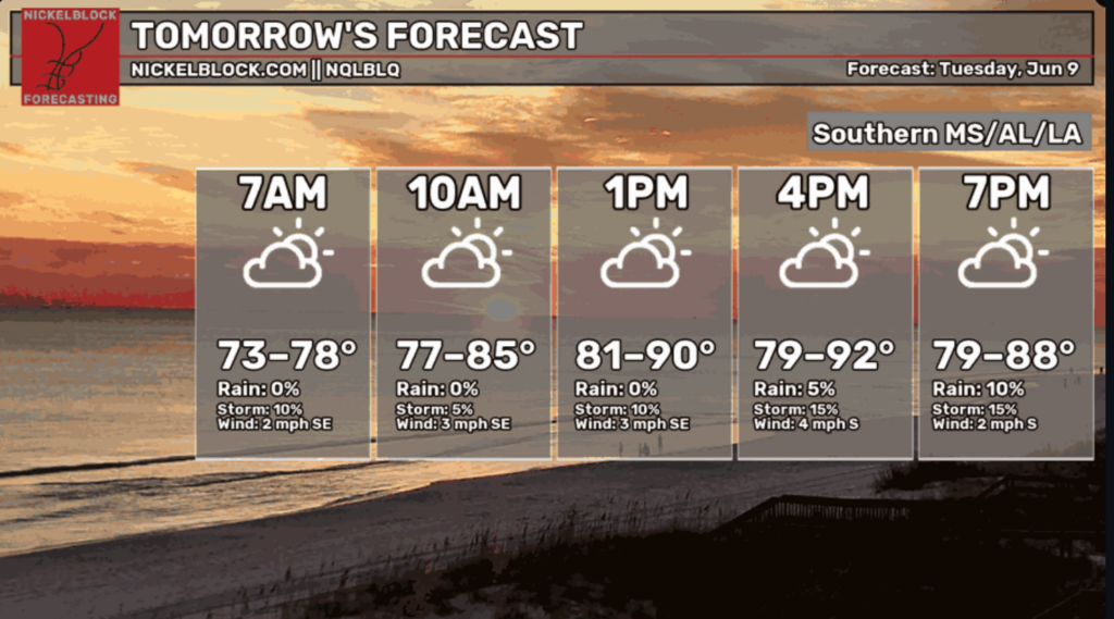
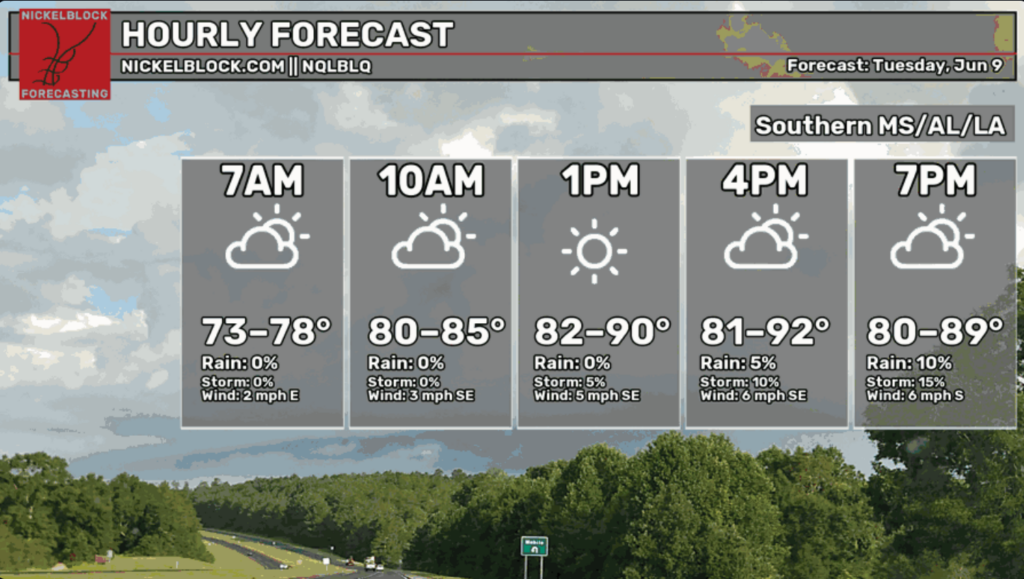
Conditions are currently dry and warm across our area, with the chance for some sneaky showers moving in towards the evening.
Midday temperatures should hang in the upper 80s, with real feels creeping towards the 90s across most of the area. A slight breeze moving off the Gulf will cool coastal towns and travel up to the more central parts of the region, helping to slightly alleviate the heat.
Overall, not much has changed from our Monday local forecast. Below, we see if anything, slightly higher temperatures in the area creeping into the evening while rain chances narrow throughout the day.
Tomorrow and Beyond
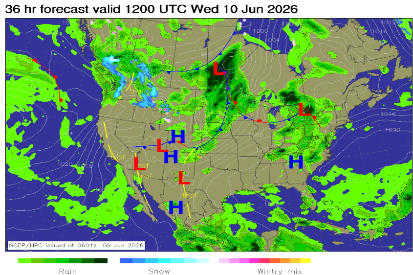
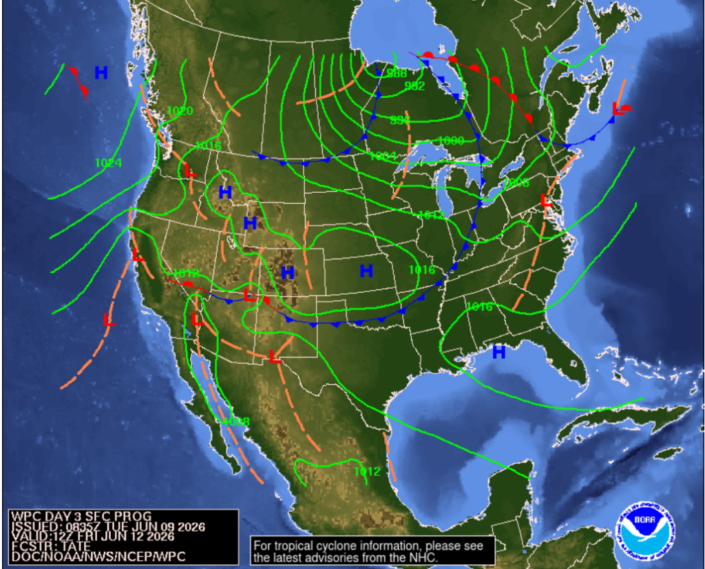
Looking back at yesterday’s forecast, the high-pressure system hanging over the Appalachians will be shifting further South over the next few days, continuing to bring us quiet weather.
As for the temps and stuff, it’s looking to be warm with a low likelihood of a rainstorm moving in to cool things off. We can expect warm temperatures tomorrow with a slightly stronger breeze of around 9-11 mph, even in central regions like Hattiesburg and Jackson. We can thank that high-pressure system for keeping things calm and summery around here!