Today’s Overall Setup
The overall atmospheric setup is certainly supportive of severe weather across the northern Plains and Upper Midwest this week. The 500 mb pattern shows a trough digging into the northern Rockies and a large ridge over the East Coast. The trough brings upper-level spin, cooler air aloft, and increasing lift, while the ridge helps funnel warm, moist air northward from the Gulf. As these two features interact, they also create stronger wind shear, which can help support organized severe thunderstorms.

Looking at the Weather Prediction Center’s National Forecast Chart for today, we can see that much of the country will experience some form of unsettled weather. The most eye-catching would be the severe weather threat in the central and northern Plains, which is quite large. I’ll discuss the specific severe weather threats below. Another area to watch is in the Tennessee Valley in the southern Appalachians, where heavy rain and flash flooding are possible. Everyone else in the light green colors could see some spotty showers or thunderstorms today.
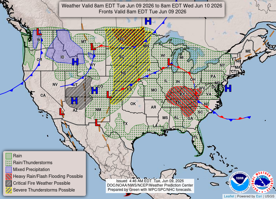
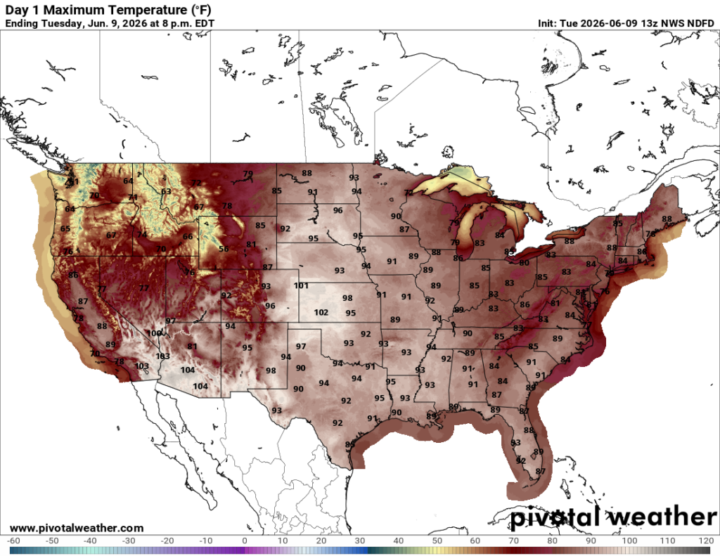
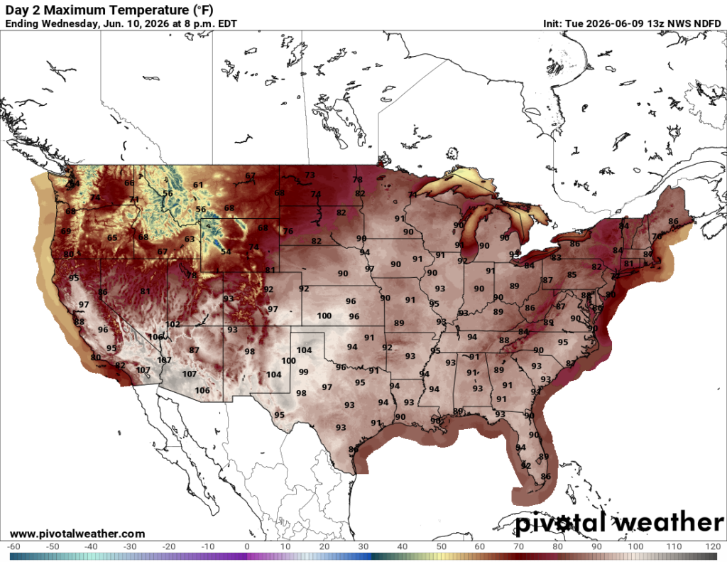
Temperatures are SOARING across much of the country today, with highs reaching the 90s and lower 100s across the Plains and much of the Southeast. The Northeast is a bit more comfortable, with temperatures generally in the 80s. Out West, temperatures will vary quite a bit by location, but most of California will sit in the 70s and 80s, while the Northwest stays mainly in the 60s and 70s.
Today’s Severe Weather Threat
Here’s a look at the severe weather threat and the associated hazard types. As we can see, there is a large area of Enhanced Risk, which is level 3 out of 5 on the severity scale.
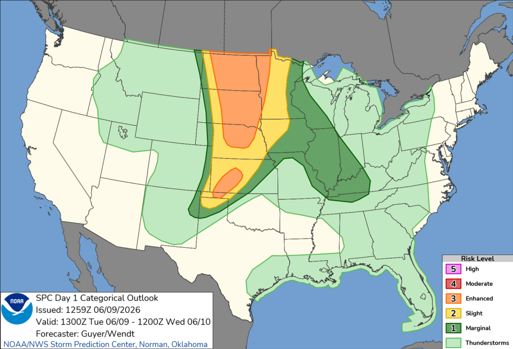
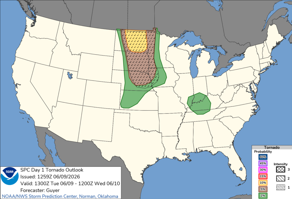
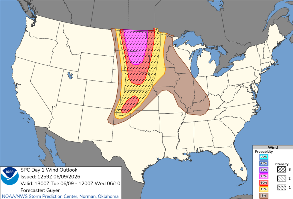
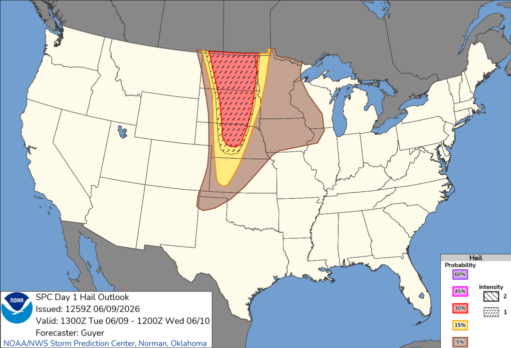
As we can see, a significant severe weather threat is unfolding across the northern and central Plains this afternoon and tonight. Storms will initially be capable of very large hail and a few tornadoes, some of which could be strong, especially across the Dakotas. As storms grow into a larger line this evening, the main threat will shift toward widespread damaging winds of 60 to 80 mph, with locally higher gusts. This line will then push east toward Minnesota and parts of Iowa tonight. Definitely not somewhere you want to be today.
Tomorrow’s Weather
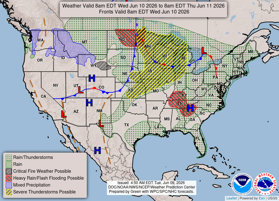
Wednesday will be another active weather day across much of the country. Rain and thunderstorms will stretch from the central Plains through the Midwest and into the Northeast, while severe storms are possible across a large portion of the Midwest. Heavy rain and flash flooding will also be possible across parts of the northern Plains and Tennessee Valley. Most of the west stays dry!
Temperatures remain very hot across much of the country on Wednesday, with widespread 90s from the Plains through the Southeast. The northeast warms up closer to the 90s. Heat indices will exceed 100 in many areas, while the northern Rockies and Pacific Northwest will stay noticeably cooler in the 60s and 70s. Stay very hydrated if you must be outside!
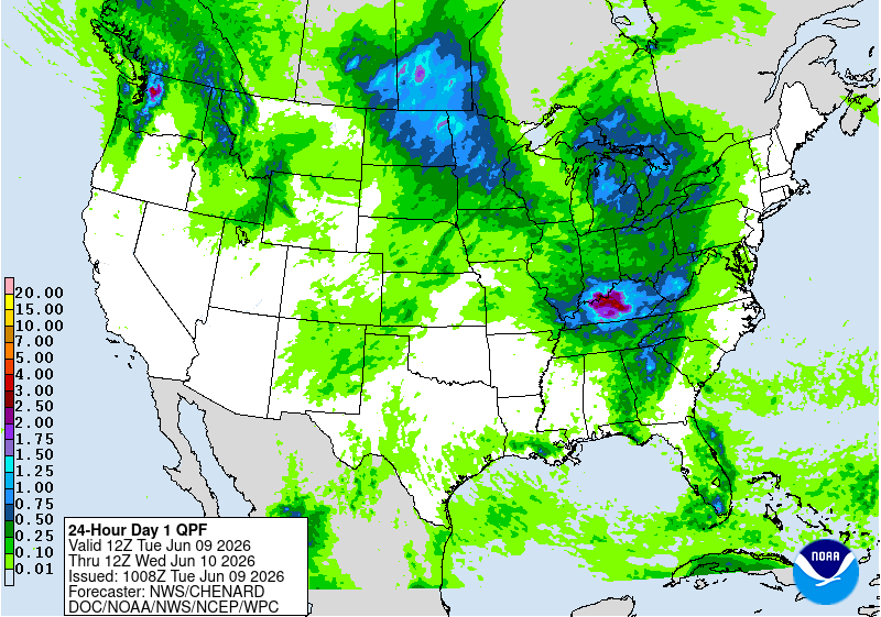
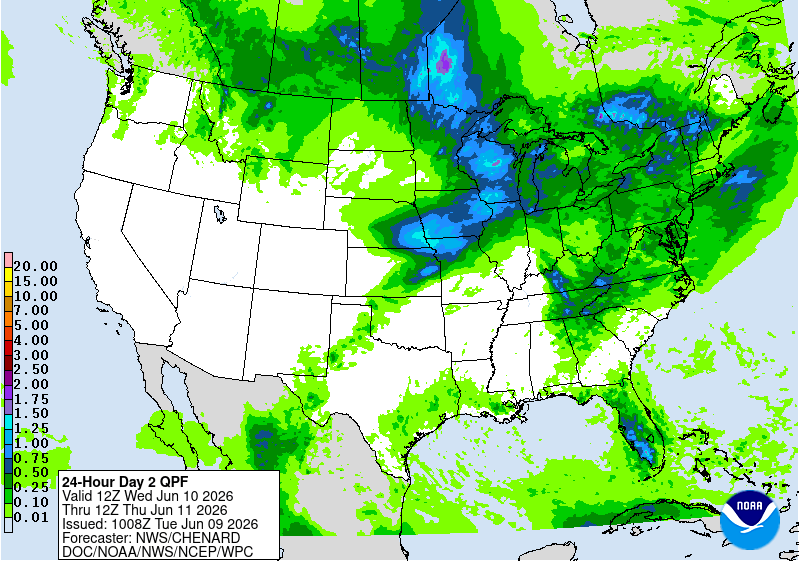
The heaviest rainfall will be focused from the central Plains through the Upper Midwest and Great Lakes, where some areas could pick up over an inch. Rain will also spread across much of the eastern U.S., with additional heavier pockets possible through the Southeast and Florida.
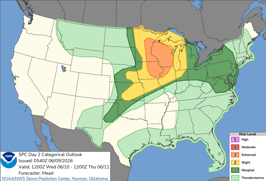
The severe weather threat will shift into the Upper Midwest on Wednesday, with an Enhanced Risk across parts of Minnesota, Wisconsin, Iowa, and Illinois. The SPC warns that storms may begin as supercells capable of very large hail and a few strong tornadoes before growing into a larger line during the evening. Damaging winds over 75 mph could become the main threat as storms move toward the Great Lakes, while more isolated severe storms are also possible farther south and east.
Another Day of Severe Weather – Thursday
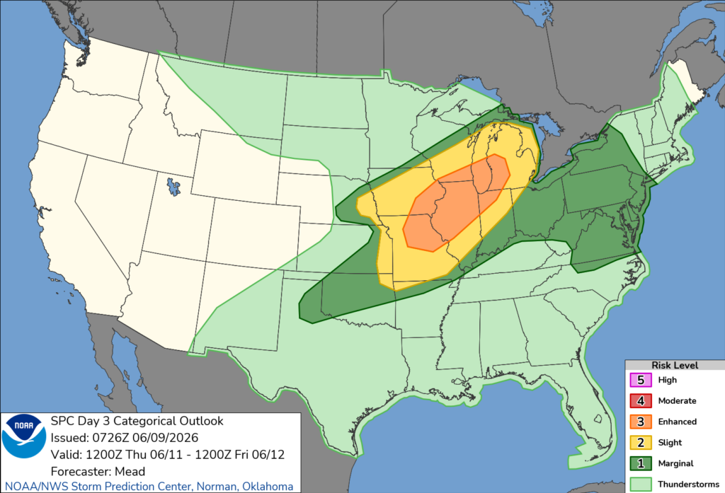
And it looks like Thursday could bring yet another round of severe weather, this time from Missouri and Iowa into Illinois, Wisconsin, and western Michigan. Storms may get going pretty early, with large hail, damaging winds, and a few tornadoes all possible. More storms could also fire farther southwest into the Ozarks and southern Plains, where a few long-tracked supercells may develop. It has definitely been an active stretch, and Thursday looks like another day to stay weather-aware.
CONUS Weekly Temperature & Precipitation Outlook
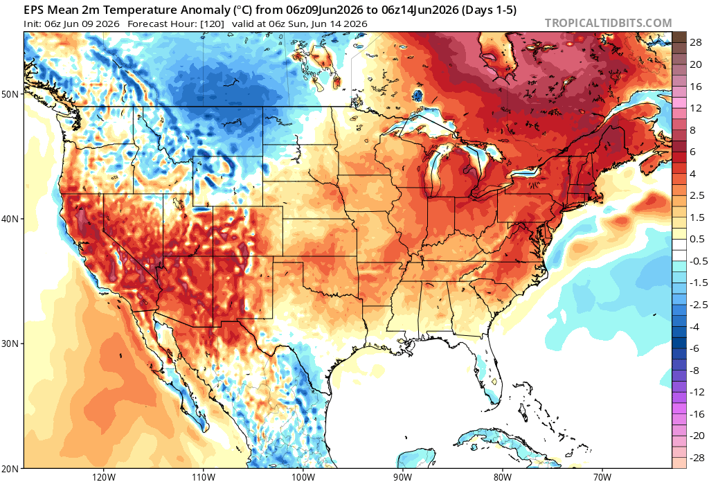
Here’s a look at the EPS modeled temperature anomalies through Sunday. Red indicates above-average temperatures on average for the week, white indicates average temperatures, and blue indicates below-average temperatures.
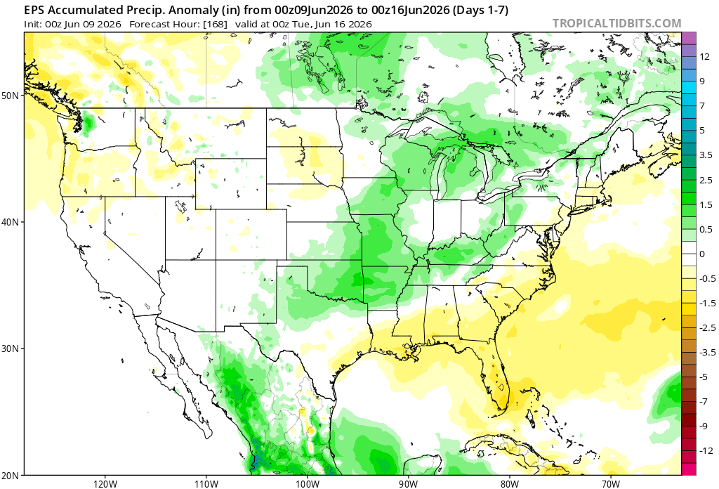
Here’s a look at the EPS modeled precipitation anomalies through next Tuesday. Green indicates above-average precipitation, white indicates average precipitation, and yellow indicates below-average precipitation. Let’s look into the details by region:
Weekly Outlook: Western & Central United States
Looking at the week ahead, it’ll stay cooler across the north thanks to the troughing, while the Southwest and parts of the central Plains keep heating up. Most of the rain in the northern and central Plains that we see above are coming from the multiple rounds of rain and severe weather over the coming day. The northern Plains and Upper Midwest look to get the highest totals, while the Southwest stays pretty dry.
Weekly Outlook: Eastern United States
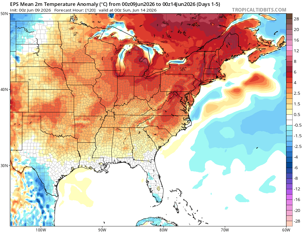

Across the Northeast, the ridge keeps temperatures running well above average, so the heat looks like it will stick around through Sunday. Rainfall there looks closer to normal overall, with a few rounds of showers and storms possible, but nothing overly widespread.
Down in the Southeast, sinking air under the ridge should keep rain chances lower, which is why much of the Southeast may end up drier than normal through next Tuesday. No huge systems coming through the southeast this week, but afternoon thunderstorms are possible each day.
Extended Outlook
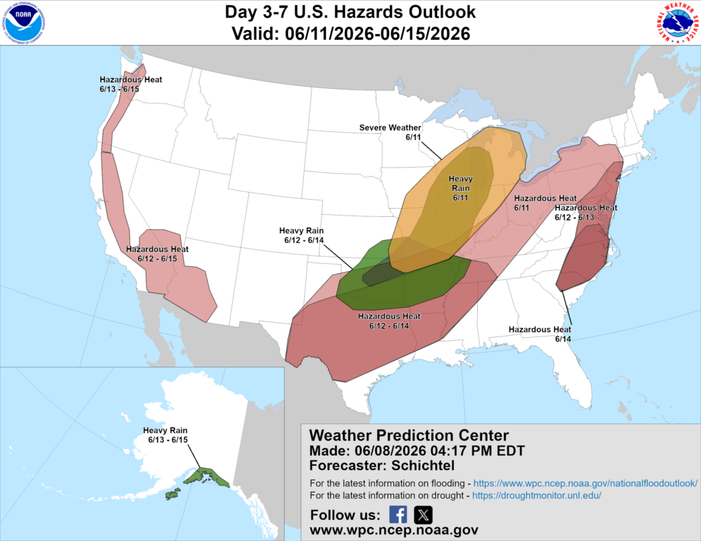
Above is a look at the U.S. Hazards Outlook from NOAA, highlighting areas of more impactful weather to be aware of over the next 3 to 7 days.
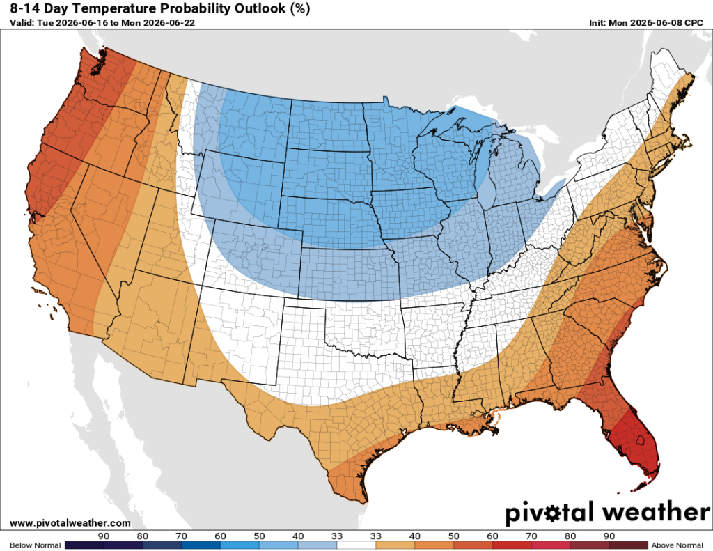
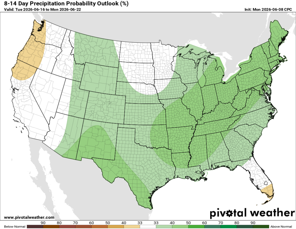
Looking farther out, the 8 to 14 day outlook keeps the cooler pattern going across much of the northern and central U.S., while the West, Southeast, and parts of the Northeast lean warmer than normal. Rain chances also look higher than normal across a large part of the central and eastern U.S., including the Northeast and much of the Southeast. Florida is the main exception, where the pattern looks a little drier than normal.
Thanks for tuning in to this National Forecast! Tune in to our local, tropical, and regional forecasts to stay updated on the latest!


