Howdy!
These next couple of weeks will bring on the summer weather as temperatures heat up. However, next week there is a possibility of a break from the summer-like pattern and an even higher chance for thunderstorms. For the next few days, though, expect temperatures to be in the lower 90s with dry conditions.

TODAY/TONIGHT
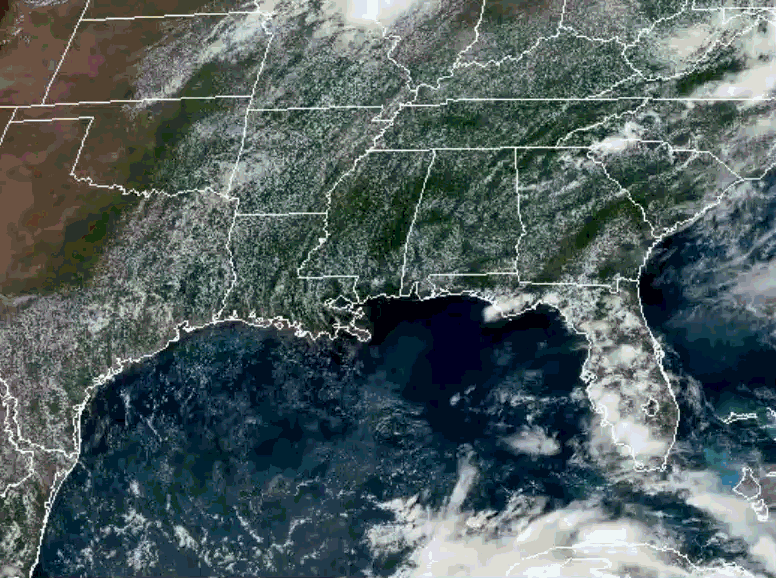
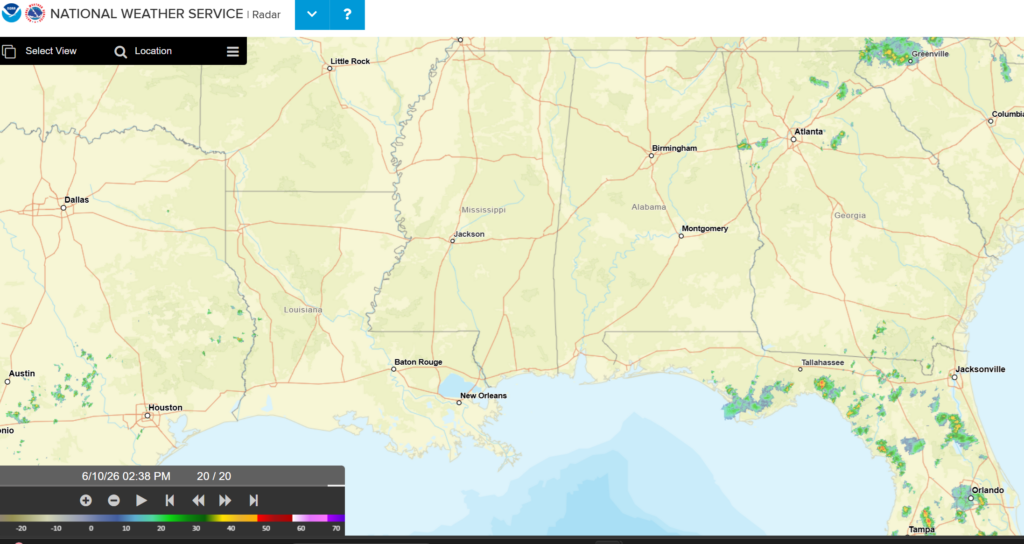
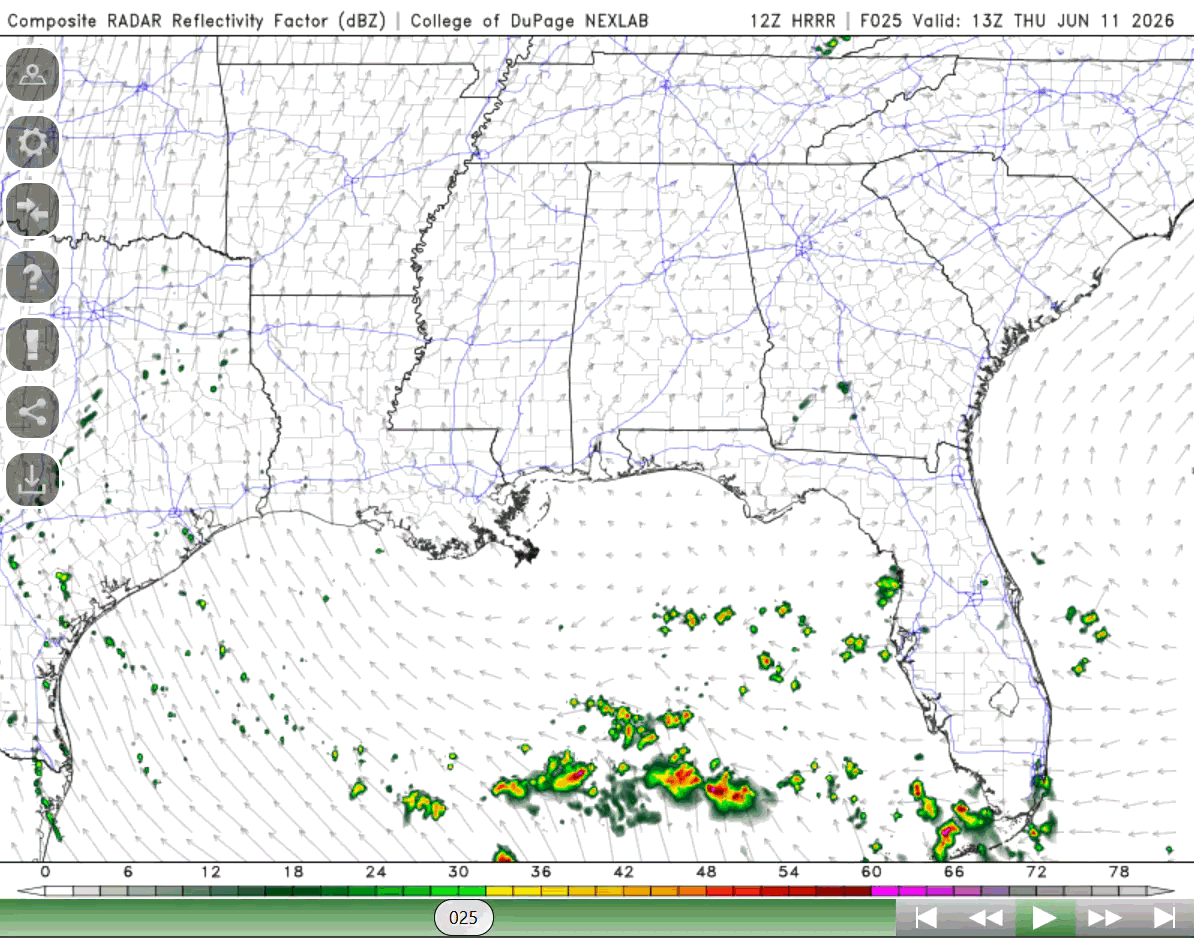
Let’s take a look at what is currently going on out the window. We can see on the satellite image (NOAA) there are a good number of clouds over the region, air flowing in from the south bringing with it some moisture from the gulf. There is little to no rain based off the NWS radar, so not a lot going on at the moment!
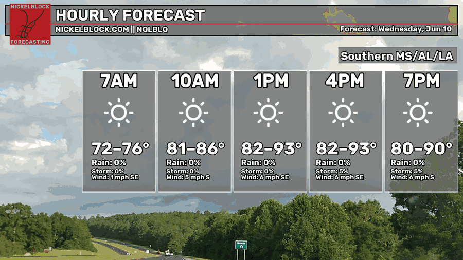
Temperatures are currently in the upper 80s and low 90s, and they will continue warming up for the next couple of hours. Highs will reach the lower 90s with dewpoints in the lower 70s. There is no significant chance for rain today, some areas might see some pop-up showers later in the afternoon, but most of the region will remain dry.
TOMORROW
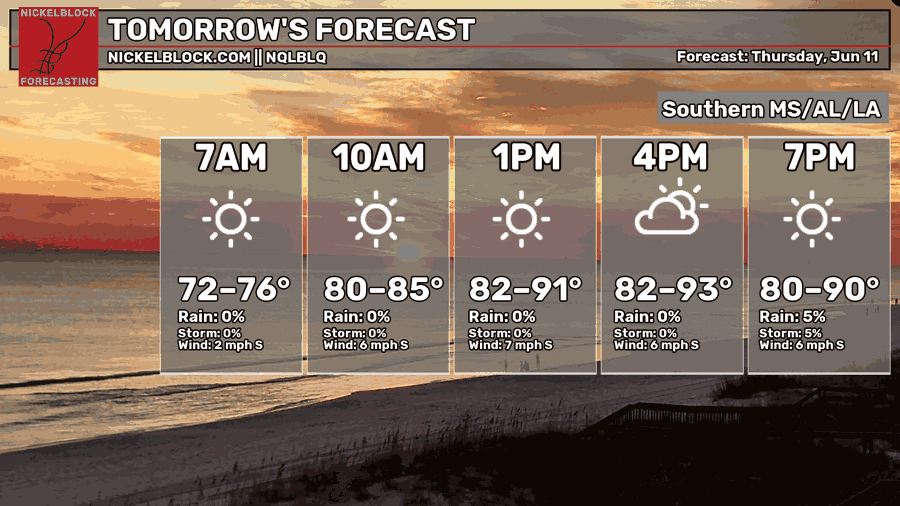
Tomorrow is looking pretty hot, highs in the lower 90s and much more sun for the region. Again, it will remain relatively dry, pop-up showers are possible for some areas, but most of the region won’t see any rain.
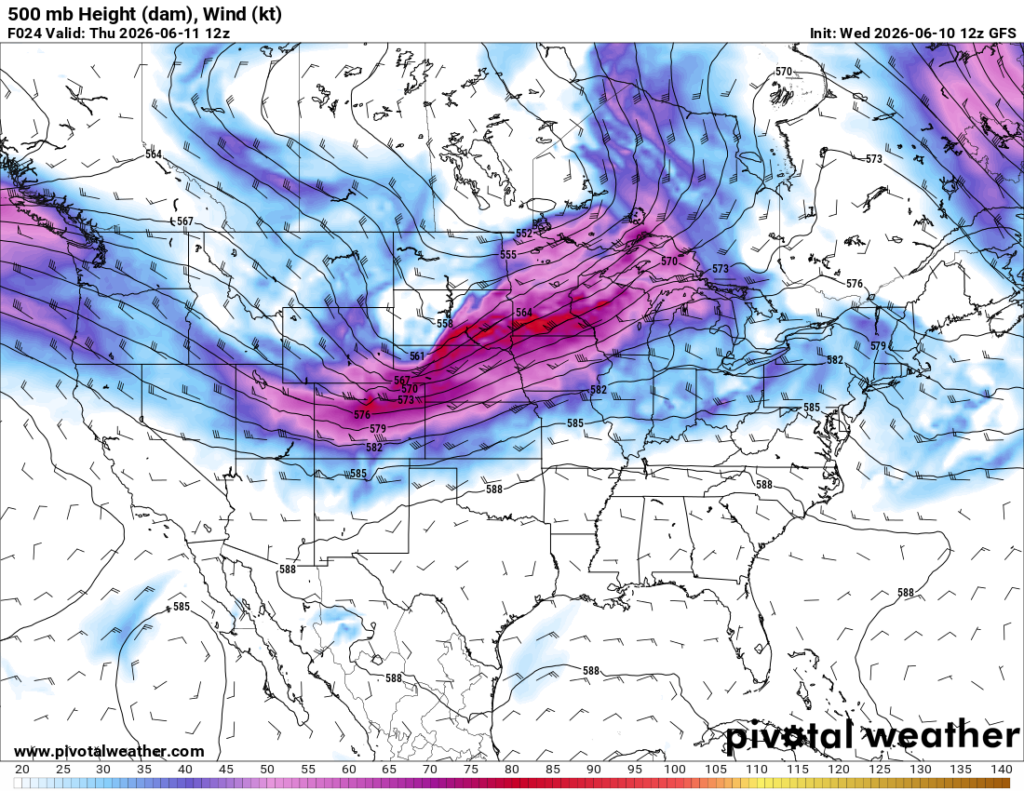
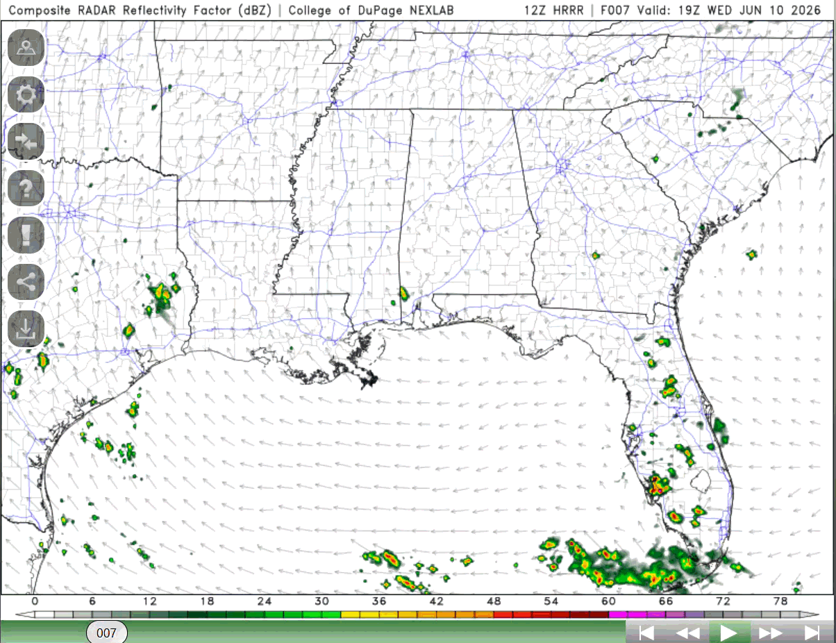
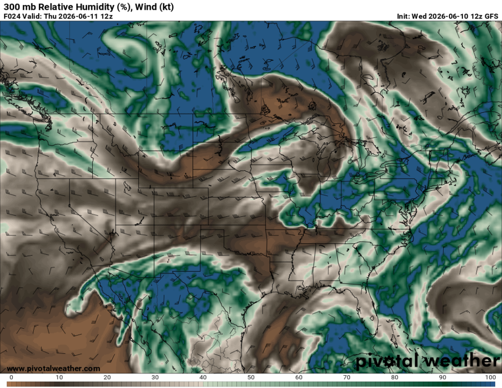
We can attribute the drier and hotter pattern to the broad high pressure that is over the southeast U.S. (as shown above). While we do have moisture and hot temperatures that can trigger some thunderstorms, this drier air above us in the mid-levels is suppressing that development (see below, the brown area over Louisiana, Mississippi, and most of Alabama has lower relative humidity).
With the high pressure also comes subsidence, the broad descent of air over this region. This also suppresses thunderstorm development. Overall, the pattern right now is not favoring the region to have much rain for the next few days. Areas with the greatest chance of rain for tomorrow is central/southern Alabama and southeastern Louisiana.

FRIDAY
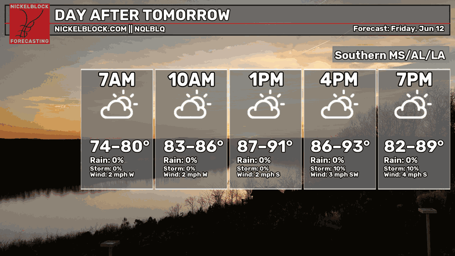
Same kind of pattern for Friday. Highs in the lower 90s, dewpoints in the low to mid 70s, and drier conditions for much of the region. There are some chances for afternoon pop-up showers, but most of the region will not see any rain.
These next few days are the perfect time to make plans for swimming or going to the beach! Next week will be different and a lot more wet, so take in the next few days.

EXTENDED OUTLOOK
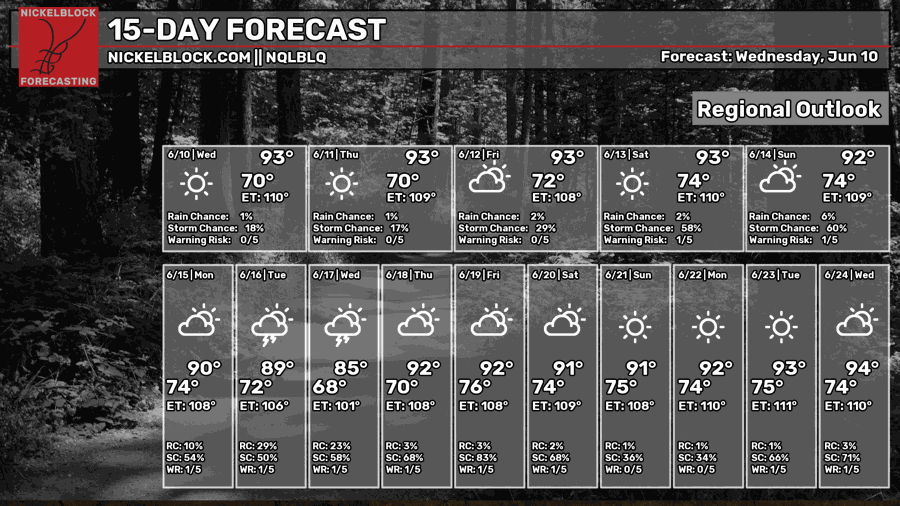
Much of the next couple of weeks will remain the same. The most interesting thing we will see is what will occur on Tuesday/Wednesday next week.
Several models point to the possibility of a slight cold front making its way through Tuesday and Wednesday. This “cold front” will give us a bit of relief, cooling the temperatures down a few degrees, but the main thing we expect from it is rain and thunderstorms.
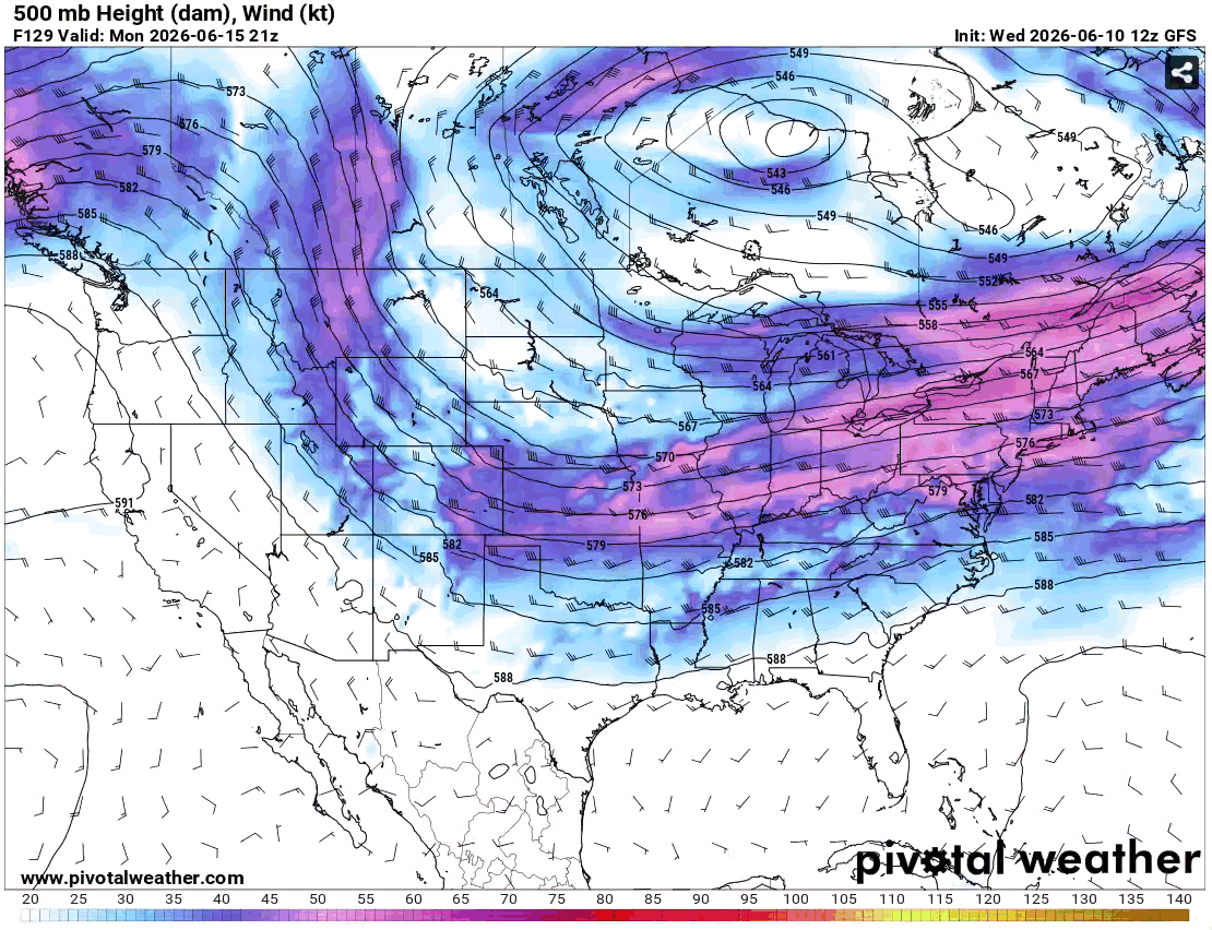
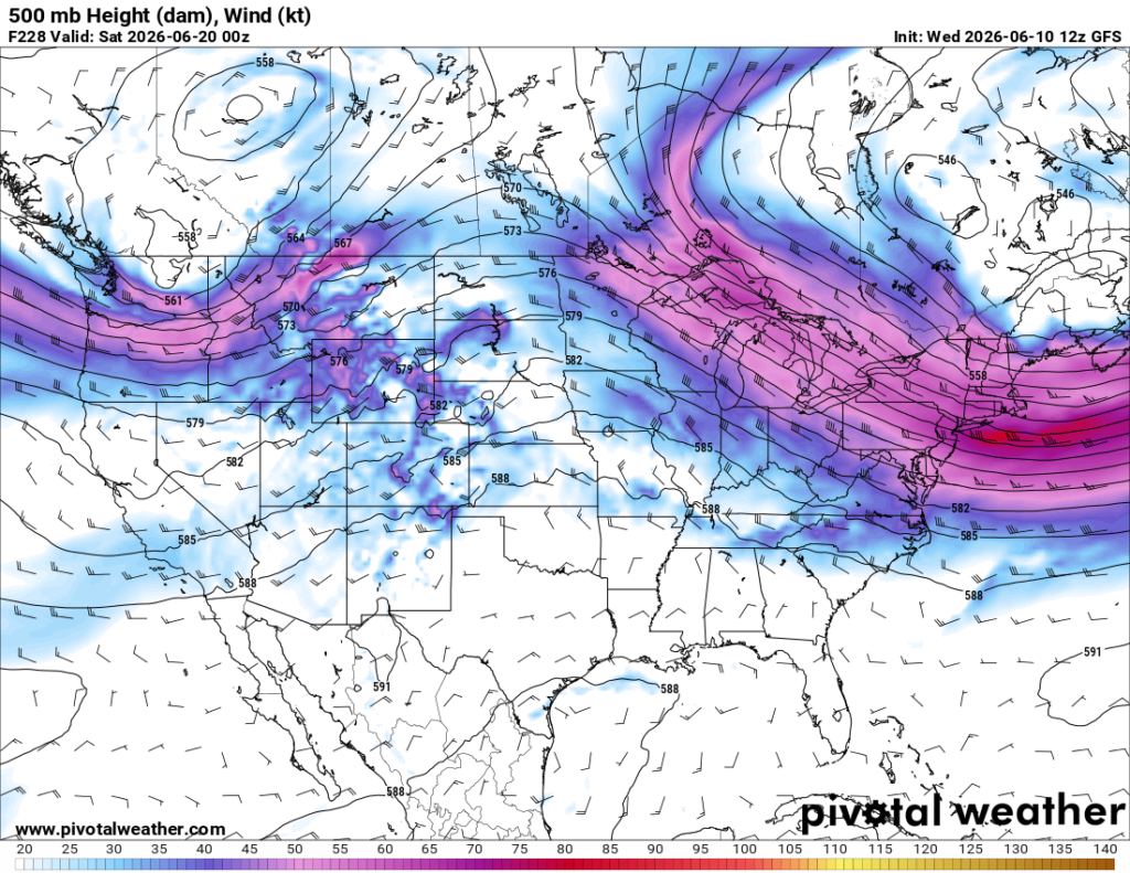
Below shows how that trough that is present in Canada extends that front into the region on Tuesday, bringing with it slightly cooler air and potential for storms. The “kinks” (sharper indents) in the height contours (the black lines) are the perfect indication on where this front is and where it is going.
We can also see the boundary in the forecast radar. I indicated below with a blue line where that boundary is with the long line of showers and thunderstorms ahead of the front. Anytime you see this, it is an indication of some sort of boundary traveling through the region.
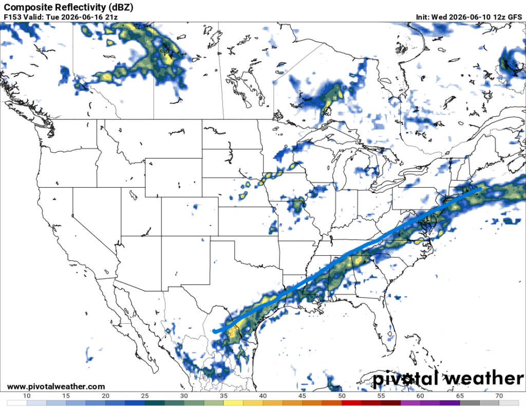
This front is the perfect set up to see lots of rain and thunderstorms developing. Unlike the typical fronts that give us cold and dry air, we will still have plenty of moisture and instability for rain and thunderstorms. It is still a little too far out to be fully confident on how strong the storms will be, but the region will be seeing rain Tuesday through Thursday.
After this event, we return back to the summer pattern of high pressure and ridging, temps building up once again.
Make sure to get out and enjoy the sun for the rest of this week!


