Howdy!
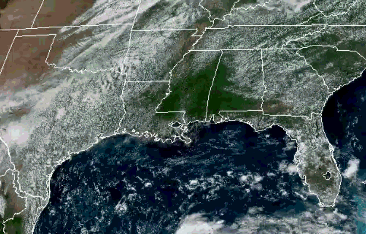
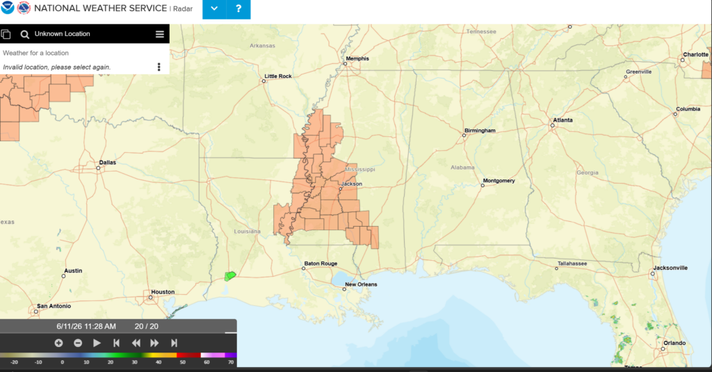
Looking out the window, there are currently (as I am writing this around 11:30am) quite a few clouds over the region, building up as the day progresses (NOAA Geocolor satellite image). We can see based off the NWS radar that there is no rain to start off the day. The most notable thing is the heat advisory for northeast Louisiana and a good portion of eastern Mississippi (as indicated by the orange area).
Temperatures are in the low to mid 80s currently and will warm up to the low 90s for the high. Low 70s for the dewpoints, so it’s a bit muggy outside. This will make the heat index higher, so make sure to take care of yourself when outside!
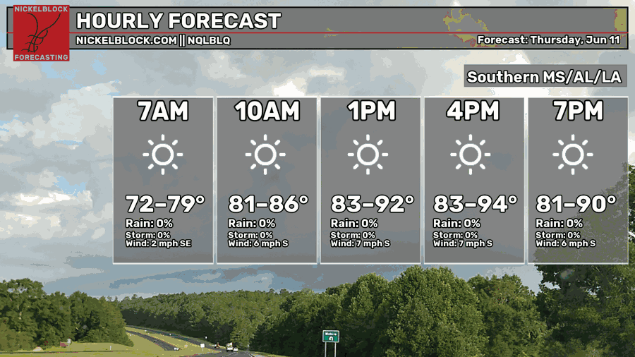
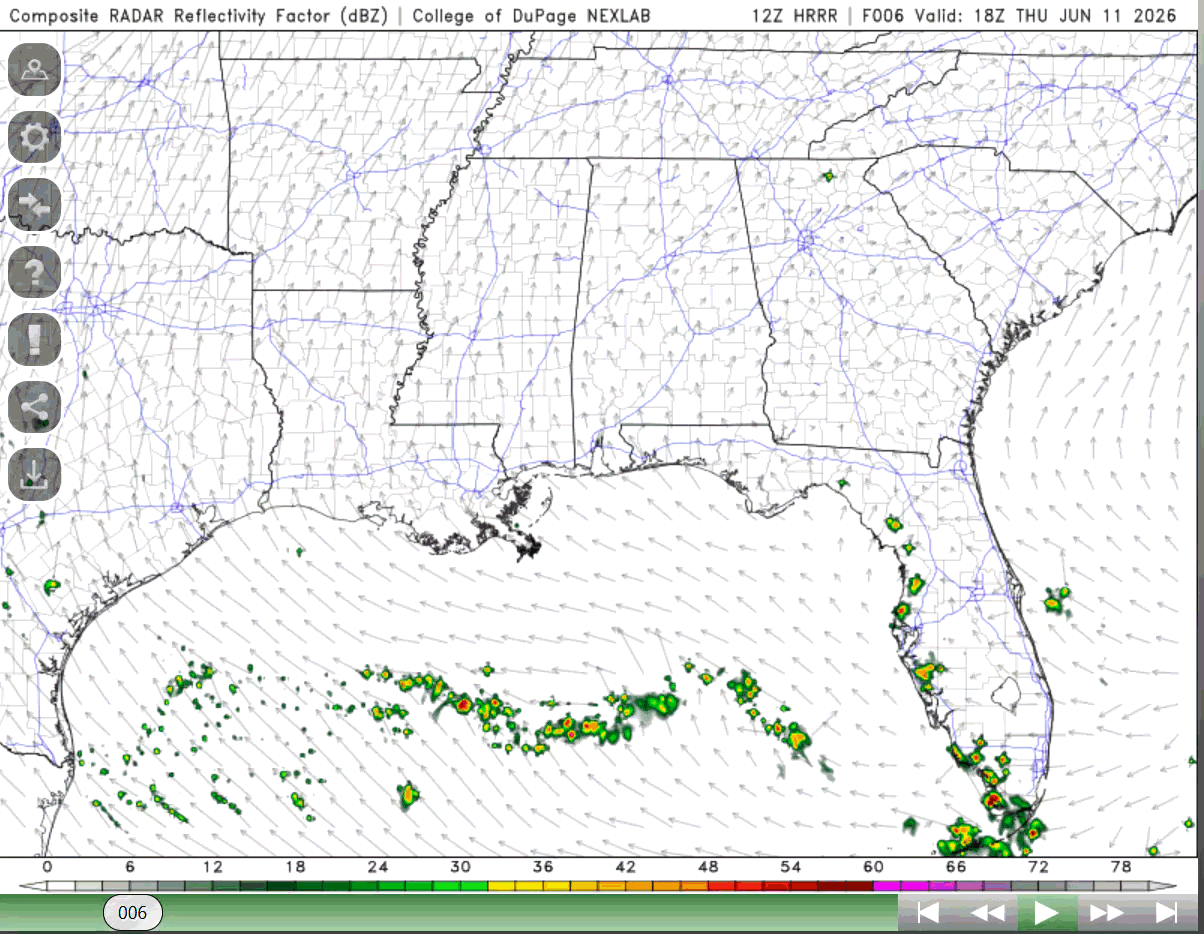
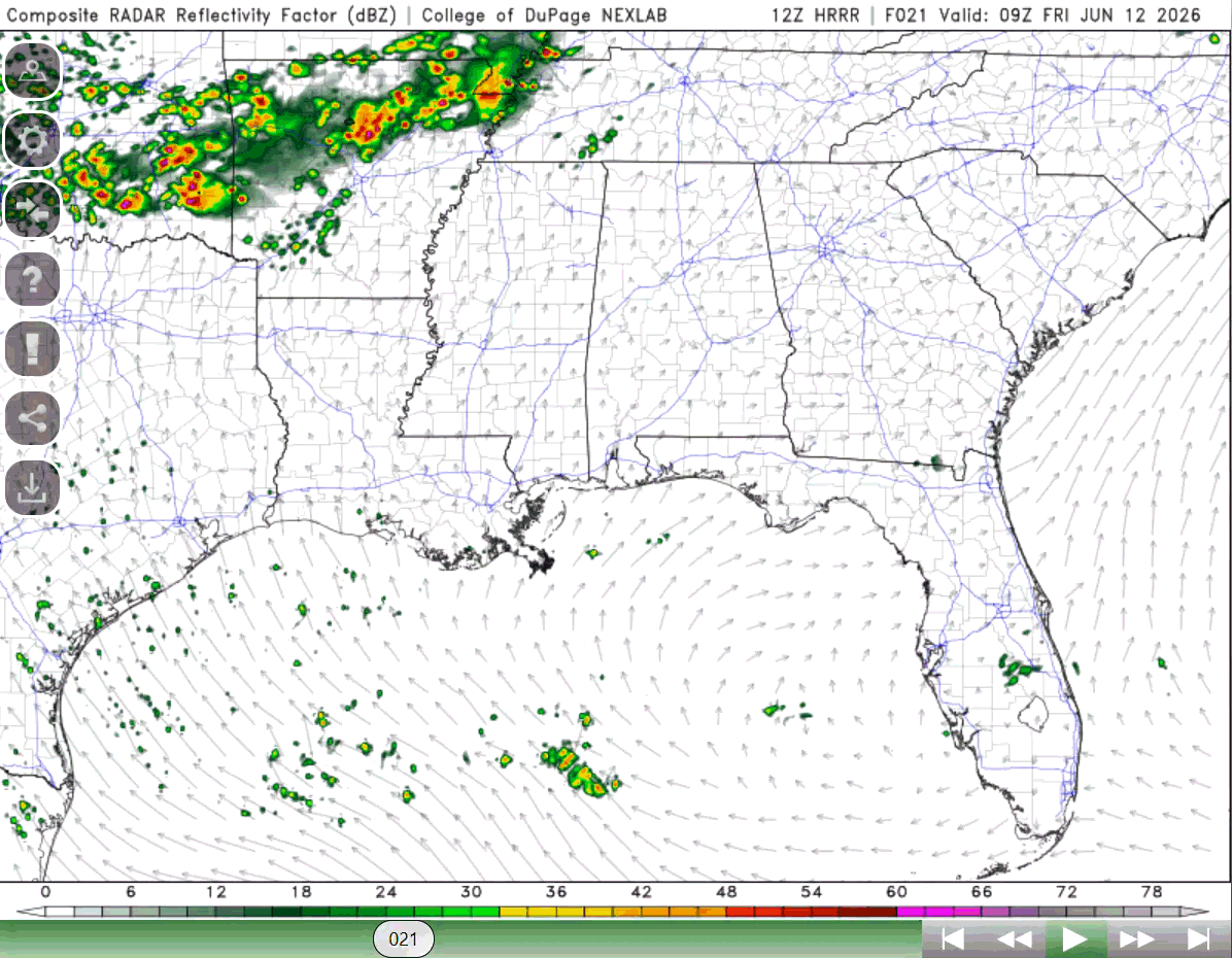
Not any change to the forecast since yesterday. Low chance of rain for most of the region today, but some areas will see some scattered pop-up showers later in the afternoon (see below on radar). Winds are from the south still bringing in some moisture from the gulf, but since the mid-levels are dry, no further thunderstorm development is expected.
TOMORROW
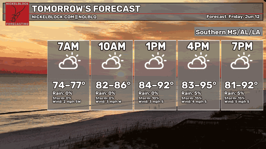
This pattern will continue into tomorrow, highs in the low 90s and humid conditions. There is a slight increase in the chance of afternoon showers and thunderstorms for the region, but again a lot of the region will remain dry. We can see this below in the forecast for tomorrow.
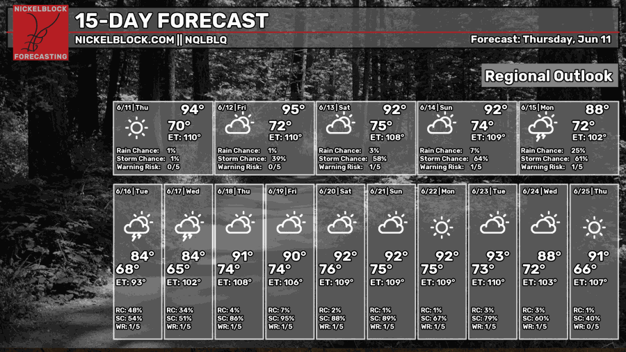
EXTENDED OUTLOOK
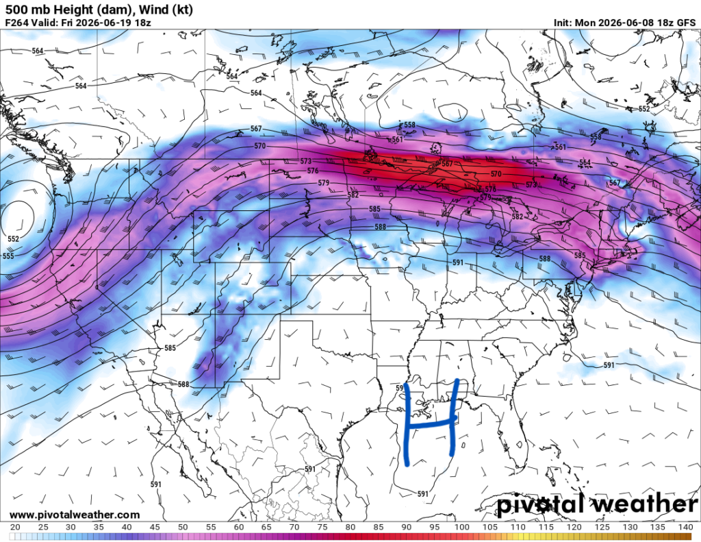
No significant changes to the forecast. Going into the weekend we might see more scattered and isolated chances of rain as the ridging pattern weakens transitioning into next week. It will be hot, highs in the low 90s for the most part with humid conditions.
The front I mentioned yesterday is still in play, slightly decreasing our high temperatures giving us a bit of relief, but also bringing lots of rain with it. Below we can see that trough extend into our region, setting us up to see thunderstorms and rain.
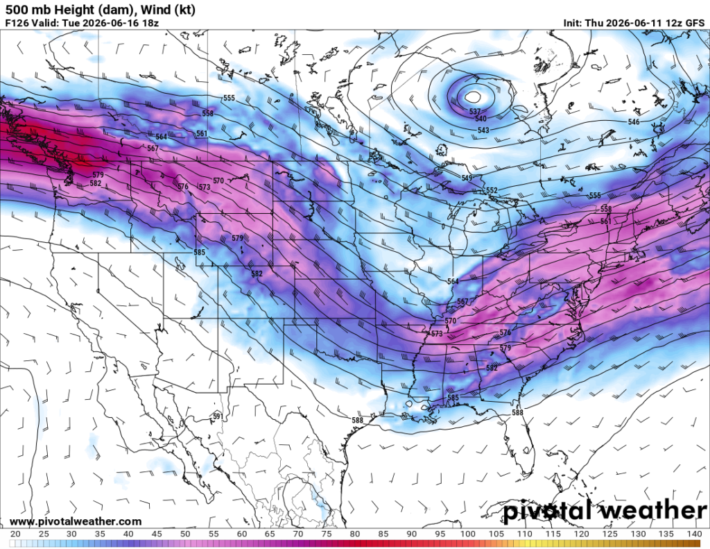
While it still is too far out to be fully confident in how strong the storms might be, there is a chance we might see heavy rainfall and some localized areas of flooding. I am confident that most of the southeast United States will get a good amount of rain Tuesday and Wednesday.
After the passage of the trough and front, we resume back to the high-pressure ridging that we see a lot in the summer, and temperatures warm up once again. Chances of afternoon showers remain for the next couple of weeks.
Again, no chance to the forecast since yesterday. Going into the weekend and into next week, make sure to carry that umbrella with you and enjoy the next few days!


