Hotttttttttt.
Very hot.
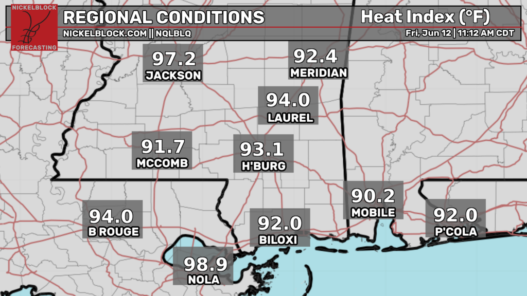
Temperatures are already in the mid 80s with dew points in the 70s. And it’s only gonna get worse. The National Weather service has issued a heat advisory from 12pm today through 8pm tomorrow for western Mississippi and far eastern Louisiana.
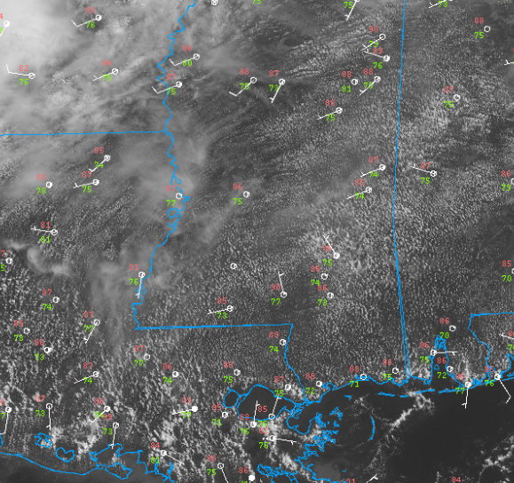
Satellite imagery shows some diurnal cumulus across the region as the surface warms. Winds are very light in most areas which will keep the heat hazards in place.
Try to limit your time outside as much as possible and take frequent breaks in air conditioning. Remember to also drink plenty of water and wear loose fitting clothing. A great day to go swimming but not much else.
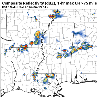
Some convective allowing models show a few isolated thunderstorms developing this evening. This is far from certain however. If these storms occur, they would be capable of heavy rain and frequent lightning (and maybe some gusty winds as they collapse). Most location will remain dry though.
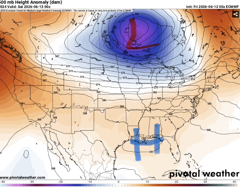
The reason these storms will be weak (and that it will be so hot) is due to the pattern in aloft. While there is a large upper trough near the Canadian border, our area is under high pressure. This means hot sinking air and weak winds allowing our area to continue to bake. Thankfully, this pattern will be changing in the next couple days.


