Well. Something may be starting to form (barely). The National Hurricane Center has outlined an area with a 30% chance of development.
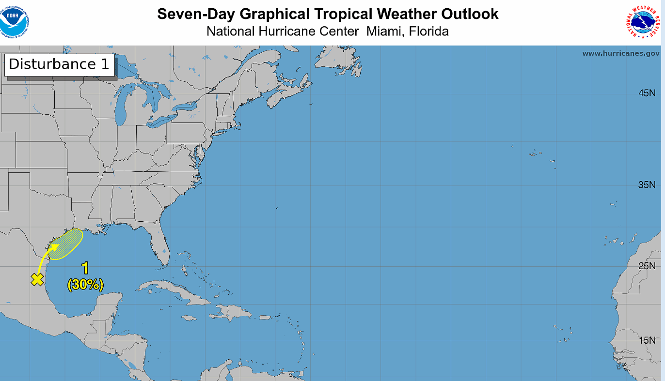
A broad area of low pressure is located over northeast Mexico currently producing some weak showers and thunderstorms. This low is expected to interact with a frontal boundary and be tugged northeast into the Gulf. This may allow for it to briefly strengthen as it reaches warm water.

Waters in the Gulf have gradually been warming, enough to support tropical cyclone development. Warm waters are only part of the story however…
There is significant amount of shear in the southern United States during the time period that this low is expected to move into. Given that and the stalled front, A strong system is not expected to develop.
This does not mean that there are no threats, but instead that the main hazards will be heavy rain and flooding rather than a major hurricane. These conditions will likely be present regardless of whether not the low takes on tropical characteristics.
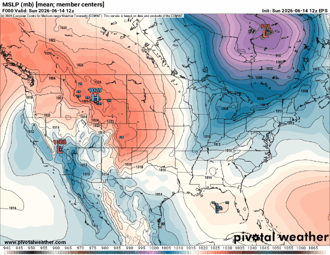
A few members of the ECMWF ensemble show the low deepening into the 990s and moving onshore up the Mississippi river valley. First of all, this is far from a sure and the more likely scenario is that this does NOT happen. Secondly, the ceiling for this system is still WELL below hurricane status.
The main takeaway: heavy rain and flooding is likely for the central Gulf Coast but this will not be very significant storm.


