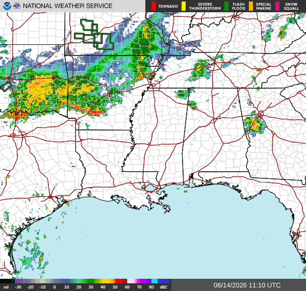
For our Sunday across the region, after a quiet morning, expect scattered thunderstorms moving in towards the afternoon. These storms will remain confined to Northern MS/AL/LA, but could become heavy and bring damaging winds to the area.

Today
Looking into the afternoon, there is a general risk of thunderstorms over most of the South. The graphic below is the Aviation Weather Center’s forecast for 2 pm CST, showing typical afternoon showers and thunderstorms. These charts are typically used to monitor aviation risks in a region, and you can even plug in your flight information into this website to see what risks you might be flying into.
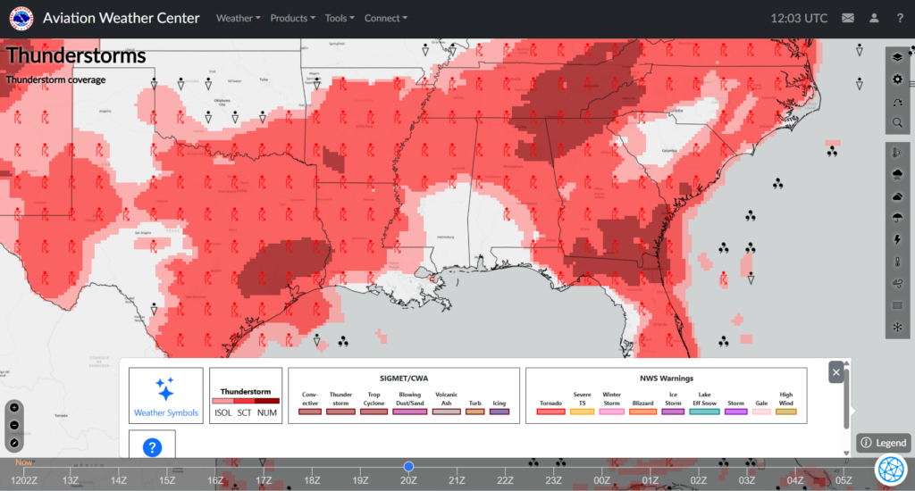
The area with the greatest risk of storms today would be the northern half of our viewing area, as stormy pieces from the low-pressure system over Arkansas escape and travel southeast. Along the Gulf Coast, expect a warm and mostly dry day with highs in the high 80s to low 90s depending on where you are. Any storms that develop inland this afternoon could bring heavy rain, lightning, and gusty winds continuing overnight.
Tomorrow
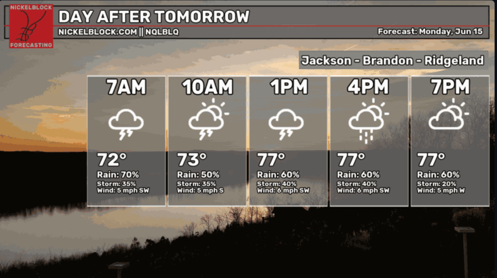
To start the workweek, Monday is fixing to be a slow, rainy day over much of the area. The southeast-moving storm drenching Arkansas today will be closing in on MS/AL/LA late this evening and continuing into the daylight hours tomorrow.
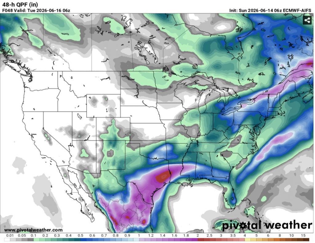
Above, our 48-hr Quantitative Precipitation Forecast (QPF) shows some decent rainfall amounts accumulating in our area. As these slow-moving storms continue all day Monday, definitely expect wet soil and even some localized flooding as this model expects high precipitation values in central Louisiana and Mississippi.
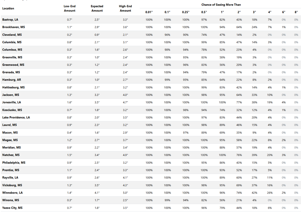
Above is a probabilistic (QPF) from Weather.gov over our area predicting rainfall totals from 7am today until 7am Wednesday. This big ole storm moving in from the northwest late this evening and continuing all day Monday will bring the bulk of the rain for our area. With the highest expected amounts in Winnsboro, Vicksburg, Natchez, Jonesville, and Jackson, ensure residents prepare for the possibility of localized flooding, as 3.5 inches is a lot of rain over just a few days.

Tuesday
After a soggy start to our week, residents can expect MORE rain hanging around on Tuesday. This would be because of the continued area of low-pressure from Arkansas we will feel tonight, which is traveling then parking over East Texas on Tuesday. This combined with the warm front over central LA/MS and the stationary front over AL allows this storm to pour out over our area, taking up most of the day on Tuesday.
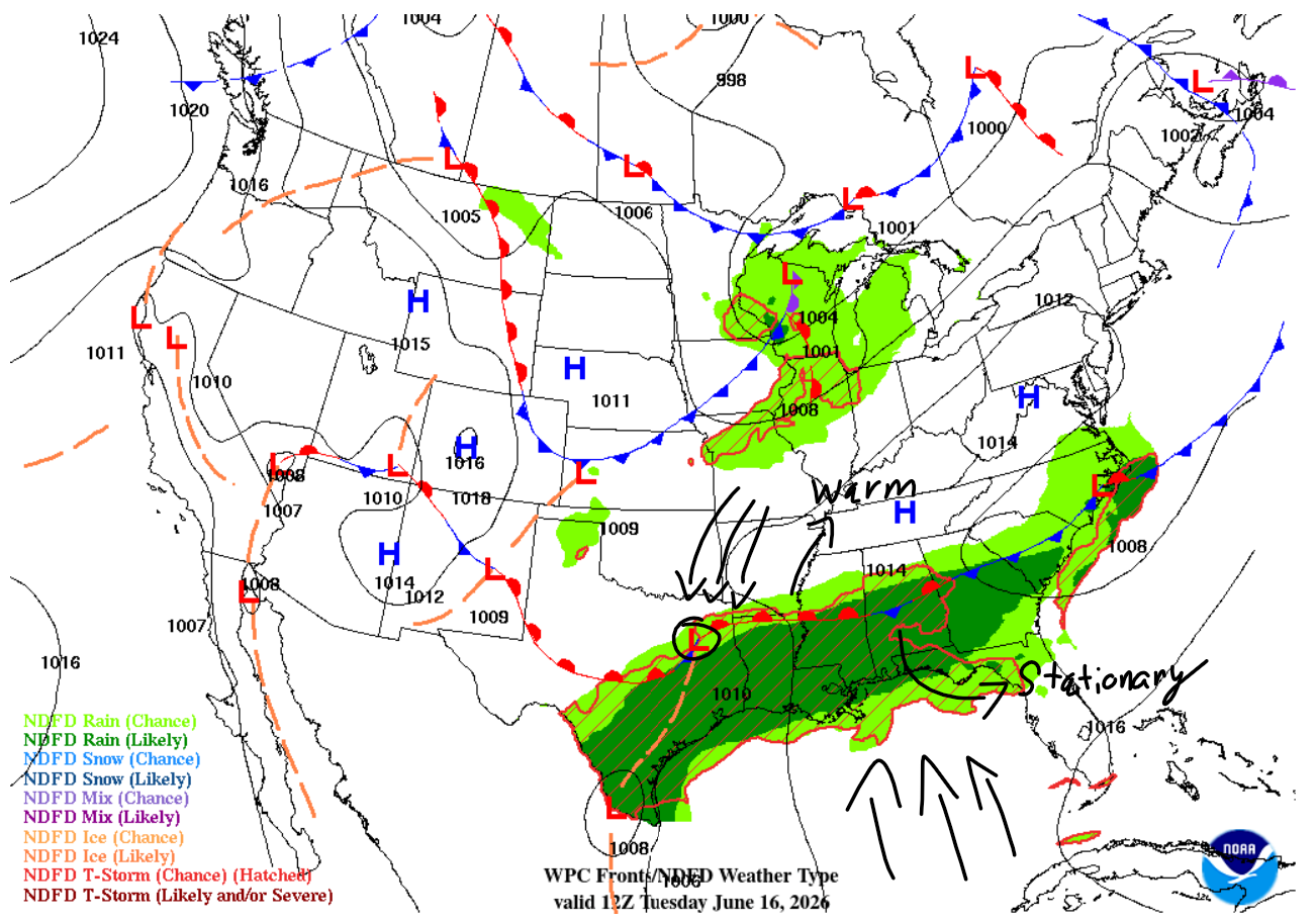
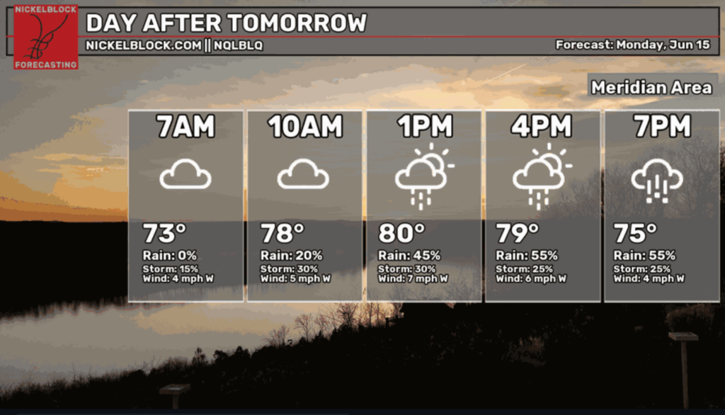
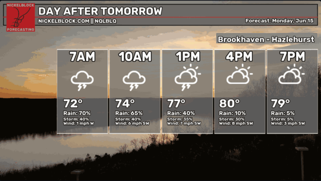
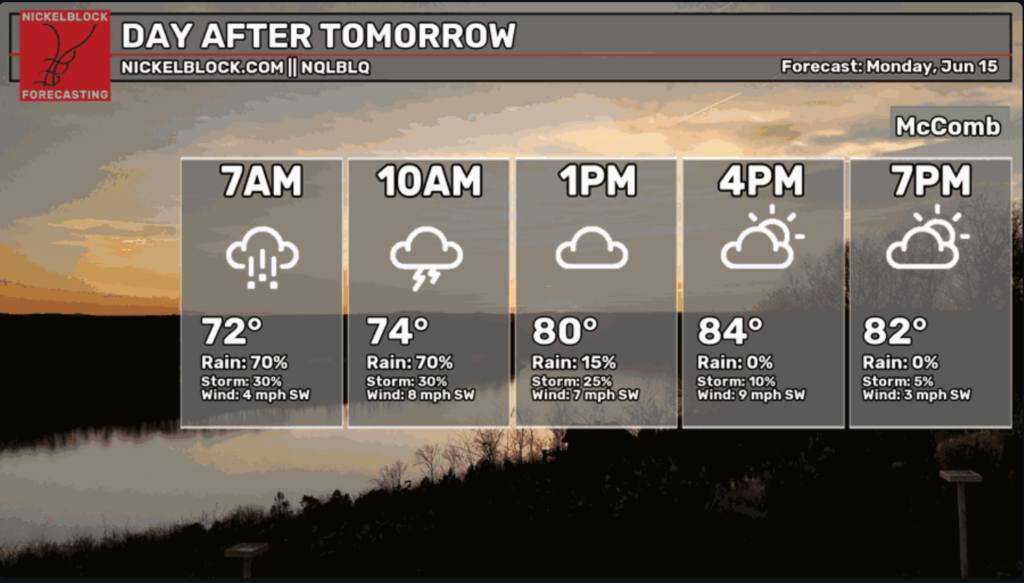
Temperature wise, this rain will cool down the region as expected, YAY. Just take a look at these Tuesday temperatures across Central Mississippi!

Extended Forecast
Good news! We can expect a cooler couple of days (Tuesday and Wednesday) when the highs will only reach the upper 90s! After that though, we are back to the summertime schedule of high temps and humidity fueling afternoon storms and driving up the heat index.
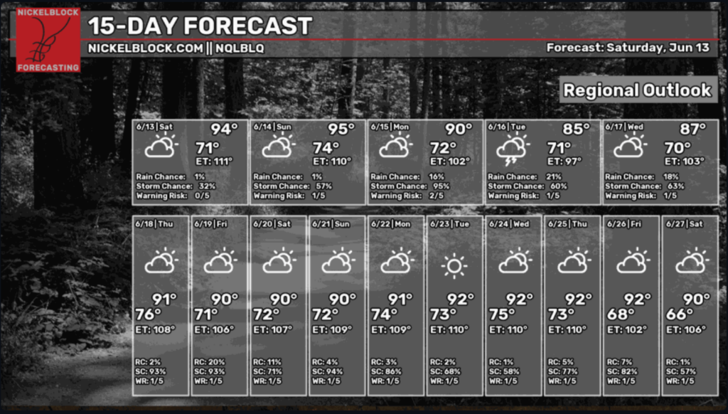
For our 11-day outlook, we see some interesting patterns as we head further into June. A sneaky area of low-pressure building from the Rocky Mountains, then travelling down to Texas could bring widespread storms to the region this coming Thursday. We also see some funky systems moving in from the Atlantic that are expected to hit Florida next week, which could mean conditions are becoming more favorable for tropical development as hurricane season progresses.
Overall, a midweek cooldown keeps things interesting for the area, along with the storms accompanying it of course. But as the week progresses, expect temperatures to return to normal as we hop back on the typical southern weather trend of hot and stormy afternoons.


