Today will be hot.
Tomorrow will be hot.
Than it’s time to get the arc ready.
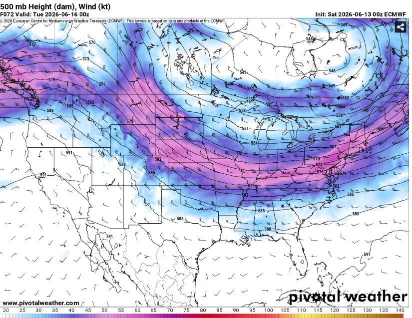
A cold front will slowly sink south over the next few days as the jet stream pushes it. The front is then expected to stall in the region allowing for several days of widespread rainfall.
This will provide the forcing that will allow for repeated rounds of convection. Severe weather chances will be on the lower side but not a nill. The most likely hazard would be damaging winds but a weak tornado or two cannot be ruled out.
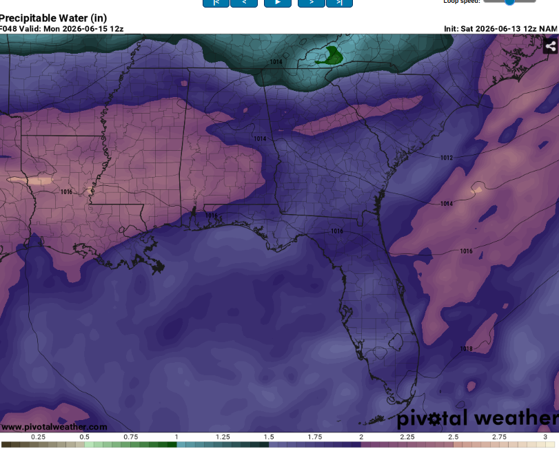
The main threat however, will be flooding. Storms will likely train in the same area for at least a couple days. Given that precipitable water values may exceed 2.25 inches, storms will have access to LOTS of moisture.
Make sure to never to drive through flood waters as the road may not even be in tact below (most flooding deaths occur in vehicles). This is still a few days out (so a bit of uncertainty remains) but it appears likely that at least some areas that normally flood may do so again.
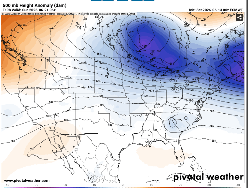
This pattern may stick around for a while as the jet stream remains in the region so get ready to need the canoe. High temperatures will likely be a little cooler than normal due to all the clouds and precip.
Airport Forecasts
Houston (KIAH/KHOU)- Tonight will be fine. Thunderstorm chances increase tomorrow afternoon into the evening. There will probably be at least a delay or two for lightning (and maybe downbursts).
Shreveport (KSHV)- The next 24 hours or so will be chill. Thunderstorms become more likely after this with a chance for lightning and or downdrafts making delays possible.
Baton Rouge (KBTR)- The next 36 hours look mostly calm. A few isolated thunderstorms are possible but the main chances will be Monday morning and beyond (which will probably cause some delays for lightning or damaging winds).
New Orleans (KMSY)- The next day or two will be mostly calm. Some thunderstorms are possible in the afternoon which may cause some brief delays. The more widespread storms probably won’t start until Tuesday.
Jackson (KJAN)- The next 24 hours will be calm. Thunderstorm chances slowly increase after that which may cause some delays for lightning and or wind.
Mobile (KMOB)- Any thunderstorms around will die off after sunset. Tomorrow will mostly be calm but there is a non zero chance of afternoon storms with a small delay for lightning possible. The main threat for storms will ramp up on Tuesday and beyond.
Birmingham (KBMH)- Tonight will be the driest time. Thunderstorm chances increase tomorrow and even more so on Monday. Delays will be possible for lightning or microbursts.
Tallahassee (KTLH)- The morning hours will be fine. Thunderstorms will be possible each afternoon and evening, potentially causing short delays for lightning or downdrafts.
Atlanta (KATL)- Tonight and tomorrow morning will be fine. Thunderstorms are possible during the afternoon and evening both tomorrow and Monday which may cause some delays for lightning or downbursts.
Highways
I-10 – Fine for tonight and tomorrow. Some storms may develop across east Texas and western Louisiana overnight Sunday into Monday, slow down to avoid hydroplaning if these occur.
I-20 – Tonight and tomorrow will be good. Scattered storms are likely across Mississippi into Louisiana after midnight on Sunday Night.
I-49 – Same story. Chill till overnight Sunday, then some scattered storms.
I-55 and I-59 – The next day and a half will be calm. Then, a chance of storms in the predawn hours on Monday.
I-65 – Most of the time will be good. Can’t rule out an isolated storm tomorrow in northern Alabama but should be dry in most places
I-75 – Some scattered storms possible during the late evening tomorrow but most times and areas will be dry.
City Forecasts
Houston, TX
Tonight- Partly cloudy with a low in the upper 70s. Dry.
Tomorrow- Partly sunny with a high in the low 90s. Scattered showers and storms likely.
Monday- Mostly cloudy with thunderstorms likely throughout the day. High around 90.
Shreveport, LA
Tonight- Dry with a low in the upper 70s. Mostly clear.
Tomorrow- Increasing clouds with a chance for afternoon thunderstorms. Highs in the mid 90s.
Monday- Numerous thunderstorms likely with mostly cloudy skies. High in the low 80s.
Baton Rouge, LA
Tonight- Mostly clear and dry with a low in the mid 70s.
Tomorrow- Mostly sunny with a high in the mid 90s. Isolated thunderstorms possible in the afternoon.
Monday- Scattered thunderstorms likely with mostly cloudy skies. Highs in the upper 80s.
New Orleans, LA
Tonight- Partly cloudy with a low in the upper 70s. No rain.
Tomorrow- Mostly sunny with a slight chance of afternoon storms. High in the low 90s.
Monday- Scattered Thunderstorms possible. High in the lows 90s and partly sunny.
Jackson, MS
Tonight- Mostly clear with a low in the mid 70s. Dry.
Tomorrow- Mostly sunny with a high in the mid 90s. An isolated thunderstorm is possible in the afternoon.
Monday- Mostly cloudy with a low in the lower 70s. Thunderstorms becoming more widespread as sunrise approaches.
Birmingham, AL
Tonight- Partly cloudy with a small chance for isolated thunderstorms. Low in the mid 70s.
Tomorrow- Scattered thunderstorms likely in the afternoon. Partly sunny with a high in the low 90s.
Monday- Thunderstorms likely and mostly cloudy skies. High in the low 80s.
Mobile, AL
Tonight- Mostly clear with a low in the upper 70s. Thunderstorms die off after sunset.
Tomorrow- Mostly sunny and dry. High in the mid 90s.
Monday- Chance of scattered thunderstorms. Partly sunny with a high around 90.
Tallahassee, FL
Tonight- Thunderstorms die off at sunset. Partly cloudy with a low in the mid 70s.
Tomorrow- Chance of scattered thunderstorms in the afternoon. Partly sunny with a high in the mid 90s.
Monday- Afternoon thunderstorms likely with increasing clouds. High in the low to mid 90s.
Atlanta, GA
Tonight- Partly cloudy and dry with a low in the mid 70s.
Tomorrow- Scattered afternoon thunderstorms possible with increasing clouds. High in the low 90s.
Monday- Increasing clouds with a high in the mid 80s. Chance of afternoon possible.


