We’re out of the drought according to the Climate Prediction Center. We got hit by a heat wave at the end of the week last week. Is there anything else that Summer 2026 can hit us with?


Today’s Setup
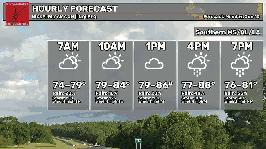
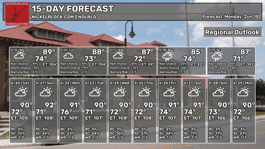
The rain has already moved in this morning and we’ll see it coming in all day. This system is moving in from the west and will keep moving in with varying rainfall amounts. It’s going to rain on and off, so bring your umbrella with you and keep your after-work plans indoors. Highs will be in the mid to upper 80s and lows will be in the low 70s. It’ll be a muggy night ahead and a rainy morning tomorrow.

Tomorrow
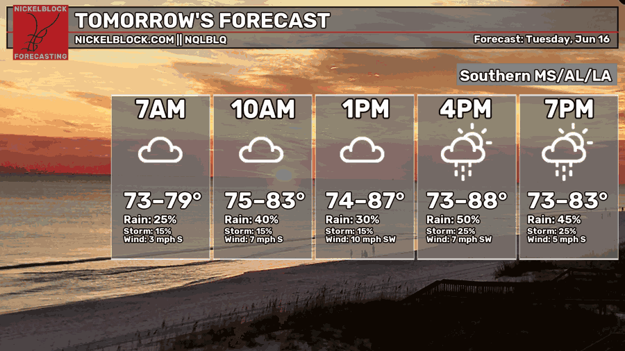
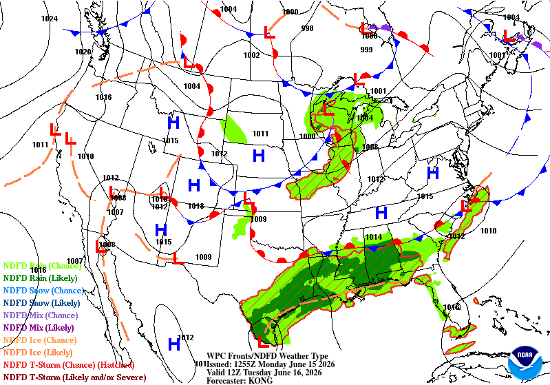
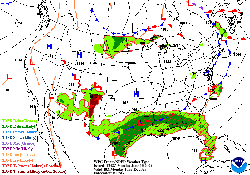
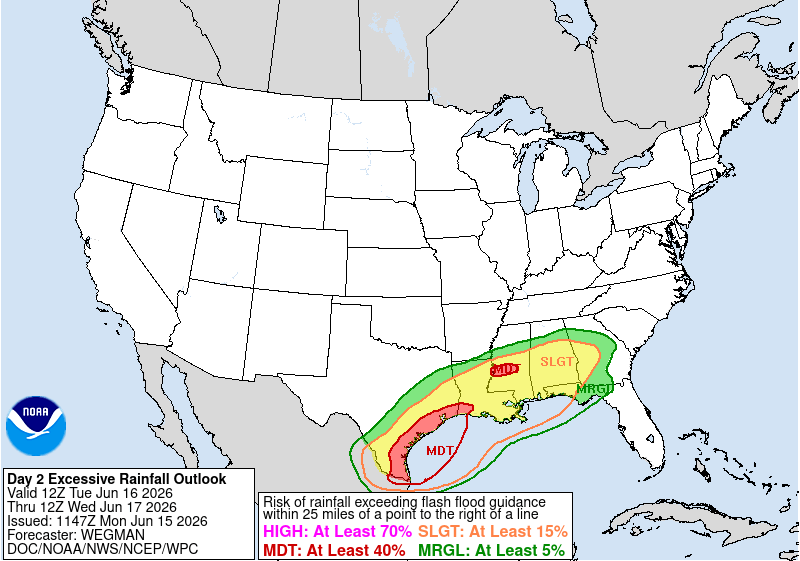
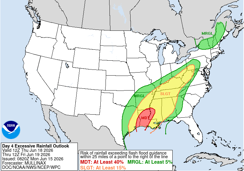
The stationary front will slowly move south moving the moisture flow towards the Gulf coast. This means more rain in is coming in over the next few days. Along with the low in Mexico/Texas, this will add to the moisture flow. Overall, another rainy day is ahead on Tuesday. Highs will be in the mid to upper 80s and lows in the low 70s. We’ll have a brief break from the rain overnight, however it’ll return by Wednesday morning. The WPC has placed us under a slight risk for excessive rainfall with a moderate risk near the I-20 corridor.
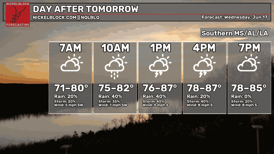
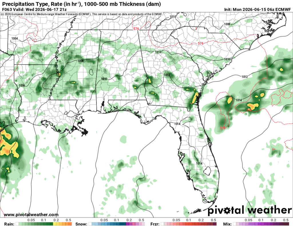
Wednesday
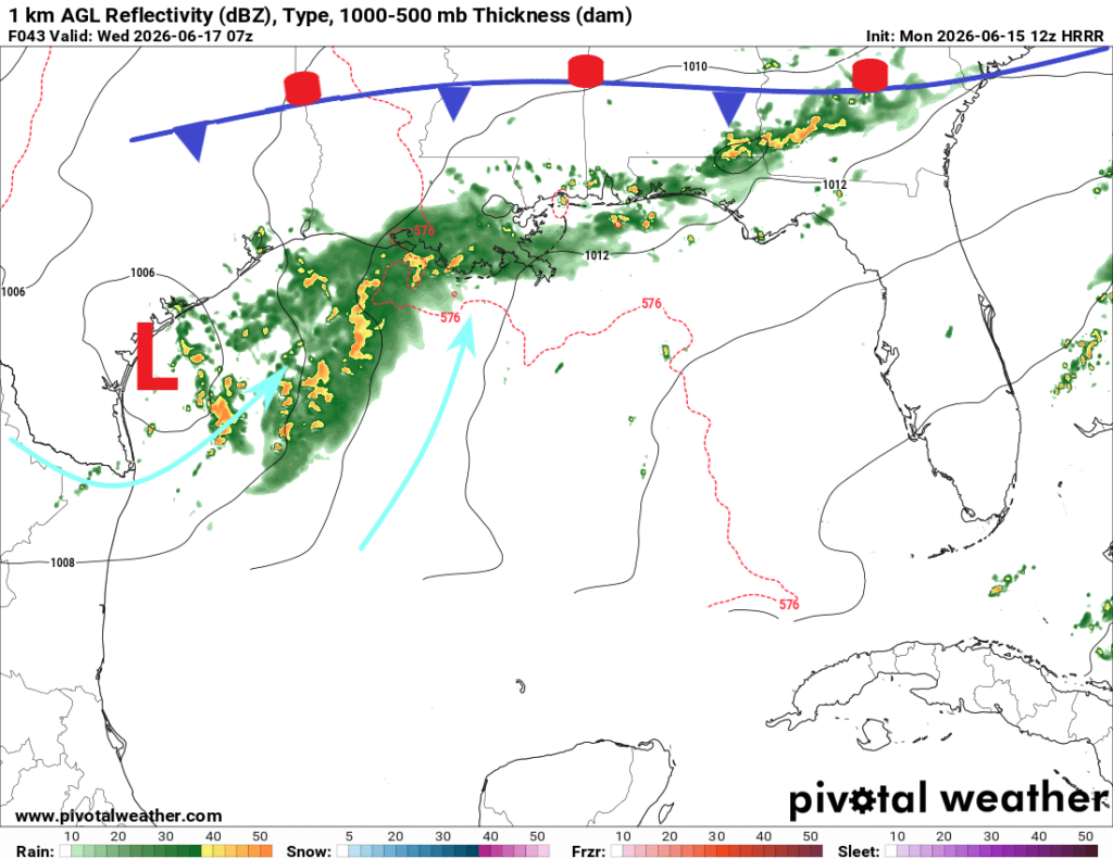
The subtropical low is hugging the Texas coastline and will slowly move towards the Deep South by Thursday. The stationary front in our neck of the woods is going to dissolve allowing the low to move in and dump a bunch of rain for the latter half of the week.
For Wednesday, we’ll have another shot for rain, but we can expect it move in from the South with a little help from the sea breeze. Scattered thunderstorms are likely throughout the day with more moving in during the afternoon. Highs will be in the mid 80s and lows in the low 70s with winds out of the South.
End of the Week
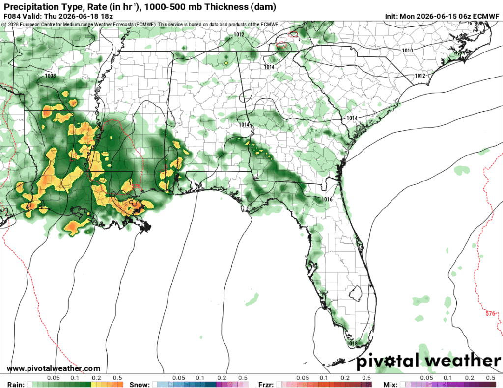
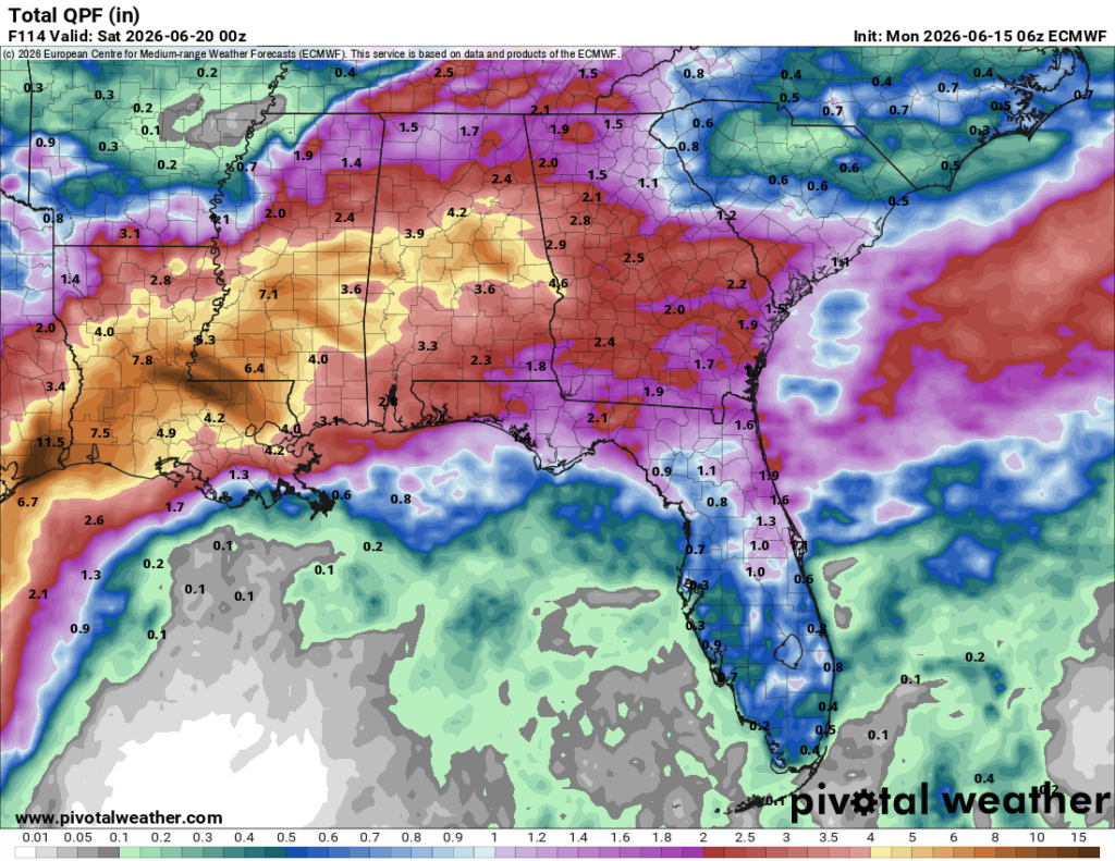
The subtropical low will move into east Texas/west Louisiana by Thursday increasing rain chances and output by a large margin. Most of our rain will be on Thursday into Friday. Expect rain and thunderstorms all day on Thursday and the first half of Friday (so far according to the model guidance). The temperature range won’t change much, but expect a hot day afterwards on Friday and into the weekend as we’re back to the status quo for Summer. Rainfall amounts will range between 1-4″ for us in the Pine Belt and much higher in southwestern MS/southeastern LA. I wouldn’t be surprised if the lower part of the Mississippi river rises quite a bit or even floods by next week. If you live near the river, heed any flood warnings!
Have a good week and stay dry!