As I’m writing this at 12p CDT, temperatures are generally in the upper 70s and mid 80s across our region, with a somewhat sharp north-south temperature gradient.
On our radar, we are experiencing some significant precipitation, with a large area of storms and heavy showers from Shreveport to Jackson to Tallahassee. Many of these storms may produce localized flash flooding.
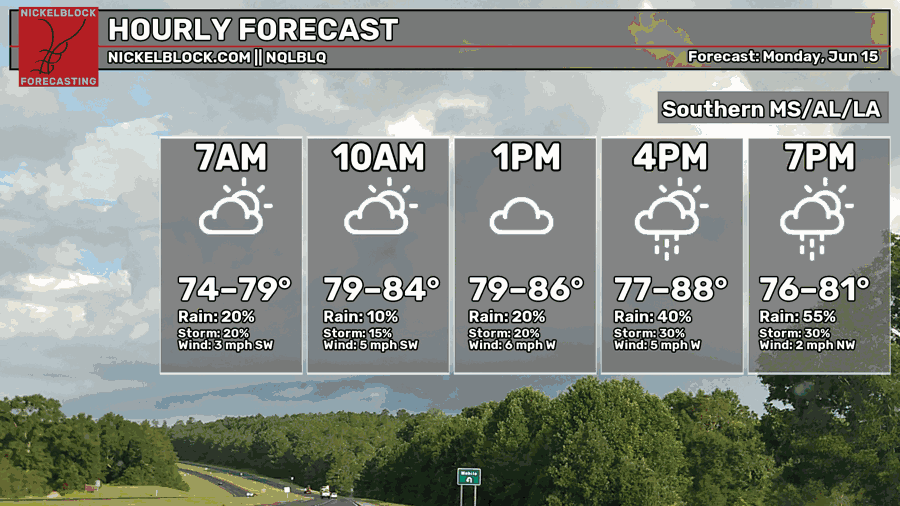
Afternoon highs today will range anywhere from the upper 70s to the upper 80s, with the warmest highs most likely being further south towards the coast as the rain has not reached that area yet, and the coolest highs most likely being further north where the rain currently is.
For tonight, most areas south of Laurel, MS will be spared from the rain until about 5 or 6 this evening, which is when the storms will reach the coast of MS, AL, and the FL panhandle. The big winner (tonight) will be southeastern Louisiana, especially in the area south of New Orleans, which may not see much significant rainfall tonight.
Rainfall totals tonight will range from half an inch to 2″ of rain, with local amounts that could be significantly higher.

Tomorrow
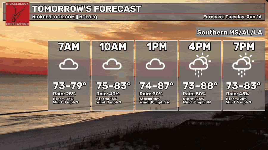
Moving into tomorrow, we’re in for another rainy and slightly cooler day. Afternoon high temperatures will range from the low-mid 70s to the upper 80s. Similar to today, a north-south temperature gradient due to the rain will set up.
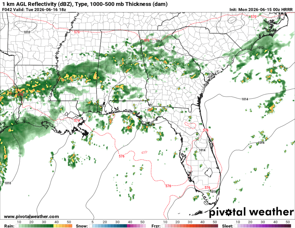
Strangely, the location of the line of storms will be centered around Jackson tomorrow, in almost the exact same place as today. For the area between Monroe, LA, Jackson, MS, and Meridian, MS, the rain will be nearly constant from now until tomorrow night. If you’re in those areas, expect some localize flooding. If you live by a place that floods frequently, that area will likely flood.
It’s looking like an all-day rain kinda day tomorrow!
Wednesday
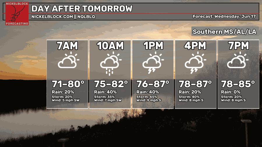
Going into Wednesday, we’re expected to see afternoon highs that will range from the mid 70s (in areas with lots of rain) to the upper 80s (in drier areas). Much like tomorrow, Wednesday will feature heavy rain, especially in the morning. In the afternoon and evening, things may clear up a little bit, but not too much.
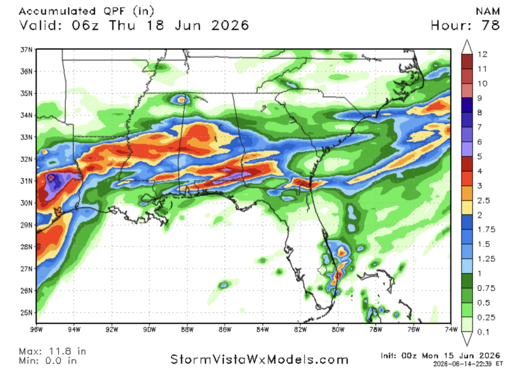
Over the next 2 and a half days, our region is forecasted to receive some hefty precipitation totals. Most of our region, except for southern Louisiana, will see a widespread 1-3″ of rain. The heaviest swath of rain will likely set up right along the I-20 corridor, with totals that could approach 5″. During this rain event, there is a very good chance of flash flooding, so make sure to pay attention to your local weather warnings and turn around and don’t drown!

Extended Outlook
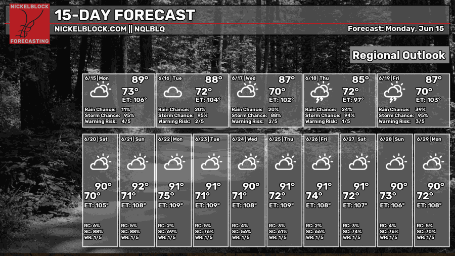
The next 2 weeks, besides Thursday and Friday, look pretty typical for June in the deep south, with most days getting into the lower 90s with a daily chance of storms.
Late Wednesday night going into the early hours of Thursday, the tropical disturbance currently situated over Mexico will make its way northeast creeping into Louisiana. After that, it will make its way east, dropping heavy rain in the exact same areas forecasted to get soaked tonight, tomorrow, and Wednesday.
This may cause some more flooding issues, since the ground will already be significantly saturated and cannot hold as much water.
We just can’t catch a break, can we.
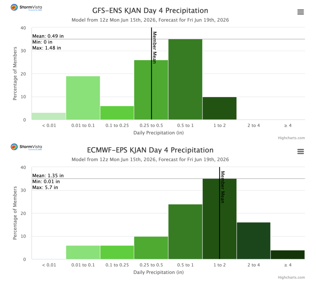
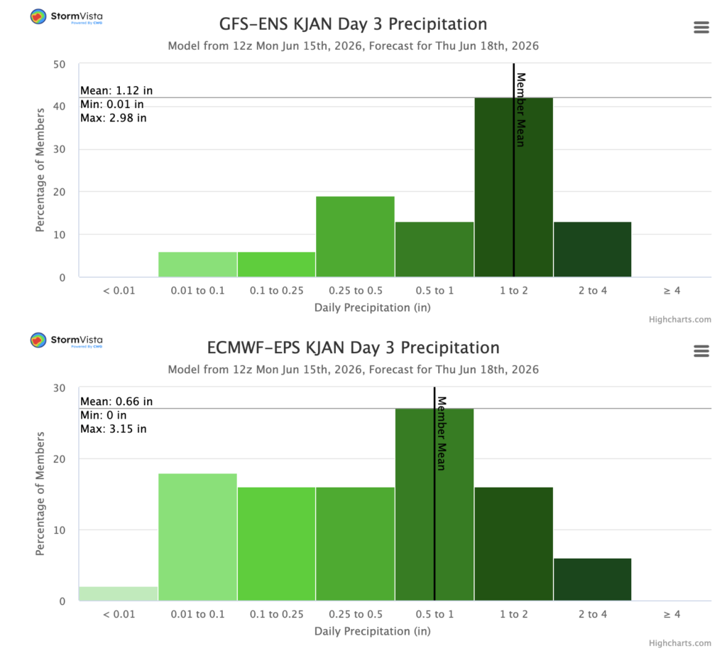
The GFS and ECMWF ensemble members are suggesting that a good 1-3″ of rain is likely for Jackson from this tropical disturbance. I included both June 18th and June 19th since the low pressure system is forecasted to move into the area overnight.
If you add up the mean precipitation for both days for the GFS and Euro, they come out to be roughly the same, even though they predict different amounts for each day. What this means is that the only thing they disagree on is the timing.
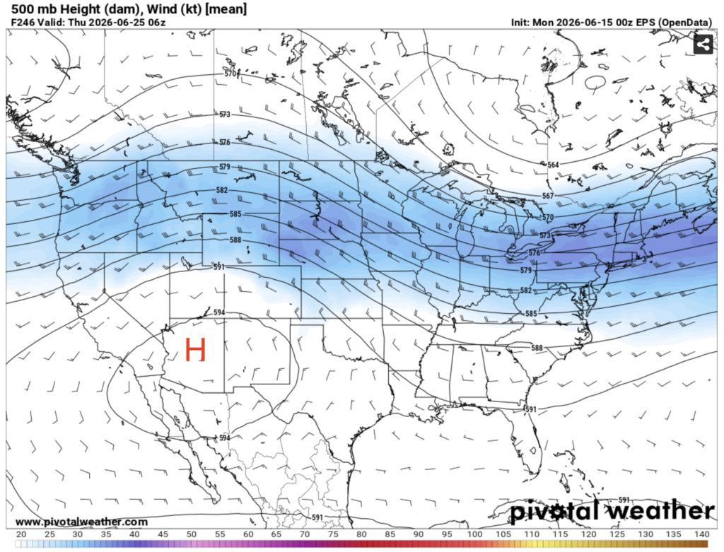
Looking further ahead, it’s looking like some ridging may develop over the southwestern U.S., allowing the trough over the midwest to dip down a bit further south than it has been. For us, this means temperatures will remain close to average with a daily chance of storms, very typical for this time of year.


