Howdy!
These next few days are going to be wet, and under a marginal risk of severe weather during this period. High rainfall amounts are possible especially in southern parts of the region near the coasts. Widespread flash flooding is possible due to the intense rainfall, and possible weak, short-lived tornadoes can occur, so make sure to prepare for this and to keep weather aware if you live in these areas.
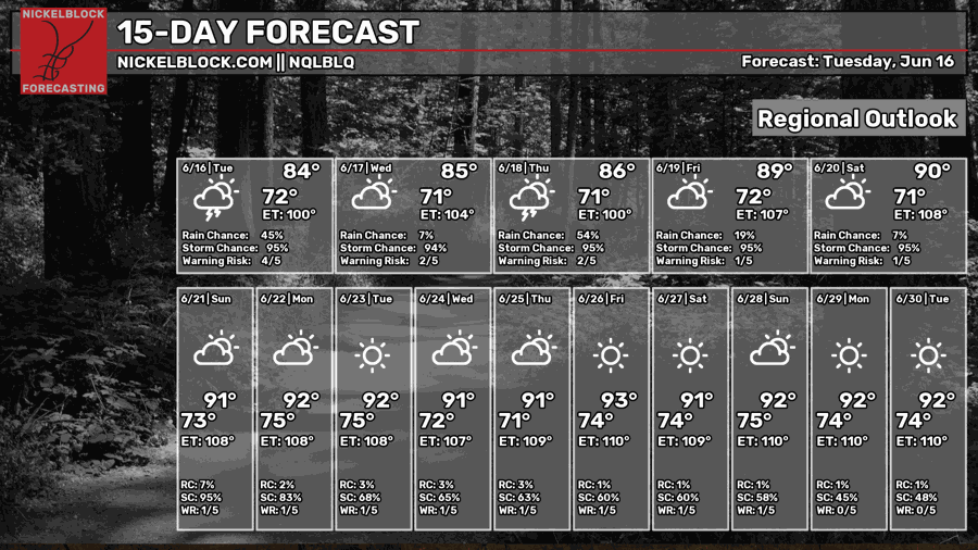
By next week, chances of rain will decrease, and we will return to summer weather.

TODAY AND TONIGHT
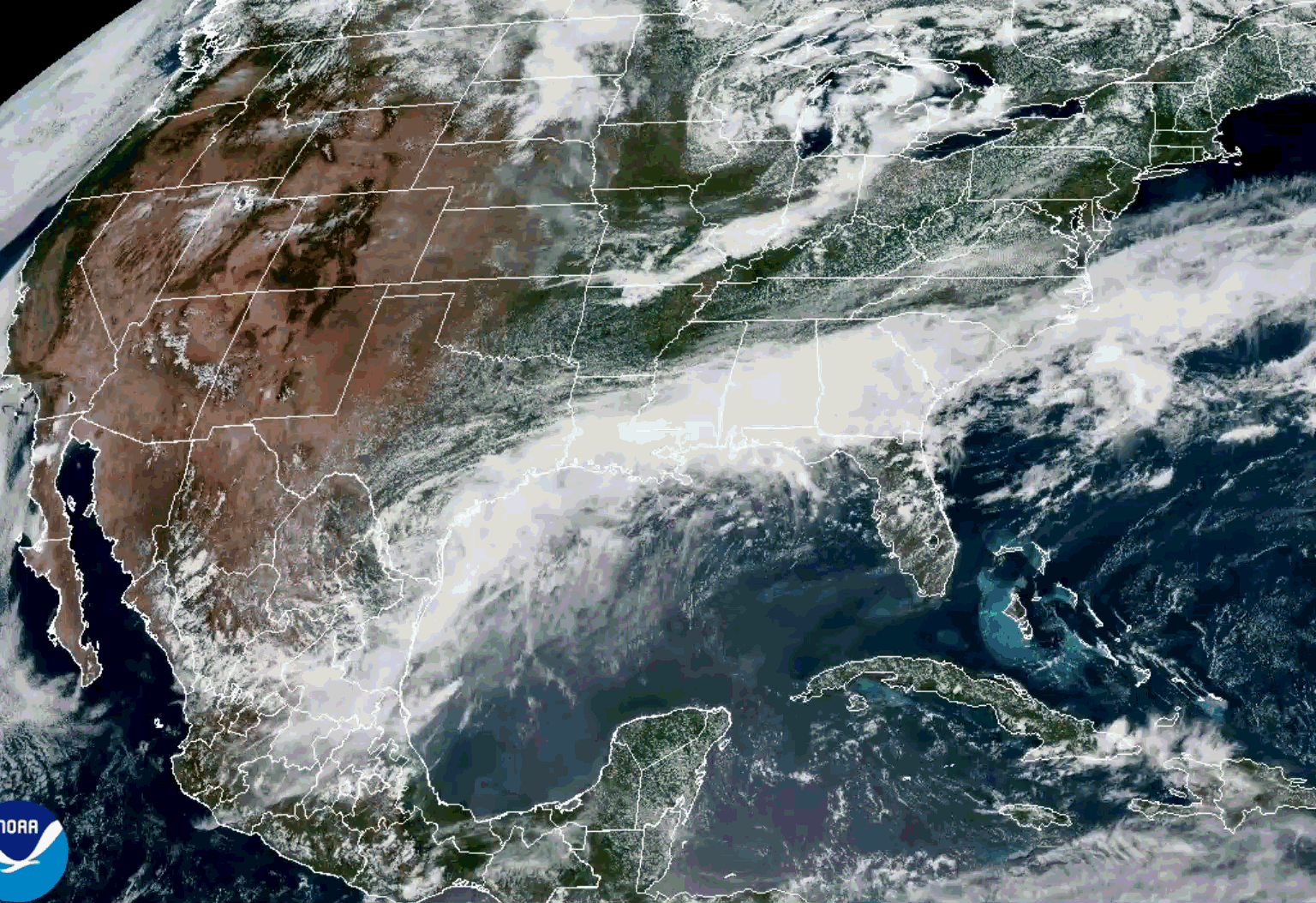
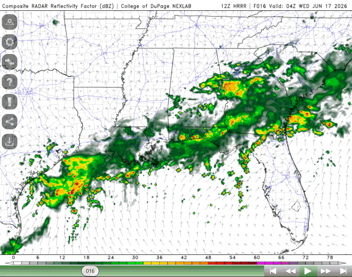
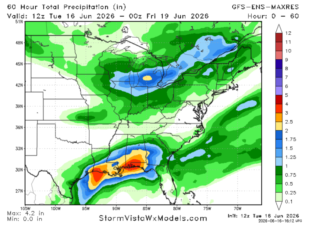
Much rain in the area to start off the week. Between the frontal boundary and the tropical low over south Texas, there is abundant moisture and rainfall extending from Mexico to the Carolinas (see NWS radar). Below we can see on the satellite imagery (from NOAA) the cyclonic spin over southern Texas and the frontal boundary over our region currently. Flash flood watches and warnings have already been issued in the region.
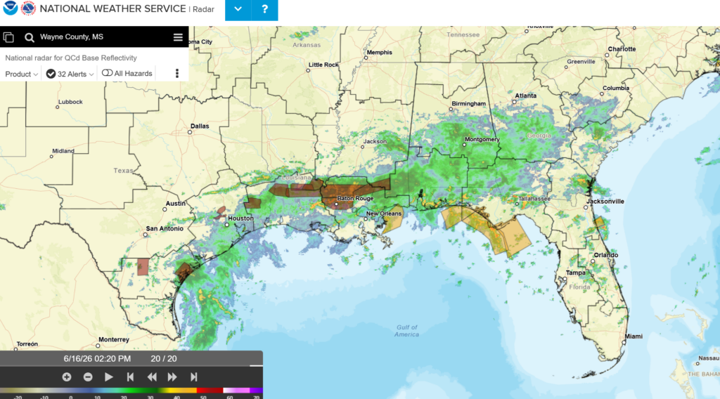
Temperatures currently range from the low 70s up to 80 for the region, dewpoints in the low to upper 70s. The rain will continue for the rest of the day into tomorrow, southern areas of the states will see the greatest amount of rainfall. The rain will keep temperatures cooler, but high amounts of rainfall are possible especially in southern Louisiana, Mississippi, and Alabama (leaving this are under a flood watch and some warnings).
The SPC has the region under a marginal risk of severe weather until Thursday. Some strong storms can develop, producing hazardous conditions. Thunderstorms are also possible for the entire region today and tonight, so make sure to stay weather aware and pay attention to what is going on around you! Also damaging wind gusts in the stronger cells are possible.
Rainfall amounts for today can range from a quarter of an inch to almost two inches for southern LA, MS, and AL.
TOMORROW
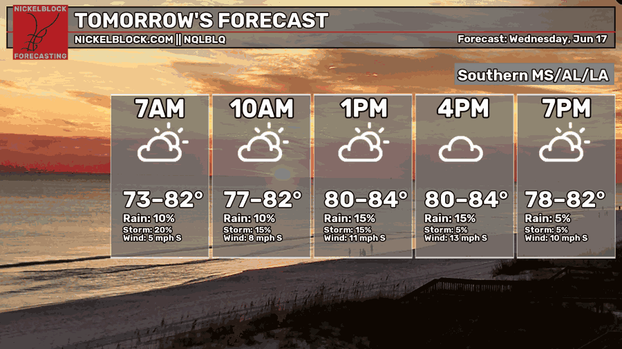
Tomorrow, the highs will be cooler due to all the rain in the region, ranging in the low to mid 80s. The lows will be in the lower 70s, dewpoints still in the 70s for much of the region. While the region will see less rain than today, heavy rainfall will still be possible especially for southern parts of Louisiana near the coast. This area can also see some flooding, so plan around this!
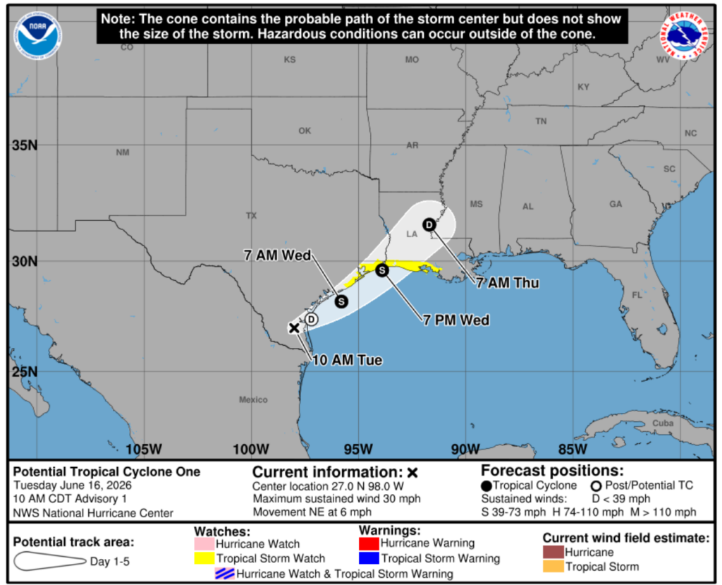
The tropical low has the possibility of entering the gulf again and briefly forming into a tropical depression/storm producing more rainfall. This area will continue being monitored for the next couple of days. the NHC has some areas along the coast in southwestern Louisiana under a tropical storm watch. This will impact the weather tomorrow into Thursday as the system heads closer and over the region (see below for NHC cone path).

THURSDAY
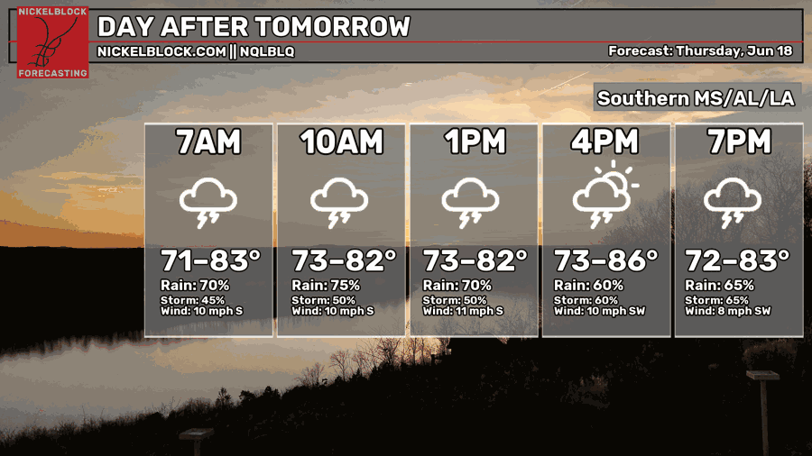
Thursday we will see more rain and thunderstorms for the region. Highs range from the low 70s to the mid 80s due to all the rain that will occur. Strong thunderstorms are possible, the tropical system can aide in producing some strong wind gusts and heavy rainfall along the coast for Louisiana, Mississippi, and Alabama. Coastal flooding is possible in these regions.
Below in the GIF, this is showing what the different members of the GFS-ENS are showing for the amount of precipitation is possible for this week into the weekend. There are much agreement and disagreement, some members point to the coast of Alabama having the most amount of precipitation, others pointing to the whole area along the coast. I think this is useful to see the different possible outcomes, and it also shows the uncertainty in the total amount of precipitation possible.
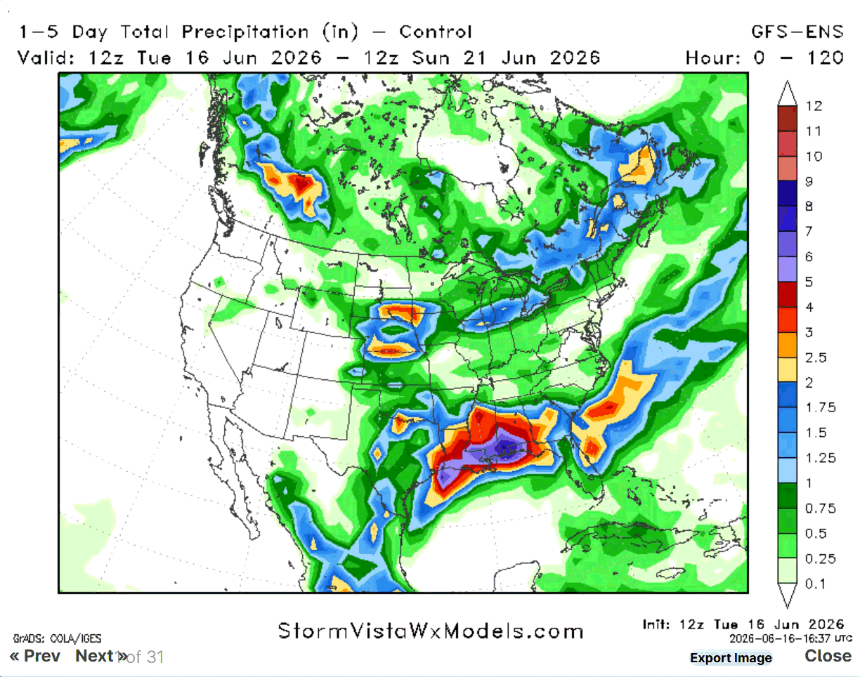
Overall, much of the region will get rain, some areas with heavy rain (along the coast/southern areas) so please take this seriously and plan around the weather these next few days.

EXTENDED OUTLOOK
These next few days will be wet, and widespread flooding is possible. Main hazards for the next few days include flooding, high winds, and possible short-lived and weak tornadoes. Even with marginal environmental conditions, the tornadoes can form from tropical systems and are very short-lived. They don’t take down houses but can knock down power lines and trees and can damage roofs. Like I said, make sure to stay weather aware!
Going into the weekend, we return to summer weather and by next week, we have shortwave ridging build over us. This will increase the high temperatures, and we will see more sun. Moisture and convective potential will remain through the weekend, decreasing into Monday where isolated chances of rain are possible. Afternoon chances of rain are possible each day.
The main thing to take away from all of this is to please keep checking with the weather these next few days. Heavy rainfall is no joke, especially from a tropical system. Stay safe and have a good day!


