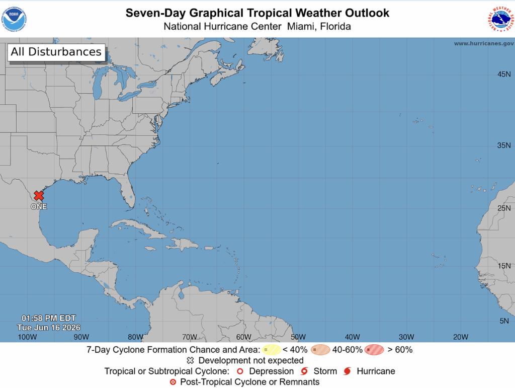
Right now, we have a potential Tropical Cyclone One. It’s located near the south Texas coast, slowly moving northeast. The disturbance could become a tropical storm on Wednesday. The expected path would follow the coast of the Gulf through Texas and into Louisiana by Wednesday or Thursday night.
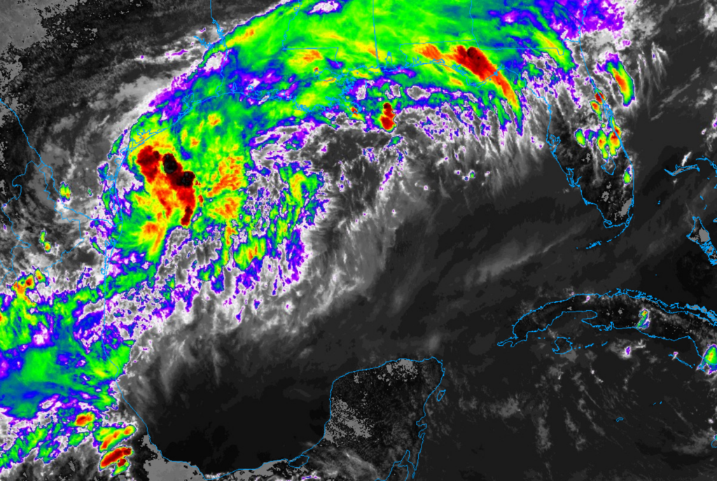
The lingering front across the Southern region brought cold, dry air that is mixing with the warm, moist air from Tropical Cyclone One. Where the air masses have met, there has been lots of rain and thunderstorm activity. The image on the right, infrared imagery, shows us cloud-top temperatures. Colors that are black and red tell us the cloud tops are very cold with strong lifting, so strong thunderstorms. The green also has cold cloud tops but with moderate lifting, so more rainfall.

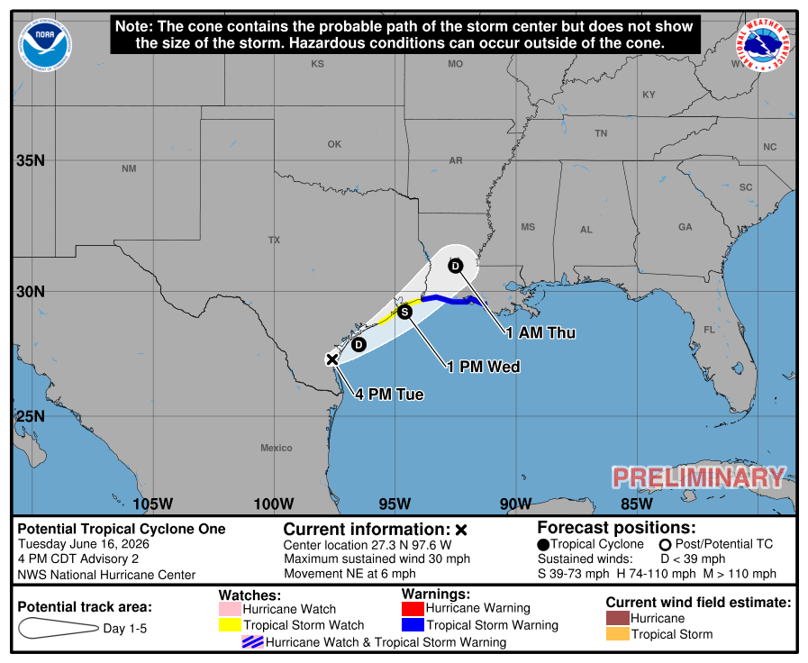
By Wednesday afternoon, the center of the tropical cyclone will be near the MS/LA border. While the center won’t make landfall until tomorrow, the effects will be felt early. East of the center will dump tons of rainfall in deep south.
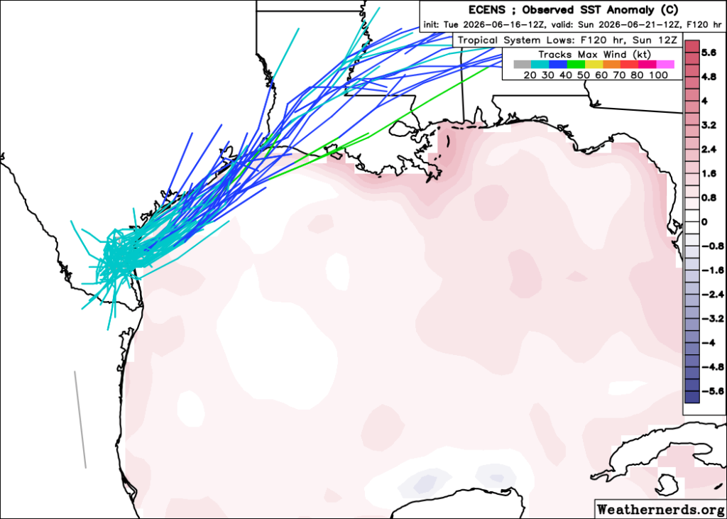
The ECMWF Ensemble follows the NHC cone quite accurately, with landfall near eastern Texas and a turn northeast.
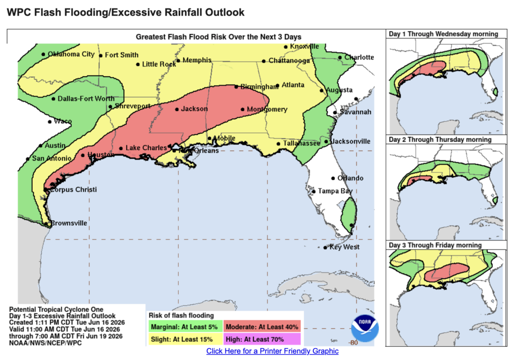
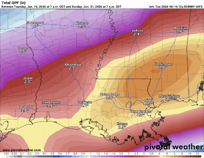
The heavy rain and flooding risk would be in Texas, Louisiana, Mississippi, Alabama, and even the Florida Panhandle. The rain could produce 4-8 inches, with an extreme of 12 inches in some areas. Our region will be under a slight and/or moderate risk over the next 3 days (between 15% and 40%).
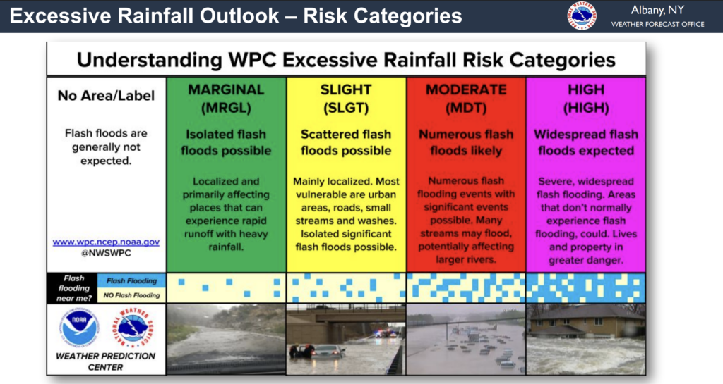
Below explains what the risk categories mean:
Multiple models agree on the flood risk here in the deep south, especially in LA, southern MS, and southern AL.
Tropical Cyclone One winds are currently 30 mph with even higher gusts. The winds will strengthen before making landfall. The winds should begin to weaken on Thursday once the cyclone moves inland.


