It’s mid June and we’re talking about warm temperatures and chances for rain. What else is new?
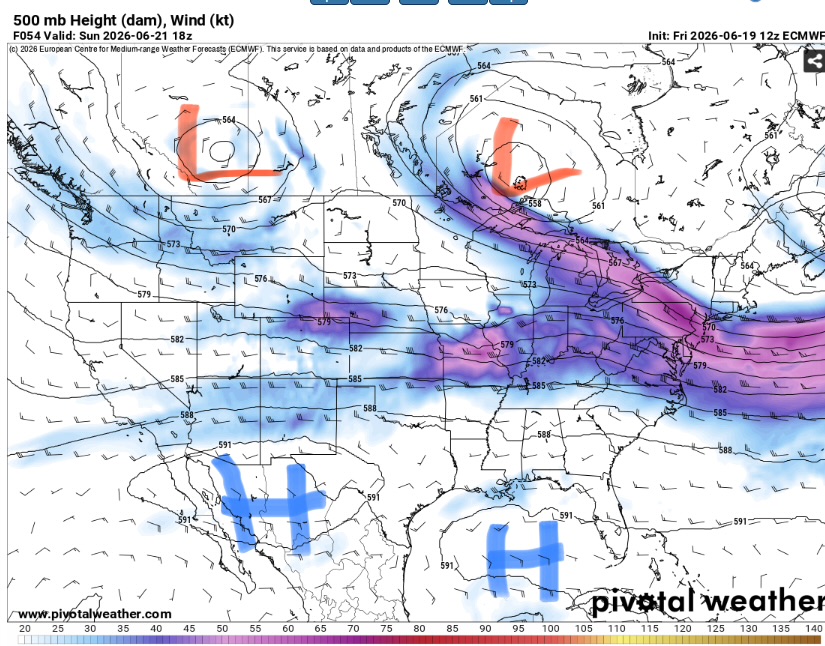
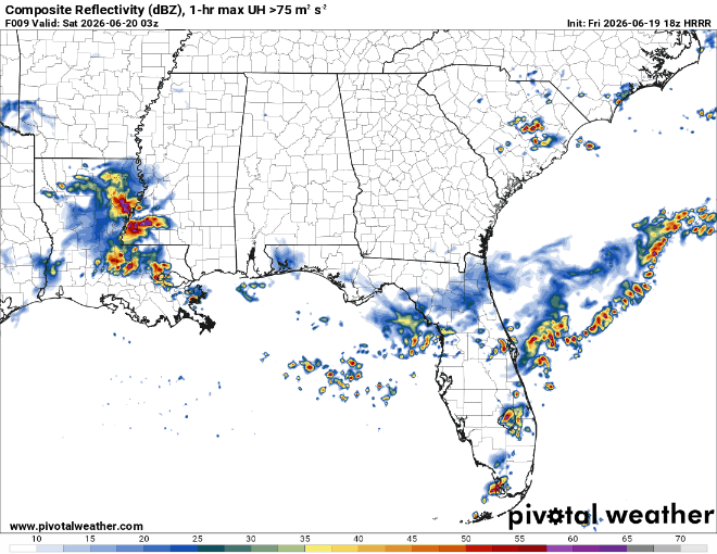
The jet stream has dipped a bit south and pushed a frontal boundary with it. This will provide enough lift for repeated rounds of convection. The severe weather threat is very low but not zero.
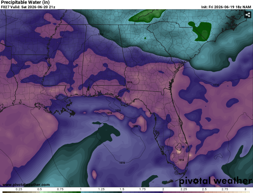
The main story will be the chance for flooding. Deep moisture and weak wind shear (on top of very saturated soils) will provide a regime that is favorable for flooding (both flash and river). Make sure to never to drive through floodwaters.
No one location will have it rain all day many places will at least see some precip. Temperatures will be warm but not anything crazy due to the increased cloud cover. All in all, a pattern not uncommon for this time of year.
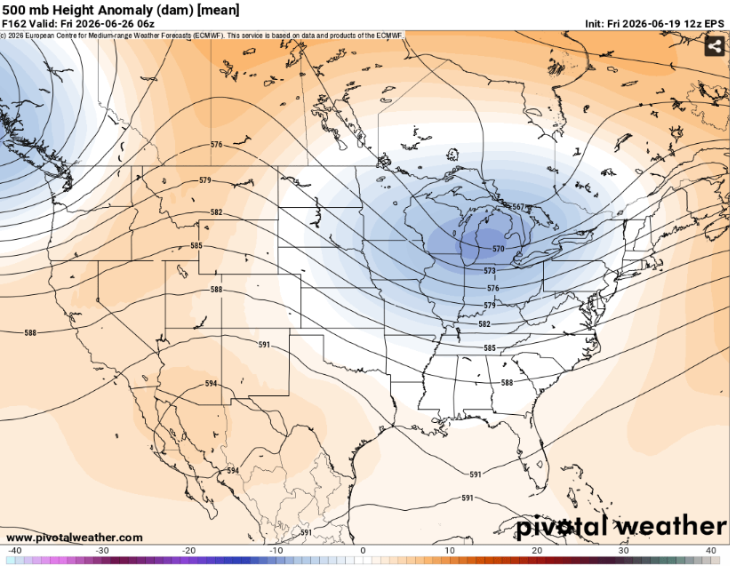
The jet stream looks to hang around through the week, so expect temperatures to be on the cooler side if the front actually does push through and an increasing chance of rain by Wednesday.
Airport Forecasts
Houston (KIAH/KHOU)- Thunderstorms possible throughout the next few days. There will be plenty of dry time but also a few delays for lightning or microbursts likely.
Shreveport (KSHV)- Thunderstorms likely during the morning on Saturday. This may cause delays for lightning or maybe downbursts. Dryer afterwards but can’t rule out some brief storm delays on Sunday.
Baton Rouge (KBTR)- Tonight and tomorrow should be fine. Storms are likely on Saturday afternoon with a chance of lightning and downdraft delays.
New Orleans (KMSY)- A round or two of storms likely tomorrow afternoon may cause some delays for lightning or microbursts but should be fine besides that.
Jackson (KJAN)- Widespread storms for the next couple days. Although it won’t rain the whole time each day and night will likely at least have a delay or two for lightning or downbursts.
Mobile (KMOB)- On and off rounds of thunderstorms likely. It won’t rain the entire day but there will likely be at least few delays for lightning or microbursts.
Birmingham (KBMH)- Similar to Jackson and Mobile. It won’t rain the whole time but there will probably some delays for lightning and downdrafts.
Tallahassee (KTLH)- Afternoon thunderstorms likely tomorrow and Sunday. Storm chances are lower at other times but not zero. There will likely be some delays for lightning or downbursts but they shouldn’t be super long.
Atlanta (KATL)- The next 40 hours should be dry. Afternoon thunderstorms are possible on Sunday evening along with a delay for lightning and microbursts.
Highways
I-10 – Scattered showers and thunderstorms for the next few days. It won’t continuously rain at one location the entire time but there will be precipitation somewhere on the highway most of the time. Be mindful of water on the road and associated hydroplaning risk.
I-20 – Similar story but probably a little less widespread. Storms will peak in the afternoon but are possible throughout the day.
I-49 – Lots of storms likely tomorrow morning. There may be a break during late afternoon and convection will be less widespread on Sunday.
I-55 and I-59 – Storms should diminish this evening with the loss of daytime heating. The overnight hours should be calm before numerous storms develop during the day Saturday.
I-65 – Clear tonight but lots of storms tomorrow. Should be dryer on Sunday but storms are still possible in the afternoon.
I-75 – The driest of them all but storms are still likely over the southern half of Georgia on Saturday afternoon.
City Forecasts
Houston, TX
Tonight- Mostly cloudy with scattered thunderstorms likely. Low around 80.
Tomorrow- High in the low 90s with scattered thunderstorms possible. Partly sunny sky.
Sunday- Isolated thunderstorms possible. High in the low 90s and mostly sunny.
Shreveport, LA
Tonight- Cloudy with a low in the mid 70s. Widespread thunderstorms likely.
Tomorrow- Scattered thunderstorms likely in the morning. Decreasing clouds with a high around 90.
Sunday- Isolated thunderstorms possible in the afternoon. Mostly sunny with a high in the low 90s.
Baton Rouge, LA
Tonight- Mostly cloudy with a low in the upper 70s. No precipitation is expected.
Tomorrow- High in the low 90s with increasing clouds. Scattered thunderstorms likely in the afternoon.
Sunday- Mostly sunny with a high in the low 90s. Dry.
New Orleans, LA
Tonight- Mostly cloudy but dry with a low around 80.
Tomorrow- Afternoon thunderstorms possible. Increasing clouds with a high in the low 90s.
Sunday- Mostly sunny and dry with a high in the low 90s.
Jackson, MS
Tonight- Scattered thunderstorms likely. Mostly cloudy with a low in the mid 70s.
Tomorrow- Numerous showers and thunderstorms likely. Mostly cloudy with a high in the mid 80s.
Sunday- Scattered showers and thunderstorms likely. Partly sunny with a high around 90.
Birmingham, AL
Tonight- Thunderstorms gradually diminish by late evening. Mostly cloudy with a low around 70.
Tomorrow- Scattered thunderstorms likely. Mostly cloudy with a high in the mid 80s.
Sunday- Increasing clouds with afternoon thunderstorms likely. High in the mid 80s.
Mobile, AL
Tonight- Mostly cloudy with thunderstorms gradually diminishing. Low in the upper 70s.
Tomorrow- Partly sunny with a high in the upper 80s. Scattered thunderstorms likely.
Sunday- Afternoon thunderstorms likely. Increasing clouds with a high in the mid 80s.
Tallahassee, FL
Tonight- Scattered thunderstorms possible. Mostly cloudy with a low in the mid 70s.
Tomorrow- Widespread showers and storms likely in the afternoon. Partly sunny with a high in the upper 80s.
Sunday- Afternoon thunderstorms likely. Partly sunny with a high around 90.
Atlanta, GA
Tonight- Partly cloudy and dry with a low in the upper 60s.
Tomorrow- Mostly sunny with a high in the mid 80s. No precipitation is expected.
Sunday- Increasing clouds with afternoon thunderstorms possible. High in the mid 80s.


