Howdy!
Today there are threats of severe weather for the region, greatest risk for northern Alabama and Mississippi. Storms for the next couple of days can be strong, producing strong winds and lightning. Chances of rain remain throughout the week and by the weekend, upper-level ridging moves into the region limiting chances of rain. By next week, summer weather returns with hot conditions.

TODAY/TONIGHT
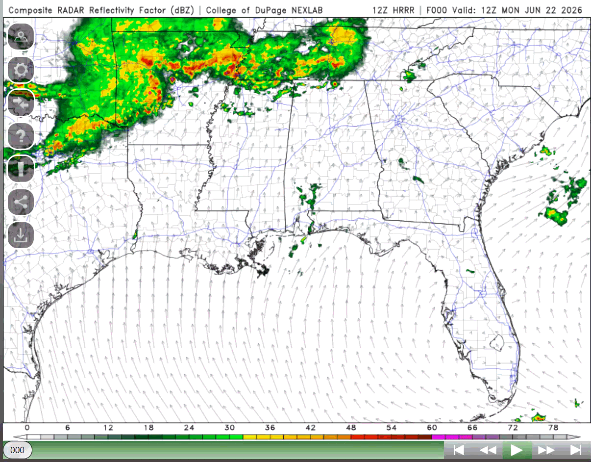
Looking out the window (NOAA satellite), we can see that there are quite a few clouds over our region as that frontal boundary moves closer. We can also see there is an outflow boundary over Texas currently, not doing much to produce some storms.

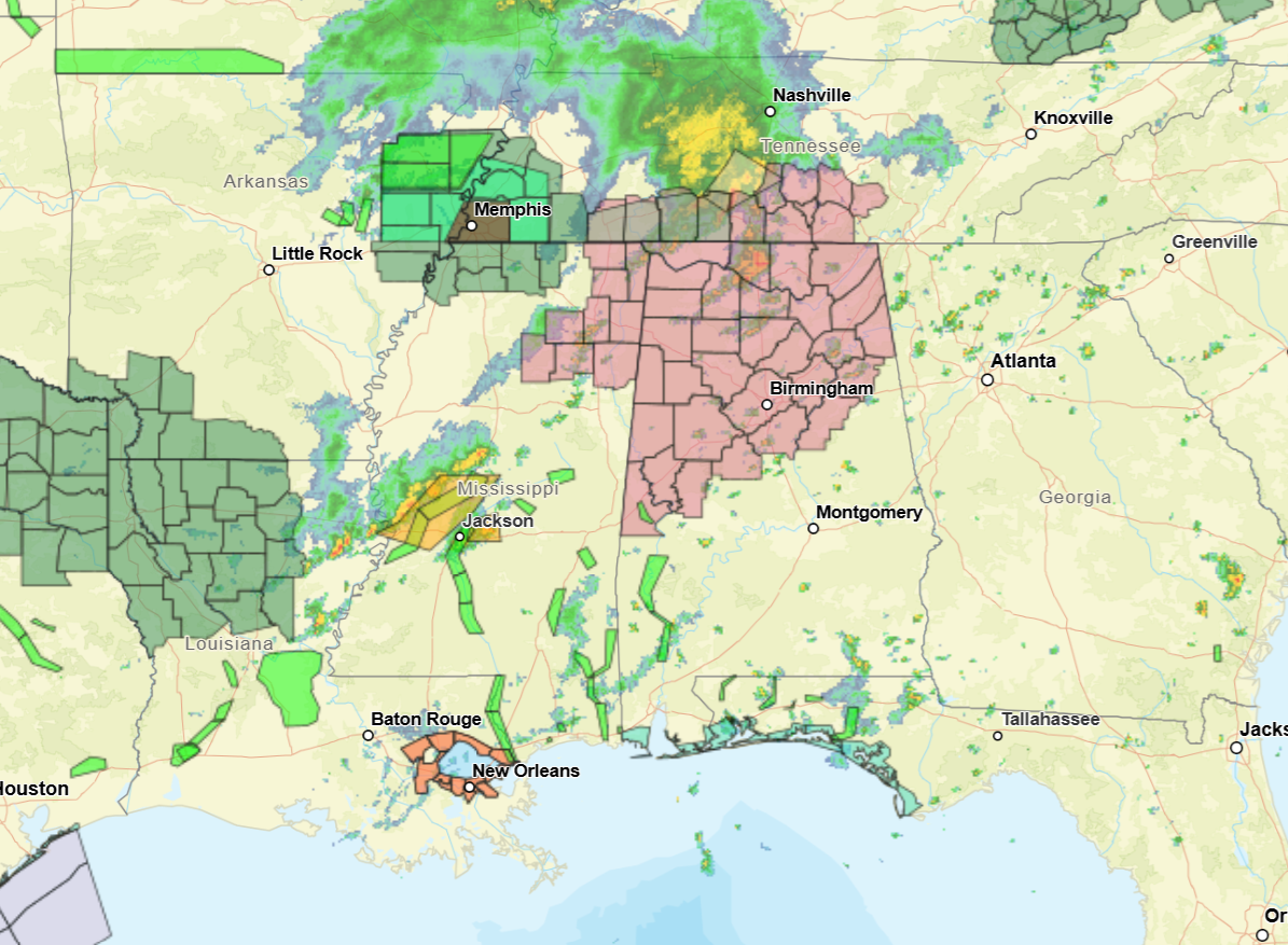
There is some scattered rain for the region, out in northeastern Louisiana, severe thunderstorm warned storms out near Jackson, MS. Flood watch is in effect for north Louisiana, warnings for some areas in central/southern LA and severe thunderstorm watch for central/northern Alabama to northeast Mississippi.
Currently (as I am writing this around 12:30 CST), temperatures range from the low 80s up to 90. Dewpoints are in the low to mid 70s, so it’s pretty humid today.
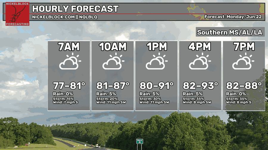
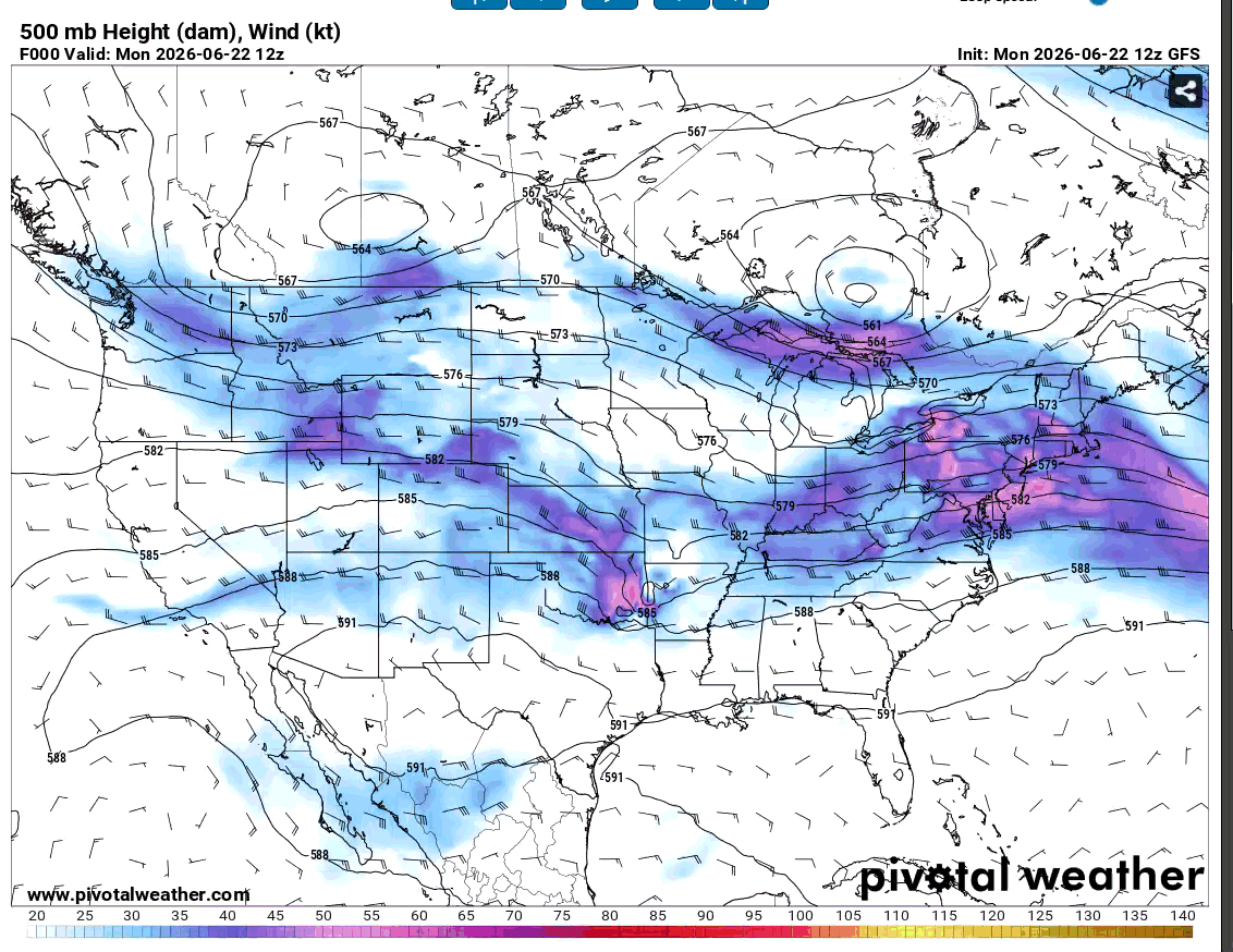
The highs today will range from the low 80s to low 90s, depending on where rain will be seen today. Currently, the region is sitting between an upper-level trough located to the northeast, and an upper-level ridge that to our west. This pattern could induce some shortwave disturbances to move over the region.
A shortwave (or shortwave trough) is a disturbance in the mid to upper levels in the atmosphere that supports upward motion, and if the environmental conditions favor it, thunderstorms can develop ahead of the shortwave. These shortwaves are embedded within the longwave flow.
In terms of environmental conditions, there is plenty of instability and moisture to support storm development, and shear values range from lower to moderate. Storms will develop today (and are already happening, these storms have a good chance of being strong to severe.
Remnants of a severe MCS that occurred overnight are still present in the Southeast U.S. and will move into the region and produce strong to severe storms throughout the region. This storm system can produce an outflow boundary that later today could move in and stall briefly, potentially creating new storms and more chance for rain for tonight and the week. High wind gusts and lightning would be the main threat from the storms.
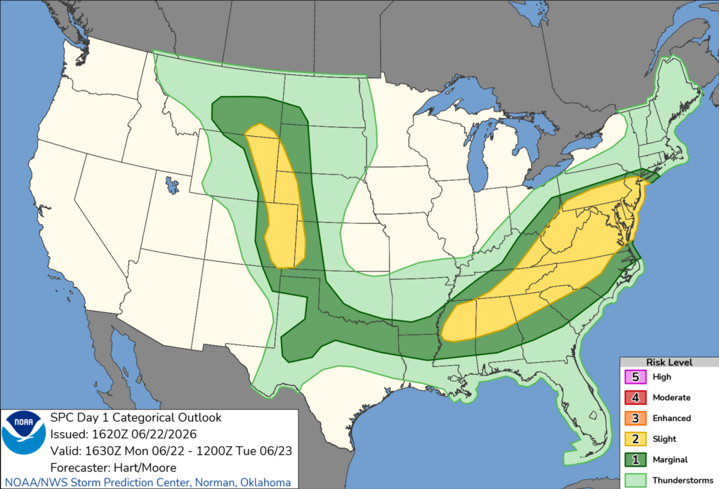
Severe storms are possible for parts of Louisiana, Mississippi, and Alabama (mainly central/north), some parts being under the slight risk category today (see below for SPC severe weather outlook). Main threats are high winds and lightning; slight risk of tornadoes is not ruled out either for northern Alabama or northern Mississippi.
TOMORROW
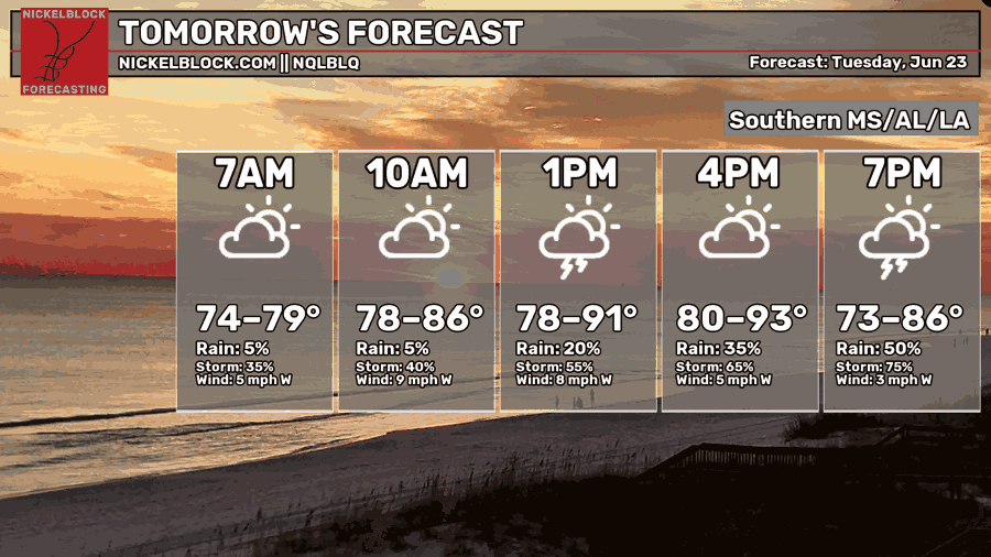
Highs will range from the low 80s to the low 90s, lows being in the lower 70s. This range in temperature can be attributed to the rain that the region will see, so more chances of rain for tomorrow! Scattered showers and storms are possible, mainly more south for the region. Southern Louisiana will not get as much rain as the other states, thunderstorms are still likely to develop for some.
Storms tomorrow have less risk of being severe but can still be strong and produce strong winds, so make sure to keep updated on the weather.

WEDNESDAY
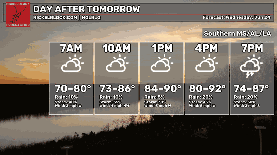
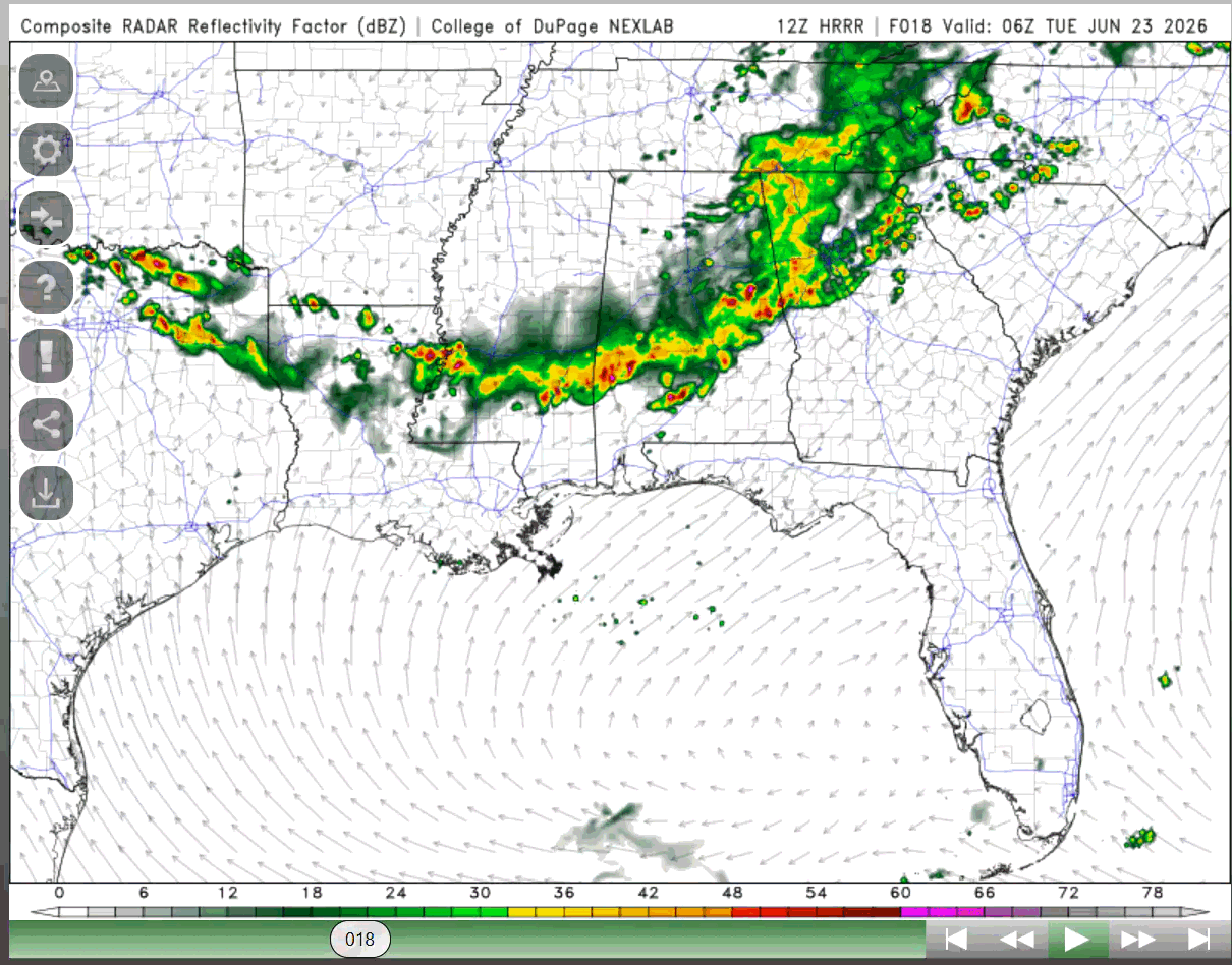
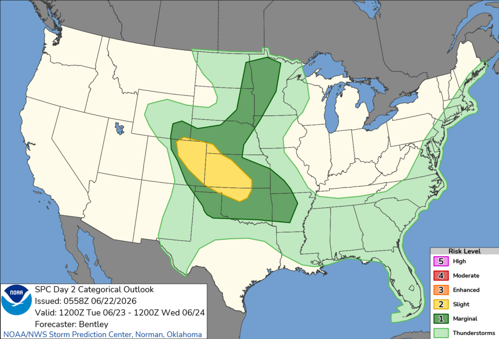
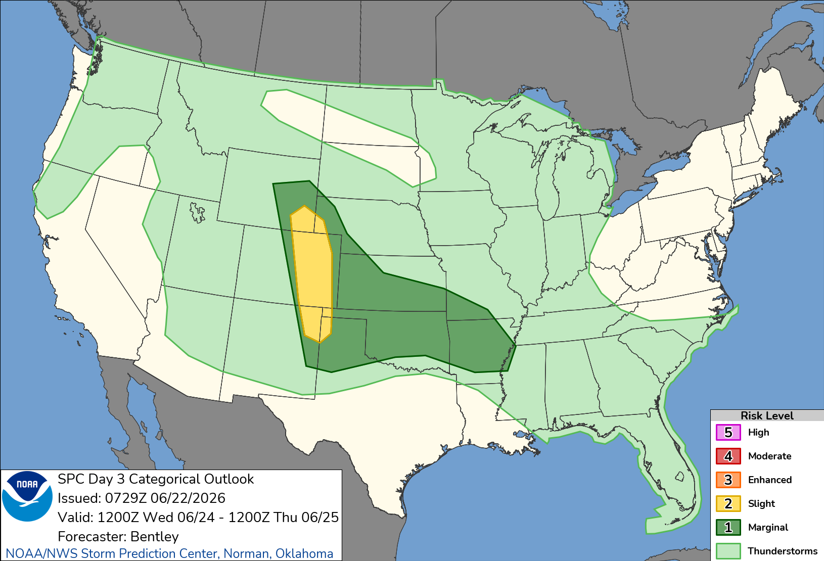
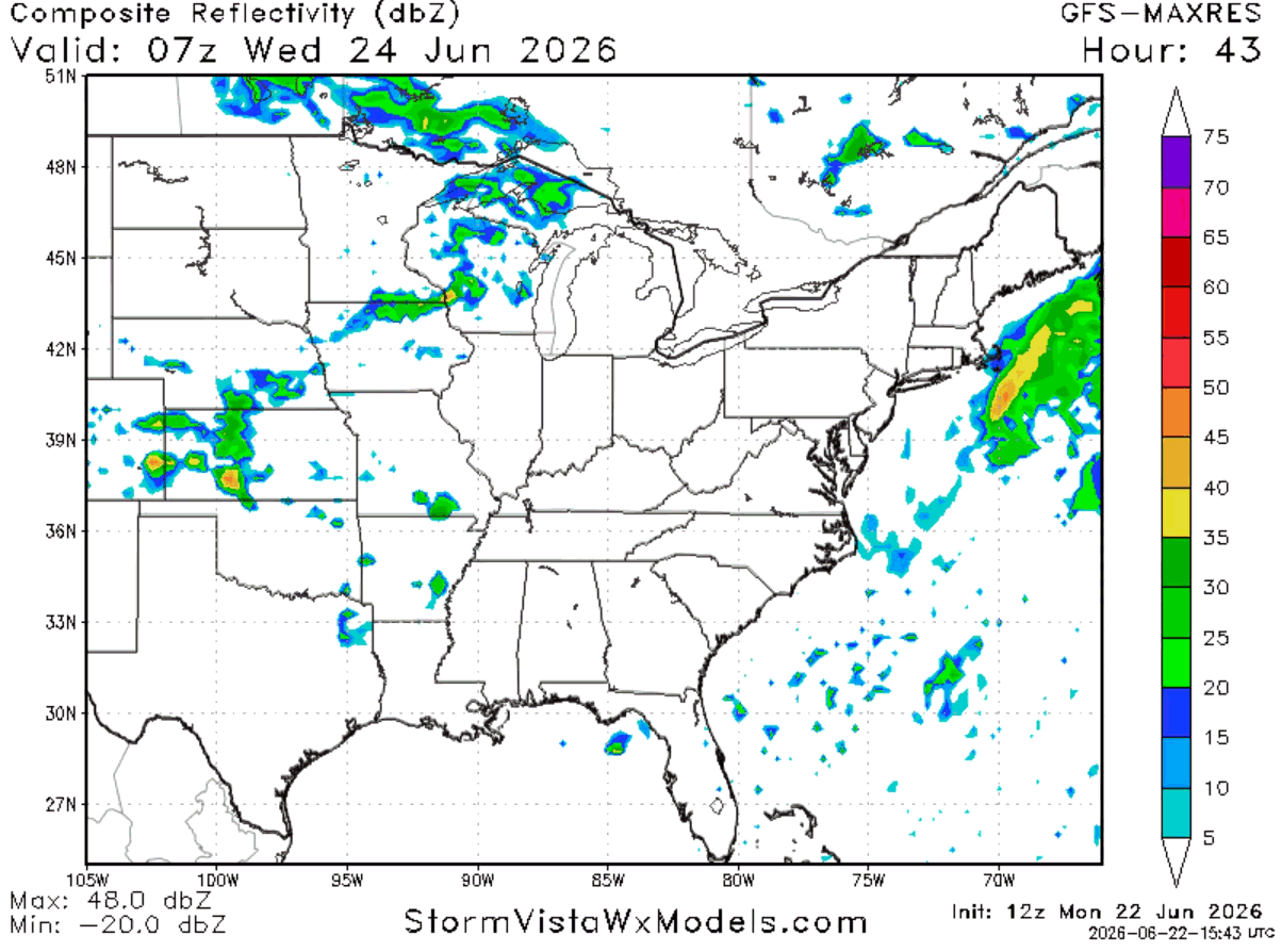
Once again, highs will range from the low 80s to the low 90s, lows being in the lower 70s. Storms and rain are again possible for Alabama and Mississippi, not much for Louisiana. Storms currently do not have the chance to be severe (see below on SPC outlook and radar from StormVista).

EXTENDED OUTLOOK
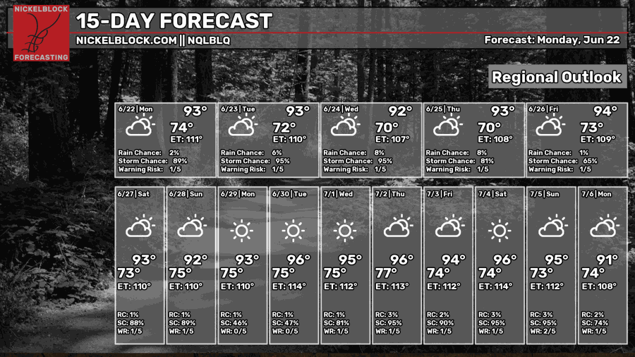
Looking ahead at the next couple weeks, the high temperatures remain in the low to mid 90s, a typical summer pattern starts to take over with the chance for some afternoon pop-up showers most days.
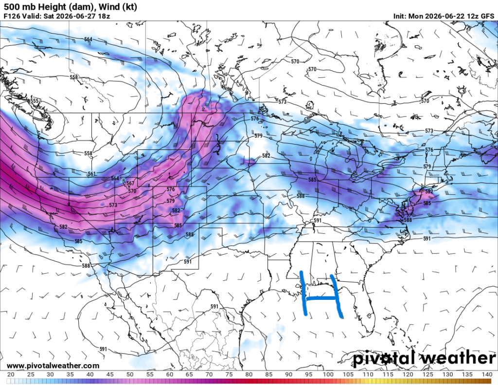
By Friday, the ridge from the west will move into the region, limiting any rain potential for the weekend, and that summer pattern will return by the weekend into next week.
Make sure to keep updated on the weather as the thunderstorms impact our region for the next few days. Other than that, enjoy the rest of your Monday!


