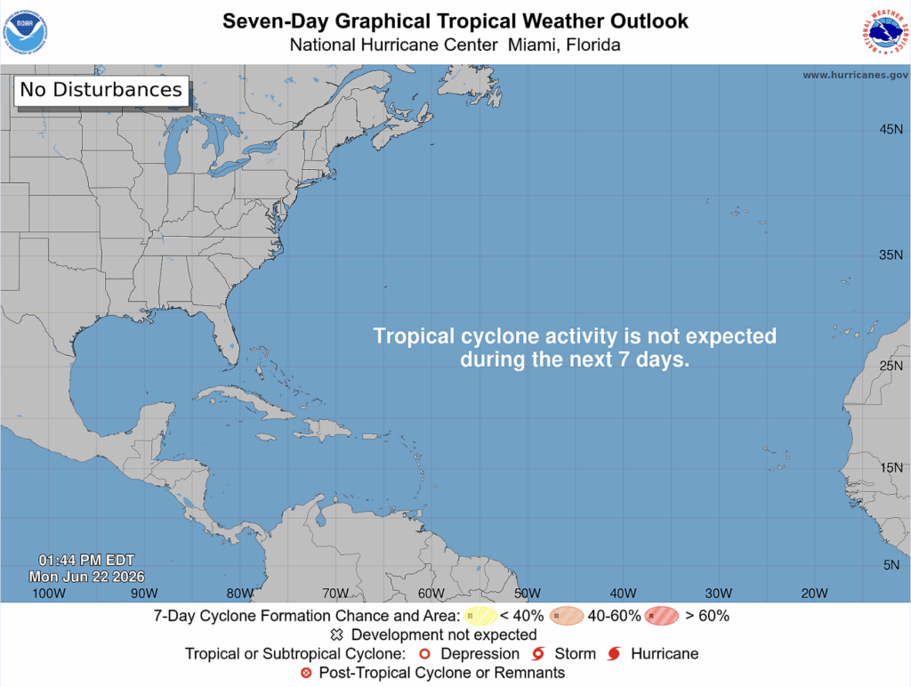
There is no tropical cyclone activity expected in the Atlantic for the next week.
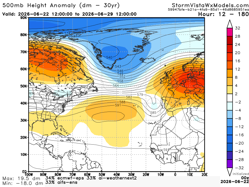
Here we have a 500 mb height anomaly model blend over the next week. We see a ridge stretching across the Atlantic and a trough on the southeast side of Greenland. This would suggest a hard time for development in the Atlantic. The sinking air associated with ridging suppresses the development of a tropical cyclone. Also, the clockwise rotation and pattern of a high-pressure system would push a tropical disturbance toward the west to the Caribbean and Gulf. Since the trough is not super strong, if there were a disturbance in the Atlantic, the track would most likely go north out to sea. Let’s take a look at the ocean’s surface temperatures.
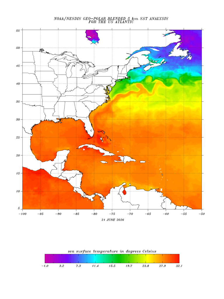
The Atlantic SST is warm enough to support development. The Caribbean and Gulf are very warm, which definitely supports development. What about the wind shear?
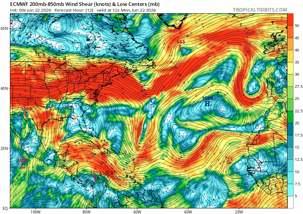
This current setup for the week is not ideal for the Atlantic. The wind shear is mostly moderate or strong, which is not supportive of development. As for the Gulf, wind shear is relatively low.
Overall, the Caribbean and Gulf are worth monitoring but not fully favorable for development.


