Today’s Overall Setup
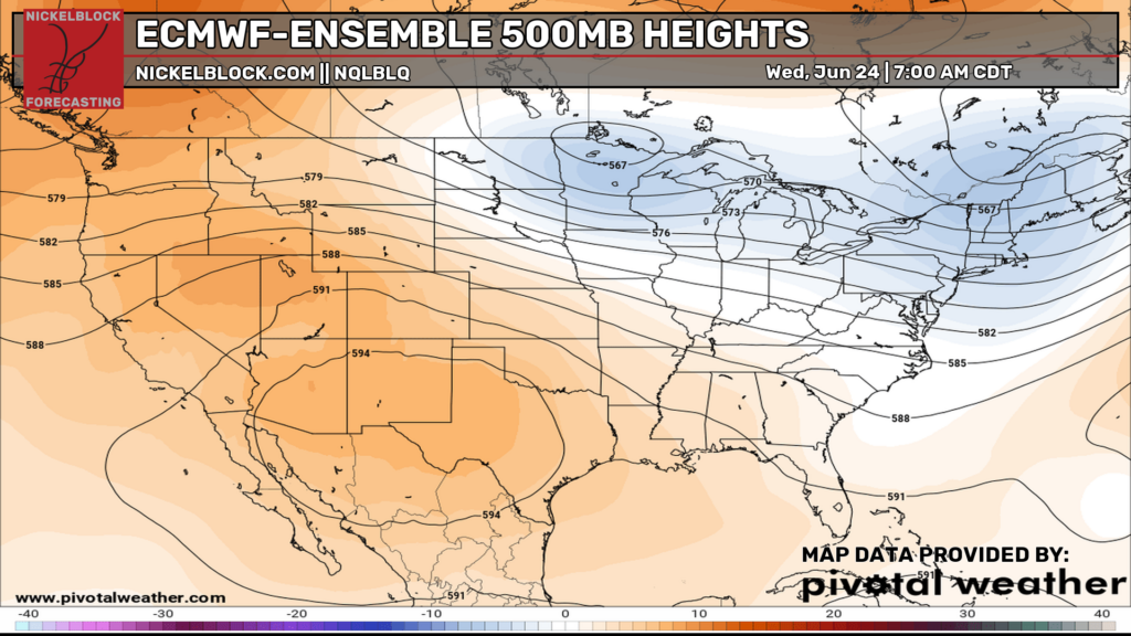
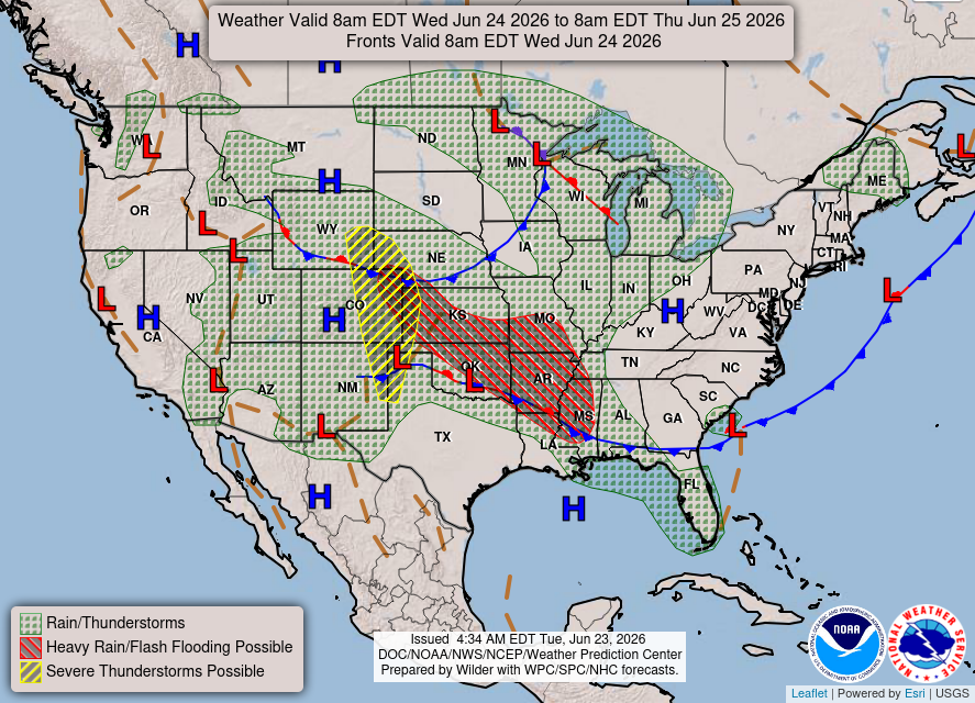
The overall pattern today has ridging across the West and southern U.S., while troughing remains over the northern tier into the Northeast. That keeps the heat focused south and west, with the more active weather across the Plains, Midwest, and parts of the East.
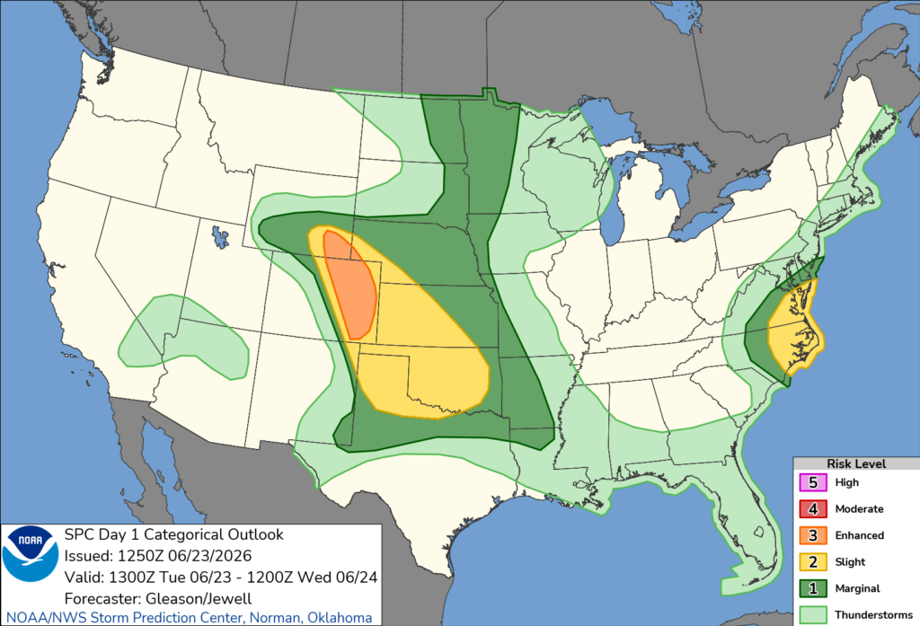
The main story today is the severe weather and flash flooding threat in the central and southern Plains, as well as a small area highlighted over eastern North Carolina and Virginia. Heavy rain is possible in spots, and a few stronger storms may develop out ahead of that dryline and warm front over the areas highlighted in yellow down below. Other than that, scattered storms are also possible along the Gulf Coast, Florida, upper Midwest, and parts of the mid-Atlantic and northeast.
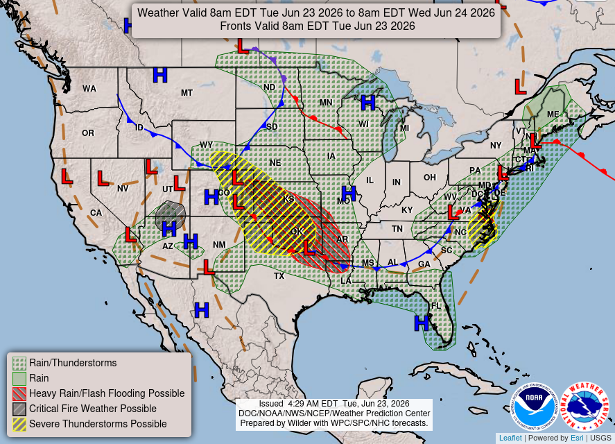
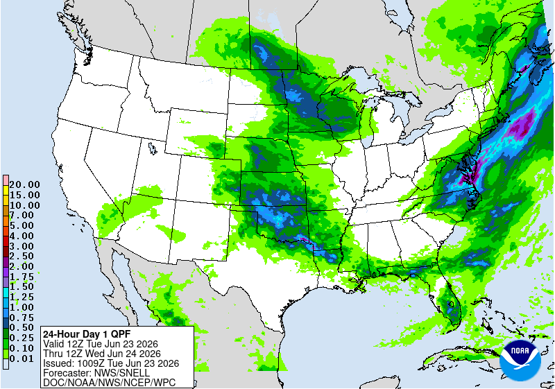
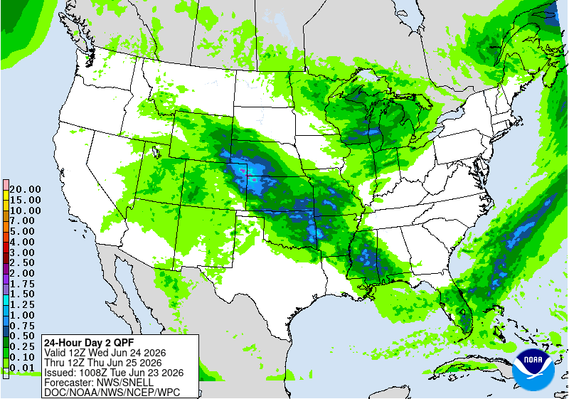
The best chance for heavier rain today is from Kansas and Oklahoma into the central Plains and Upper Midwest. Some areas could see a decent soaking, especially where storms repeat over the same spots. There are already several Flash Flood Warnings over these areas, so ensure you are not on the roads today.
The Southeast and East Coast will have more scattered, hit-or-miss rain chances.
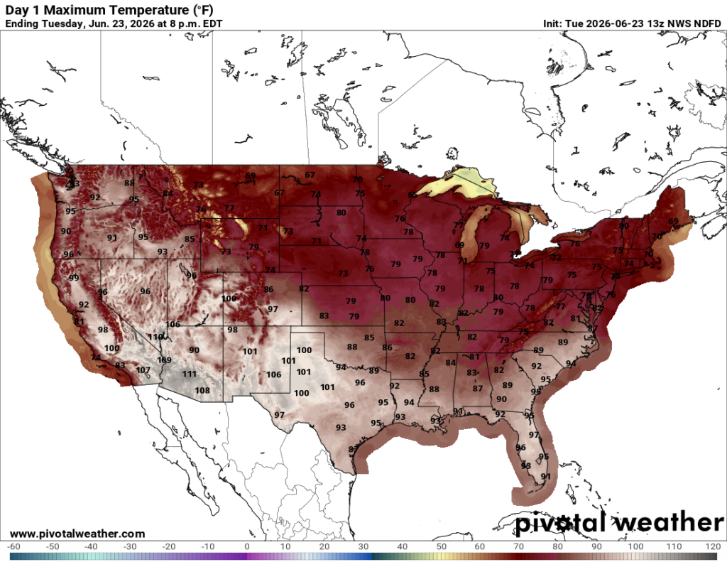
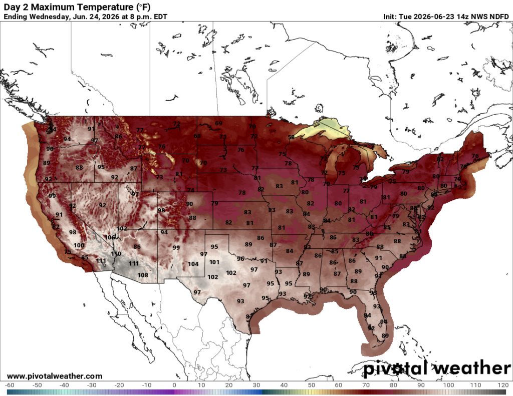
Heat is certainly out there across the southern half of the country. Highs are widespread in the 90s, with 100s possible in Texas, the desert Southwest, and parts of California. Up in the central and northern areas, clouds and rain are going to keep temperatures closer to the 70s and 80s.
Today’s Severe Weather Threat
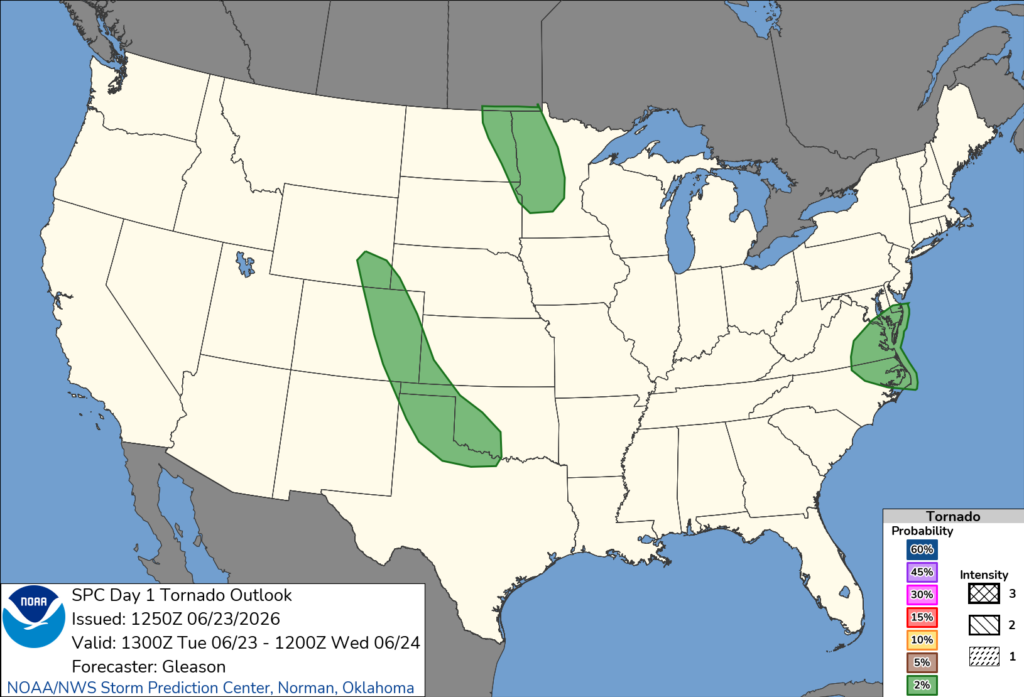
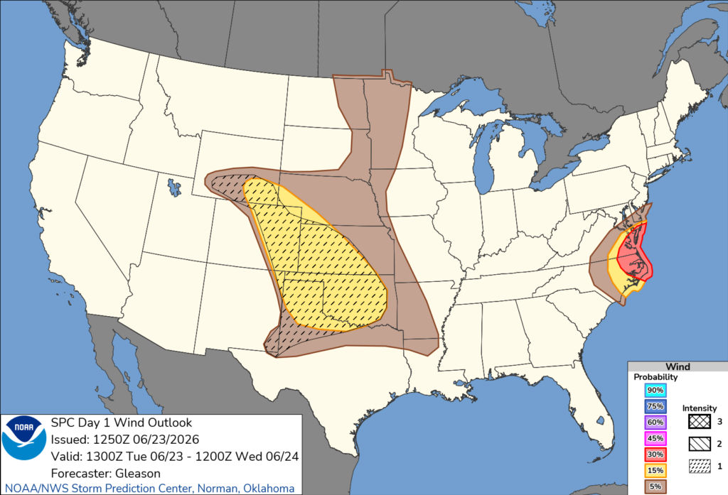
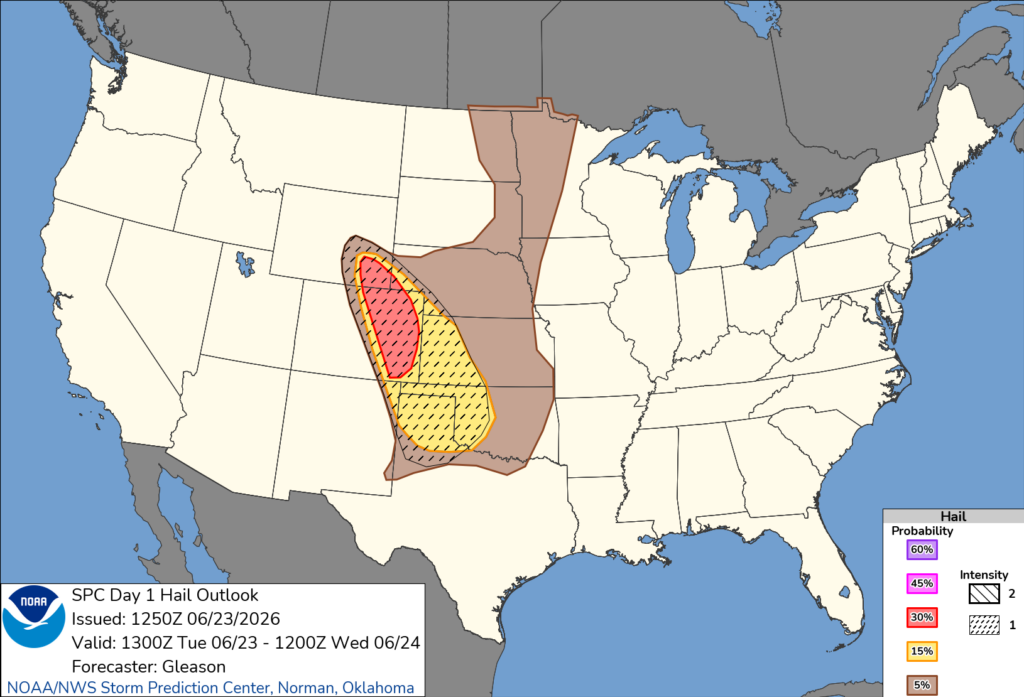
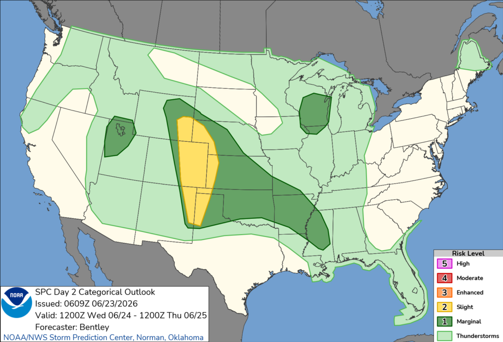
To get more detailed, severe weather today is focused mainly across the central High Plains into the southern Plains, with another spot to watch in southeast Virginia and eastern North Carolina. In the Plains, storms are already going this morning near Kansas and Oklahoma, with a front sitting close to the Red River. According to the SPC, early on, large hail is the main concern. Later today and tonight, storms may grow into clusters, which could bring more of a damaging wind threat into the Texas Panhandle and western/central Oklahoma.
Farther northwest, storms may take a while to get going across eastern Colorado and southeast Wyoming, but any storm that does form could mean business with very large hail, damaging winds, and maybe an isolated tornado. There is an Enhanced (level 3 out of 5) risk out there.
Over southeast Virginia and eastern North Carolina, storms should fire late morning into the afternoon along and ahead of a cold front, with damaging winds as the main issue. There’s also a lower-end risk later today near the Dakotas into western Minnesota near the low/front, but that looks more isolated.
Tomorrow’s Weather
For tomorrow, we will see rain and thunderstorms in similar areas to today, as well as another severe weather threat towards the eastern Rockies and western Plains, and a threat of flash flooding down towards Arkansas and Mississippi given the proximity to the stationary front chilling out over our region. The rain threat moves off of the east coast for tomorrow as high pressure gains control, so a nice day with no rain for much of the east.
Temperatures do warm up in the east and northeast given the decrease in cloud cover tomorrow, reaching the 80s and 90s. The northern tier will reach the 70s and 80s, while the south reaches the 80s and 90s once again.
The main severe weather area for tomorrow will be across the central/southern High Plains, especially eastern Colorado into southeast Wyoming and nearby areas, where scattered supercells may develop by mid-afternoon. Large to very large hail and damaging winds will be the main threats, with gusts potentially over 75 mph in a few spots.
More isolated severe storms are also possible from Kansas and Oklahoma into the Ozarks, Arkansas into Mississippi, the western Great Lakes, and northern Utah, but those areas have more uncertainty depending on morning storms and cloud cover.
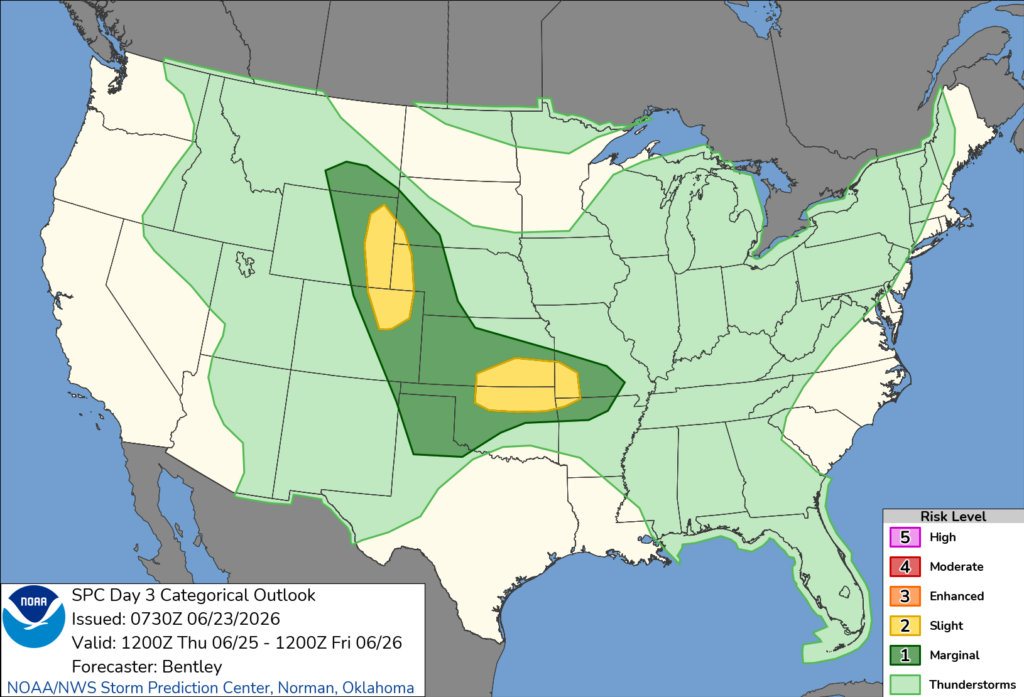
Another Day of Severe Weather – Thursday
Thursday keeps the severe weather pattern going, mainly in two areas. One focus is the central/northern High Plains, especially eastern Wyoming into northeast Colorado, where upslope flow and stronger winds aloft should support supercells during the afternoon. Large to very large hail and damaging wind gusts look like the main threats there.
The other area to watch is from northern Oklahoma and southern Kansas into the Ozarks along a frontal zone tied to a developing low near the Texas Panhandle. Storms may already be ongoing in the morning, so the exact setup depends on how that evolves, but the environment could support large hail, damaging winds, and even a few tornadoes.
CONUS Weekly Temperature & Precipitation Outlook
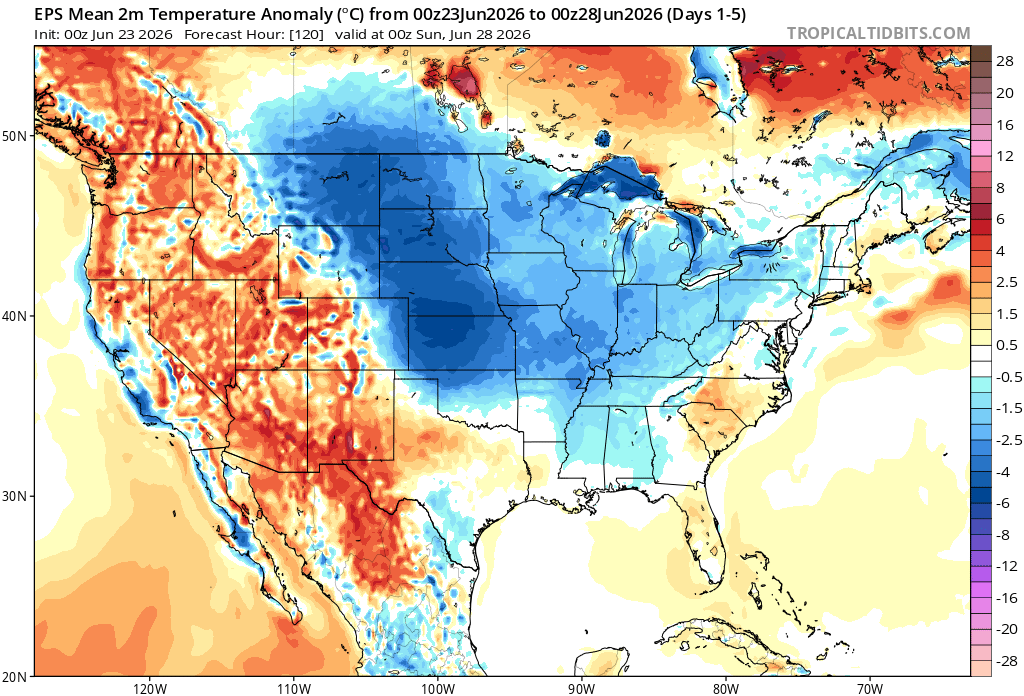
Here’s a look at the EPS modeled temperature anomalies through Sunday. Red indicates above-average temperatures on average for the week, white indicates average temperatures, and blue indicates below-average temperatures.
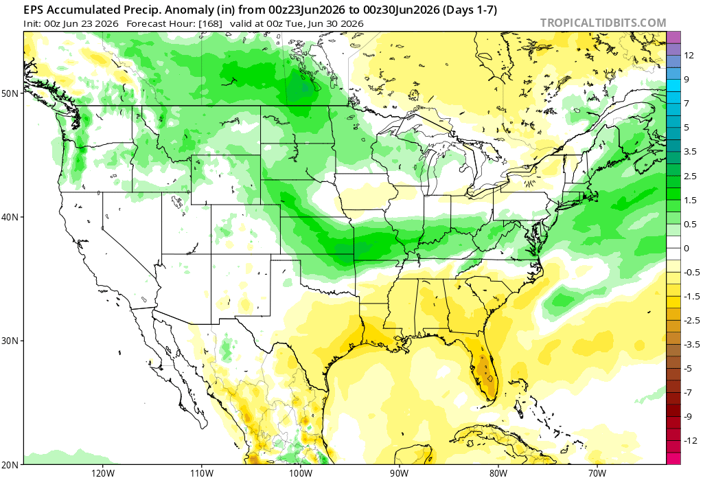
Here’s a look at the EPS modeled precipitation anomalies through next Tuesday. Green indicates above-average precipitation, white indicates average precipitation, and yellow indicates below-average precipitation. Let’s look into the details by region:
Weekly Outlook: Western & Central United States
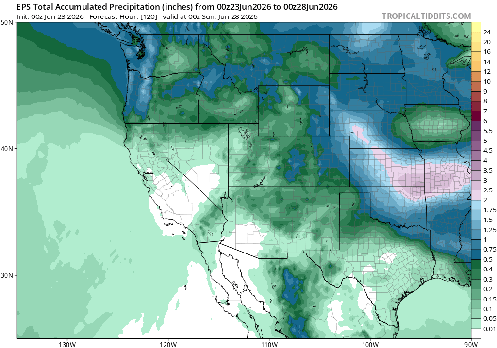
This week keeps a ridge in place out west, so the hotter and drier pattern continues there. Farther east, weak troughs and disturbances sliding through the flow will keep the pattern more unsettled at times, which we saw above with the repeated severe weather and flash flooding threats.
Weekly Outlook: Eastern United States
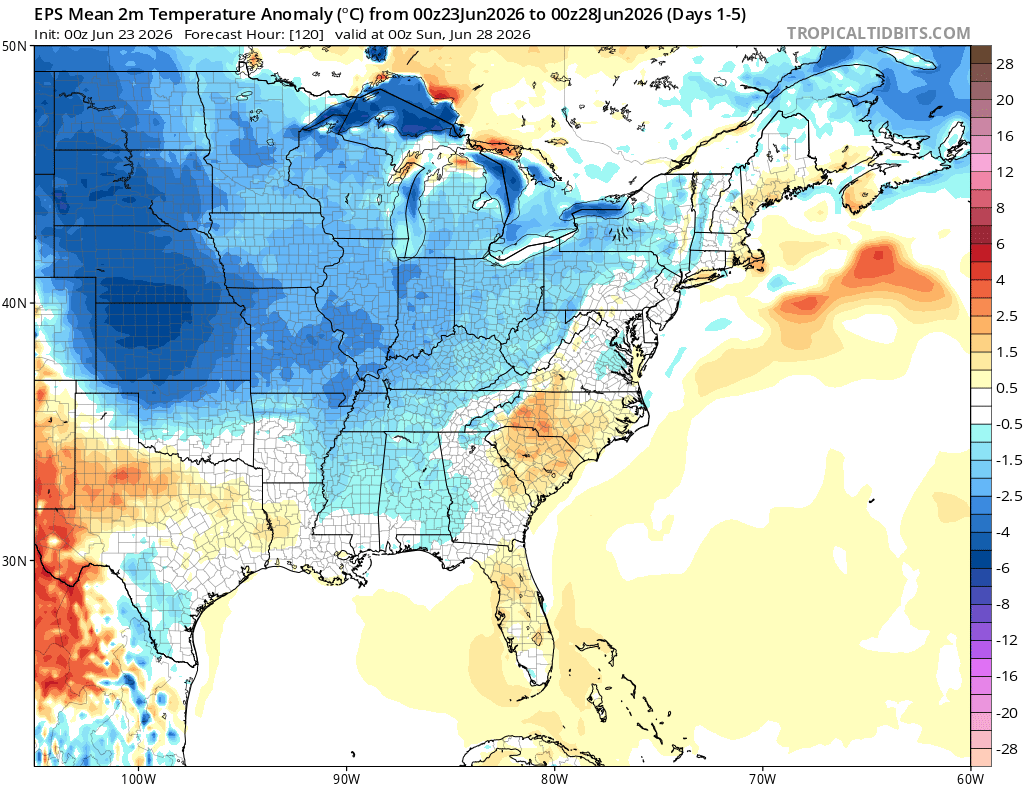
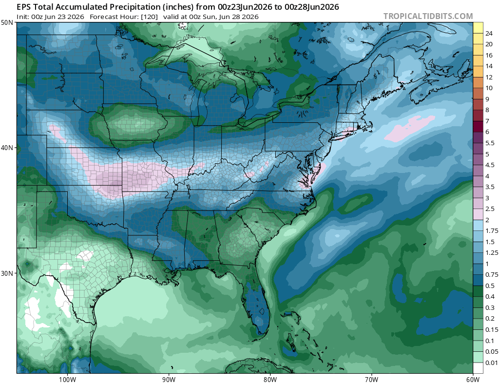
For the eastern outlook, the rain threats mentioned throughout the week will all work together to support above-average rainfall. With multiple rounds of clouds, showers, and storms around at times, temperatures should also run cooler than normal overall.
The cooler look is mostly tied to the wetter pattern, not a major cold push. More cloud cover and repeated rainfall should keep daytime highs cooler than average, especially in the areas that see the most consistent rain and storm activity.
Extended Outlook
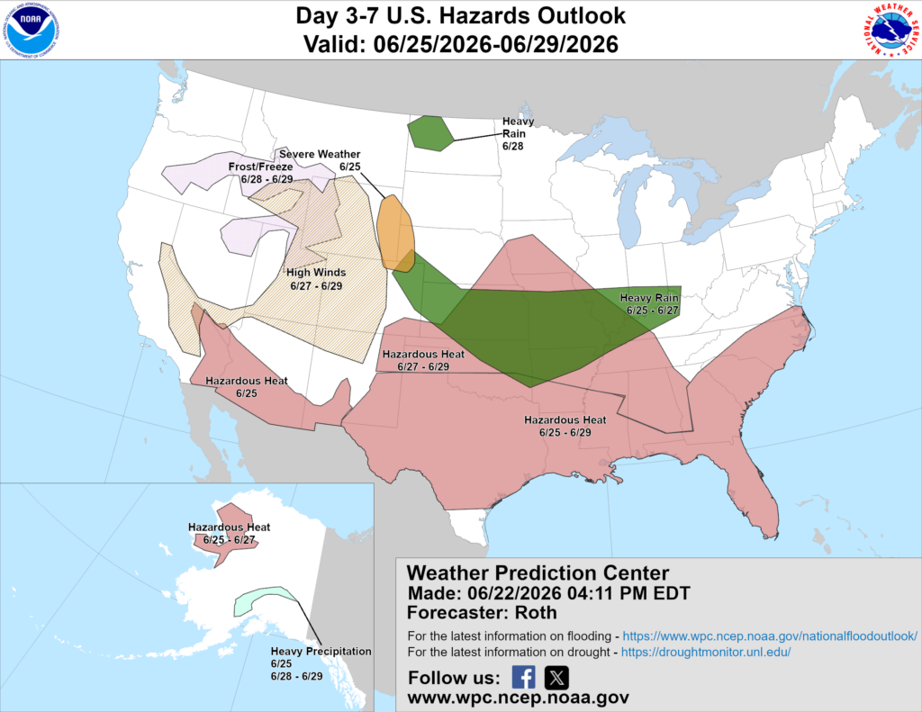
Above is a look at the U.S. Hazards Outlook from NOAA, highlighting areas of more impactful weather to be aware of over the next 3 to 7 days.
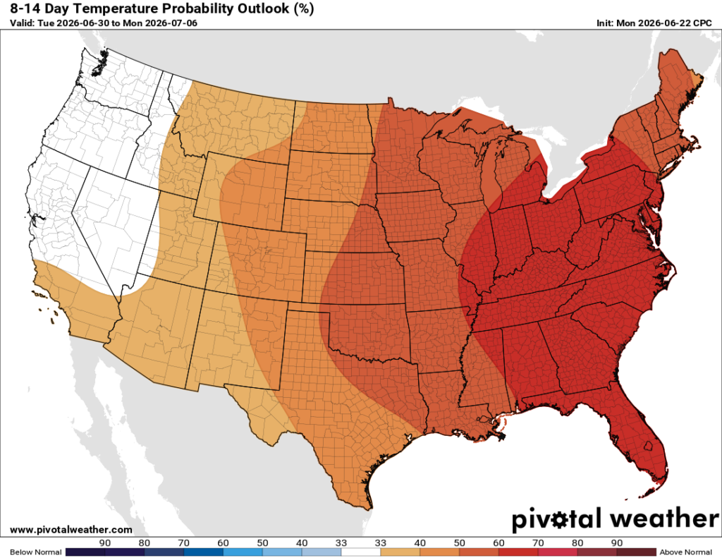
For next week, the pattern starts to flip a bit as ridging builds farther east. That supports a warmer look for a large part of the country, with above-normal temperatures becoming more likely, especially across the eastern half.
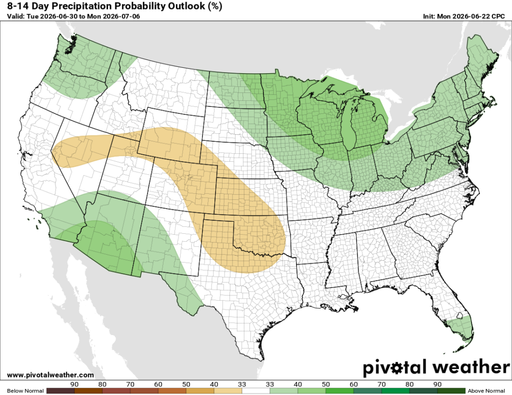
Rain chances look more mixed, but the wetter signal favors parts of the northern tier and Northeast, while some central areas may trend a little drier. Overall, after the active stretch this week, next week looks warmer as the ridge takes over more of the pattern.
Thanks for tuning in to this National Forecast! Tune in to our local, tropical, and regional forecasts to stay updated on the latest!


