Howdy!
Make sure to watch my video forecast update for more discussion on the weather!
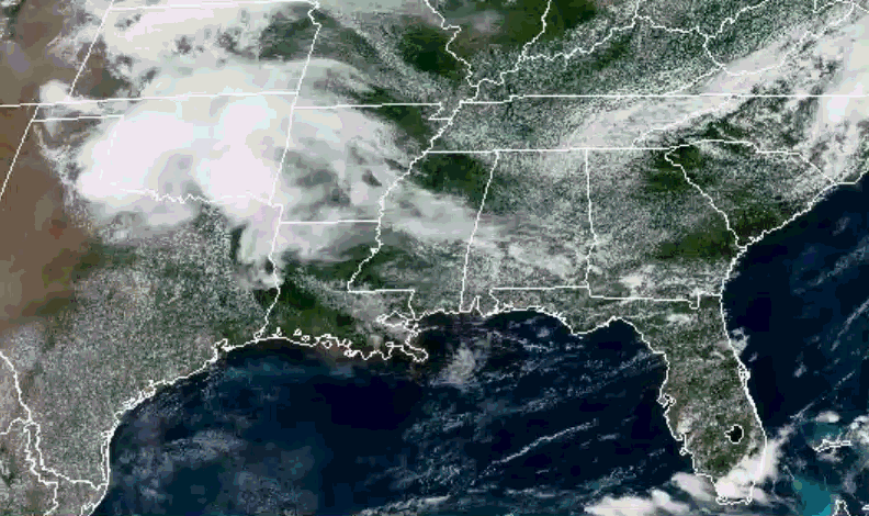
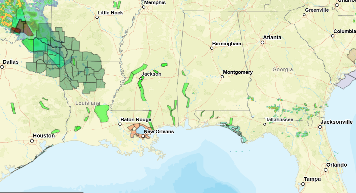
Looking out the window (NOAA), there is not much currently (around 1:30pm CST) going on for our region, a little rain out in northern Louisiana. Flood watches and warnings are in effect throughout the region, and a heat advisory is in effect for a portion of southeast Louisiana.
TODAY
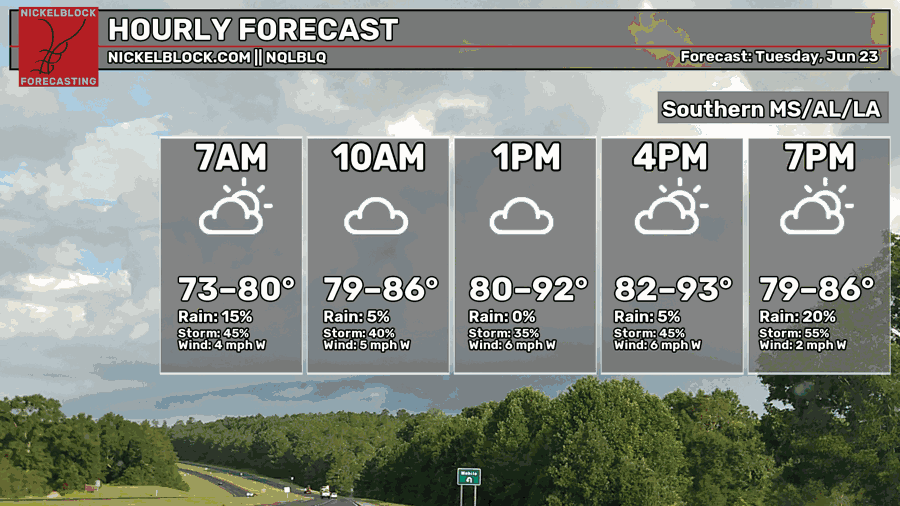
Temperatures are currently in the low 80s to low 90s with dewpoints in the mid to upper 70s, increasing the heat index to reach 100 in some areas. The highs today will reach range from the low 80s to the low 90s, chances of rain increasing in the afternoon. A frontal boundary (by a shortwave) is propagating through that could trigger some scattered showers and thunderstorms later today.
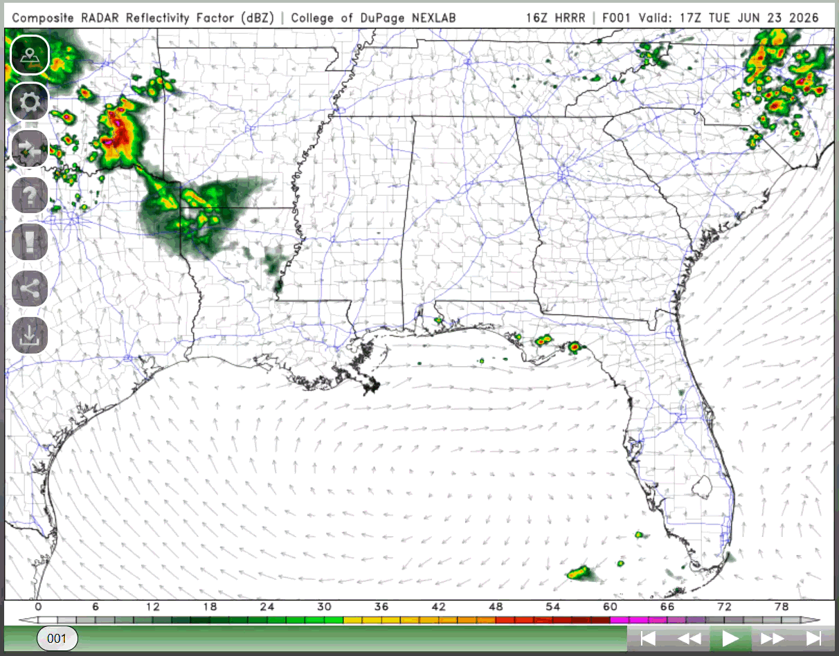
The SPC outlook changed a bit for today, enhanced risk for severe weather out in Colorado and Wyoming. For us, our main risk is thunderstorms, with parts of northern Louisiana being under the marginal risk.
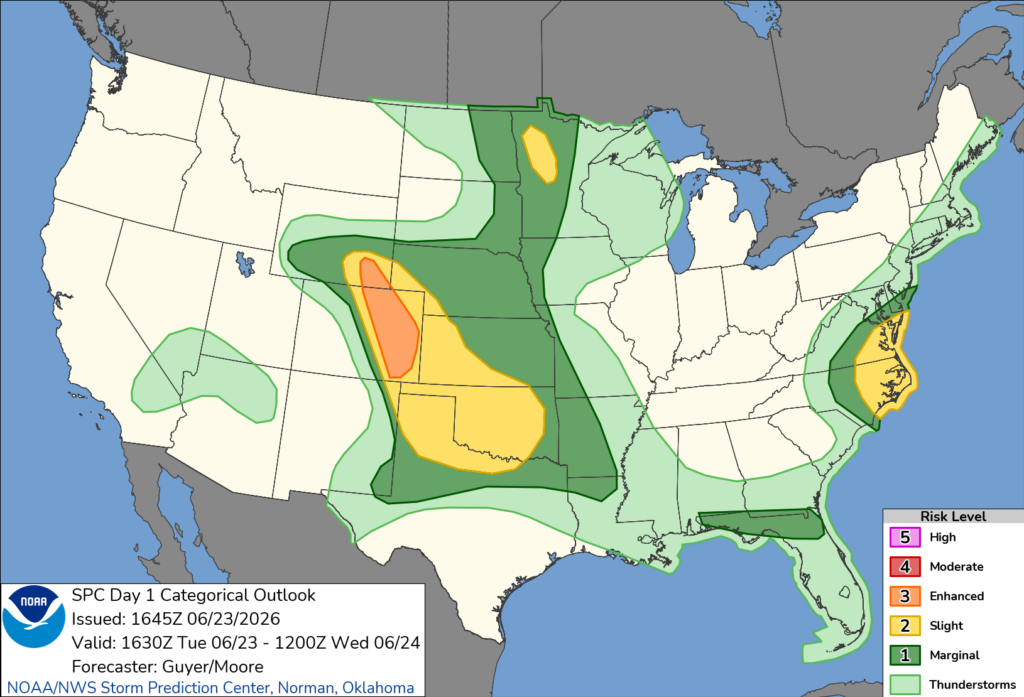
Plenty of instability and moisture in the region, frontal boundary serving as a lift, so thunderstorms are possible for the region. No change to that from the forecast.
TOMORROW
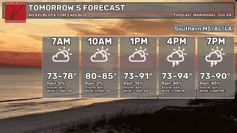
Same kind of trend for tomorrow. Another shortwave will move over the region, triggering lift and thunderstorms. Instability and moisture will still be present, shear values range from low to moderate, potentially supporting the development of severe weather for areas like central/northwestern Mississippi. Much of the region has a risk for thunderstorms.
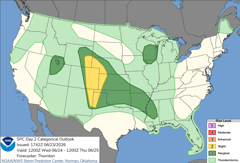
Some changes to the SPC outlook for Wednesday, the marginal risk pushing into Mississippi, and the risk of thunderstorms pushing more in Louisiana. Make sure to keep up to date with the weather for the next couple of days as these storms impact the area.
EXTENDED OUTLOOK
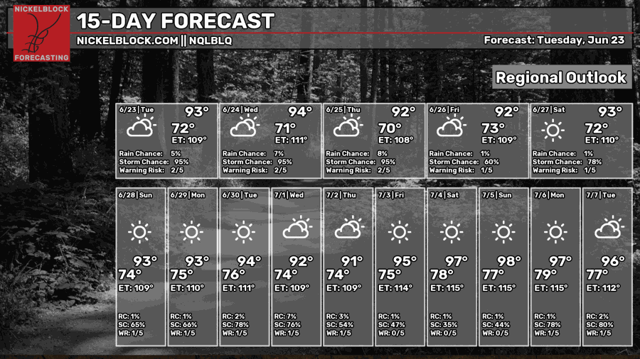
No major chances to the extended outlook. Summer weather will return by next week as upper-level ridging moves into the area limiting chances for rain and increasing temperatures. Afternoon pop-up showers are possible for the next couple of weeks. The heat index will be over 100, so when you are outside make sure to stay hydrated, put on sunscreen, and take care of yourself!
Keep up to date with the weather and enjoy the rest of your Tuesday!


