Howdy!
Temperatures are heating up, and so are the heat risks. Make sure to take care of yourself when outside as summer is in full swing. Chances for rain exist in the coming days.

TODAY/TONIGHT
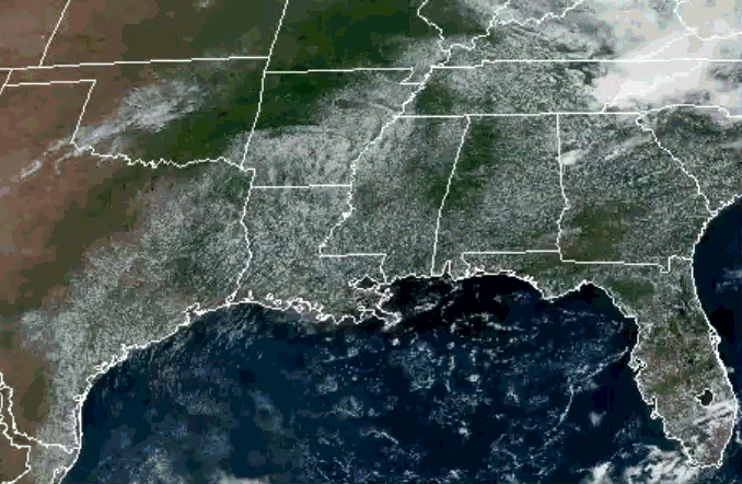
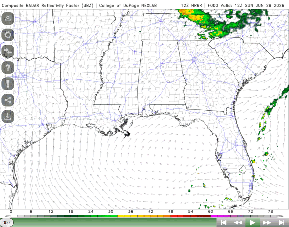
Taking a look out the window (NOAA satellite), there is not much going on currently (around 1:00 CST). No precipitation in our region (see below in NWS radar), and little clouds.
Temperatures currently range from the mid to upper 80s, dewpoints in the mid 70s for much of the region. Heat index values are already reaching the upper 90s in some areas, such as Pensacola, Mobile, and New Orleans, and likely to increase over 100 in the afternoon.
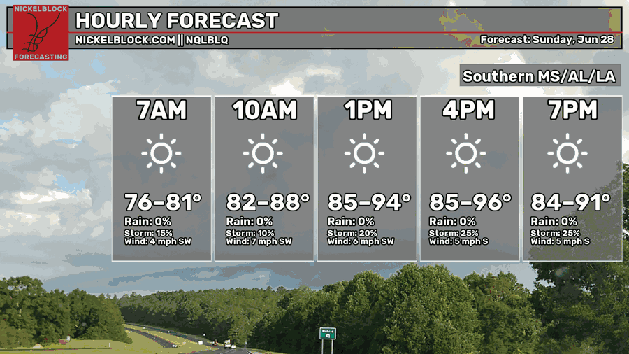
Minimal rain in the forecast, maybe a few pop-up showers for southern Louisiana. High pressure and ridging is causing this hot, minimal chance for rain weather. Highs could reach the mid 90s today, heat index values over 100, so make sure to take care of yourself when outside!
This evening, a couple showers are possible for southern Louisiana, but most of the region will not be seeing anything.
TOMORROW
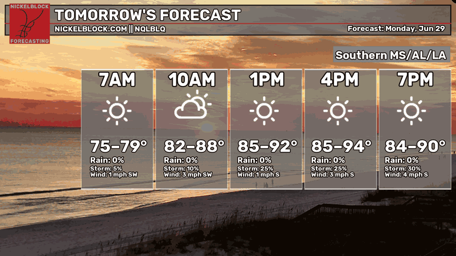
Much of the same weather pattern for tomorrow. Highs in the mid 90s and most of the region will not be seeing any rain. Southeast Alabama could see some thunderstorms tomorrow evening into Tuesday.
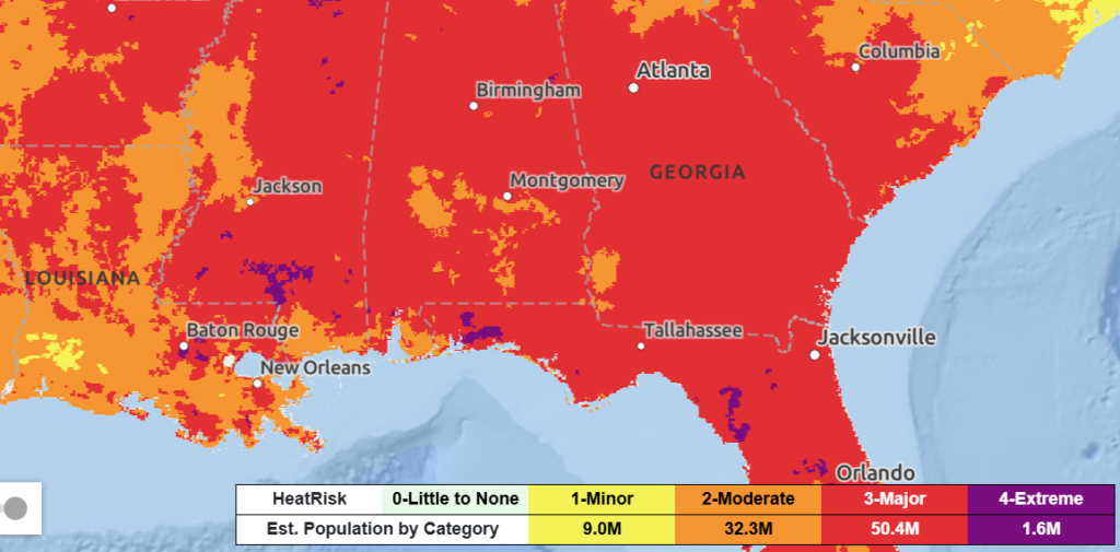
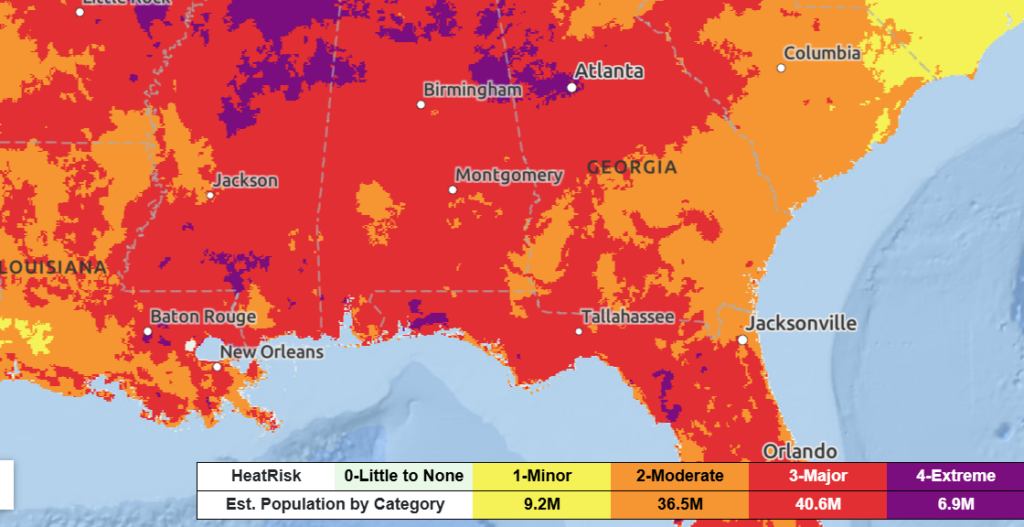
As temperatures start to increase, it is important to take care of yourself. The NWS heat risk outlook puts much of the region under major risk, a few areas out near Baton Rouge and southern Mississippi under extreme risk. When outside, make sure to hydrate, put on sunscreen, and try not to spend prolonged time in the sun. As it is the summer, it is important to take heat risk seriously as it is the leading cause of death related to weather.

TUESDAY
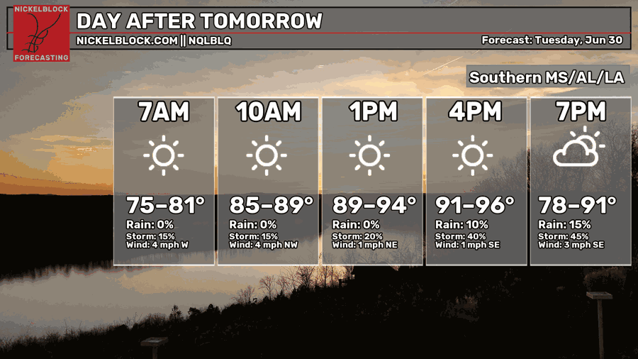
Tuesday is looking to be a hot day for the region, high temperatures ranging from the low to mid 90s. Again, much of the region is under major heat risk, some areas under extreme. When outside, pay attention to how you feel and drink plenty of water!
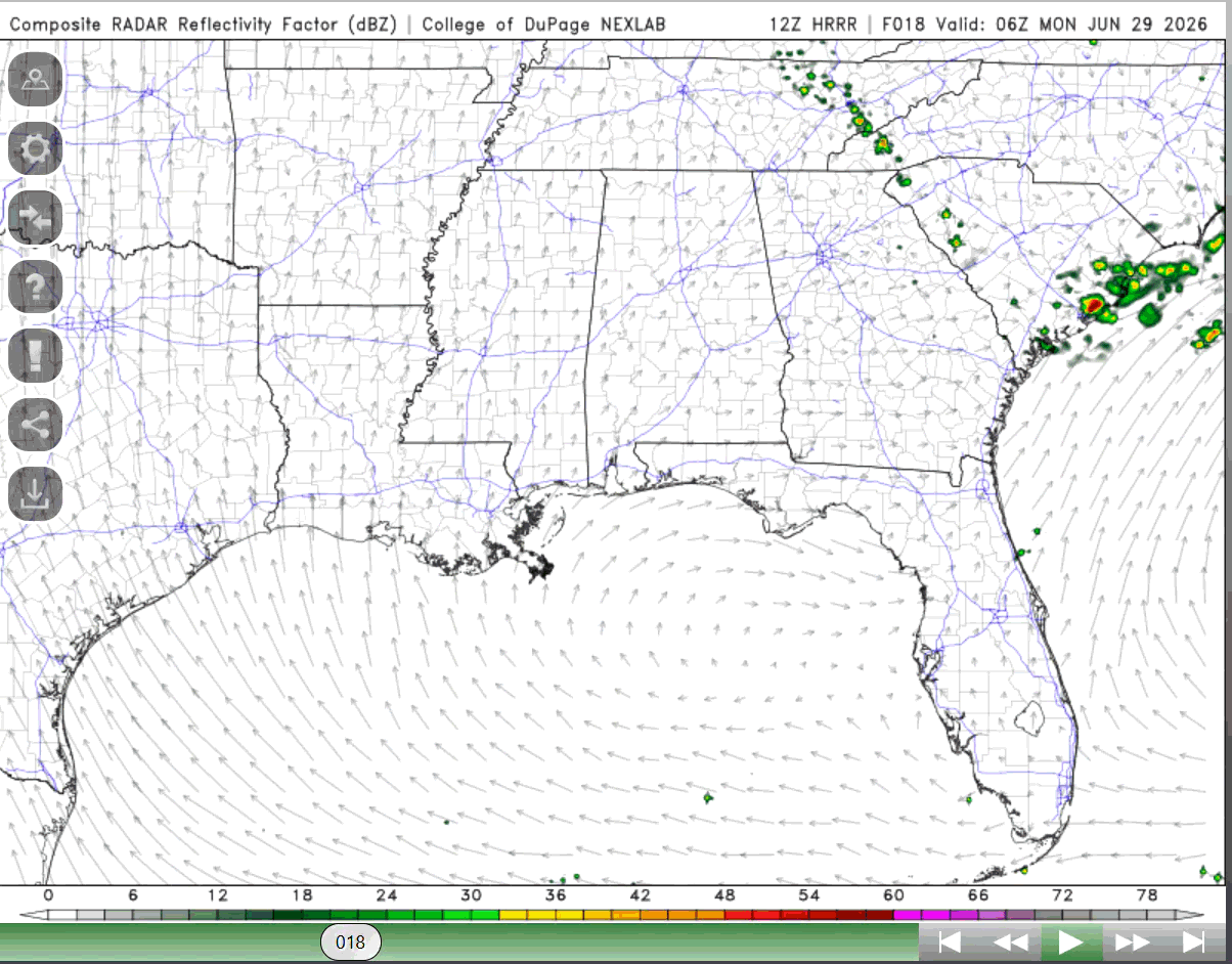
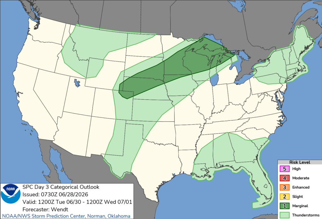
The region will see a chance for scattered thunderstorms on Tuesday afternoon (see below in SPC outlook), enough moisture and instability to support, and lift through a shortwave being brought in as a trough moves through northern parts of the country. If storms occur, they will not be severe but could produce strong and gusty winds.

EXTENDED OUTLOOK
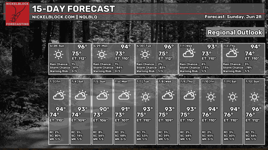
Looking ahead, the heat will remain, afternoon chances of rain exist for the next couple of weeks. Though it may be too far out to know exactly what could occur, by the weekend of July 10-12, the region could see a high chance for rain and thunderstorms as a broad trough is present and extends into the region over the northeastern United States.
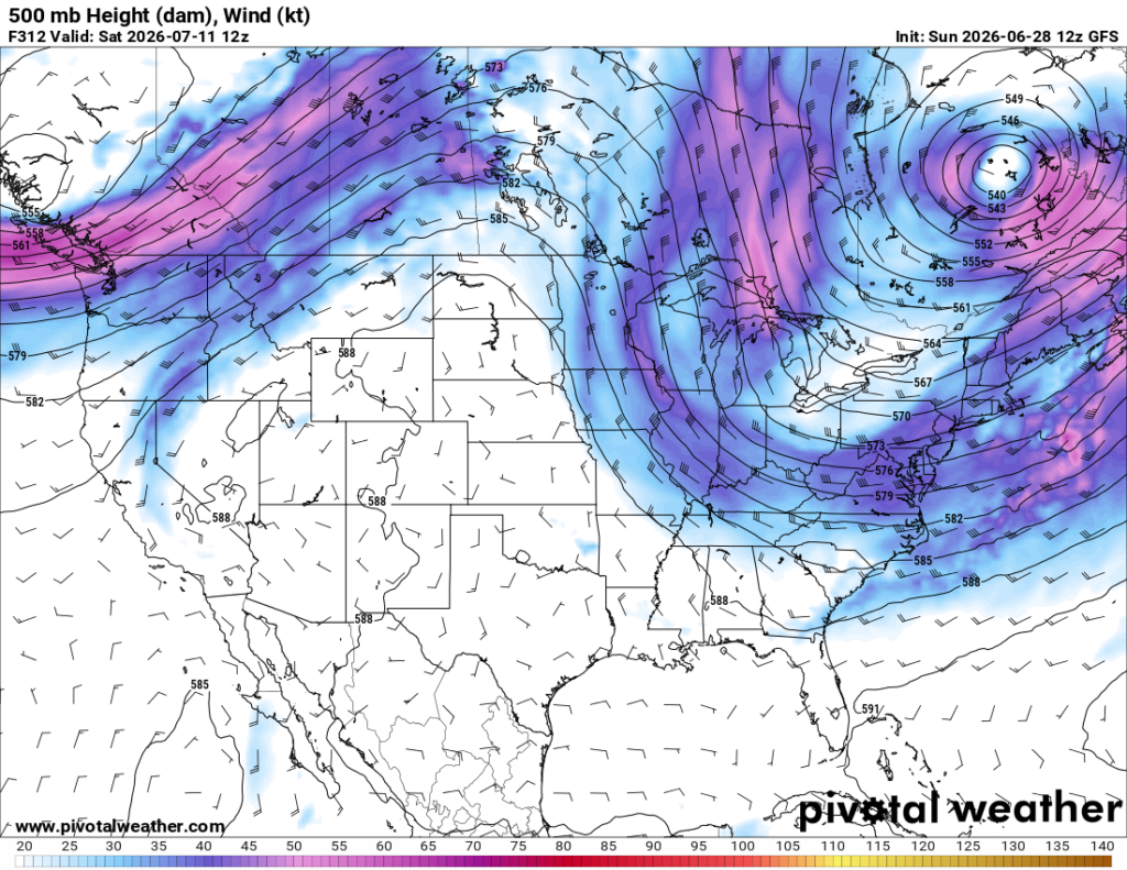
This event could produce thunderstorms for us and bring with it slightly cooler air from the north/northwest. It will not last long though as this trough will move, and ridging will be brought back for even more heat. Again, this event is still too far out to know if it will happen exactly, but there is a possibility to see some more thunderstorms in the next couple weeks.
For now, make sure to keep hydrated and cool when outdoors and look after each other. Enjoy the rest of your Sunday!


