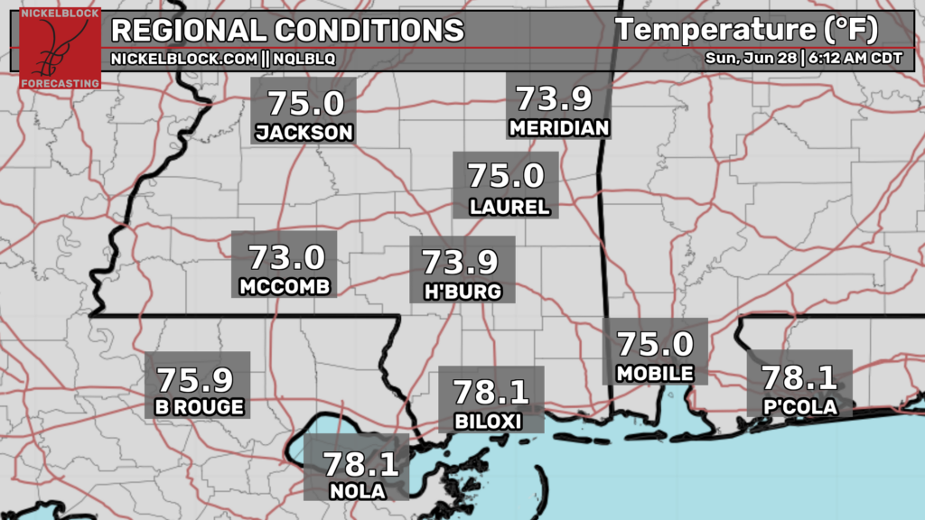
Good morning! As I’m writing this at 6:45a CDT, our radar is looking quiet, and temperatures are in the mid 70s pretty much everywhere in our region.
Today
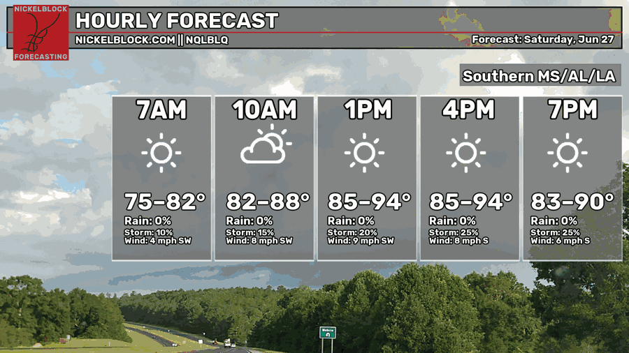
We’re in for another hot today as the ridge of high pressure over our area continues to be anchored down. Afternoon high temperatures are forecasted to be anywhere from the mid 80s to the mid 90s. Temperatures will be “coolest” in the area bounded by Jackson, Mobile, and Montgomery, while temperatures will be hottest in Louisiana as well as up near Birmingham.
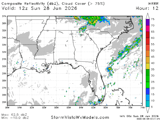
As for storms, they’re rather unlikely today, with the HRRR showing next to nothing for most of our region. The only areas that may see some storm action are further east in Georgia and the Carolinas, as well as an area near to slightly north of Baton Rouge. The threat of storms tonight is low overall.
Not much has changed in the forecast since yesterday, when the SPC noted that storms were more likely in the areas east of Biloxi.
Tomorrow
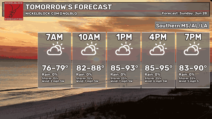
Moving into tomorrow, you can expect another hot day. High temperatures will range from the mid 80s to the mid 90s. The “coolest” temperatures will again be found in the area bounded by Jackson, Mobile, and Montgomery, while the hottest temperatures will be found in Louisiana and in areas north of the cool zone.
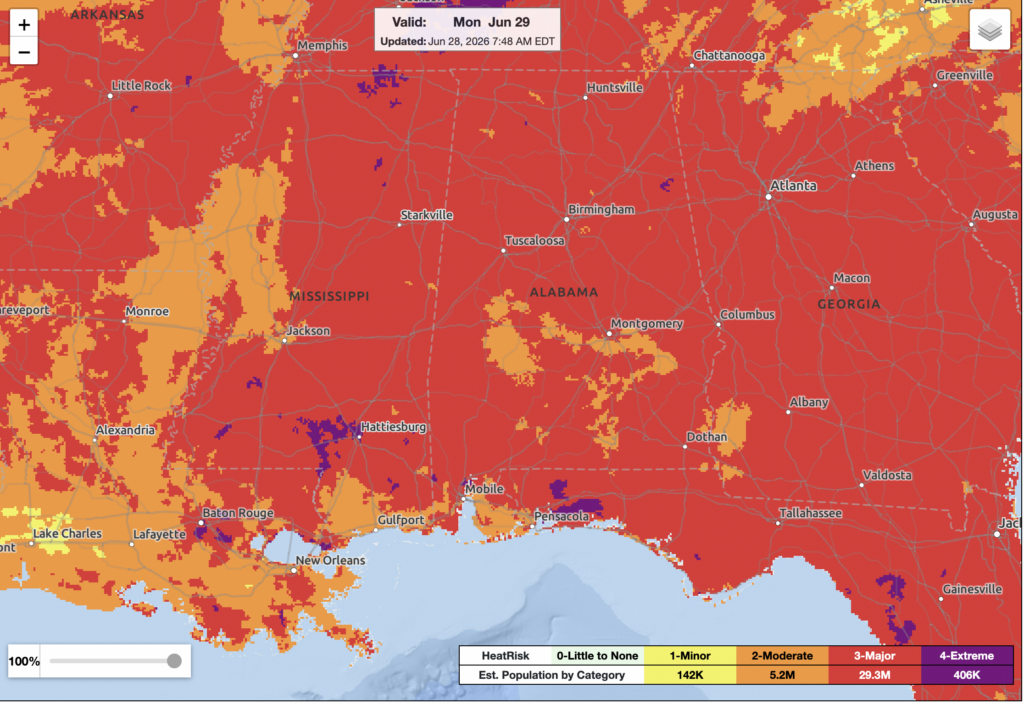
The NWS is covering a significant portion of our area in a category 3 heat risk for tomorrow. Some localized areas are even in a category 4 risk, the highest risk. Today, and especially tomorrow, it’s important to stay hydrated, limit outdoor activity, wear cool clothing, and wear sun protection.
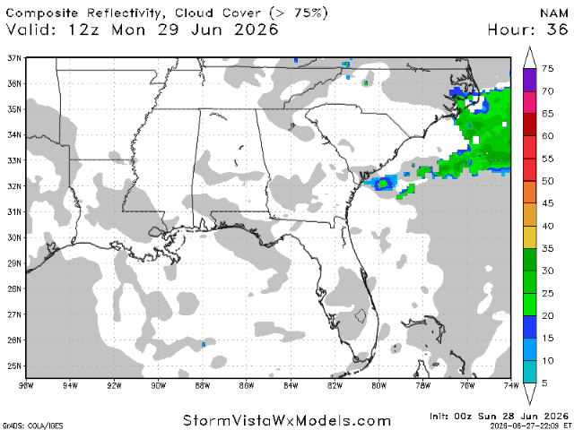
For storms, tomorrow looks like another rather quiet day. Storms are most likely in Georgia and the Carolinas, where the boundary between the high pressure over our area and an area of low pressure off the coast of the Carolinas lies. The high pressure over us will act as a lid, preventing strong storms from developing in the evening.
Not much has changed in the forecast since yesterday.


