Good news for the East Coast! The National Hurricane Center has lowered the development odds for this disturbance from 20% to 10%, indicating a reduced likelihood of tropical development.
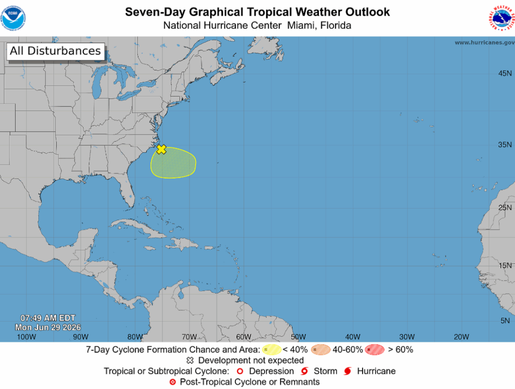
This disturbance is mainly disorganized showers and thunderstorms associated with an area of low pressure along a frontal boundary off the East Coast. Formation is not expected with this system, with development chances around 10% over both the next 48 hours and the 7-day outlook.
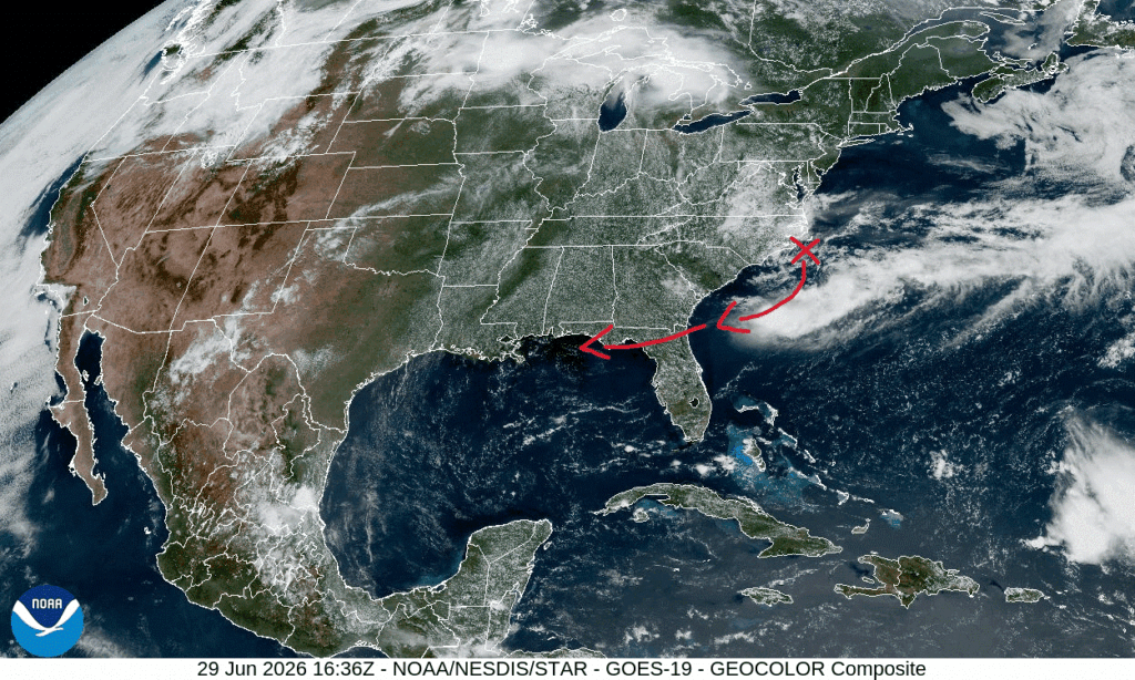
This system is moving South and Westward as conditions become less favorable towards the end of the week. Impacts include showers and isolated thunderstorms across the East Coast, specifically in shore-side cities, while also carrying moisture into our Gulf Coast region towards the end of the week as this storm dissipates. Increased surf could also occur across the FL/GA/SC coastline as this storm travels South/Southwest.
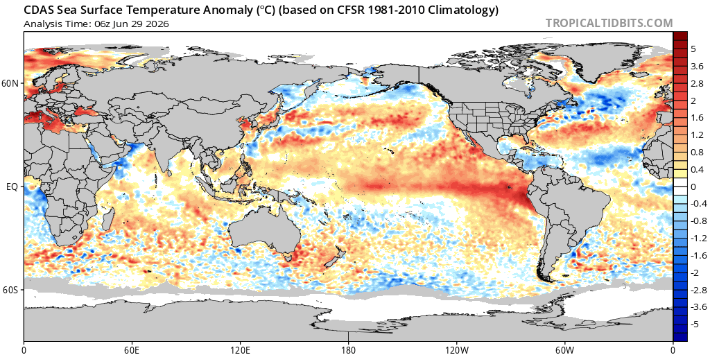
As for any future development, sea surface temperatures are trending slightly warmer than average around our Southeastern coast and the Eastern side of the Gulf. Ocean temperatures of above 80 degrees are required for hurricanes to form and currently our Atlantic temperatures are fairly high above that threshold, potentially allowing for hurricane formation.
Currently, we can thank the Saharan Dust tracking across the Atlantic and into the Gulf for stalling hurricane formation. This dust smothers moisture and evaporates the cloud core of developing storms since the SAL (Saharan Air Layer) is so dry. This dust also creates a temperature inversion as the dust particles absorb sunlight, heating up the air higher in the sky and creating a layer of hot air stacked on top of a layer of cooler air. This phenomenon restricts storm formation because air only rises when it is warmer than the air surrounding it, meaning that rising tropical air currents die out when they hit this hot dust layer. This dust also has lasting effects by cooling the ocean surface temperatures. Yay for no storms!


