Yes, unfortunately, we are going through a bit of a rainy period, bringing the risk of flooding back. On the bright side, the rain is not forecasted to stick around for long. A low-pressure system and its associated fronts will approach from the north and linger nearby Monday through Tuesday.
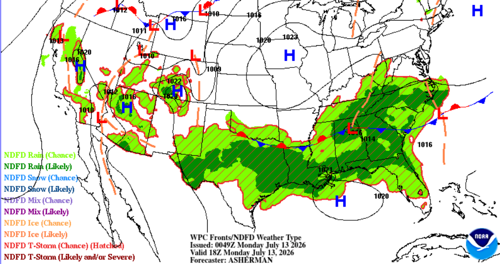
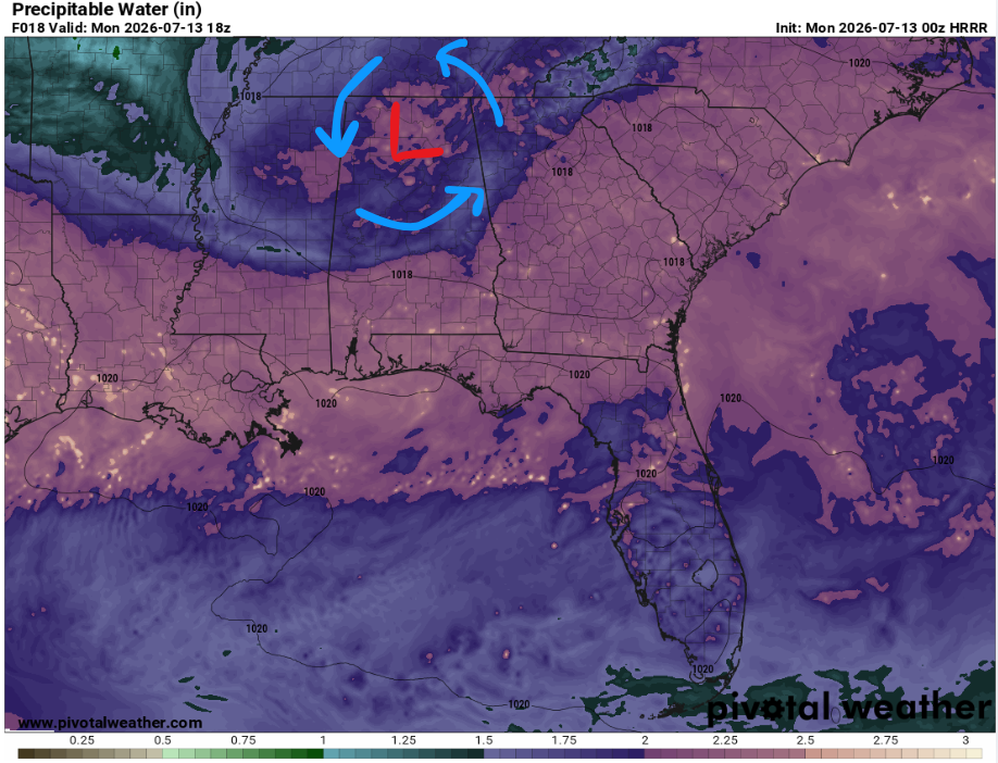
In terms of ingredients, the atmosphere is very moist! High precipitable water values are shown below by the pinks and purples. Also, winds will be weak throughout the atmosphere, meaning there is not much to push these storms along. As a result, storms will be slow-moving and capable of dumping a lot of rain over the same locations. Highest concerns are flash flooding (especially in areas that receive repeated rounds of storms), gusty winds. and frequent lightning.
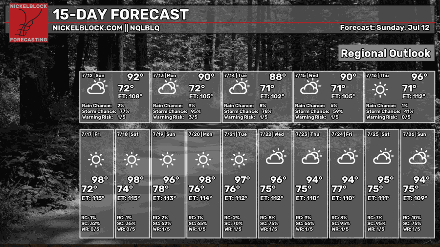
Don’t worry, there is hope! A drier pattern is expected in the latter half of the week, with the trade-off being much hotter temperatures.

TONIGHT
Tonight, showers and thunderstorms will continue well into the morning hours tomorrow under cloudy skies. The slow movement of these storms could quickly produce ponding or localized flash flooding. Gusty winds up to 40 mph and frequent lightning will also be possible.
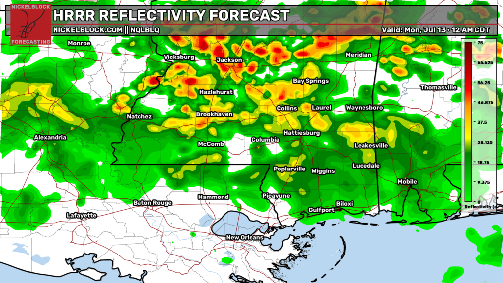
Mostly cloudy skies, with temperatures dropping to around 72 near Brookhaven and 77 near Houma.
TOMORROW
Monday, the greatest flash flooding and heavy rainfall concern of this week comes as the surface low and front settle nearby.
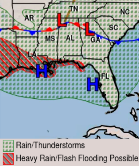
Numerous showers and thunderstorms are expected starting in the early morning. These storms will be capable of producing intense rain rates in a short amount of time, leading to scattered flash flooding. Some slow-moving storms may also train over the same area, increasing the flooding threat. Give yourself extra time driving!
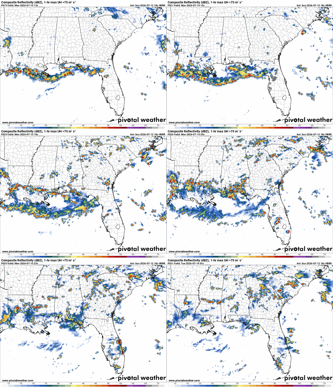
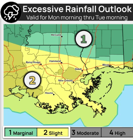
Models have the highest 24-hour rainfall totals along and south of I-10. The Storm Prediction Center has southern Louisiana under a Slight Risk of excessive rainfall tomorrow, with a Marginal Risk for southern Mississippi.

THE DAY AFTER TOMORROW
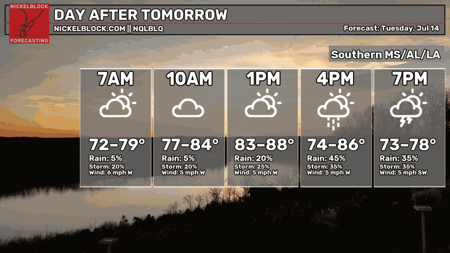
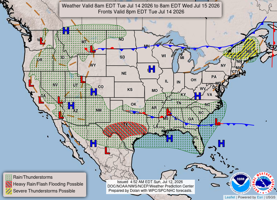
Tuesday, wet weather hangs around with numerous showers and thunderstorms. Soils will be saturated from Monday, so just a little more rain could trigger minor flooding. With increased cloud cover and rainfall, daily highs will stay just under 90 degrees.

EXTENDED OUTLOOK
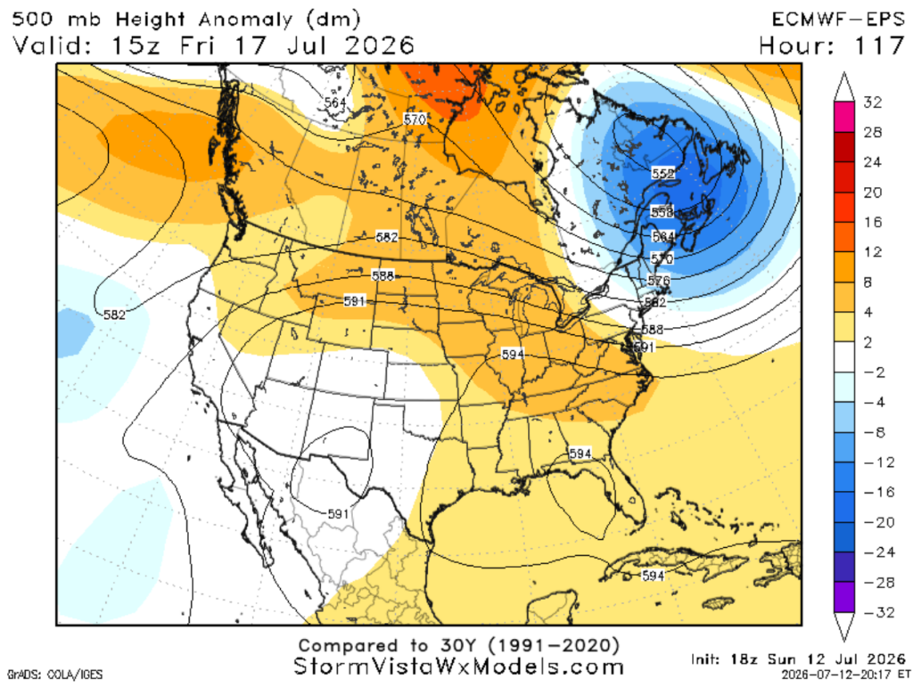
We do quite the flip-flop starting Wednesday night. An upper-level ridge builds across the region, allowing for a gradual drying trend into the weekend. This will bring us from widespread heavy rainfall to your typical sunny summer days, with quick pop-up storms possible in the afternoon.
Temps will climb well back into the 90s, and with high humidity, it’s going to feel 15 degrees warmer, making it quite hot Fri-Sat.
DAY-BY-DAY FORECAST
Tonight – Numerous showers and thunderstorms, flooding possible. Lows will range from 72 near Brookhaven to around 77 near Houma. Otherwise, mostly cloudy with calm winds. Rain chance: 50%
Monday – Numerous showers and thunderstorms likely, with heavy rainfall and localized flooding. Cooling down with a high near 86. Winds around 5mph blowing from the west. Rain chance: 90%
Monday Night – Showers and thunderstorms possible overnight, otherwise cloudy with a low around 72. Southwest wind around 5 mph. Rain chance: 50%
Tuesday – Wet weather hangs around with numerous showers and thunderstorms possible, watch for minor flooding in low-lying areas. Otherwise, partly sunny, with a high near 87. Winds blowing from the west at 5mph. Rain chance: 70%
Tuesday Night – Some showers could linger into the early overnight hours before settling into mostly cloudy night. Lows around 70. Winds blowing from the west at 5mph. Rain chance: 20%
Wednesday – Wet weather hangs around with scattered showers and thunderstorms possible. Highs will be hovering around 90. Rain chance: 50%
Wednesday Night – A few showers and storms may linger overnight under partly cloudy skies. Low around 72. West wind around 5 mph. Rain chance: 20%
Thursday – Mostly sunny. A few afternoon thunderstorms may pop up after 1pm, but much of the day stays dry. Highs around 92 but will feel closer to 105. Light breeze blowing from the south. Rain chance: 15%
Thursday Night – Partly cloudy skies with lows around 74. Calm winds.
Friday – Heat is the main story. Highs will be near 94, but the humidity will make it feel closer to 105. Expect a very typical hot summer day with sunny skies. Cannot rule out a brief, stray afternoon storm. Light breeze from the west. Rain chance: 15%
Friday Night – Overnight lows near 75. Mostly clear skies with a calm breeze.
Saturday –Mostly sunny with highs around 94, may feel closer to 100. Could see some scattered afternoon showers and thunderstorms. Winds from the west at 5-10mph. Rain chance: 30%
Saturday Night – A few showers and storms may linger overnight under partly cloudy skies. Low around 75. West wind around 5 mph. Rain chance: 20%


