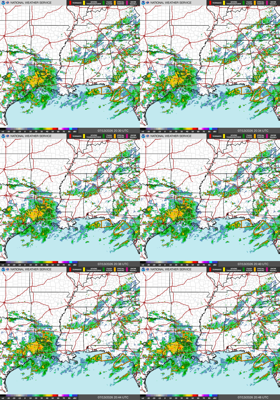
Currently, LA is experiencing heavy rainfall and thunderstorms. There are two active flash flood warnings in Central LA.

Today
Feeling a bit cooler than normal here in the south. Highs in the mid-80s around the late afternoon. Chances of showers and thunderstorms will increase going into the evening. Calm winds, mostly coming out of the west.
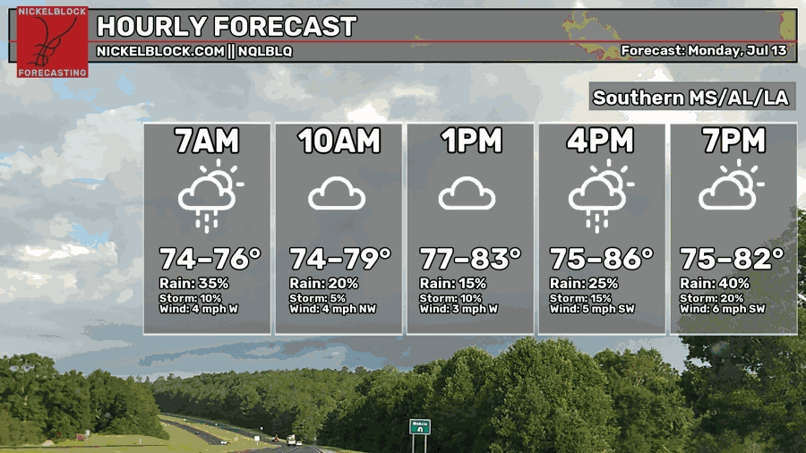
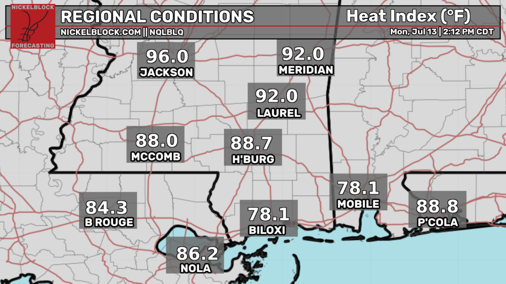
On the coast of MS and AL, temperatures are feeling like we are in the upper 70s! Much cooler than what we’ve been feeling.
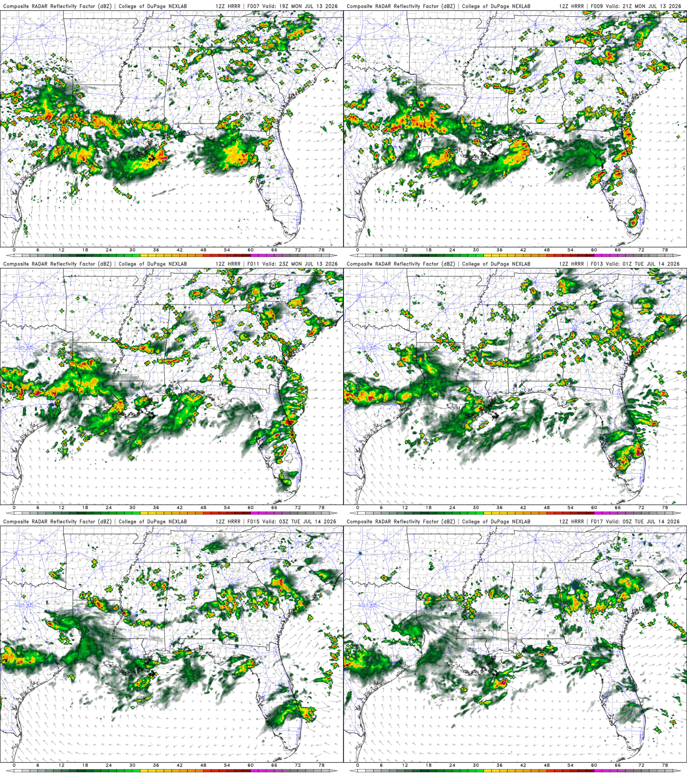
Southern MS and AL will experience rain and thunderstorms in the afternoon. Most of the heavy rain will fall from then until late evening. Southern LA, however, will have the showers and thunderstorms lingering throughout the day. Most of the rainfall is going to be in Southwest LA, seeing over 2.5 inches of rain.
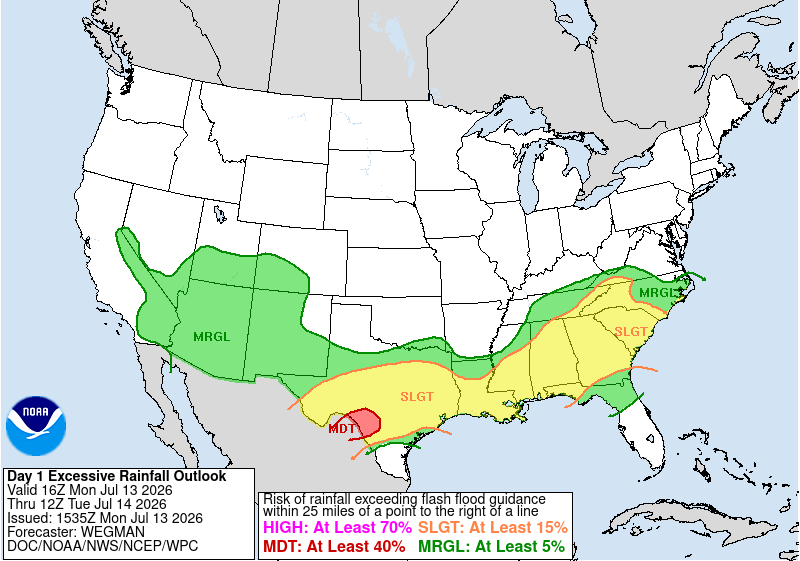
Our entire area will be under a slight risk of excessive rainfall, meaning scattered flash flooding is possible. Flood-prone areas should remain vigilant.
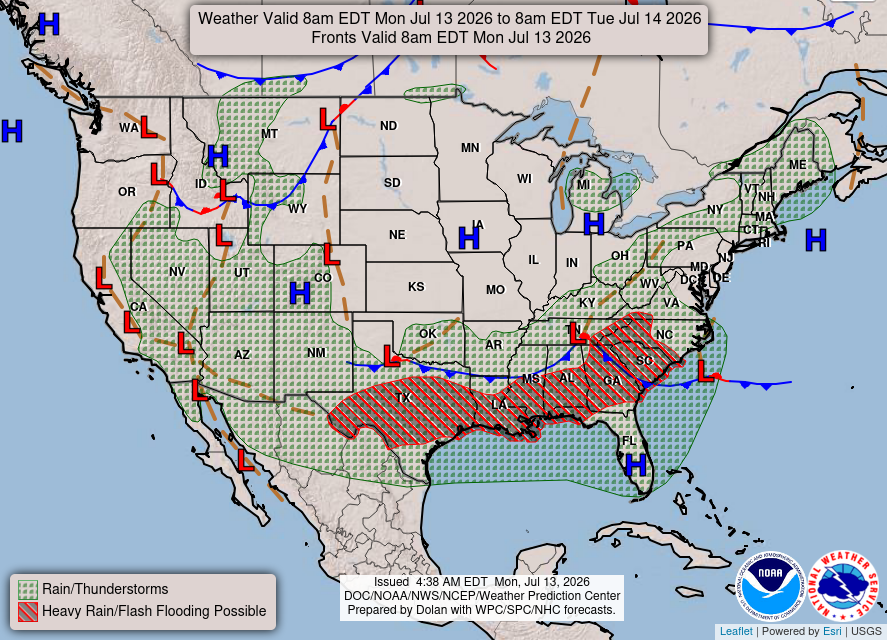
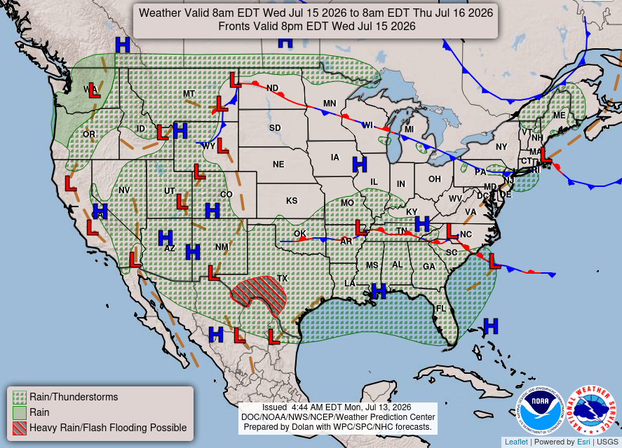
Currently, a cold front is pushing through the south, and two areas of low pressure are over Texas and Tennessee. For these reasons, the heavy rainfall and thunderstorms in our area make sense.
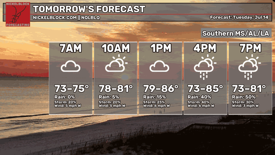
Tomorrow
We will see a similar setup tomorrow with highs in the mid-80s in the afternoon. The chances for showers and thunderstorms will increase during the late afternoon into the evening. Calm winds out of the west.
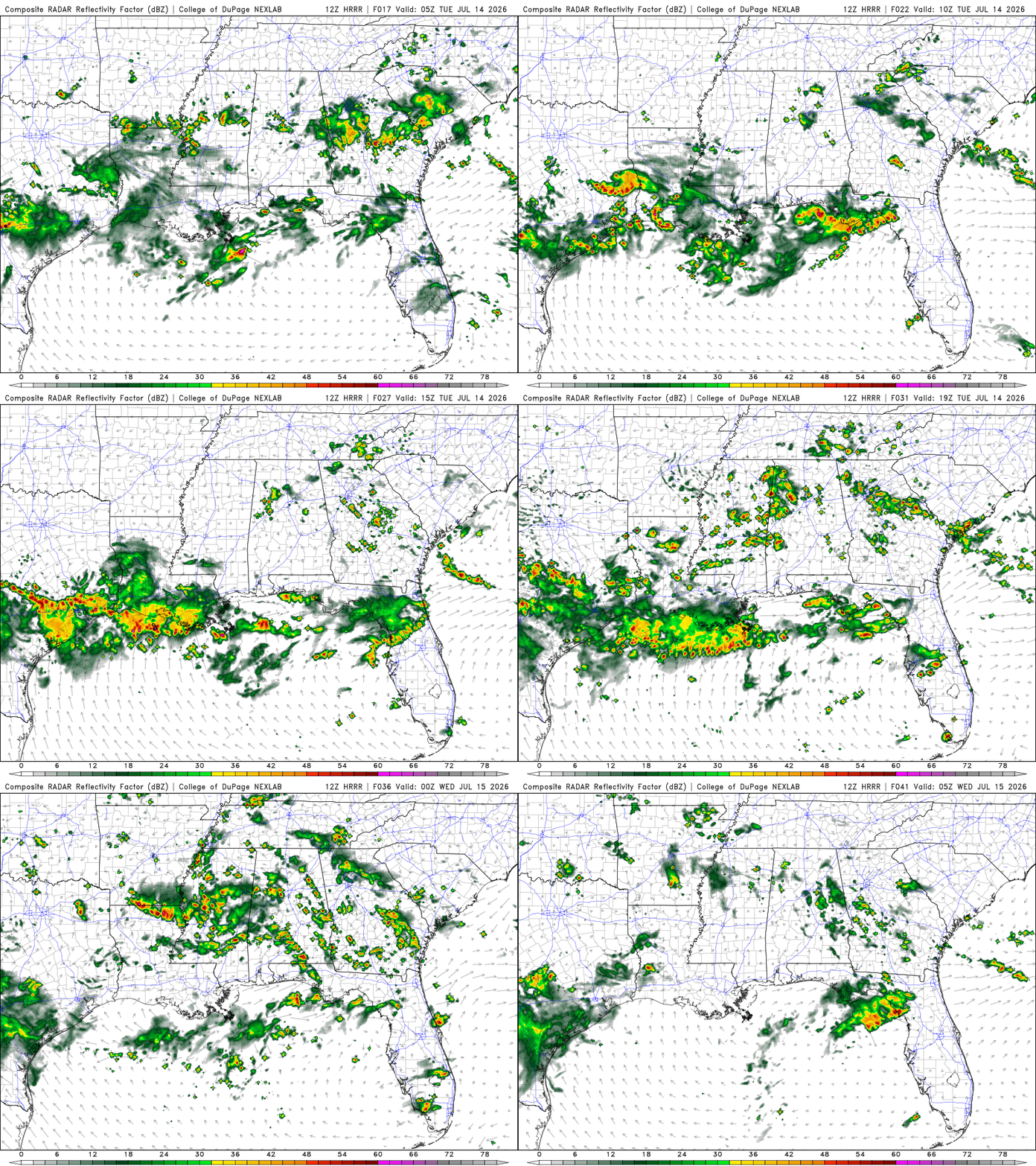
Scattered showers and thunderstorms in Southern LA until late evening. Southern MS and AL will see some brief early morning showers and possible late afternoon scattered showers and thunderstorms.
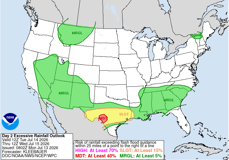
Still under a risk of excessive rainfall, but a marginal risk, meaning isolated flash flooding is possible. Most of the area will receive < half an inch of rain.

Wednesday
Temperatures are starting to rise again, with highs in the lower 90s around late afternoon. Slight chances of showers and thunderstorms later in the day.
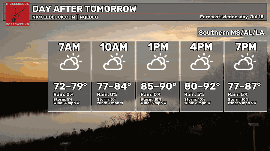
An area of high pressure in MS will bring the Gulf moisture into our area, making isolated showers and thunderstorms possible. Most of the rain will be in Southeastern LA.

Extended Forecast
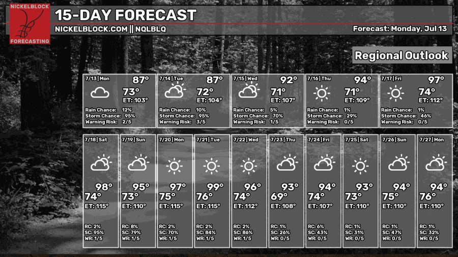
The CPC outlook had our area experiencing above average temperatures and near to slightly above normal precipitation.


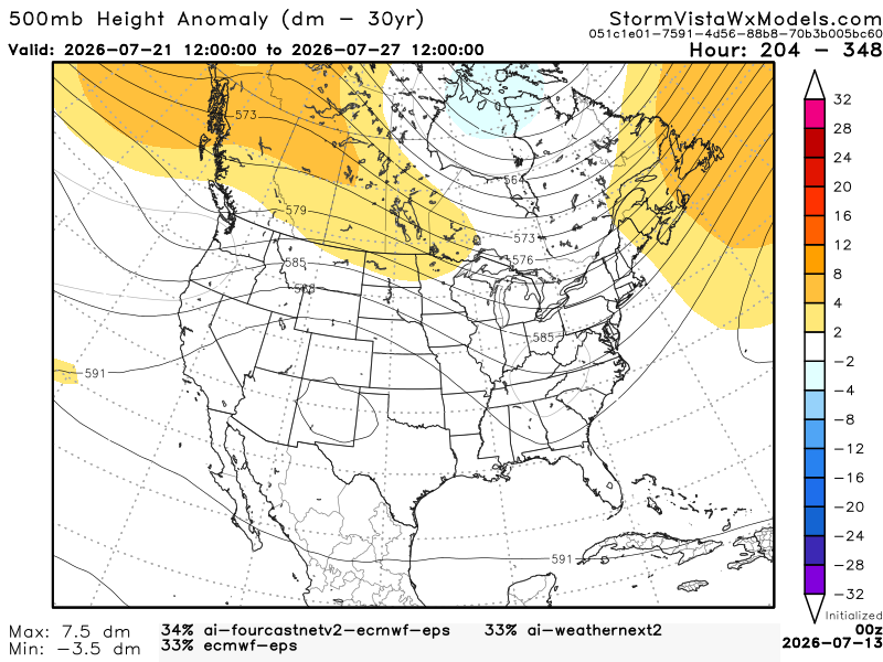
This 500mb height anomaly model has a blend of the 3 most accurate models over the past 7 days. The model runs from July 21, 7 am to July 27, 7 am. Based on the blend, I would agree with the CPC. Our region will have moisture from the Gulf, so afternoon showers and thunderstorms are still possible.