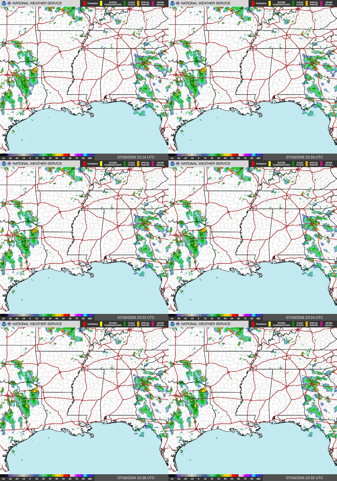
Looking at our regional outlook today, we see a mostly clear but warm Southern MS/AL/LA. Residents in Texas living West of San Antonio will need to be on high alert due to the amount of rainfall the area has accumulated over the past few days, unluckily, with more to come.
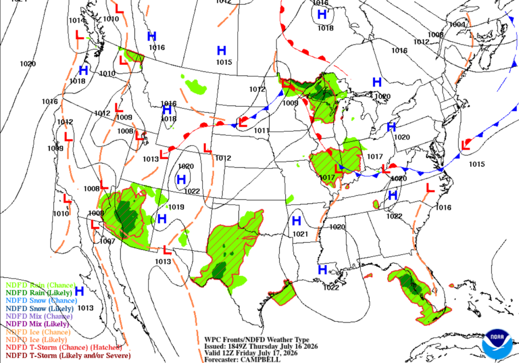
In the above graphic, we can really see the areas of high pressure in action across our area! The sinking air pushes away surrounding storms and inhibits thunderstorm formation, leaving our area warm and dry.
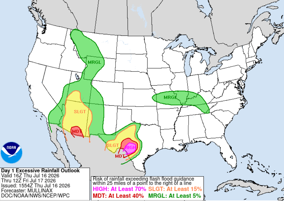
Unfortunately, the rainfall still to come for Texas will be sitting on top of an estimated 20-30 inches that have already fallen over the past 10 days as of 7 am this morning. With all this precipitation, the water has nowhere to go, amplifying the risk for flash flooding. The WPC states that 80% of flood-related damage and 1/3 of all flood-related fatalities occur on high-risk rainfall days.
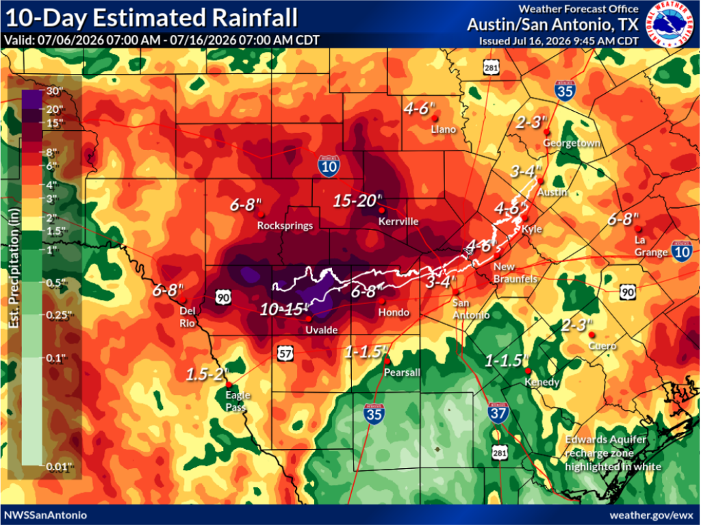
With that being said, folks in western central Texas, specifically Uvalde, Kerrville, Hondo, and other areas West of San Antonio, need to be on high alert, as the risk of flash flooding from this rainfall is immense. Residents of the Texas Hill Country are all too familiar with flash flooding after the events of last July, so be prepared as the effects from this storm are far from over.
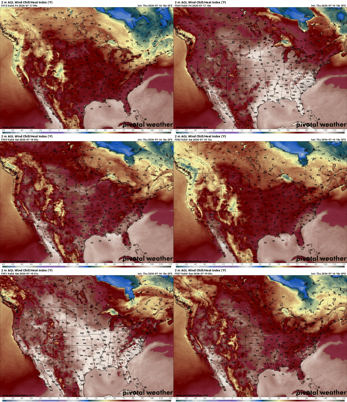
Focusing on our Southern MS/AL/LA region, warmer temperatures can be expected through the next few days as two atmospheric ridges hang around our area. The graphic below shows the pattern over the next 24 hours, which is primarily warm temperatures with limited rainfall due to the two areas of high pressure impacting the region.
Below, the heat indexes show exactly what this high pressure means for us. Warmer temperatures with a more stable atmosphere leading to less precipitation to cool things down. We do see slight dips in temperature where storms are expected to develop, but no widespread storms will impact our region the next few days. Stay cool and enjoy a warm summery weekend!
3 Day Travel Forecast
AIRPORTS
KIAH / KHOU (Houston) – Low delay risk due to weather.
KSHV (Shreveport) – Low risk for delays.
KBTR (Baton Rouge) – Mostly clear and sunny, so low risk for weather-related delays.
KMSY (New Orleans) – Low delay risk due to weather.
KJAN (Jackson) – Low delay risk from weather.
KBMH (Birmingham) – Chance for delays in the afternoons as storms build.
KMOB (Mobile) – Potential delays due to afternoon storms.
KATL (Atlanta) – Low delay risk due to showers.
KTLH (Tallahassee) – Possible delays from afternoon thunderstorms.
Highways
I-10: Afternoon thunderstorms can be expected as you travel East.
I-20: Mostly clear and hot.
I-49: Mostly warm with a higher chance for storms further South.
I-55 & I-59: Hot temperatures with potential showers.
I-65: Warm with potential showers in the southern corridors.
I-75: Afternoon thunderstorms are to be expected, especially in FL.
3-Day City Forecast
Houston, TX: Thursday (16th): Partly sunny with potential afternoon storms. High 90°F, low 80°F.
Friday (17th): Partly sunny with a 30% chance for afternoon showers. High 92°F, low 78°F.
Saturday (18th): Warm and sunny, mostly clear. High 94°F, low 76°F.
Shreveport, LA: Thursday (16th): Mostly sunny and warm. High 92°F, low 75°F.
Friday (17th): Sunny with a slight chance of afternoon storms. High 94°F, low 76°F.
Saturday (18th): Warm and sunny. High 95°F, low 76°F.
Baton Rouge, LA: Thursday (16th): Hot and clear. High 94°F, low 75°F.
Friday (17th): Warm and sunny. High 94°F, low 76°F.
Saturday (18th): Warm and clear. High 94°F, low 77°F.
New Orleans, LA: Thursday (16th): Sunny and clear. High 93°F, low 79°F.
Friday (17th): Mostly sunny. High 94°F, low 79°F.
Saturday (18th): Warm and clear. High 94°F, low 79°F.
Jackson, MS: Thursday (16th): Warm and sunny. High 92°F, low 74°F.
Friday (17th): Mostly clean and sunny. High 94°F, low 75°F.
Saturday (18th): Clear and hot. High 94°F, low 76°F.
Birmingham, AL: Thursday (16th): Hot with a chance of thunderstorms. High 89°F, low 73°F.
Friday (17th): A warm day with afternoon storms. High 91°F, low 74°F.
Saturday (18th): Warm and sunny with an increasing chance for storms. High 91°F, low 74°F.
Mobile, AL: Thursday (16th): Hot with a chance for afternoon storms. High 96°F, low 77°F.
Friday (17th): A warm day with potential storms. High 98°F, low 77°F.
Saturday (18th): Warm and sunny with a chance for storms. High 96°F, low 78°F.
Atlanta, GA: Thursday (16th): Warm with a chance of showers. High 89°F, low 73°F.
Friday (17th): Sunny with afternoon storms. High 91°F, low 74°F.
Saturday (18th): Sunny with a chance for storms. High 90°F, low 74°F.
Tallahassee, FL: Thursday (16th): Hot with afternoon thunderstorms. High 92°F, low 75°F.
Friday (17th): Sunny then T-storms building. High 94°F, low 75°F.
Saturday (18th): Warm and sunny with thunderstorms at night. High 91°F, low 74°F.


