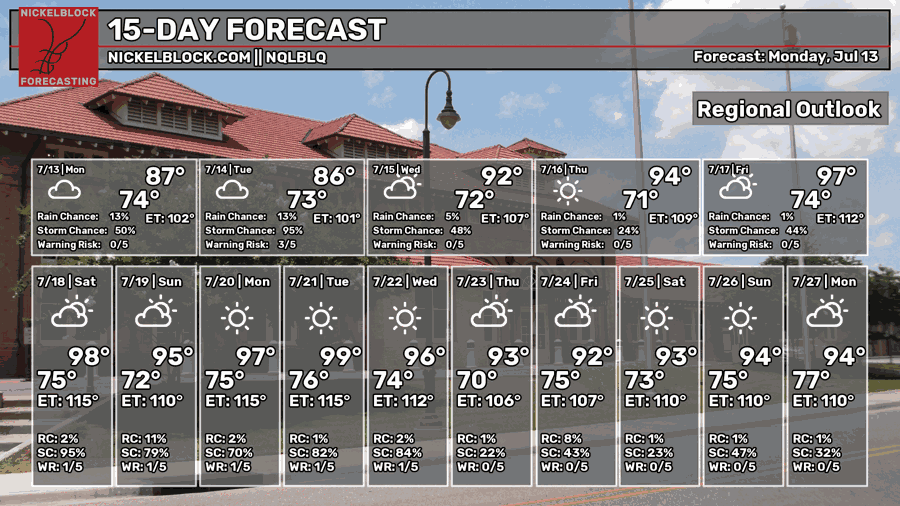
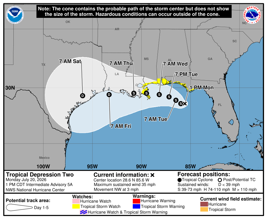
It’s going to be another hot week ahead despite the active tropics in the Gulf. Unfortunately for us, that looks like mostly heat compared to our neighbors to the east. We do have a few reasons for this which I’ll get to in a little while, but Tropical Depression 2 will struggle a bit to develop because of it. It will reach Tropical Storm status as it’s center of rotation is well defined, but otherwise it looks like it won’t be able to accomplish much as it reaches our area.

Today and Tropical Depression Two
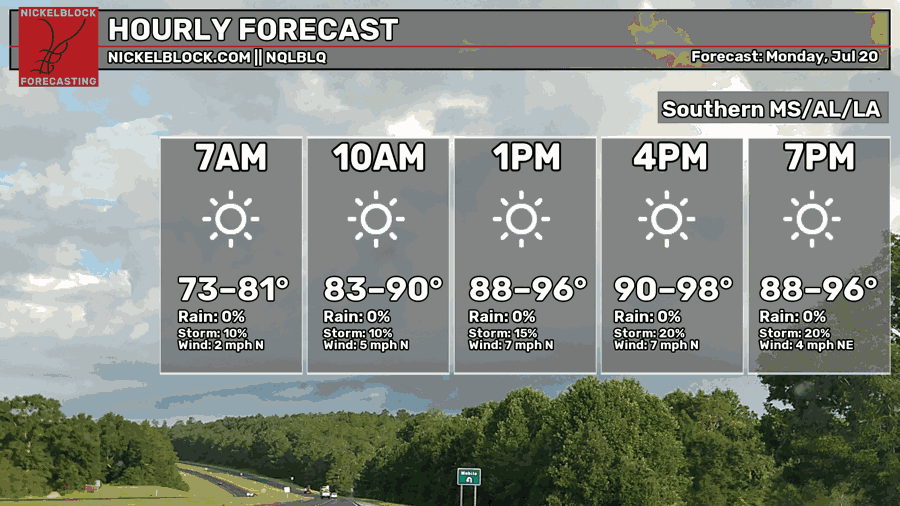
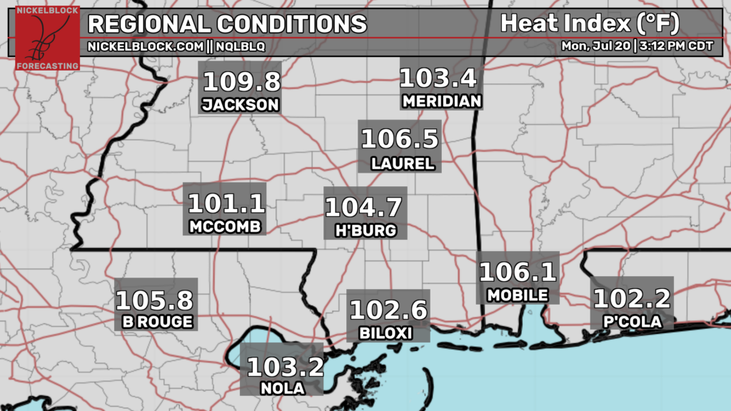
Looking at the heat index above… yeah, it’s hot. No surprise there, but the heat advisory was warranted and the excessive heat warning near the Delta. A few afternoon showers are possible during the day, but it’s going to be overwhelmingly hot even into the evening hours. Highs in the mid to upper 90s and lows in the mid 70s.
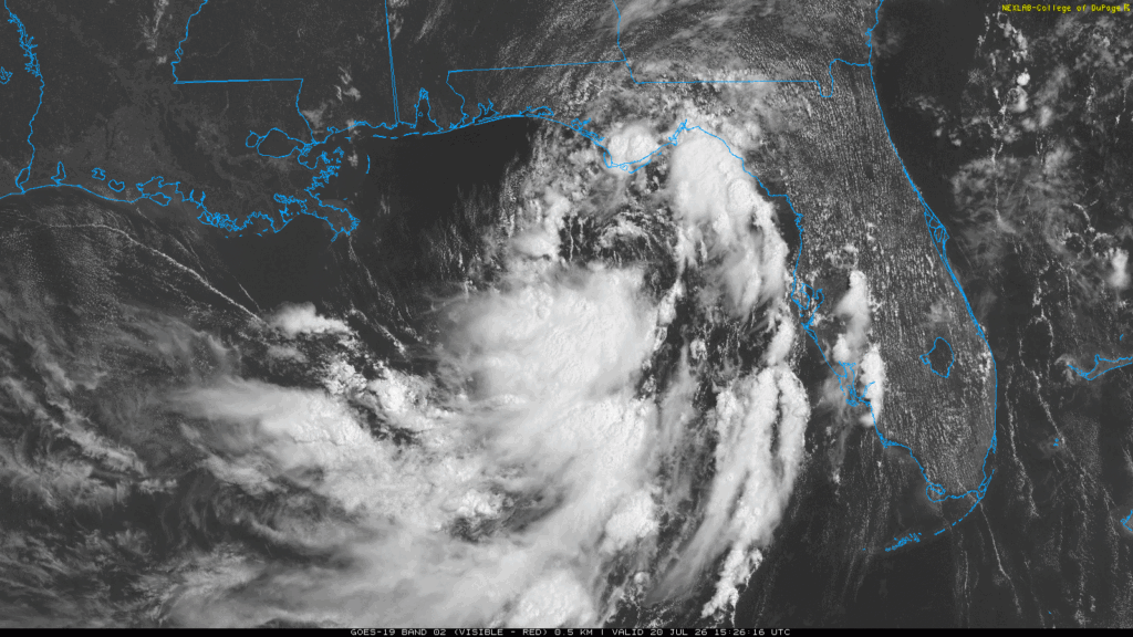
Tropical Depression Two has a good center of rotation which is a big reason why it will likely reach Tropical Storm status in the next day or so. The forecasting cone is quite broad and that’s due to the uncertainty of its direction. It can ebb and flow further or closer to the Gulf Coast which can affect how much rain we may receive.

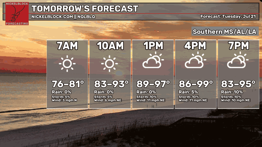
Tomorrow
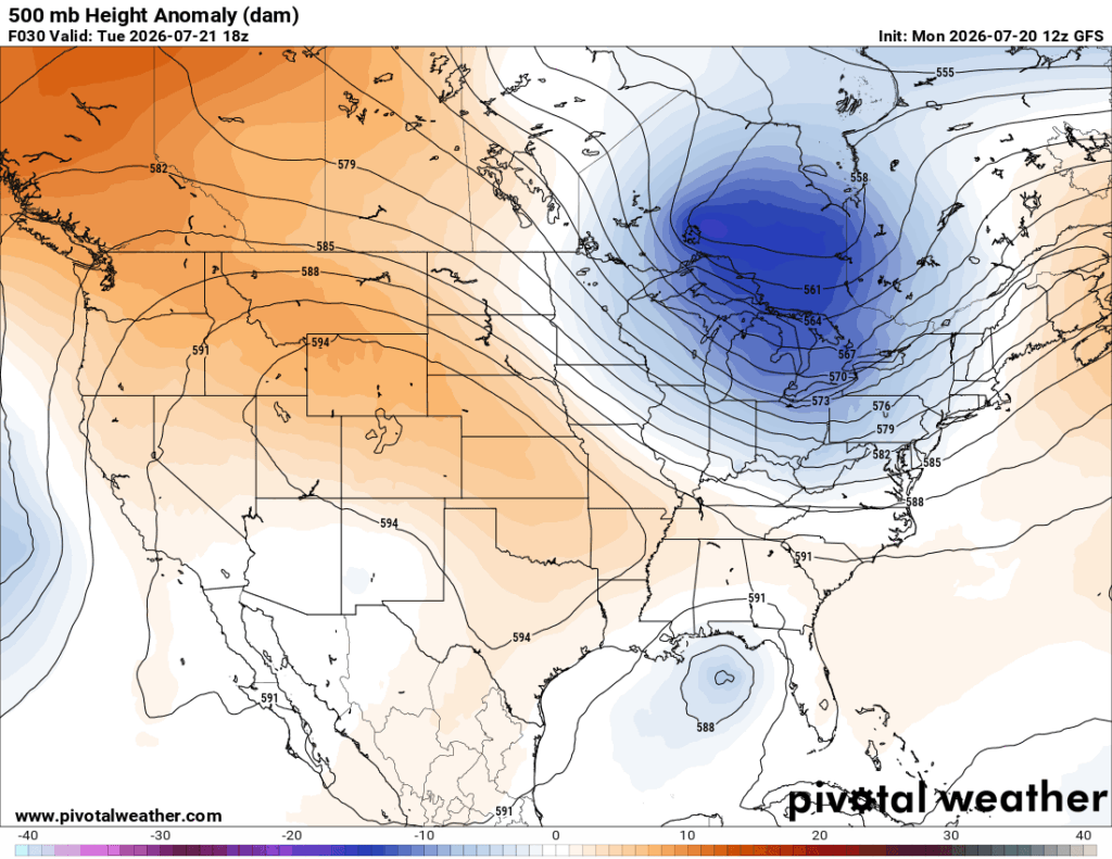
Looking at Tropical Depression Two one more time, you’ll notice it’s a bit lopsided. Most of the rain is on the south end of the low. There are a couple of reasons for this that I mentioned earlier. Looking at the 500mb map below, we can see a large ridge of high pressure over the central Rockies and southern Plains. This will have an effect on the incoming storm as the dry and compressed air will inhibit the development on the northern side of the low. The storm itself will have plenty of water to feed itself, but it will have trouble fully forming. Another reason is an incoming front at the surface which will eventually stall, but I digress.
Tuesday will be another hot one. The heat index will reach above 105 in many areas especially in the western portion of LA/MS. A few pop-up storms are possible, but pretty isolated. It’ll also be a bit windy with northeast winds around 5-15mph. After any storms pop up, we’ll go back into the mid 70s for the low.
Wednesday
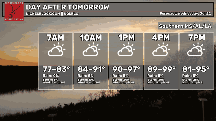
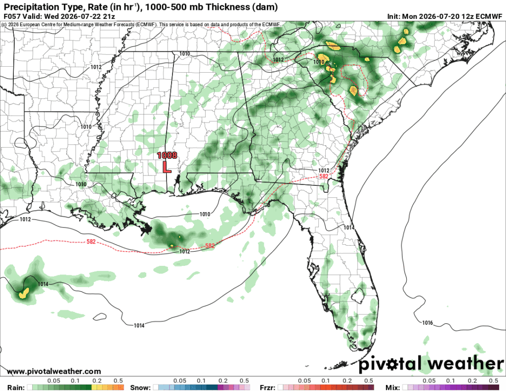
While the European model shows the low around the MS/AL border, we’ll have to take this with a grain of salt. Most of the rain will be in the Gulf and around the MS/LA Gulf Coast. It’s going to be sweltering outside with a heat index in the 110s, so dangerous heat, y’all. Have a gallon of gatorade and water on you at this point with a lot of sunscreen. A few thunderstorms are possible before sunset with a low in the mid 70s.
Tropical Depression Two’s Departure
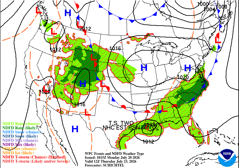
While a few areas around Louisiana will receive some rain as TS Two moves further west, it’ll be a toss-up for us in the Pine Belt as to whether or not we’ll see any more rain. We’ll have more hot days ahead as the stationary front moves in by the weekend. The good news is, we may see a bit of rain on Saturday! A combination of air masses will likely contribute to some beneficial rain before the front moves towards the Gulf. Otherwise, expect the same old heat.