Well, unfortunately, we actually have a system to discuss.
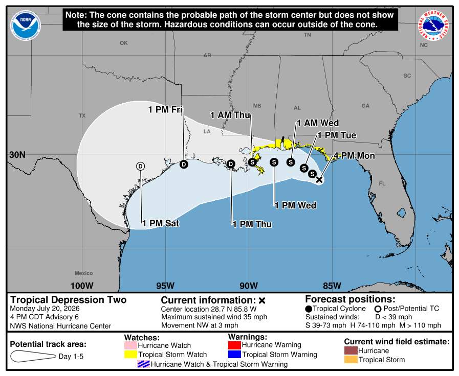
Tropical depression two is currently located in the northeastern Gulf moving northwest at 3 mph. It’s central pressure is 1005mb with maximum sustained winds of 35 mph. The system is expected to track very slowly northwest before turning west around the periphery of the ridge.
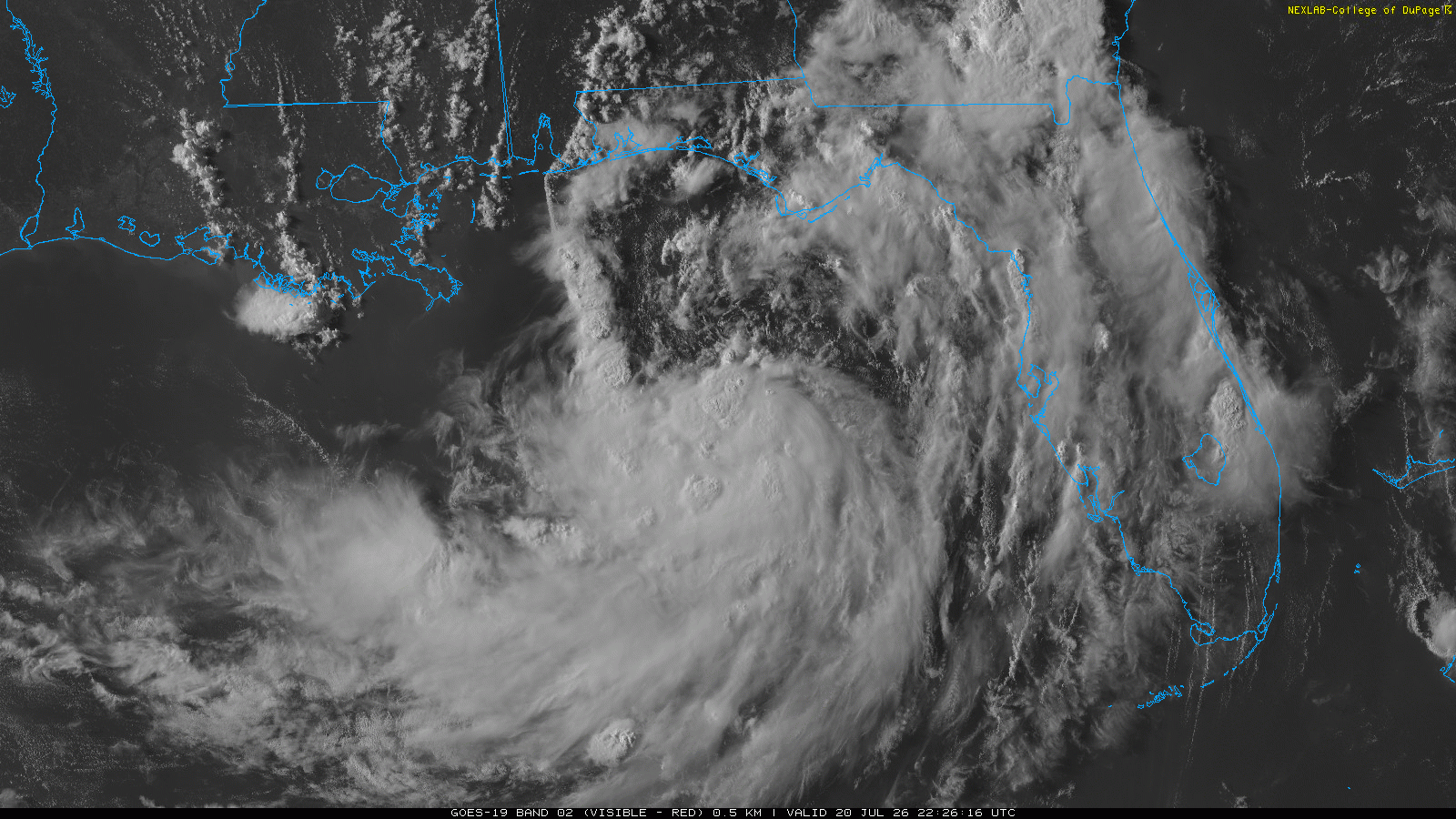
The storm is not expected to take on a perfectly circular shape due to the effects from northeasterly wind shear. This will mean that most convection will remain on the southern side of the storm and therefore over open ocean as it tracks along the gulf.
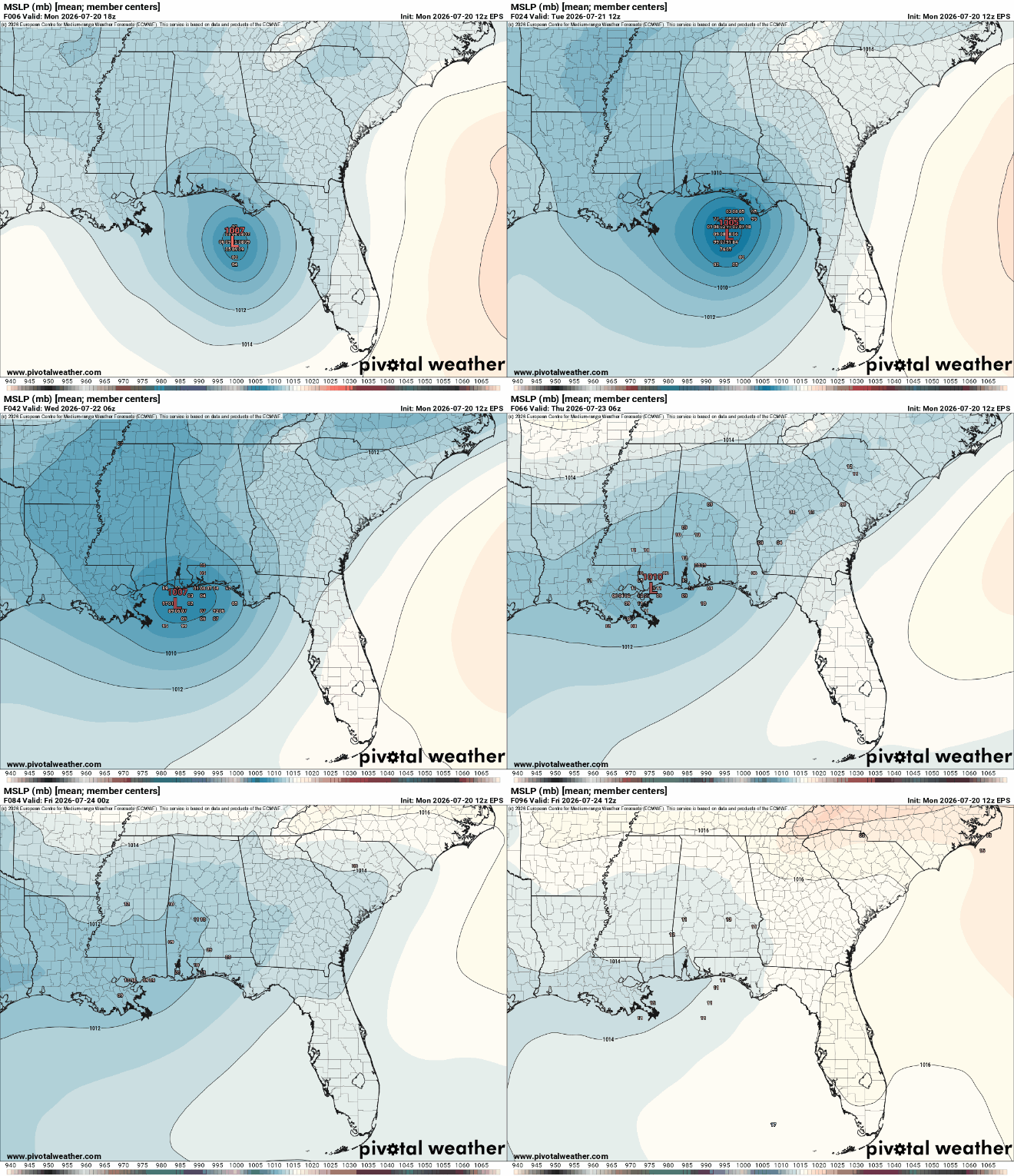
The depression is expected to soon become a tropical storm given the warm ocean waters. Intensity afterwards is still highly uncertain. Most models don’t have it reaching hurricane status but that is still definitely possible. The storm will be able to become stronger if its center remains over the ocean and does not come ashore.
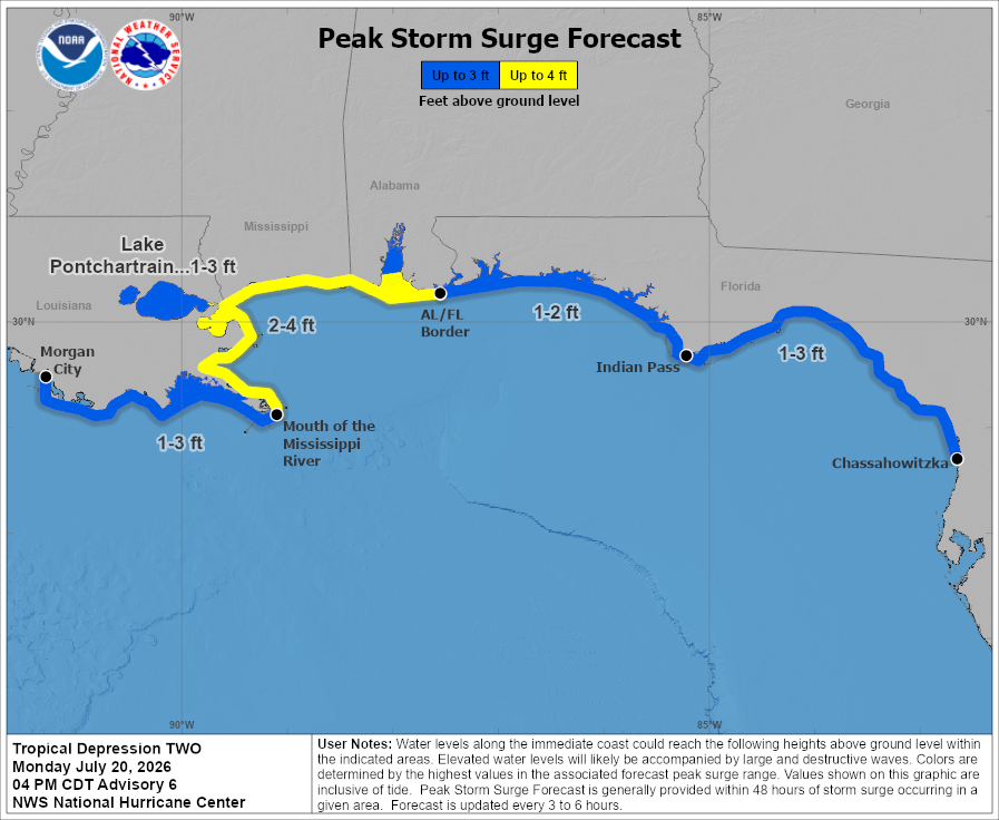
Some storm surge is expected along the coast. Tropical storm watches and storm surge watches have been placed in these locations to cover the threat.
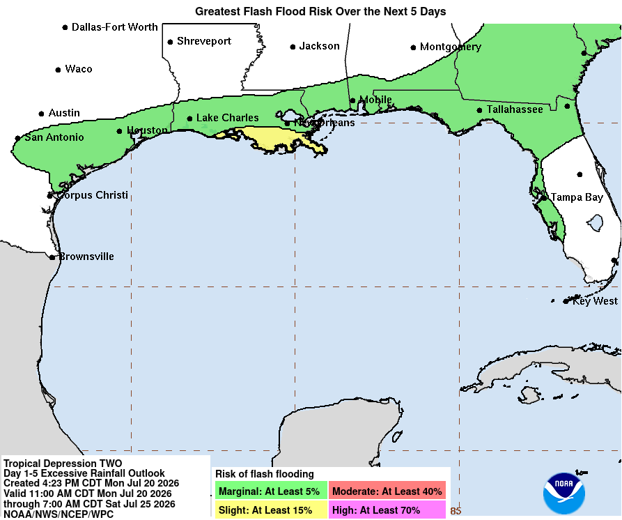
The most certain threat from this system appears to be heavy rain and flash flooding. This could occur along the length of the gulf, likely peaking across southern Louisiana.
With tropical systems, there is usually a tornado threat in the northeast quadrant of the storm. With this depression, it is uncertain whether this will occur over land or at all. Stay tuned for updates on this threat but as of now it appears on the low side.
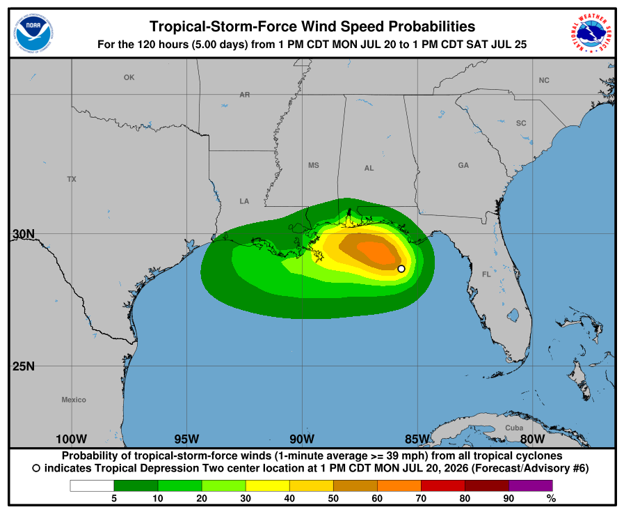
Despite current forecasts not calling for major hurricane this is not a storm to turn your back. Preparations should be ongoing if you live anywhere along the Gulf coast. Have a plan in place in case your area is expected to be impacted by flooding. Keep an eye on the forecast as it will likely change over the course of the next couple days.


