Happy Monday! Tropical Depression #2 is expected to strengthen into Tropical Storm Bertha by this evening.

Tropical Update
*The information I am about to give is from the 2pm EST Atlantic Tropical Weather Discussion from the National Hurricane Center in Miami, FL. The next discussion will be released at 8pm EST and will contain the newest updates on this storm.*
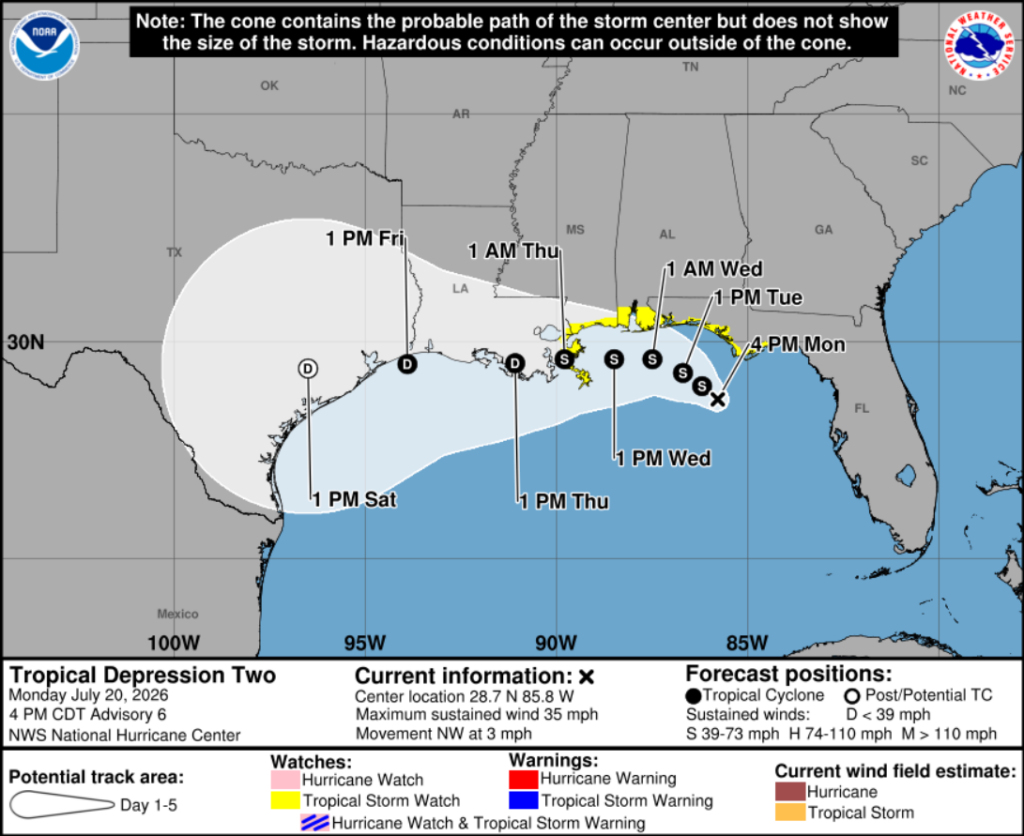
Tropical Depression #2 is currently located about 100 miles south of Panama City, Florida, and is moving northwest at 3 mph. Maximum sustained winds are 35 mph, with stronger gusts possible, and the minimum central pressure is 1007 mb.
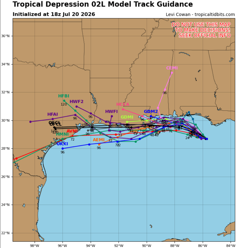
Numerous thunderstorms continue across the eastern Gulf of America and bordering states. The depression is expected to gradually strengthen into a tropical storm tonight as it tracks toward southeastern Louisiana, where it is forecasted to move inland near the Mississippi River Delta area around 1 am Thursday. This storm is anticipated to weaken into a tropical depression early Friday morning near the LA/TX border.
Coastal residents should be prepared for the possibility of storm surge flooding, especially in normally dry, low-lying areas near the coast. Swells from the system are already impacting portions of Florida’s Gulf Coast and will spread westward through the week, creating dangerous surf and life-threatening rip currents along Gulf beaches.
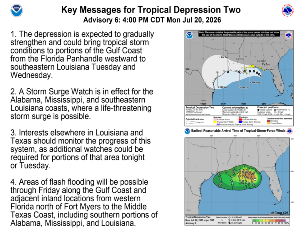
*Please check back with the NHC update at 8pm EST/7pm CT for the newest updates.*
Tonight
Now that all the tropical forecasting is covered, let’s get to the impacts we will feel tonight. Isolated thunderstorms are moving south across southern Louisiana, while we have a wider band of storms impacting northern/central Mississippi. Alabama will be feeling the brute of this storm here soon as the outer bands travel westward off of this storm.
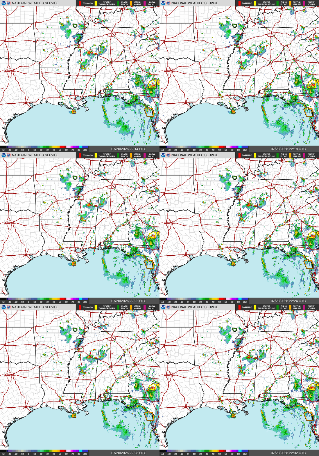
Let me tell you, Tallahassee has definitely been feeling it today with fast-moving storms dumping lots of rain in short amounts of time throughout the day. These storms are to be expected across our MS/AL/LA area until later Friday, once this system travels west, dissolves into a tropical depression, and heads out into Texas.
Tomorrow
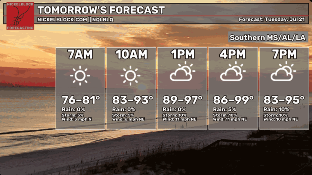
Starting off our Tuesday, rounds of scattered storms will impact our Southern MS/AL/LA region with some stronger winds as this storm moves further NW.
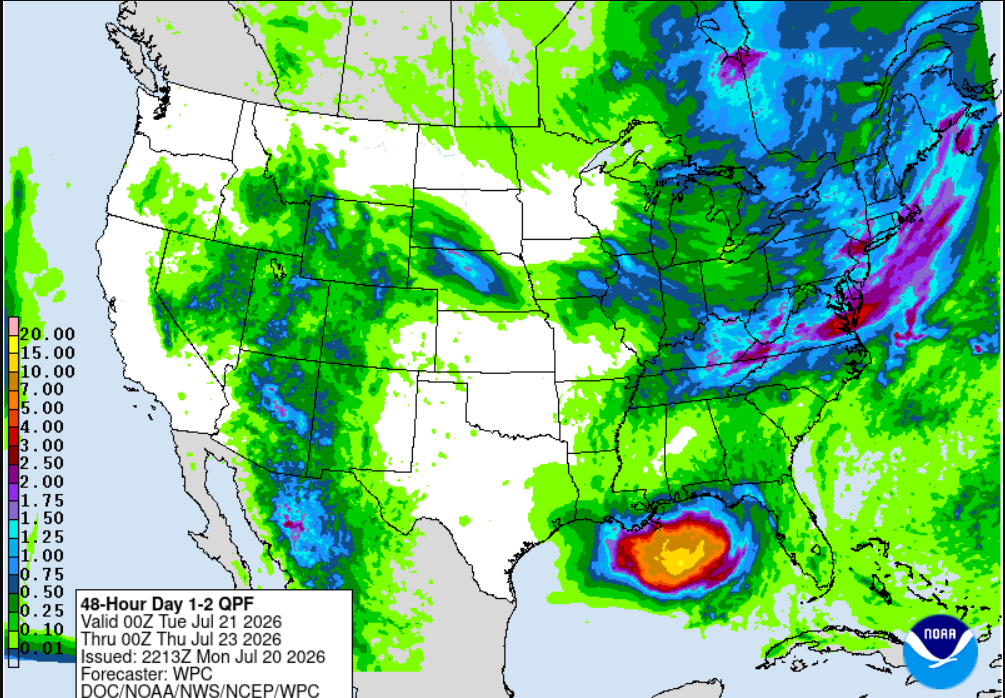
Lucky for us, this storm will be staying just offshore, sparing us from those higher numbers we are seeing on the above QPF. There are areas of the Mississippi River Delta where up to 5 inches of rainfall are expected over the next few days, so be prepared, especially in the wetland areas.
With that being said, this storm can always shift, and even a slight change in the track can quickly threaten your neighborhood. I’d advise getting your hurricane preparedness supplies ready and treating this as a severe storm, even if you are not in the directly impacted area, to ensure you are prepared for any stronger systems that may move our way later this season.
Unfortunately for us, we have another hot few days ahead despite the active tropics in the Gulf. Temperatures will reach highs in the upper 90’s with lows dipping into the mid 70’s tomorrow, as this storm brings little relief temperature wise to the region.

Wednesday
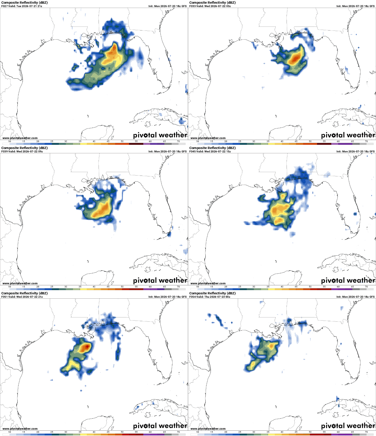
On Wednesday, this storm will still be out just off the Southern MS/AL coast and eyeing down the Delta region. Storms shouldn’t be ruled out for Wednesday as this storm will continue to strengthen up until landfall.
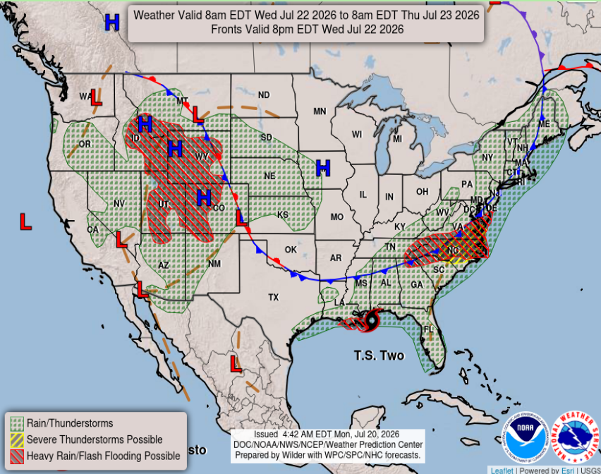
One thing that we do notice with this storm is how lopsided it is. That is a good lopsidedness since it’s got most of the heavy precipitation hanging off the southern side of the storm. This is mostly because of a large ridge of high pressure over the central Rockies and southern Plains. This will inhibit development on the northern side of the low, where dry, compressed air creates a more stable environment where it is harder for convection to occur.

Extended Forecast
Looking ahead to landfall of this storm and beyond, storm surge (if you are on the coast), flooding due to heavy precipitation, as well as damage from winds associated with this storm are the biggest threats to our area. If you live on the sole of the boot, impacts there will be the greatest as the storm will push in up to 4 feet of storm surge along the coast, with damaging winds and heavy rainfall too. The majority of these impacts will be felt on Thursday, however, because this is a very disorganized storm, significant impacts are also expected across the area on Wednesday and Friday.
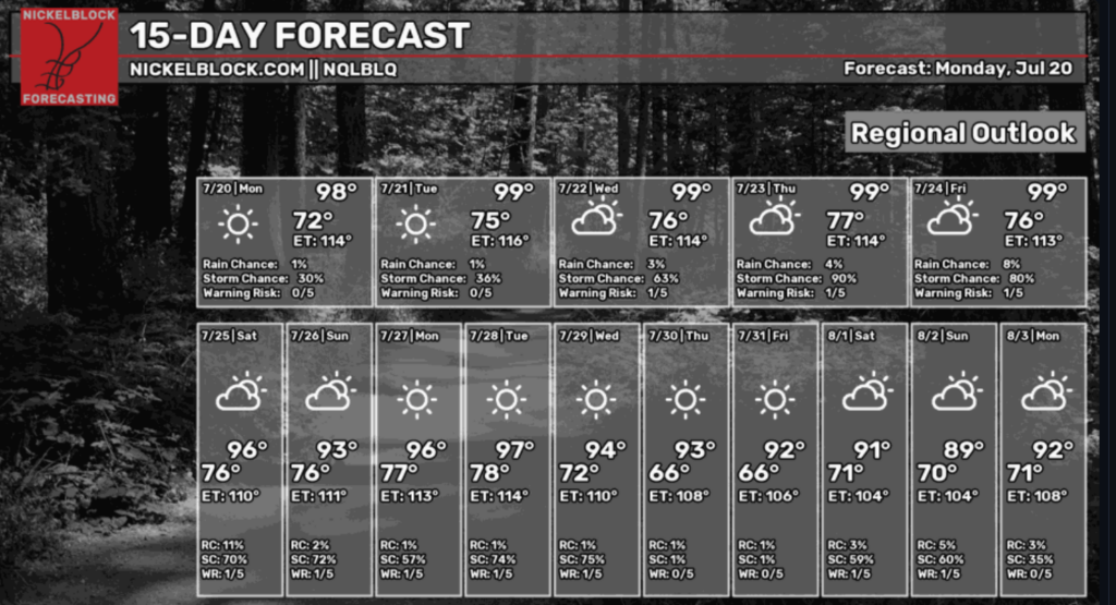
Our NickelBlock 15-day regional outlook shows high temperatures as our current heat dome competes with Tropical Depression 2 (soon to be Bertha). Nearing next weekend, we see a dip in our high temperatures and a slight increase in storm chances, meaning something could be brewing for our first week of August.
The below 8-14 day outlooks from the Climate Prediction Center show slightly above average temperatures, and near-normal precipitation probability for our area. Whatever that is.
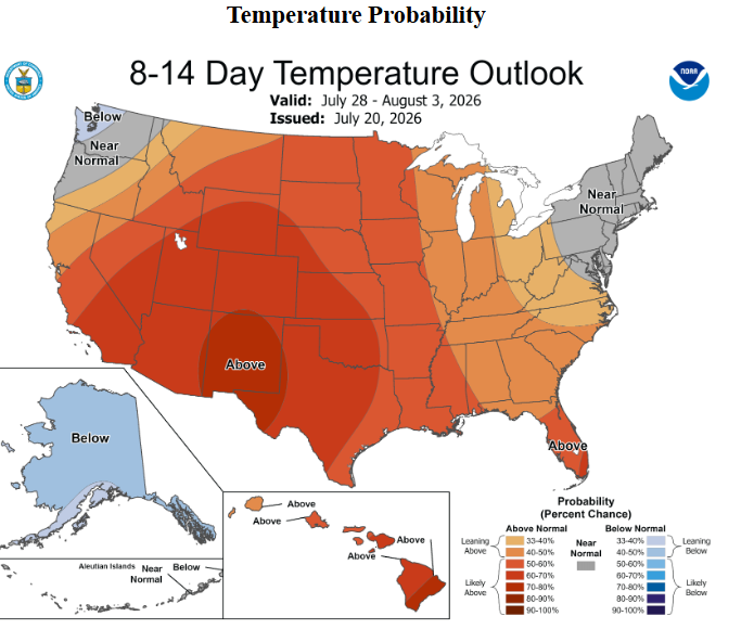
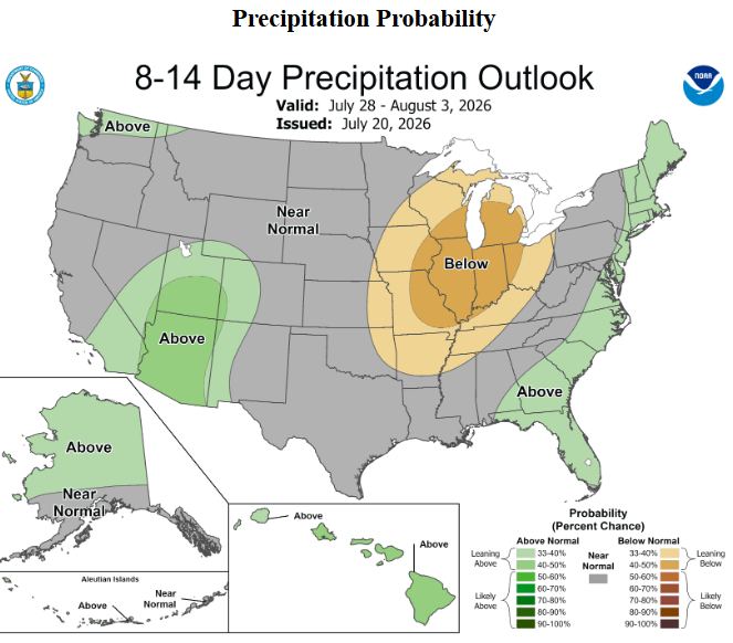
The main risks for the upcoming weeks would be high temperatures and anything potentially building in the tropics. But for now, we will focus on our soon-to-be Bertha and it’s impacts to the Southern LA/MS/AL coast. Have a great week!


Kayden, you write such informative forecasts. Great job.