Current Conditions
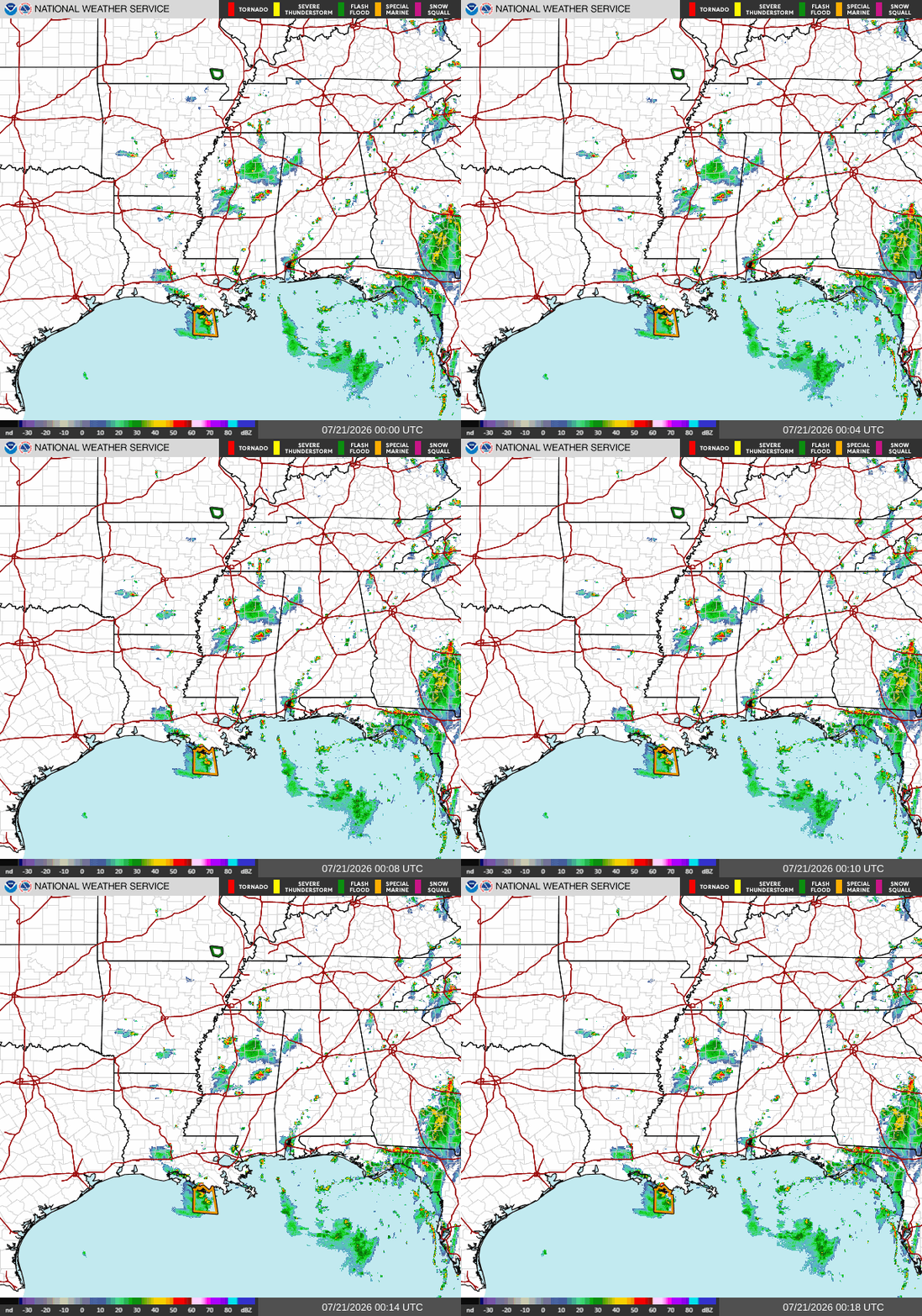
Scattered showers and possible thunderstorms moving in from the northeast into southern AL. Isolated showers and thunderstorms near the MS/ LA border, moving southwest. Active Special Marine Warning off the coast of Terrebonne County, LA.
Tonight
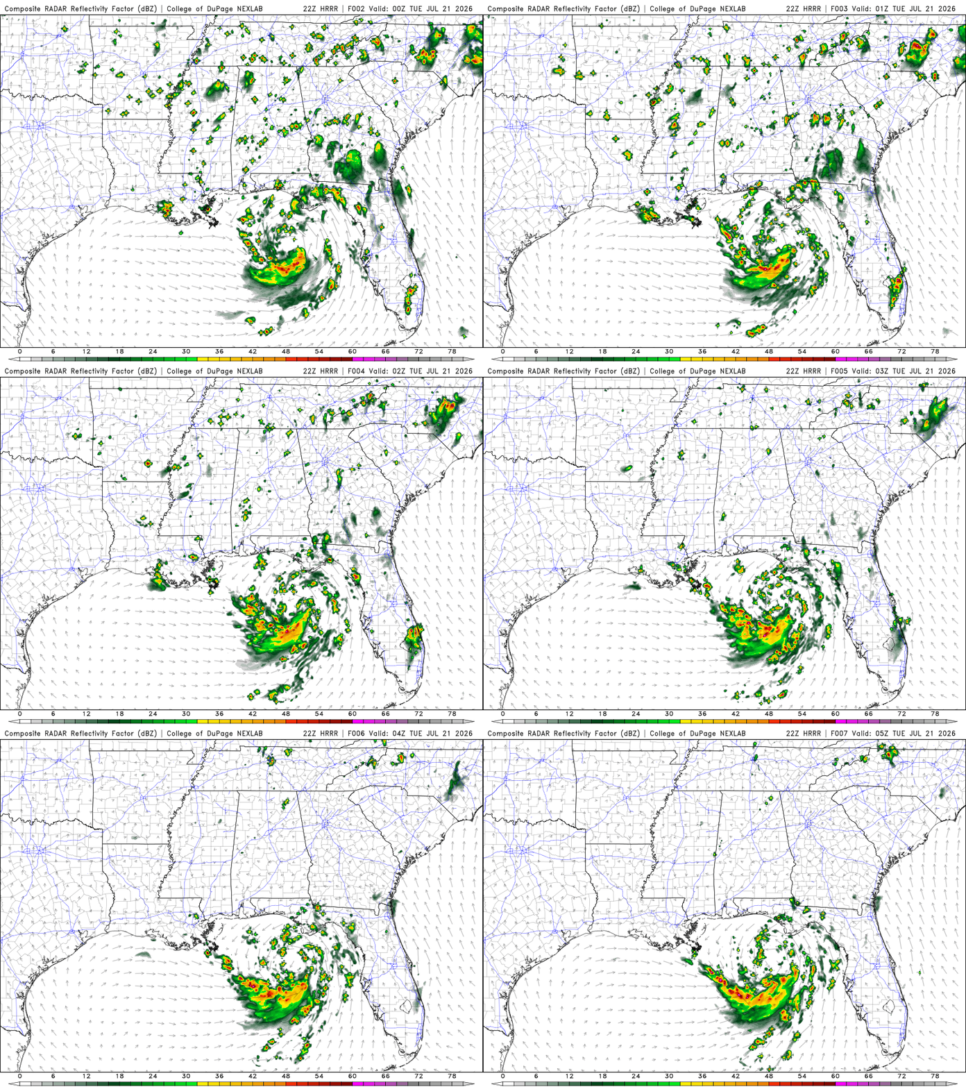
The forecast is fairly similar to yesterday, with scattered showers and thunderstorms moving in from the northeast. Now, showers and thunderstorms will be impacting mostly southern LA, with possible isolated storms in southern MS and AL around the late evening and nighttime hours. Should start to clear up just before the early morning hours.
Tomorrow
Could experience isolated showers very early in the morning off the southern LA coast. Showers and thunderstorms possible in southern LA around the early afternoon.
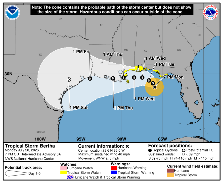
The now Tropical Storm Bertha will be just off our coast. Still, the biggest concerns are life-threatening rip currents, high surf, rough seas, local heavy rainfall, and tropical storm-force winds, especially near the coast.
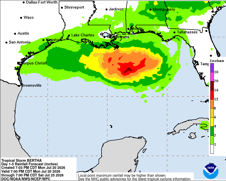
We could see around 2 to 4 inches in our area over the next few days. Maybe more in localized areas. Impacts will be seen as early as Tuesday during the afternoon or evening.