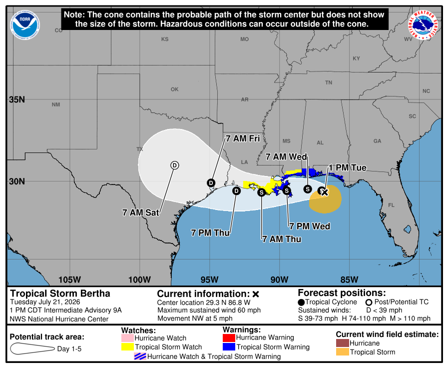
According to the latest 1 PM update from the National Hurricane Center, Tropical Storm Bertha is beginning to turn west and will track near the northern Gulf Coast over the next few days. Southern Louisiana, Mississippi, and coastal Alabama can expect rounds of heavy rain, gusty winds, rough surf, and some coastal flooding through Wednesday and Thursday. Most areas could see 2 to 4 inches of rain, with a few spots closer to 6 inches, so localized flash flooding will be possible. Current forecast is showing a weakening to a tropical despression by late Thursday, with further weakening as it moves into Texas this weekend.
Today’s Severe Weather
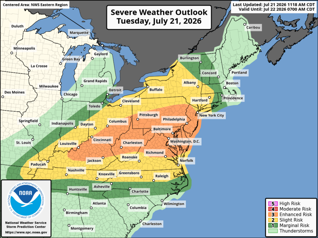
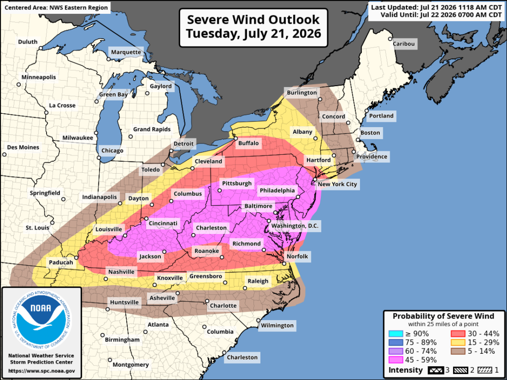
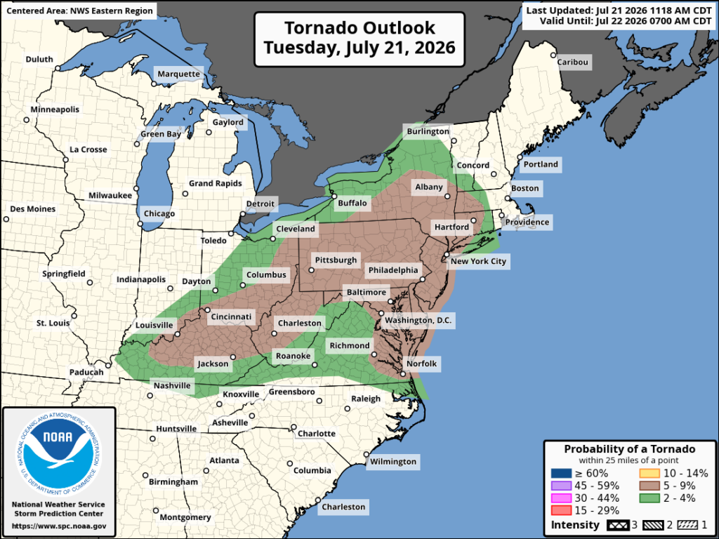
The latest SPC outlook has an Enhanced Risk from the Ohio Valley into parts of the Mid-Atlantic, with numerous strong to severe storms expected through this evening. There will be plenty of instability in place, especially where temperatures can climb into the upper 80s and low 90s, along with strong mid-level winds and enough shear to support organized storms and a few supercells.
Damaging winds will be the main threat, with gusts of 55 to 70 mph possible as storms quickly grow into lines. A few brief tornadoes are also possible, mainly near the warm front from the Hudson Valley into western New England, with large hail being more of a secondary threat. One thing to watch will be how long cloud cover sticks around, since that could limit CAPE and keep the overall wind threat a little lower in some areas. There’s been already a few severe thunderstorm and tornado warnings out in eastern PA and northern NJ, so defiently stay weather aware as this threat is already occuring in some areas.
Tomorrow’s Overall Setup
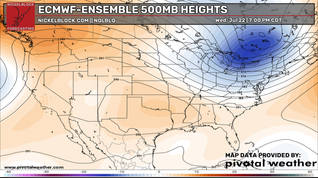
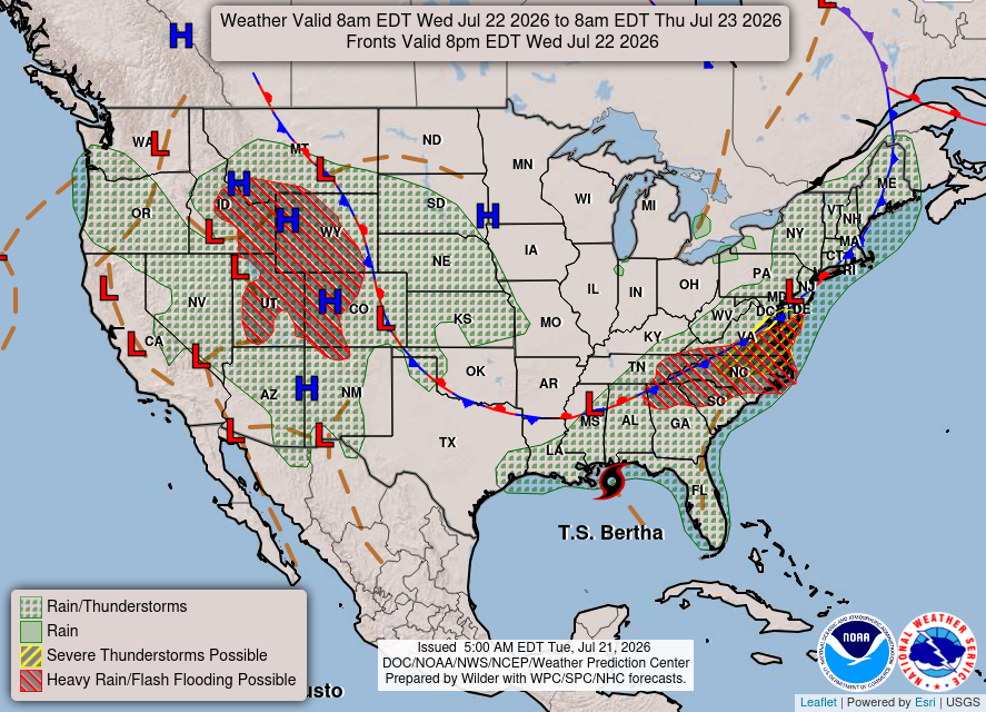
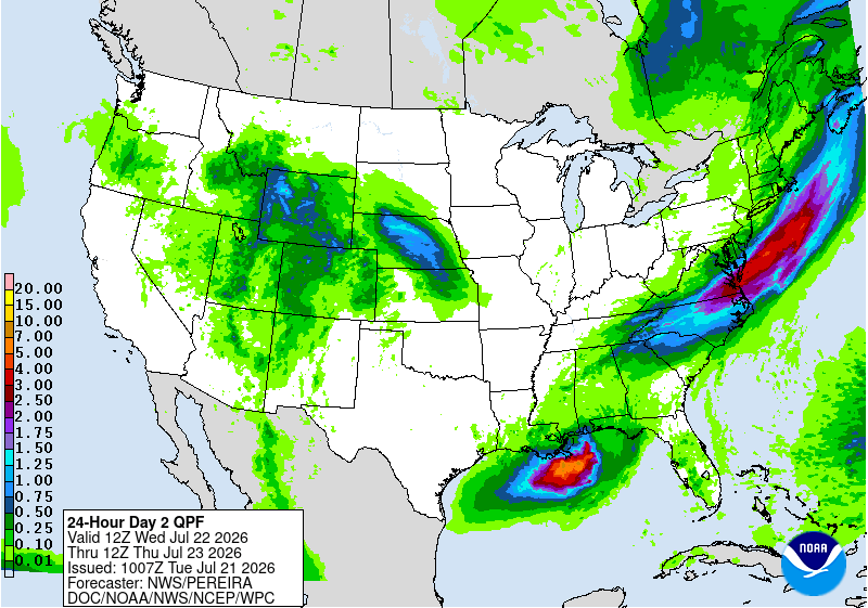
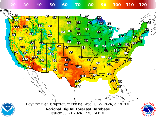
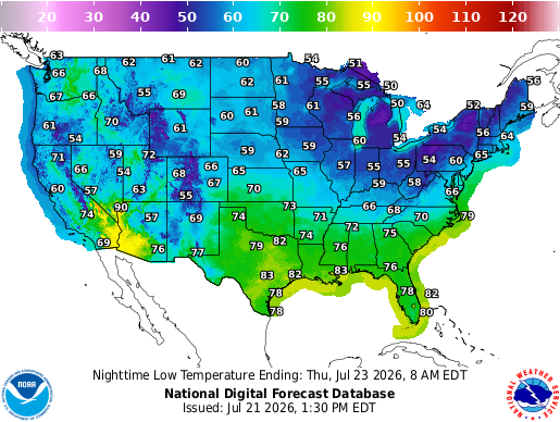
A large trough will remain in place across the Great Lakes and Northeast on Wednesday, while ridging keeps much of the western and southern U.S. hot. A cold front will continue moving through the East, bringing another round of showers and thunderstorms from the Appalachians into the Mid-Atlantic and Northeast. Some of these storms could turn strong, especially where enough daytime heating can build ahead of the front.
Tropical Storm Bertha will also continue moving west along the Gulf Coast, bringing heavy rain, gusty winds, and coastal flooding concerns. The heaviest rain will be near the storm and along parts of the East Coast, while much of the central U.S. stays drier. Highs will reach the 90s and low 100s across much of the South and West, with cooler 70s and 80s across the Great Lakes and Northeast.
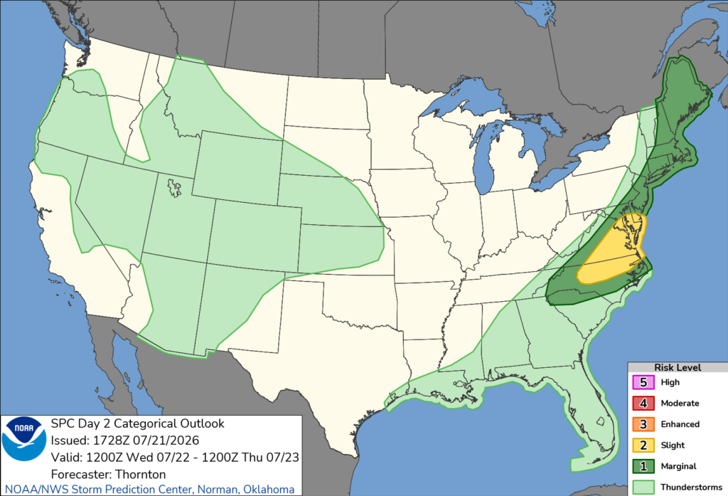
The latest SPC outlook has a Slight Risk across parts of the southern Mid-Atlantic for Wednesday, with damaging winds being the main threat. Morning clouds may stick around from the Mid-Atlantic into New England, which could limit heating and keep instability lower farther north. The best chance for stronger storms looks to be from the Carolinas into southern Delaware, where more breaks in the clouds should allow moderate CAPE to build.
Strong mid-level winds will also provide plenty of deep-layer shear, so a few organized storms or clusters could develop during the afternoon. Damaging wind gusts will be the biggest concern, although a brief tornado cannot be ruled out. Farther north into New England, the shear will still be there, but weaker instability should keep the severe threat more isolated.
Thursday’s Weather
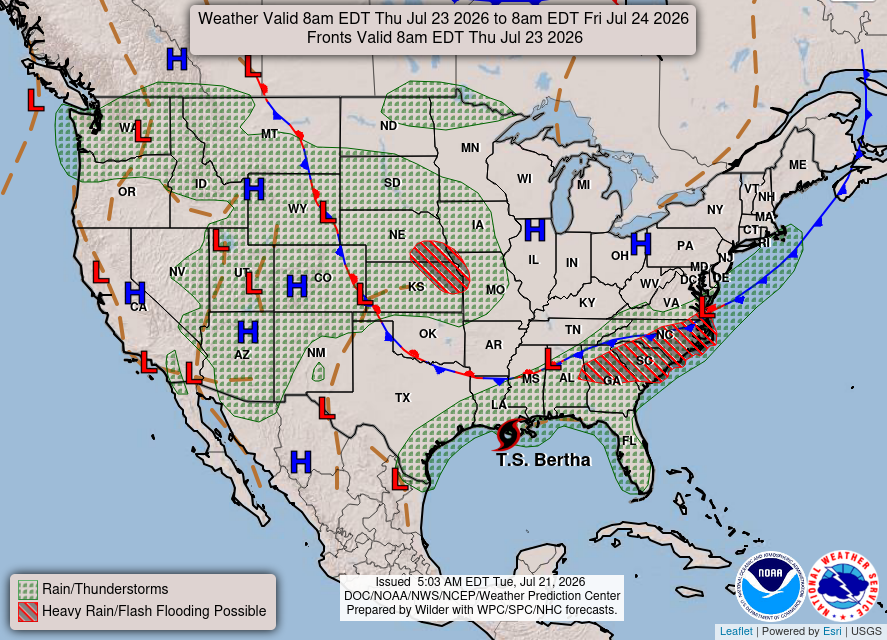
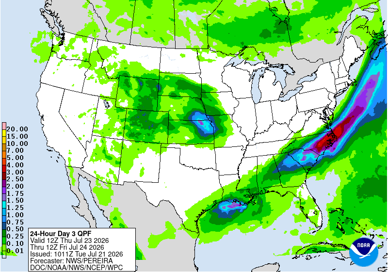
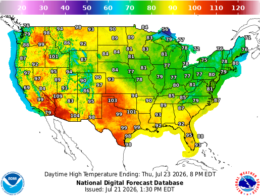
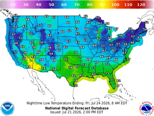
On Thursday, the main storm track will shift into the Plains and along the East Coast. Showers and thunderstorms are expected from the central Plains into the Midwest, while another round of heavier rain could move through parts of the Southeast and Mid-Atlantic. Tropical Storm Bertha will also continue bringing rain and gusty winds near the Gulf Coast.
The hottest weather will stay across the Southwest and southern Plains, where highs will reach the upper 90s and low 100s. Much of the Midwest and Northeast will be more comfortable, with highs mainly in the 70s and 80s.
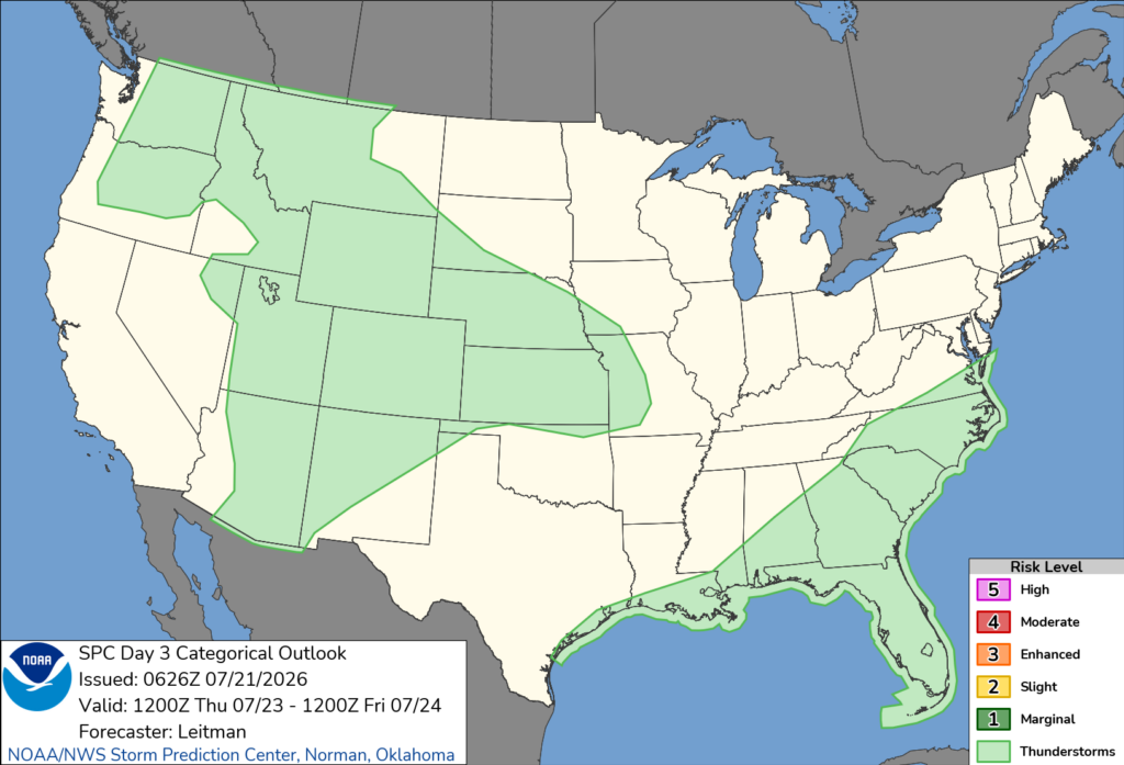
No severe storms are currently forecasted for anywhere in the U.S on Thursday.
CONUS Weekly Temperature & Precipitation Outlook
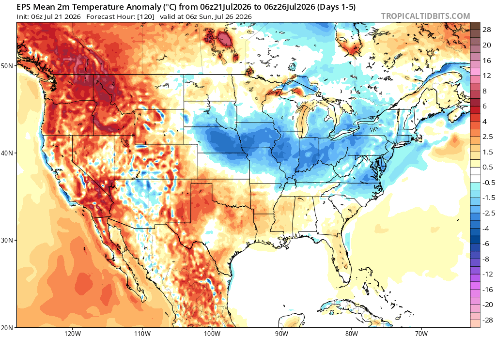
Here’s a look at the EPS modeled temperature anomalies through Sunday. Red indicates above-average temperatures on average for the week, white indicates average temperatures, and blue indicates below-average temperatures.
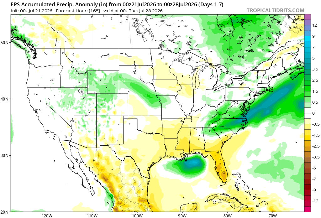
Here’s a look at the EPS modeled precipitation anomalies through next Tuesday. Green indicates above-average precipitation, white indicates average precipitation, and yellow indicates below-average precipitation. Let’s look into the details by region:
Weekly Outlook: Western & Central United States
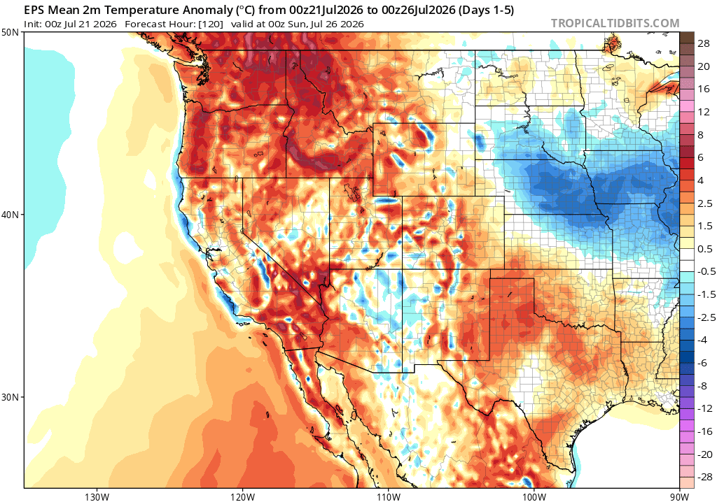
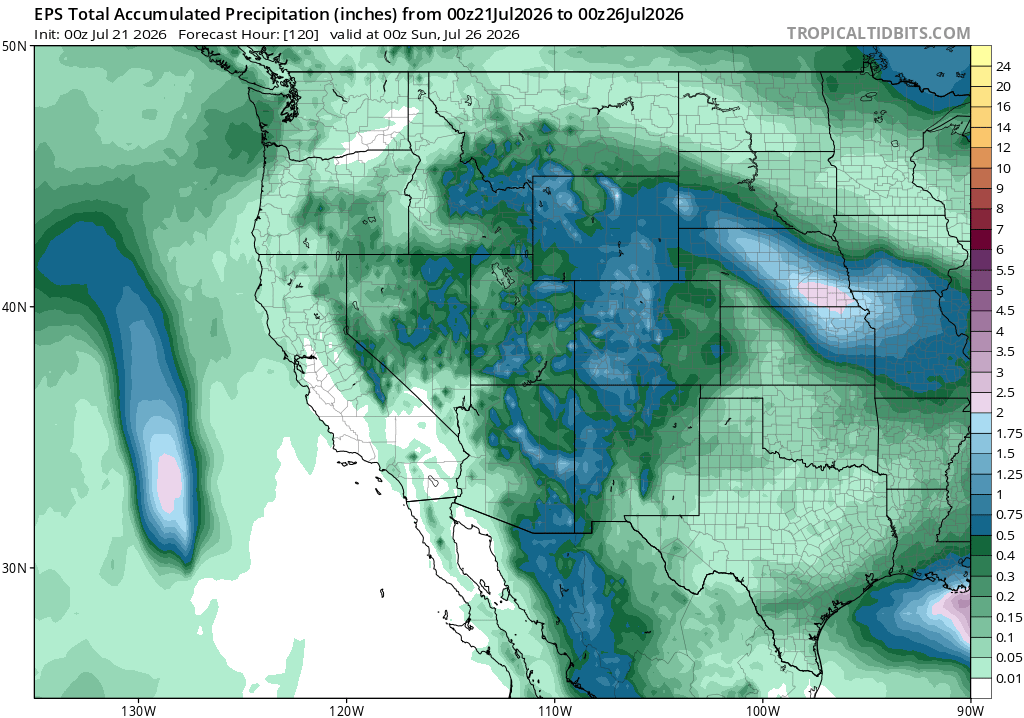
The West will stay much warmer than normal through the rest of the week, especially across the Pacific Northwest, northern Rockies, and parts of California. Meanwhile, cooler-than-normal temperatures will settle into the central Plains and Midwest, with the biggest temperature drop centered around Nebraska, Kansas, and nearby areas.
Rain chances will be highest from the Rockies into the central and northern Plains, where several rounds of showers and thunderstorms are possible through Sunday. Some locally heavy rainfall may occur, while much of California, the Southwest deserts, and west Texas stay mostly dry.
Weekly Outlook: Eastern United States
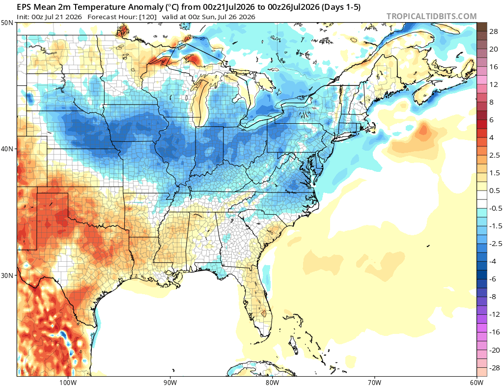
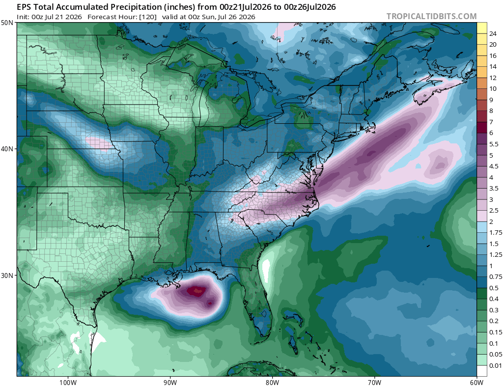
Much of the eastern U.S. will run cooler than normal through Sunday, especially from the Midwest and Ohio Valley into the Northeast. Temperatures should stay closer to normal across the Southeast, with a little more warmth possible near the Gulf Coast.
Several rounds of rain and thunderstorms are expected across the region. The heaviest rain looks to set up near the Gulf Coast with Bertha, along with another wetter corridor from the Carolinas into the Mid-Atlantic and offshore. Most areas should pick up at least some rain, but totals will vary depending on where storms repeatedly move over the same locations.
Extended Outlook
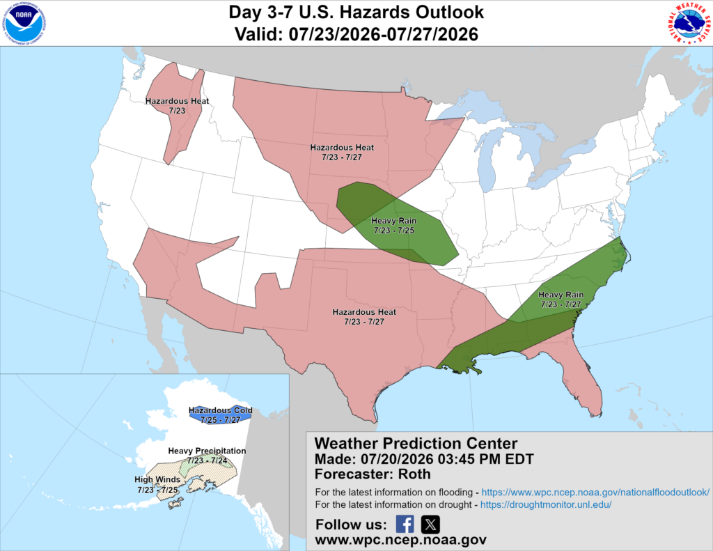
Above is a look at the U.S. Hazards Outlook from NOAA, highlighting areas of more impactful weather to be aware of over the next 3 to 7 days.
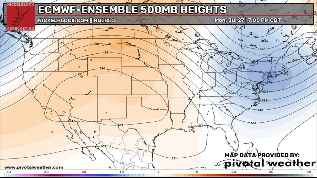
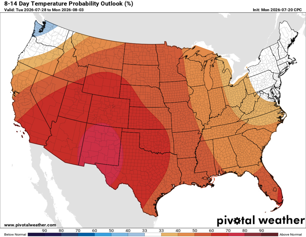
By early next week, the overall pattern still shows a strong ridge covering much of the West and central U.S., while troughing hangs on across the Northeast. That should keep the hottest weather focused from the Southwest into the Plains, with above-normal temperatures likely across most of the country. The Northeast may stay a little closer to normal underneath the trough.
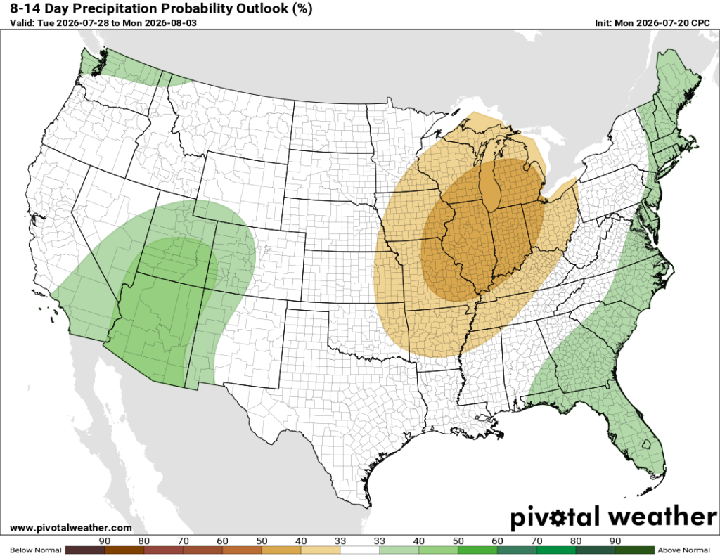
Looking farther out into the 8-to-14-day period, the heat looks like it will remain pretty widespread, especially across the Southwest, Rockies, and Plains. Drier-than-normal conditions are favored around the Great Lakes and Ohio Valley, while the Southwest and much of the East Coast have a better chance of seeing above-normal rainfall.
Thanks for tuning in to this National Forecast! Tune in to our local, tropical, and regional forecasts to stay up to date on the latest!


