Last night, Tropical Depression #2 strengthened into Tropical Storm Bertha after its maximum sustained winds reached 39 mph. Follow along to see what else has changed with the storm and what to expect next.
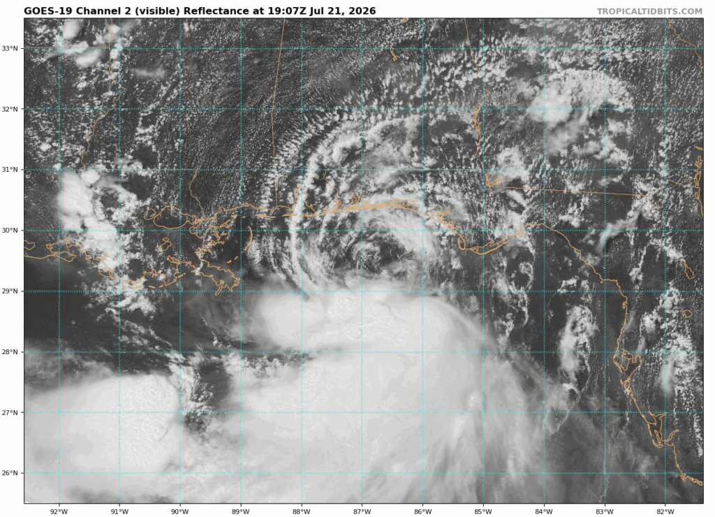
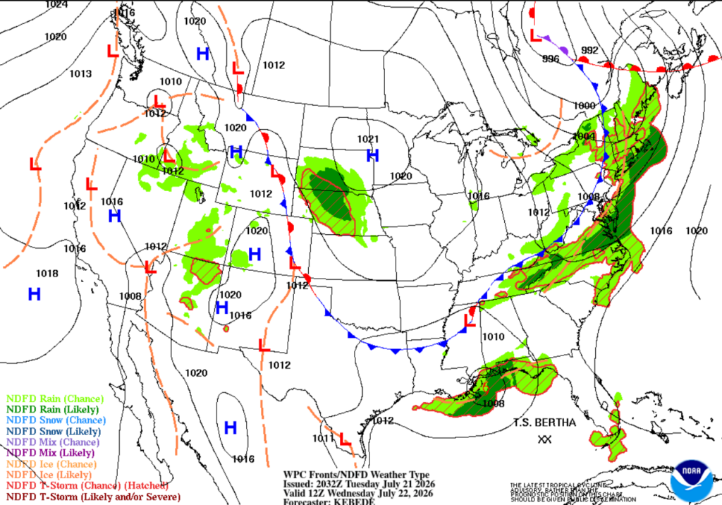
Currently, Bertha is located 60 miles south/southwest of Panama City Beach, Florida. Bertha is moving slowly northwest at 3.5 mph with maximum sustained winds of 58 mph and gusts up to 69 mph. The storm is currently sheared, with most of its thunderstorms displaced further south from the center.
Bertha is expected to move westward and continue trekking slowly across the northern Gulf of Mexico through midweek. The storm will gradually weaken, becoming a tropical depression Thursday evening before moving further inland near the Louisiana-Texas border Friday morning.
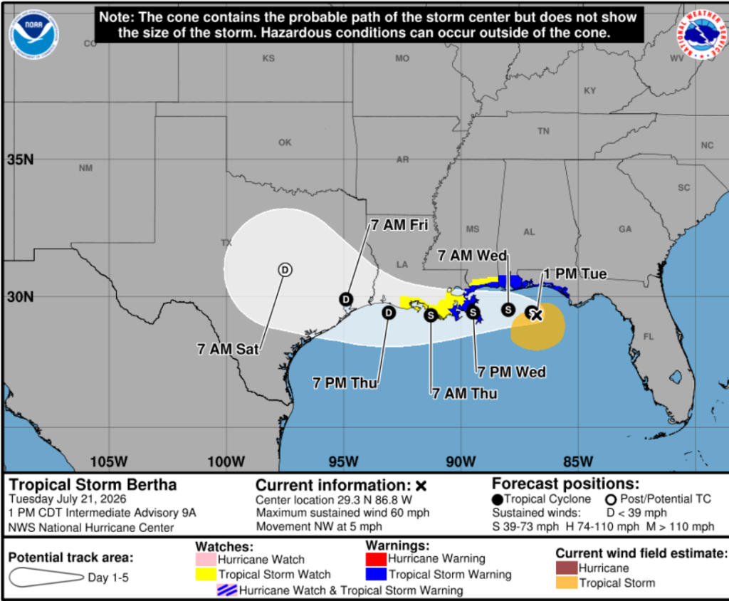
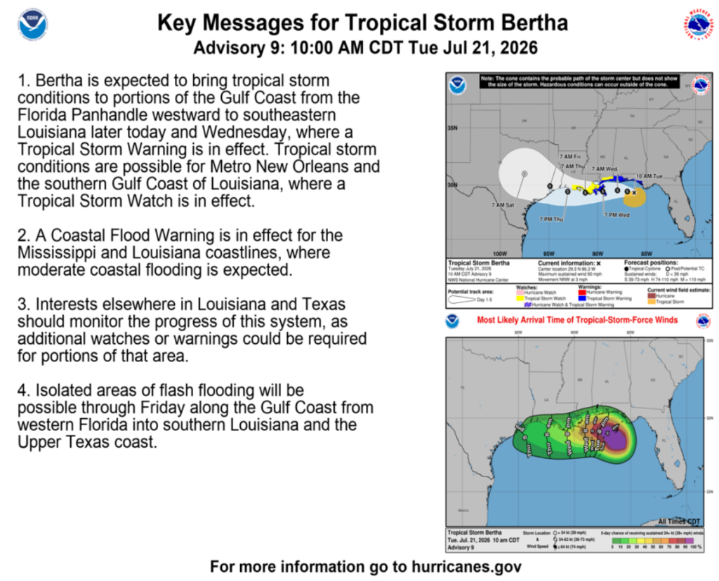
Bertha is expected to bring 2–4 inches of rain, with isolated totals up to 6 inches, from western Florida to southern Louisiana, including parts of Alabama and Mississippi. Heavy rain could cause isolated flash flooding, especially in urban areas. Swells from Bertha will also spread westward along the Gulf Coast, creating dangerous surf and rip current conditions. If you live on or near the coast, watch out for storm surge, which is expected to reach 1-3 ft from the Florida Big Bend region through southeastern Louisiana.
Besides this storm, we have another, almost opposite issue. That’s right, with temperature indices soaring over 100 degrees in some areas, we’re dealing with another heat dome! Just take a look below at our Pivotal Weather 2m AGL temperature indices over the next few days.
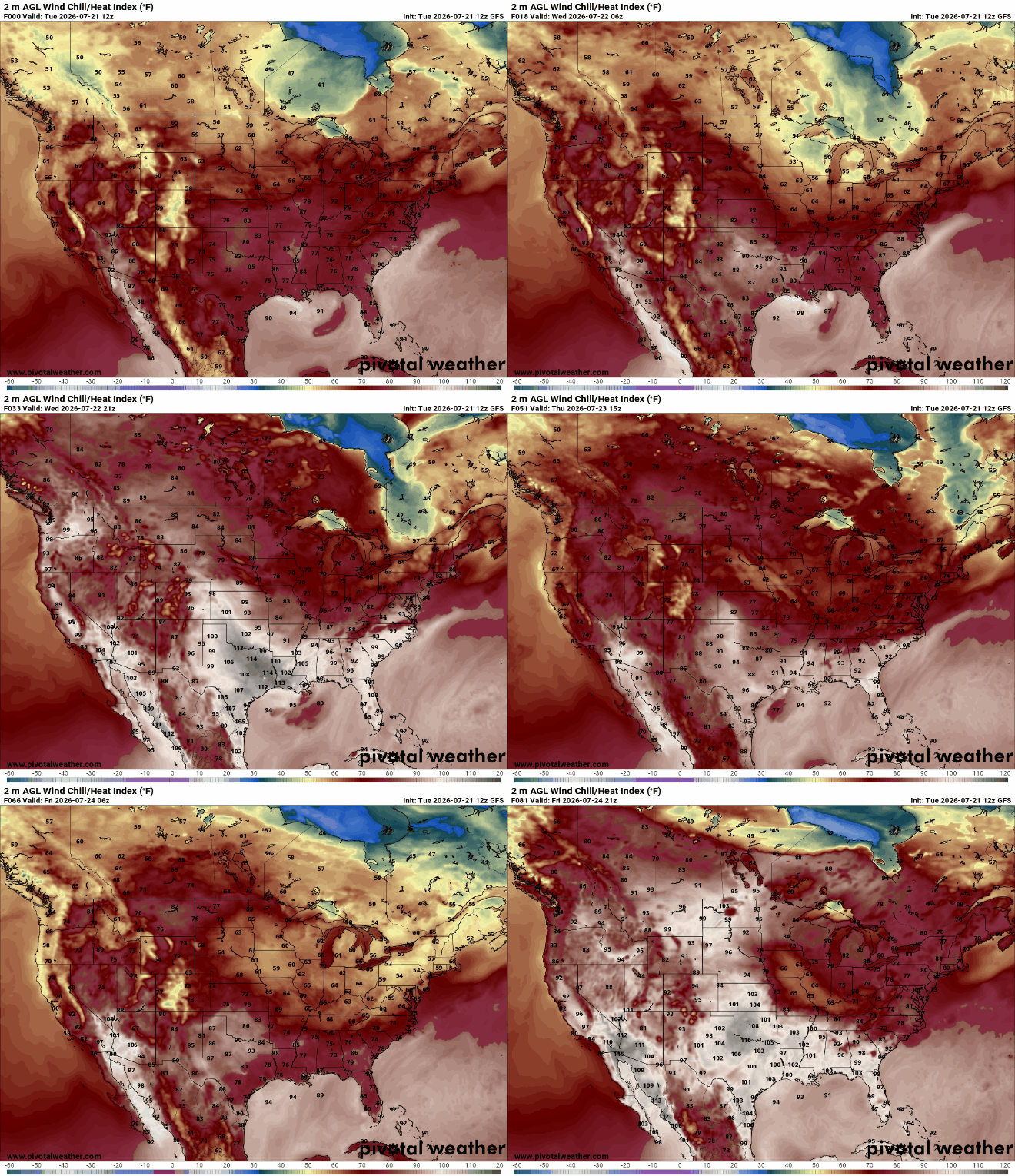
This intense heat is a direct result of ridging/high pressure over the Great Plains and the Midwest. This will keep the Gulf Coast hot and humid this week, with temperatures in the upper 90s and even higher heat indices. This pattern will also influence Tropical Storm Bertha’s track. While warm Gulf waters provide fuel for the storm, land interaction, increasing wind shear, and this ridging could limit the overall strengthening of this storm.
Furthermore, make sure you are staying up to date with Tropical Storm Bertha, as this event will be impactful for our region. Besides that, keep yourself cool and have a great rest of your week!


