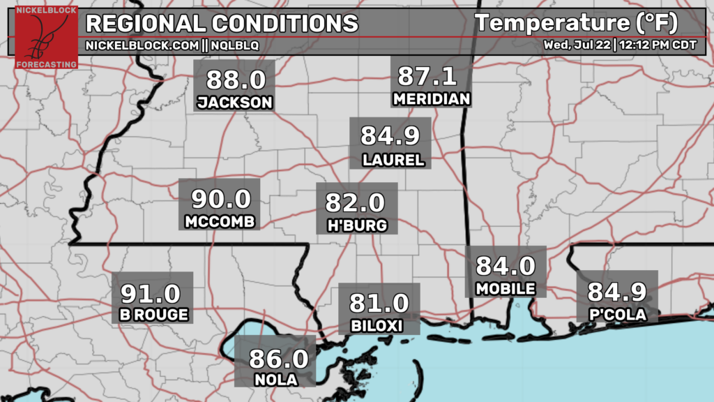
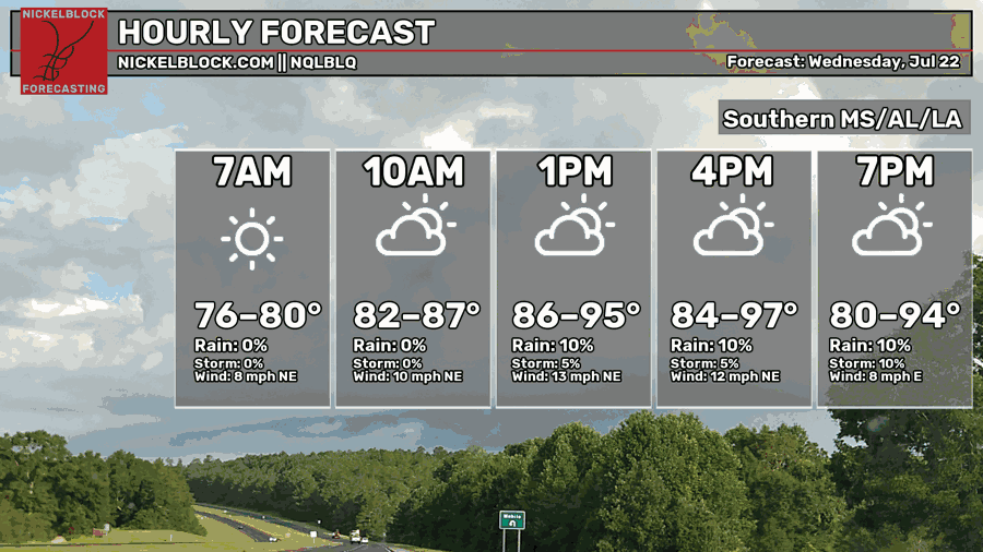
Good afternoon! As of noon CDT, the temperatures are rising, with a few spots already hitting 90ºF. These temperatures will continue to rise until about 4 this afternoon, when highs should reach the mid-upper 90s for most spots. As always, make sure to hydrate yourself adequately, avoid difficult physical labor outdoors for extended periods of time, and wear cool clothing.
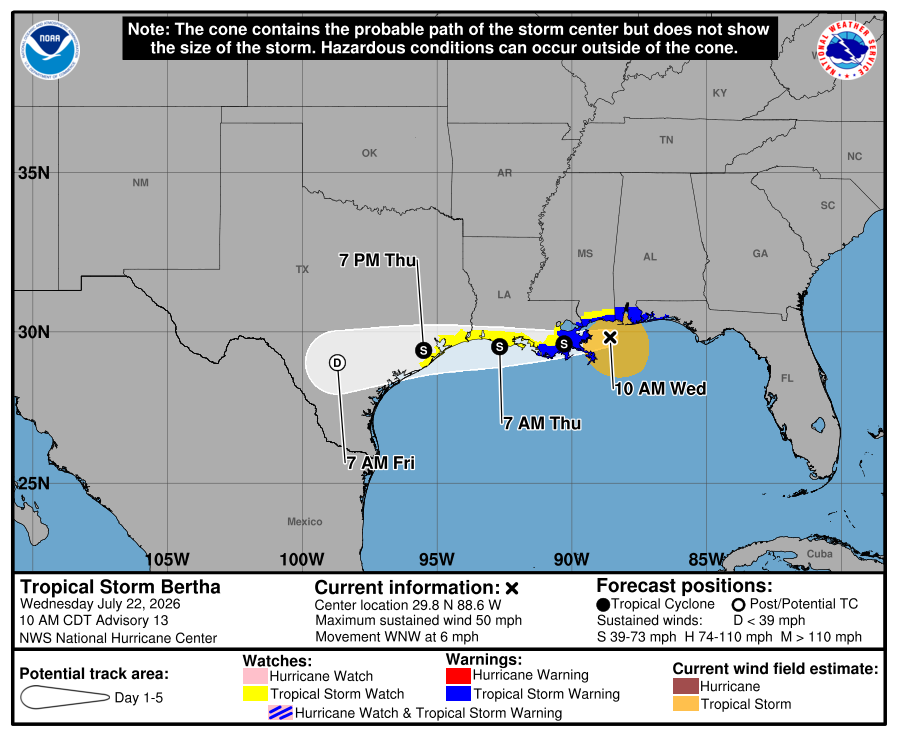
Overnight, tropical storm Bertha has slowly made its way west, and is likely to make landfall in extreme southeastern Louisiana this afternoon. However, Bertha has weakened considerably overnight. Currently, she has sustained winds of 45 mph, but last night she had sustained winds of 60 mph.
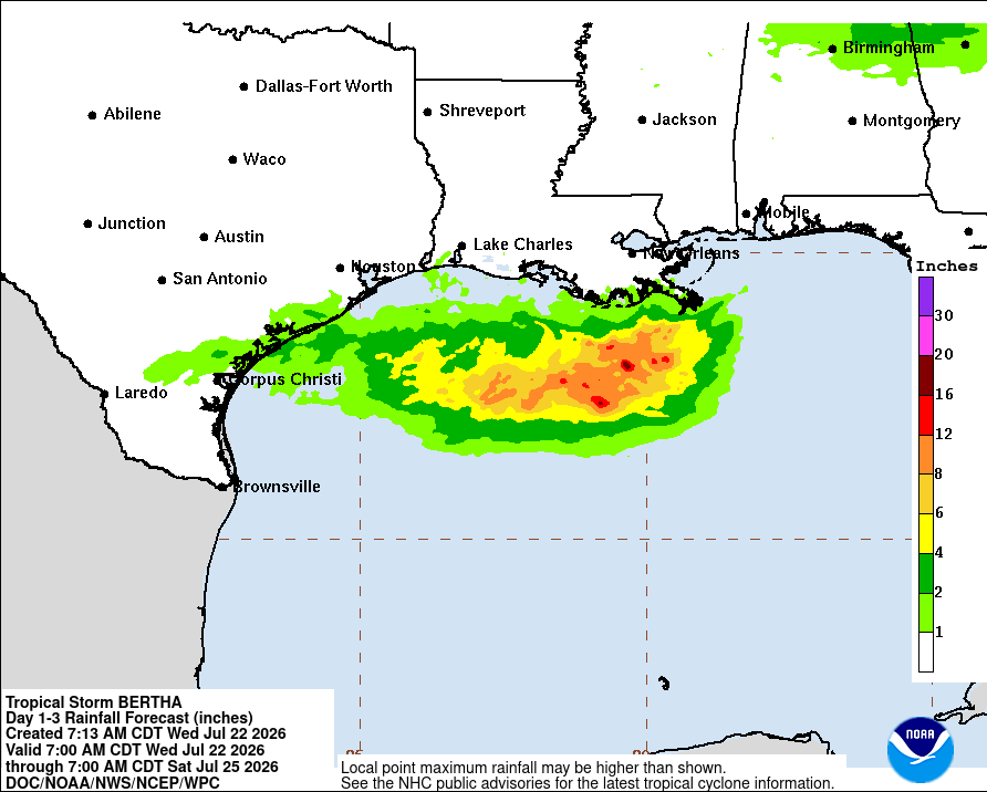
The rainfall forecast has decreased since yesterday as Bertha is forecasted to track slightly further south than previously thought. The only areas forecasted to even come close to getting an inch of rain is extreme southeastern Louisiana, near Venice, LA.
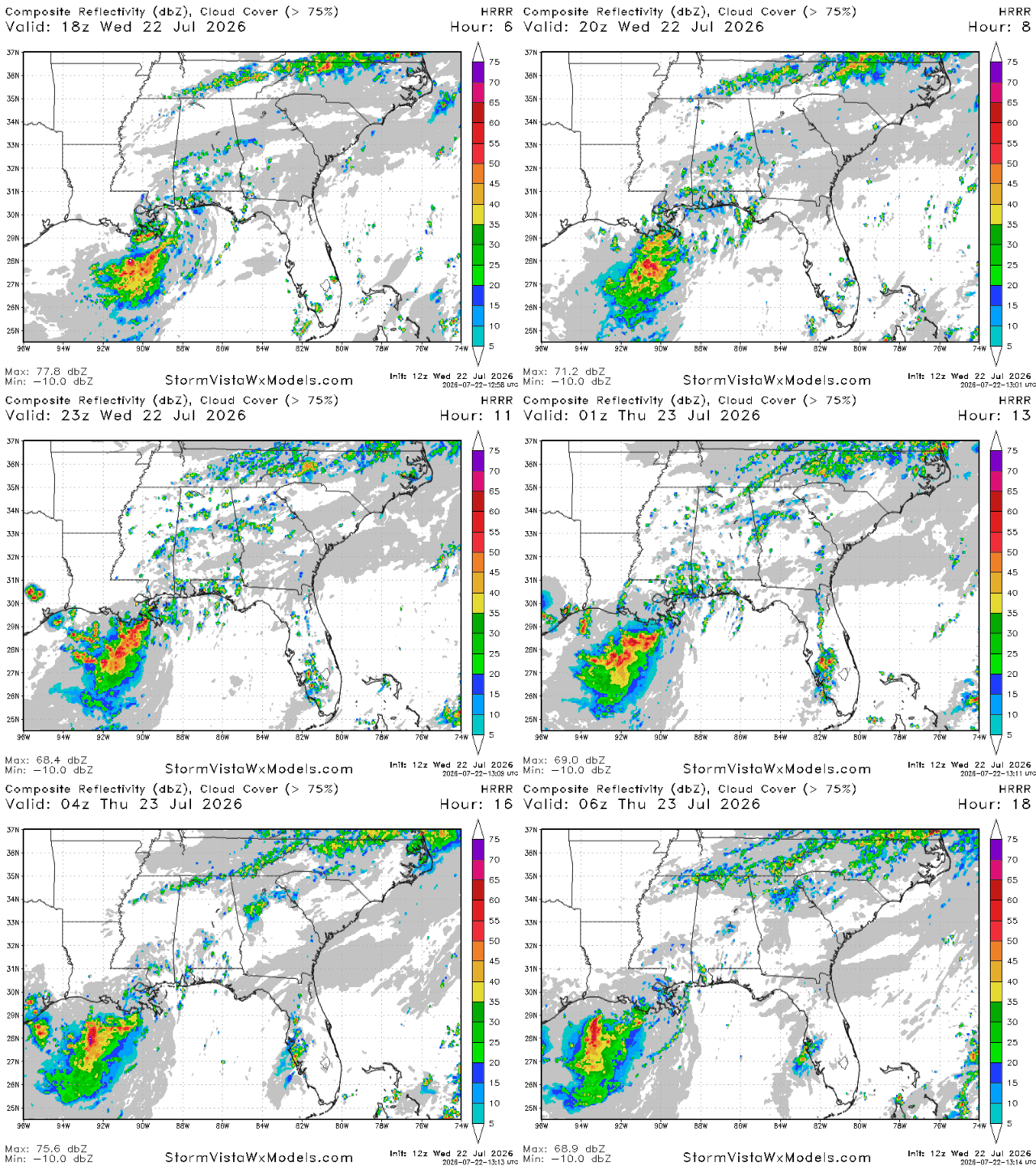
The outer bands of Bertha may also produce a few scattered and weak showers and storms tonight, mostly in areas by the water in MS, AL and the FL panhandle. These storms will be north moving and should be mostly gone by midnight.
Tomorrow
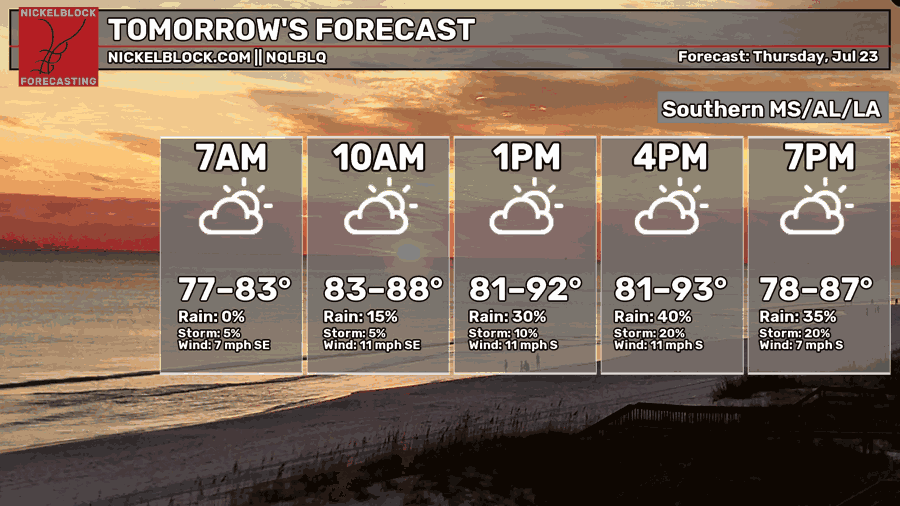
Afternoon high temperatures will cool down slightly tomorrow, with most spots likely to see highs in the lower 90s. Morning lows will be pretty sultry tomorrow, only bottoming out in the upper 70s, a reflection of the southerly winds that will bring us dew points in the mid-upper 70s tomorrow morning.
Tropical storm Bertha is expected to reach the the southwest coast of Louisiana by tomorrow morning, then the Houston area/southeast Texas by tomorrow night. In both of these places, a tropical storm watch is in effect.
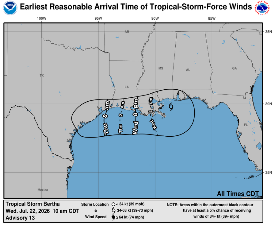
In southwest Louisiana, tropical storm force winds are expected to arrive over night, while in southeastern Texas, tropical storm force winds are expected to arrive tomorrow morning. Rain won’t be too much of an issue, but wind may be. Therefore, have your cell phones charged and have a few flashlights ready just in case you lose power.
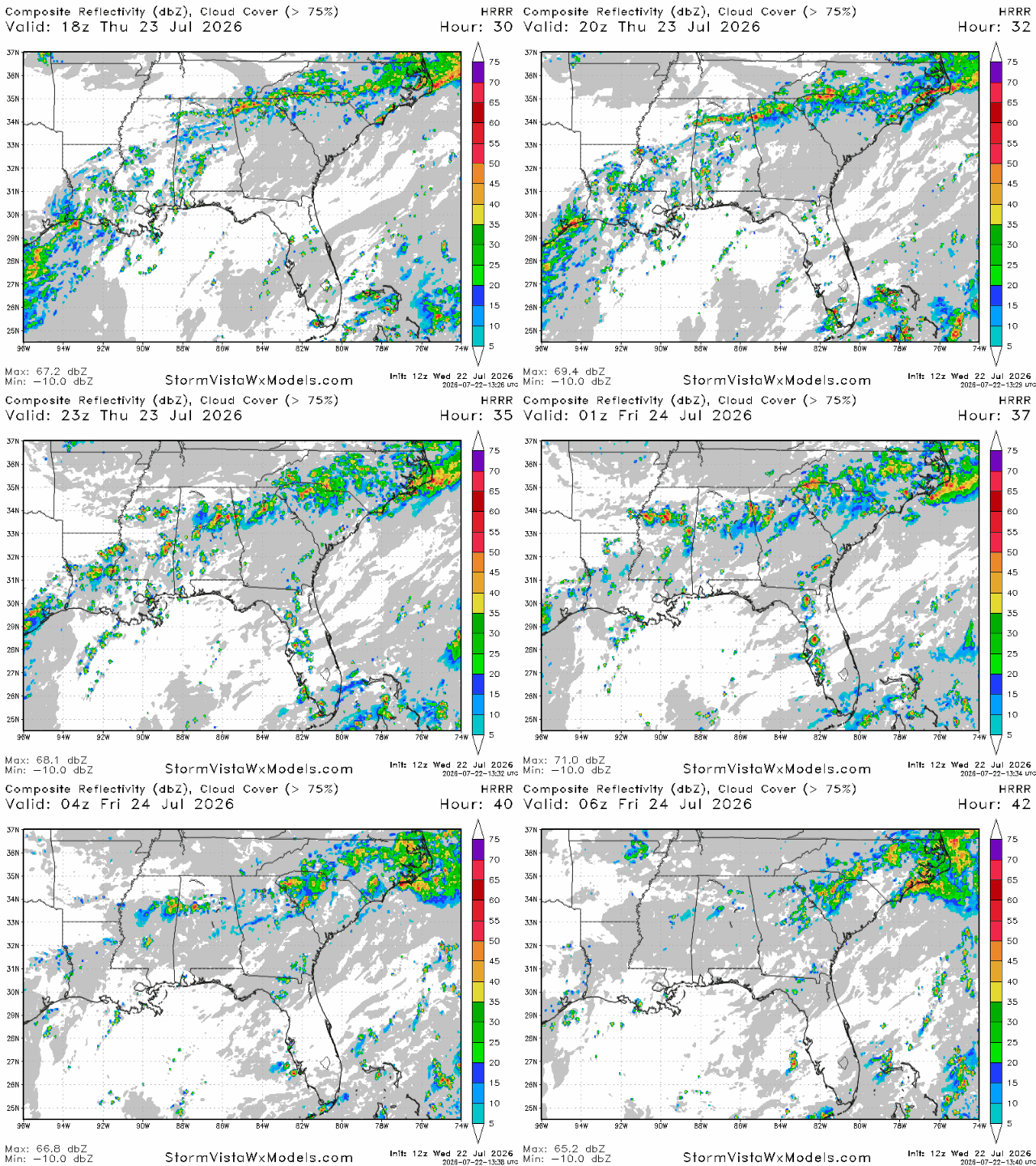
For the rest of our region, storms flare up tomorrow in the early afternoon, particularly between Jackson and Huntsville, AL. These storms will be guided south by the ridge and should be mostly fizzled out by 11 tomorrow night. Rainfall totals won’t exceed a quarter of an inch for most people, but some areas hit directly by thunderstorms may see more than that.


