And triple the ice cream. In the upcoming week, our region will be caught between a strong ridge over the central U.S. and a trough over the eastern U.S. The strong high pressure aloft (shown below on the left) will lead to a stretch of hot weather with little rain, except for parts of northern Alabama and Georgia.
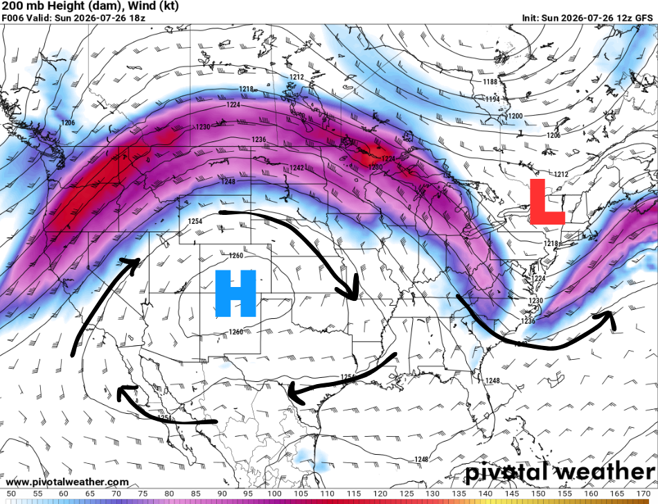
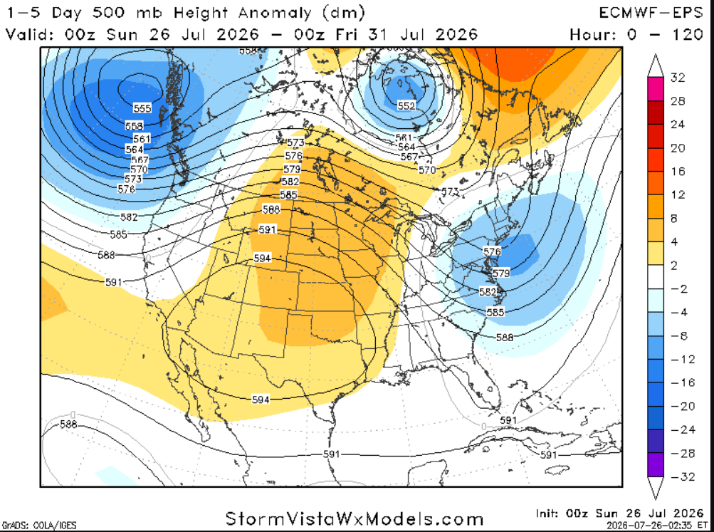
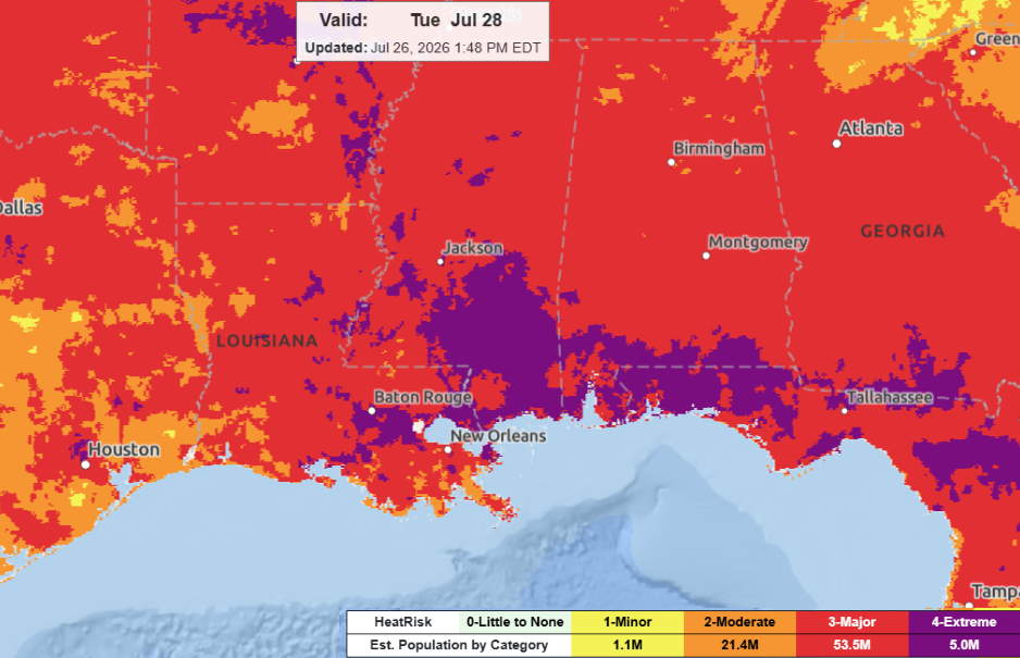
For the majority of the region, extreme heat will start off the work week. With little overnight relief, minimal rain, and abundant sunshine, heat stress will accumulate throughout the week, with the highest risk for extreme heat expected Tuesday.
In fact, extreme heat warnings and heat advisories are already in effect across much of Mississippi!
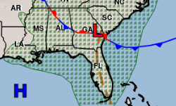
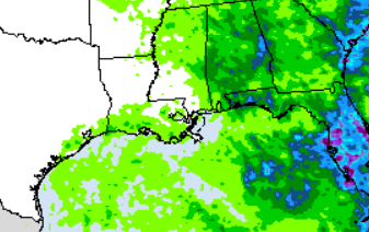
For those in the northeastern portions of the region, scattered showers and thunderstorms are possible as a nearby front moves through. This is reflected in the 72-hour rainfall totals from Sunday through Wednesday shown below. Eastern portions of the region could see 0.25–1 inch of rain, while those farther west remain pretty dry.
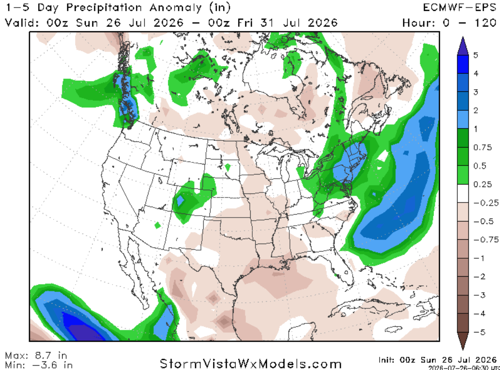
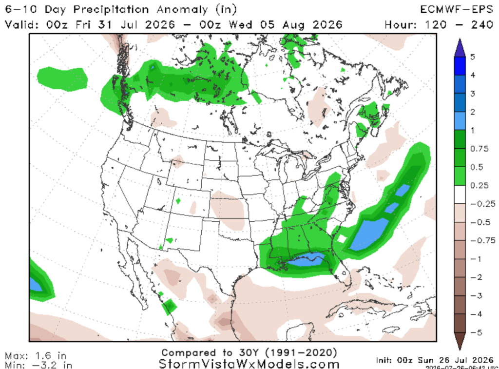
Looking ahead, Wednesday brings a better chance for rain as the ridge weakens. This will shift us from below-normal precipitation (shown below left) to above-normal precipitation (shown below right), along with slightly cooler temperatures…yay!
3-DAY TRAVEL FORECAST
Airports
KIAH / KHOU (Houston) – Patchy fog in the mid-morning hours, other than that, no weather-related issues are anticipated through Tuesday.
KSHV (Shreveport) – Except for heat, no weather-related issues are anticipated through Tuesday.
KBTR (Baton Rouge) – Low-end chance for an afternoon storm. Other than that, no weather-related issues are anticipated through Tuesday.
KMSY (New Orleans) –Low-end chance for an afternoon storm. Other than that, no weather-related issues are anticipated through Tuesday.
KJAN (Jackson) – Except for heat, no weather-related issues are anticipated through Tuesday.
KMOB (Mobile) – Low-end chance for an afternoon storm. Other than that, no weather-related issues are anticipated through Tuesday.
KBMH (Birmingham) – Risk of severe storms Monday before noon. The main threats are damaging winds up to 60 mph and heavy rain. Some intermittent flight delays are possible for lightning. Other than that, no weather impacts are expected through Tuesday.
KTLH (Tallahassee) – Scattered showers and thunderstorms possible each day, mainly after 2pm. Some intermittent flight delays are possible for lightning.
KATL (Atlanta) – Line of thunderstorms Monday morning, mainly before 10am. Some intermittent flight delays are possible. Other than that, no weather impacts are expected through Tuesday.
Highways
I-10
Looks dry between Houston and Mobile, with only a stray afternoon storm possible. There is a higher chance for scattered showers and thunderstorms as you travel closer to Tallahassee and the Florida Panhandle
I-20
Staying mostly dry between Shreveport and Jackson. West of the Alabama/Mississippi border, scattered showers and thunderstorms are expected. The best chance for rain will be Monday morning near Birmingham and Atlanta. Main hazards include heavy rainfall and wind gusts up to 60 mph
I-49
Staying dry, but spotty showers and thunderstorms are possible in the afternoon/evening hours, mainly near Lafayette.
I-55 & I-59
Looks good other than a spotty storm in the afternoon/evening hours.
I-65
Monday morning and afternoon storms are expected across the northern portions of I-65 near Decatur and Birmingham. Be prepared for brief rounds of heavy rain, lightning, and gusty winds up to 60 mph.
Other than that, the forecast looks good
I-75
Overall, conditions look pretty good, with the exception of northern Georgia. A line of thunderstorms is expected to move through Atlanta from the north during the morning. Impacts include strong to severe wind gusts and heavy rainfall. Visibility could be reduced at times, and water on roadways is possible.
Other than that, I-75 looks dry, with only an occasional spotty afternoon storm possible.
CITY FORECASTS
Houston, TX
Tonight– Staying mostly dry tonight under clear skies. Warm and humid with a low around 79 and a light breeze from the southwest.
Monday– Watch for patchy fog in the mid-morning hours. Mix of sun and clouds. High of 98, could feel 10 degrees warmer. Light breeze out of the southwest at 5-10mph.
Tuesday– Watch for patchy fog in the mid-morning hours. Heat continues, high of 100, may feel 10 degrees warmer. Abundant sunshine with a light breeze from the southwest at 5-10mph.
Shreveport, LA
Tonight– Staying mostly dry tonight under clear skies. Warm and humid with a low around 78 and a light breeze from the west.
Monday– Heat advisory in effect. Worsening heat and humidity with a high of 99, will feel like 106 in the afternoon. Plenty of sunshine with a light breeze out of the west at 5-10mph.
Tuesday– Heat continues, high of 99, may feel 10 degrees warmer. Abundant sunshine with a light breeze from the west at 5-10mph.
Baton Rouge, LA
Tonight–Staying mostly dry tonight under clear skies. Warm and humid with a low around 77 and a light breeze from the west.
Monday–Worsening heat and humidity with a high of 96, will feel like 107 in the afternoon. Plenty of sunshine with a light breeze out of the west at 5-10mph.
Tuesday–Heat advisory in effect. High of 96, could feel closer to 110. Abundant sunshine with a light breeze from the west.
New Orleans, LA
Tonight– Staying mostly dry tonight under clear skies. Warm and humid with a low around 79 and a light breeze from the west.
Monday–Worsening heat and humidity with a high of 96, will feel like 112 in the afternoon. Plenty of sunshine with a light breeze out of the west at 5-10mph.
Tuesday–Extreme heat possible for dangerously hot conditions with heat index values up to 115. Abundant sunshine with a light breeze from the west.
Jackson, MS
Tonight– Staying mostly dry tonight under partly cloudy skies. Warm with a low around 77 and a light breeze from the west.
Monday–Worsening heat and humidity with a high of 100 and “feels” like temperatures up to 115. Abundant sun with a light breeze from the west. A stray storm is possible in the afternoon/evening. Rain chance: 15%
Tuesday–Extreme heat warning in effect for dangerously hot conditions with heat index values up to 111 expected. Plenty of sunshine with a light breeze from the west.
Birmingham, AL
Tonight–Staying mostly dry tonight, but scattered storms are expected to move in around 4 AM. Low of 75 with calm winds. Rain chance: 30%
Monday–Risk of severe storms, mainly before noon. The main threats are damaging winds up to 60 mph and heavy rain. Otherwise, sunny with a spotty afternoon storm possible. High of 95. Light breeze from the west at 5–10 mph. Rain chance: 50%
Tuesday–Hottest day of the week! High of 96, however it could feel closer to 105. Plenty of sunshine with a light breeze from the west at 5mph
Mobile, AL
Tonight– Warm and humid tonight. Low of 79 with partly cloudy skies. Light breeze from the west at 6 mph.
Monday– Heat advisory in effect as it might feel like 111 in the afternoon. High of 100 with abundant sunshine. A spotty storm in the evening is possible. Winds blowing from the northwest at 5mph. Rain chance: 15%
Tuesday– Extreme heat possible, with a high of 100, but it could feel like 114 in some spots. Plenty of sunshine, with a spotty storm possible in the evening. Rain chance: 15%.
Tallahassee, FL
Tonight– Warm and humid tonight. Low of 77 with a stray evening thunderstorm possible before sunset. Then giving way to partly cloudy skies. Calm winds. Rain chance: 20%
Monday–Heat advisory in effect. High of 100, heat indices will exceed 108 for much of the area. Sunny skies. Afternoon and evening isolated thunderstorms possible, some lingering overnight. Rain chance: 30%
Tuesday–Extreme heat possible. Plenty of sunshine. High of 100, heat indices could exceed 113. Afternoon and evening isolated thunderstorms possible. Rain chance: 30%
Atlanta, GA
Tonight– Partly cloudy, with a low around 74. Breeze from the northwest 5-10mph with gusts up to 15mph.
Monday–Line of thunderstorms possible in the early morning hours. Main threats are strong winds up to 60mph and heavy rainfall. Otherwise, giving way to sunny skies. Temperatures rising to 93 but will feel closer to 100. Rain chance: 40%
Tuesday– Heat builds back in, with a high near 96, may feel closer to 104. A stray storm is possible in the afternoon. Winds blowing from the west at 5-10mph, gusts as high as 15mph. Rain chance: 15%


