Hey y’all! We’re back to our seasonally typical weather pattern with high temperatures and, of course, a chance for those diurnal afternoon thunderstorms.

Tonight
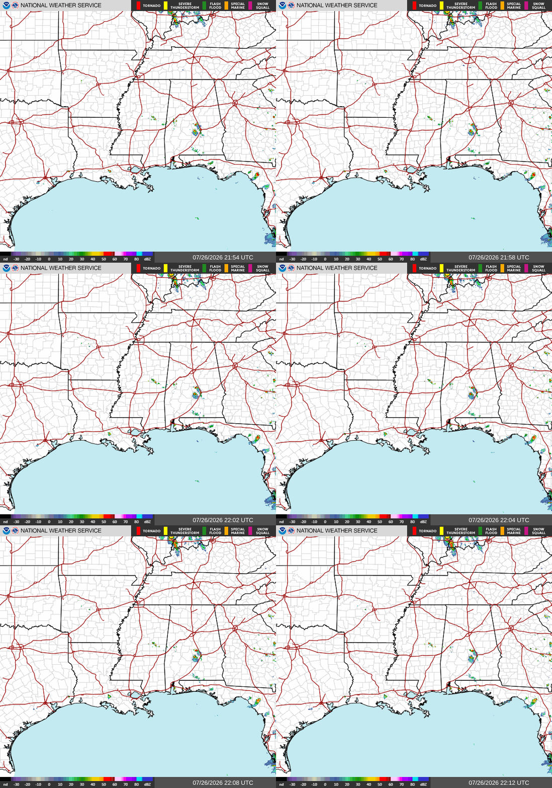
Our NWS radar down below shows just a few of those isolated afternoon storms popping up over various areas in our region. These storms are diurnal thunderstorms, which are thunderstorms that develop mainly because of the daily heating cycle. These are your classic summertime afternoon storms, forming as daytime heating causes warm, moist air to rise and the atmosphere to become more unstable. With the conditions that we typically see for summer, this usually means a quiet morning followed by showers and thunderstorms popping up during the afternoon as the heat and humidity set in.
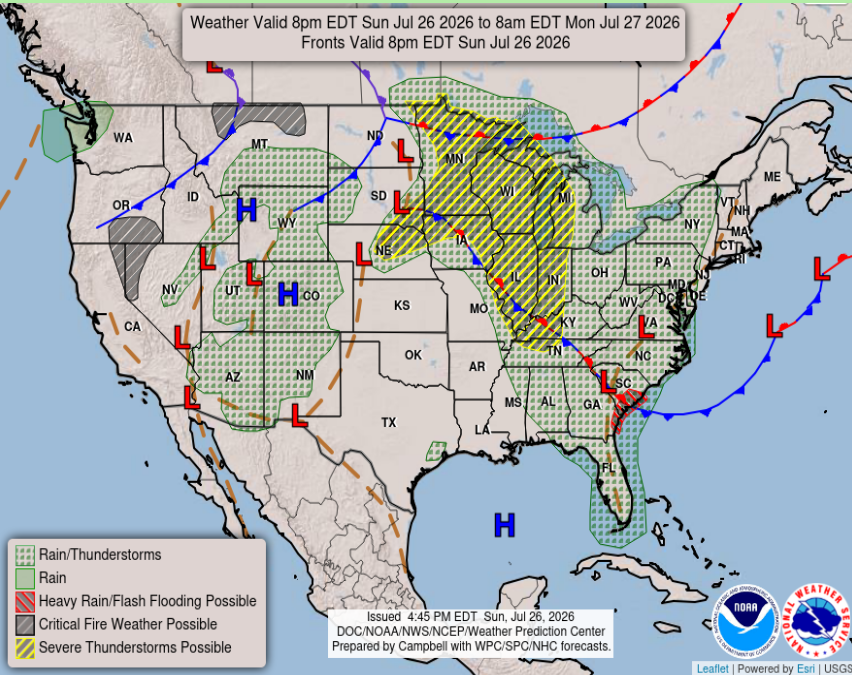
Coming up over the next few days is an area of high pressure hanging over the central Gulf. This system will help to keep any major storm systems from developing in our area and will continue to keep temperatures high. Pop-up storms are still to be expected as this system is further out on the Gulf and not strong enough to completely ward off all storms for the region.
Tomorrow
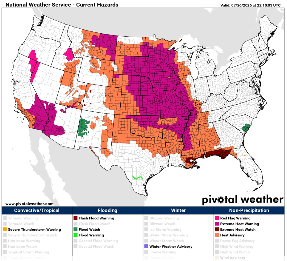
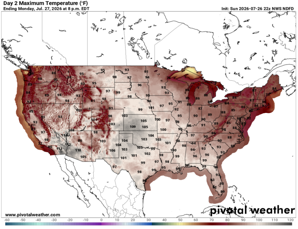
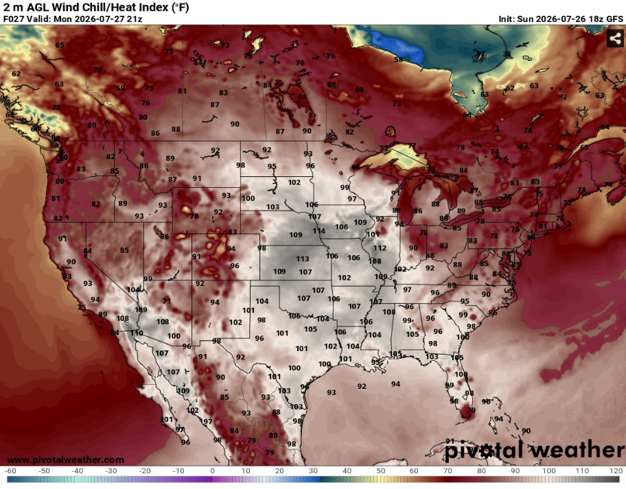
To start our work week, expect very high temperatures reaching up to 100 degrees across portions of Southern MS/AL/LA. We do have Heat Advisories along with Extreme Heat Watches and Warnings in effect for a majority of our area tomorrow, so make sure you stay hydrated and find ways to keep yourself cool. The risk for heat-related illness remains high as the humidity will push real feel temperatures into the triple digits across the Gulf Coast.
Below are our Monday maximum temperatures and our heat index values across the region. IT WILL BE HOT! Be ready to take breaks and drink lots of water while working or playing outside, as this heat is no joke. It is recommended to arrange indoor plans when possible between 12 and 4, when the heat will be most intense.

Tuesday
Unfortunately for anyone with outdoor plans on Tuesday, we will see an increase in temperatures as the Gulf ridge moves a tiny bit closer to the northern Gulf Coast. Below is our NWS HeatRisk for the region on Tuesday. A good amount of our Gulf Coast area is included in the magenta extreme HeatRisk section of the map. The extreme HeatRisk indicates an extreme risk for heat-related impacts, stating that even overnight, the extreme heat will dangerously affect anyone without ways of cooling or hydration.
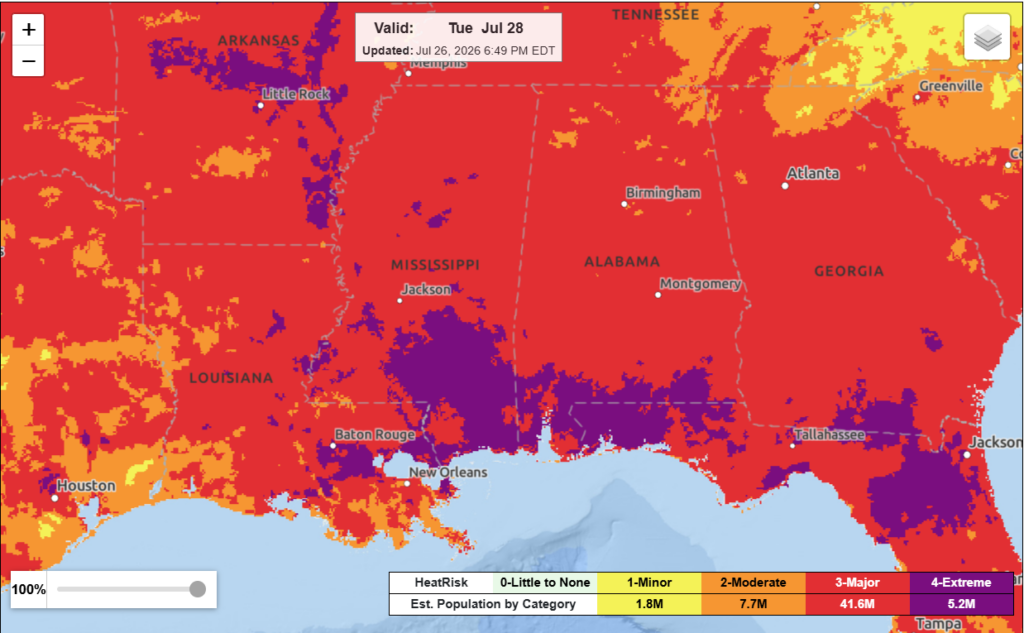
With Tuesday forecasted to be the hottest day of the week, at least we will be out of the extreme heat warning as we move later into the week. Precipitation-wise, the Gulf High will be fighting off anything organized, meaning we will have little relief from the heat due to the low probability of storm formation from the sinking air.
Below is our GFS outlook for Tuesday and Wednesday of this week. Besides the heat, this model shows the potential for some storms forming Wednesday evening along the Eastern Gulf Coast cities. If this is accurate, Mobile and cities west all the way to Tallahassee have the potential for some thunderstorms Wednesday night.
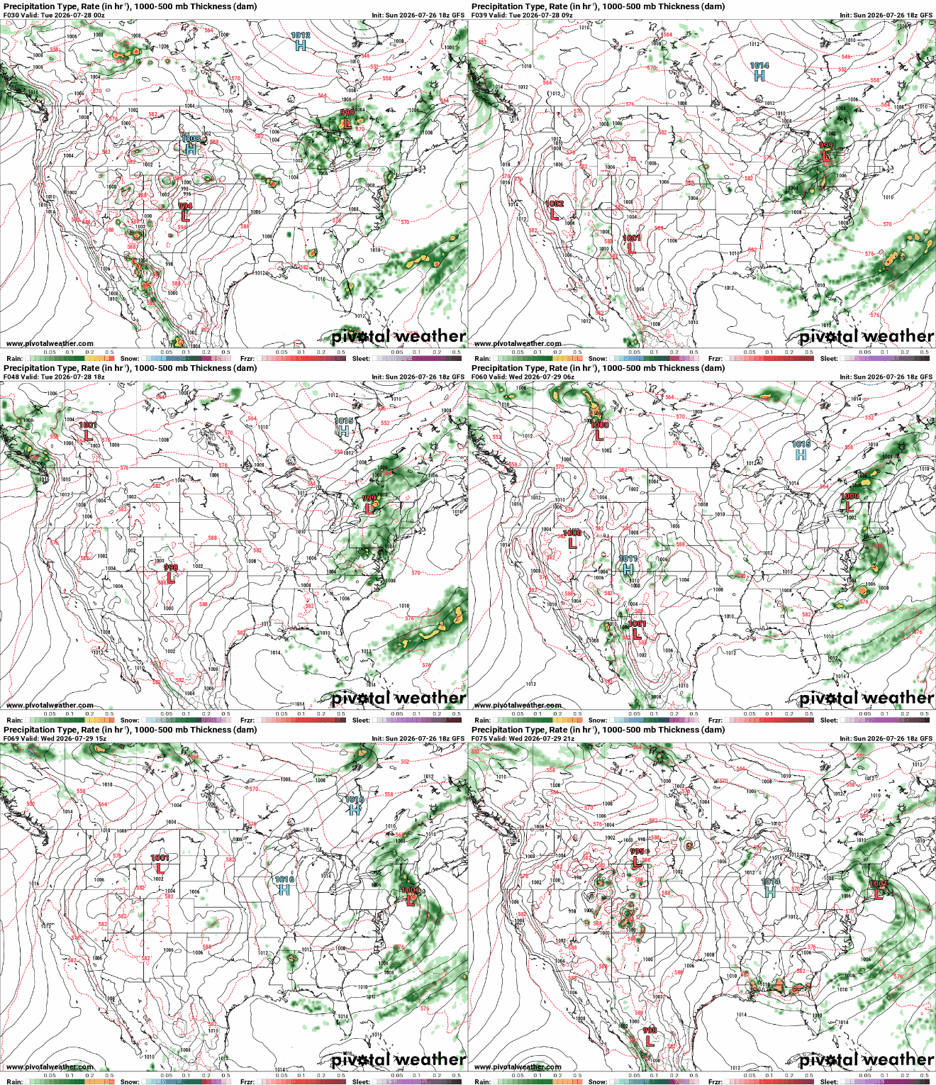
The GFS historically achieves roughly 85% to 95% accuracy for features at the 3-day mark, so we will check back about this tiny storm on Thursday to see how accurate the model was this week.

Extended Forecast
Looking ahead to our NickelBlock 15-day regional outlook, we are seeing triple-digit temperatures expected regionally on Monday, although Tuesday has a higher risk for heat-related impacts. Because this is a regional outlook covering Southern MS/AL/LA, conditions will be different when comparing Mobile to Baton Rouge to Jackson. So take this as a general guideline for what the conditions are expected to be across our Gulf Coast region as a whole.
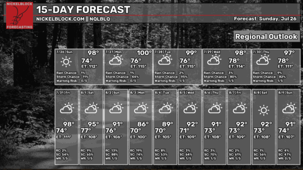
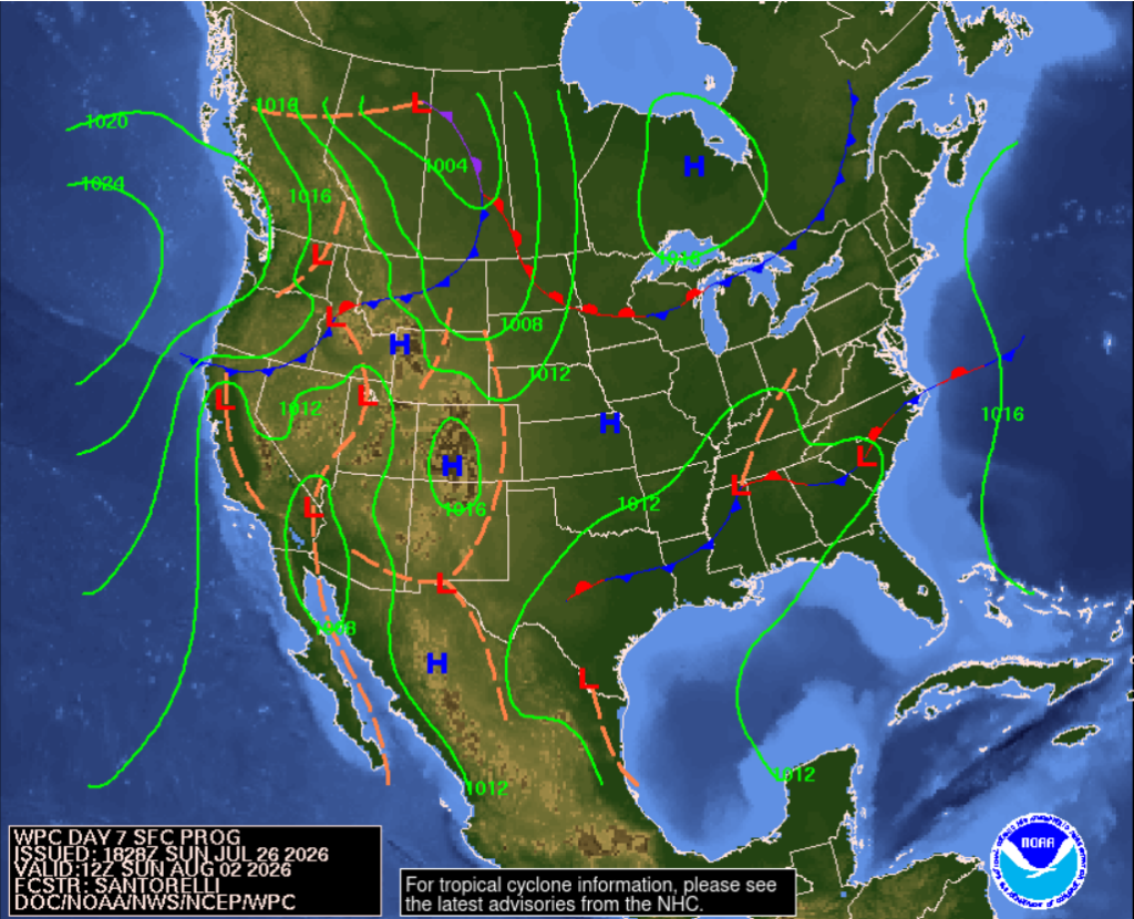
We do see relief moving in early next week as our temperatures seem to dip a little, according to the graphic. This could be due to an area of low pressure moving into the mid south next Sunday. This, along with the associated cold front, could bring us a variety of different storms traveling down south early next week. Stay tuned for more on that!
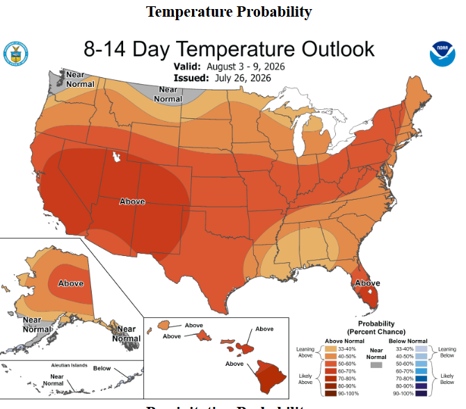
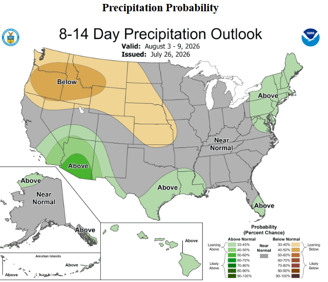
For our 8-14 day outlooks, we can expect slightly above average temperatures for the region, along with wetter conditions over Louisiana specifically. The chance for above-average temperatures is relatively small, meaning that temperatures should be dipping back to “normal” somewhat soon. The increased risk for precipitation over the NW Gulf Coast impacting Texas and Louisiana could be the result of some storms coming off the Gulf as part of a squall line or tropical disturbance.
Stay cool and hydrated this week, as temperatures will remain warm and the chances for relief from storms will be limited. Have a great week!


