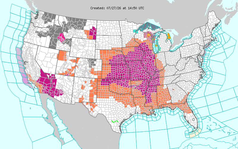
If you look at the map below, you’ll notice that a good third of the country is under some sort of heat-related advisory/warning. Most of that is due to a massive upper-level trough that is keeping conditions dry for much of the Midwest. For us, that means sweltering, humid, and record high temperatures as that ridge clashes with a Gulf ridge and several slow-moving cold fronts.
As the ridge breaks down, we’ll have a rainy end to the week as the front moves further in and brings in enough Gulf moisture to send some rain and thunderstorms our way.

Today
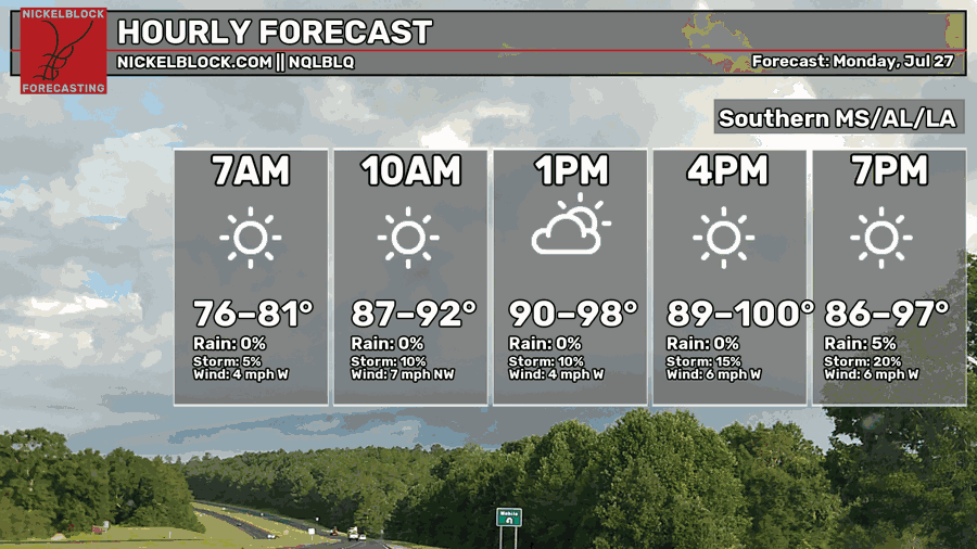
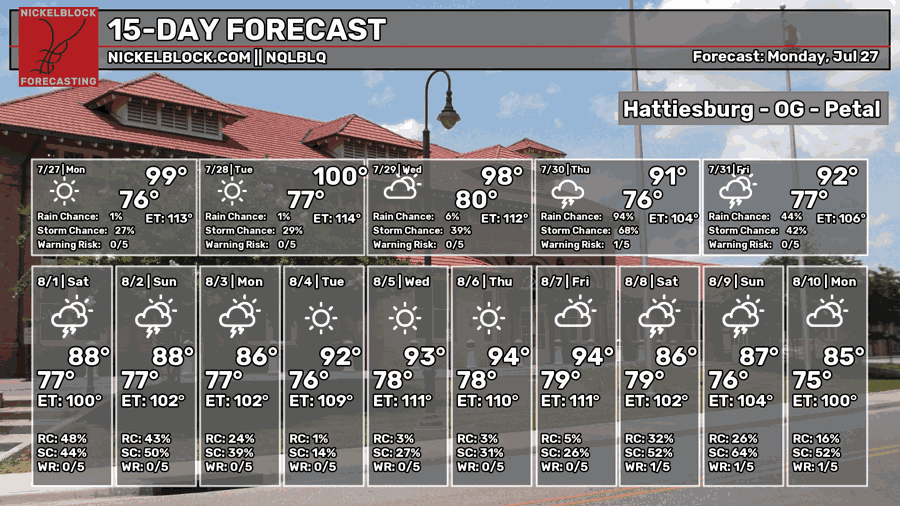
Yep, you’re looking at the correct temperatures! A high up to 100 is possible across much of the Gulf South today with the experienced temperature in the upper 100s to 110s. It’s going to be extremely hot, so if you’re outdoors, stay in the shade as much as you can, and drink plenty of water and electrolytes.
Looking at the composite reflectivity model for today, we can see storms pushing in from the north in northern Alabama moving south. An outflow boundary is helping to push them along further south and more downbursts will help contribute to their continued motion.
Afterwards, a few storms in the Pine Belt by the evening. I don’t doubt we’ll see a couple of pop-up showers, but it’s going to take a good bit of work for them to lift considering how much dry air is in the upper levels and low dewpoints at the surface.

Tomorrow
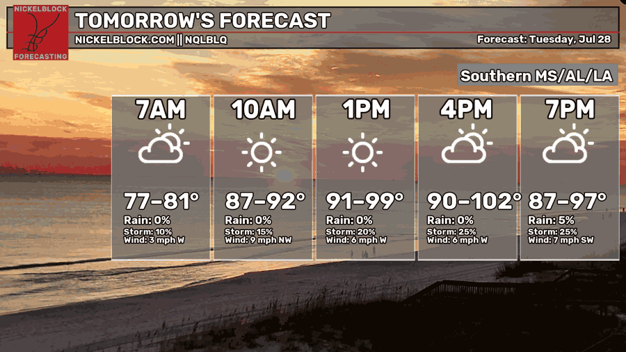
Another hot day is ahead with mostly sunny skies and temperatures topping out around 100. The heat index will hit around 110+ so be wary of that if you do anything outdoors. As we go into the afternoon, a very limited chance of pop-up thunderstorms is possible. Westerly and northwesterly winds will blow through around 5-10mph and the low will fall in the upper 70s.
Wednesday
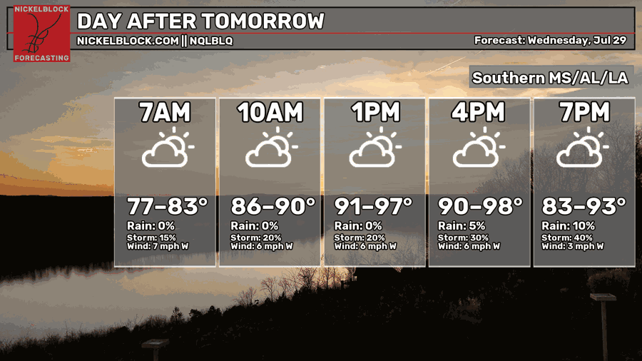
While the temperature won’t be record breaking compared to the last two days, it’s still going to be hot on Wednesday nonetheless. Highs will be in the upper 90s with a heat index in the upper 100s again. Some good news is that there is a bit of a chance of rain for some of the state. Depending on the sea breeze, the Coast may see a few storms along with areas in northern Mississippi. Otherwise, just hot. Lows will be in the upper 70s once more.
Heading into the Weekend
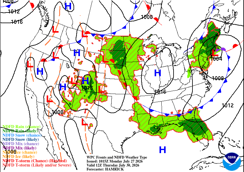
Despite all the heat I just talked about, it’s looking like we’ll get a bit of rain to end off the week! That front I mentioned earlier is moving further into the Deep South allowing for a bit of wedging and Gulf moisture to move in. Rain and thunderstorms are likely on Thursday.
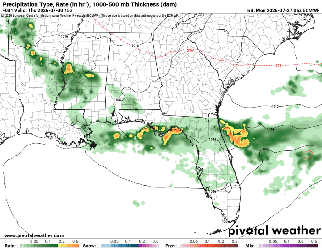
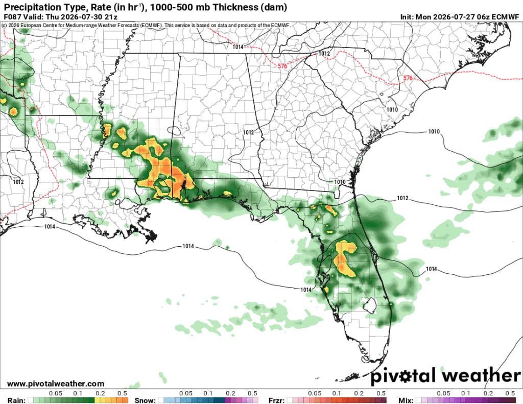
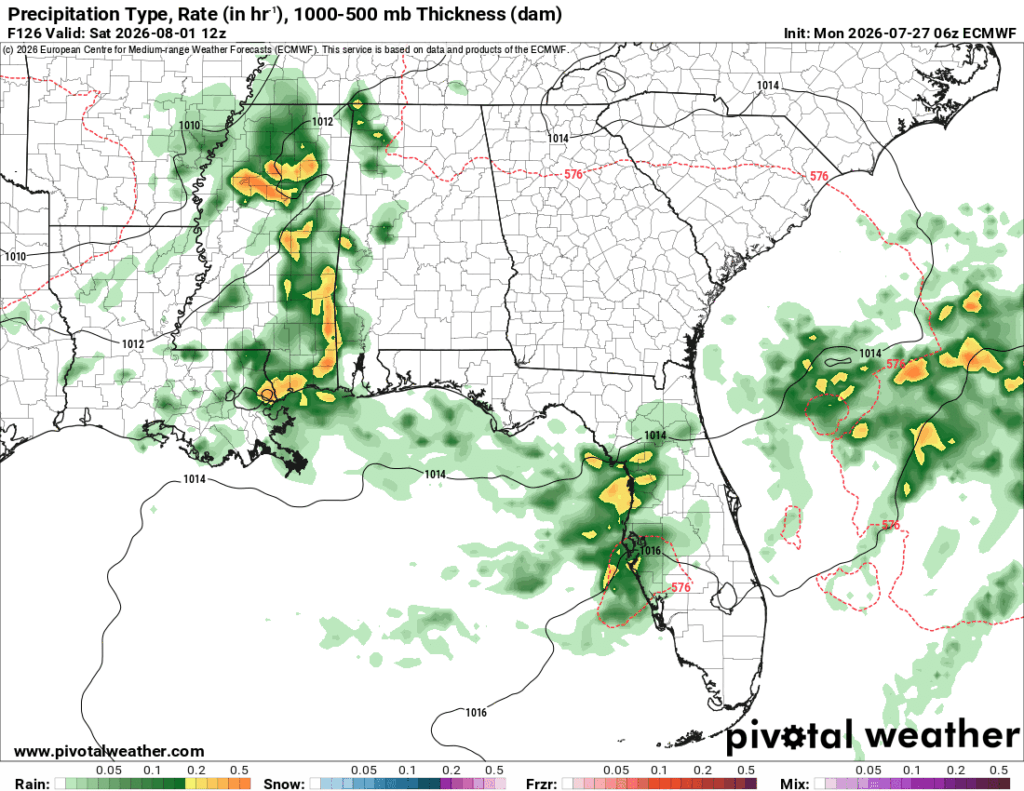
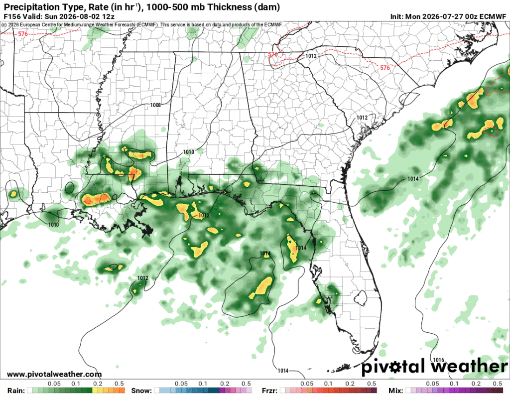
Friday’s rain moves further down the coastline and towards the Mississippi River. Overall temperatures will also fall back into the low 90s which is better news. Leading into the weekend, it’s going to be a wet one! What a way to start off August, especially when it’s normally one of our driest months. Overall cooler temperatures and rainy weather along with a cold front will start off the month a bit unconventionally.
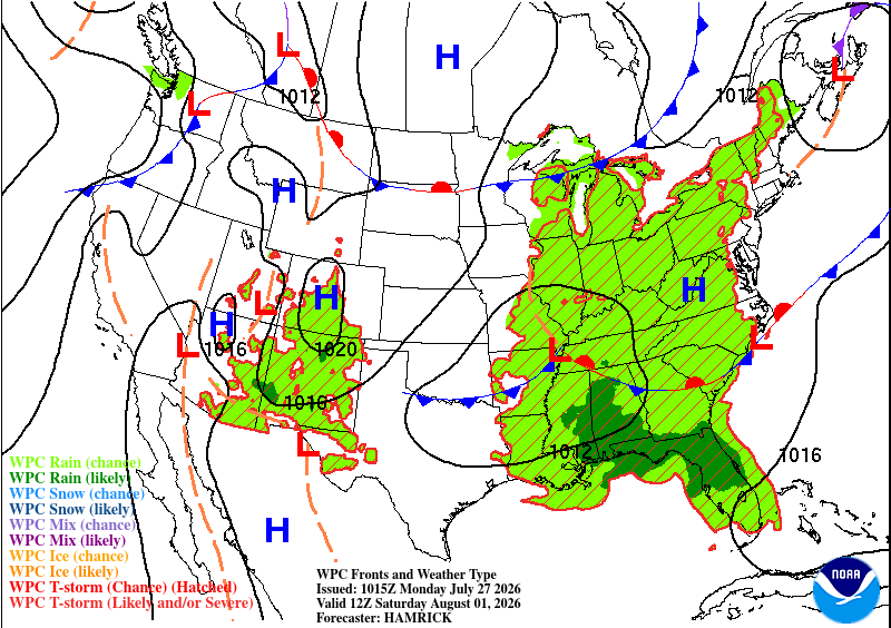
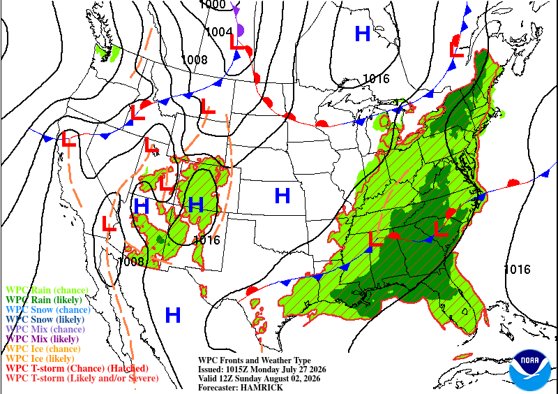
So far, models are implying that the rain will arrive in the early morning and leave us with cloudier conditions across the region. That’s great news for us! While a bit more humid, at least we’ll have some cloud cover instead of the blazing sun.