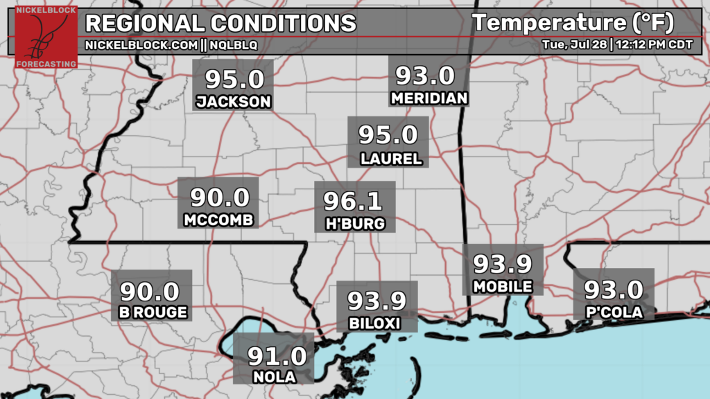
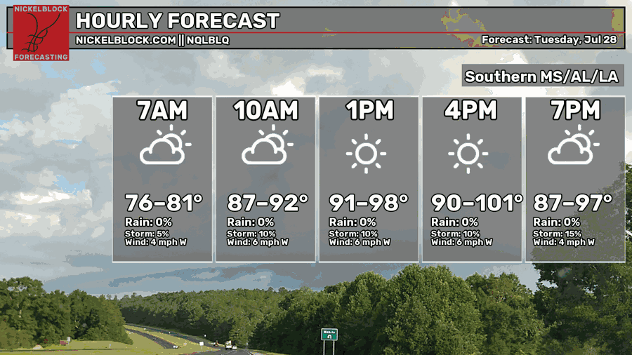
Today is just going to be one of those days. As of noon CDT, the temperatures are already in the mid 90s for many locations inland. Hattiesburg so far is the hottest city, already experiencing a temperature of 96ºF. These temperatures will continue to rise today into the low 100s for some, possibly breaking record high temperatures for this date, making it the hottest day of the summer so far.
Be absolutely sure to take precautions such as staying hydrated, wearing sensible clothing, and wearing sun protection today.
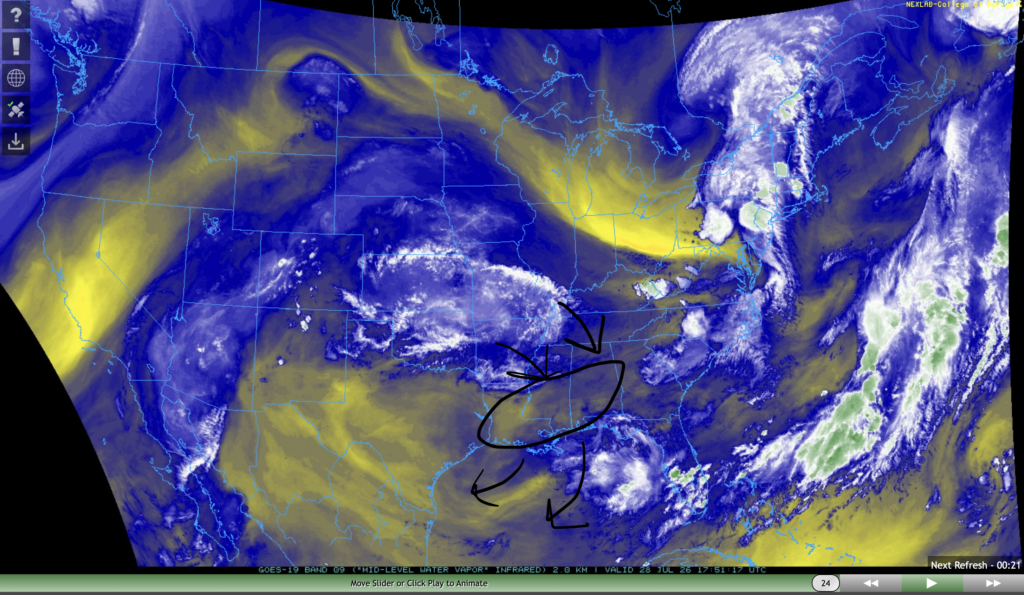
Storms are being put on hold for today, so sudden relief from the heat isn’t likely. This is due to an area of mid-level dry air which is circled in the image above. This dry air will linger in the area for today, preventing storms from forming.
Tomorrow, storms are expected to start back up again. This is because the area of mid-level moisture over the great plains will make its way south into our area.
Tomorrow
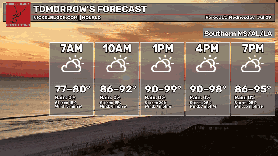
We’re expecting another hot today tomorrow, with afternoon high temperatures that could climb into the upper 90s for many. Triple digits aren’t out of the question, either.
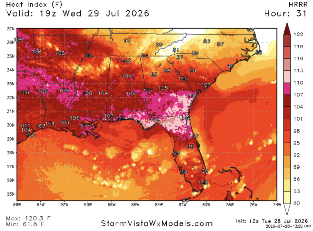
The feels like temperatures tomorrow afternoon will be nothing short of miserable. For most of our region, feels like temperatures will be in the mid-upper 100s, approaching 110ºF in some spots. The Florida panhandle and southern Georgia appear to be the hotspots, with feels like temperatures closer to 115ºF in some places.
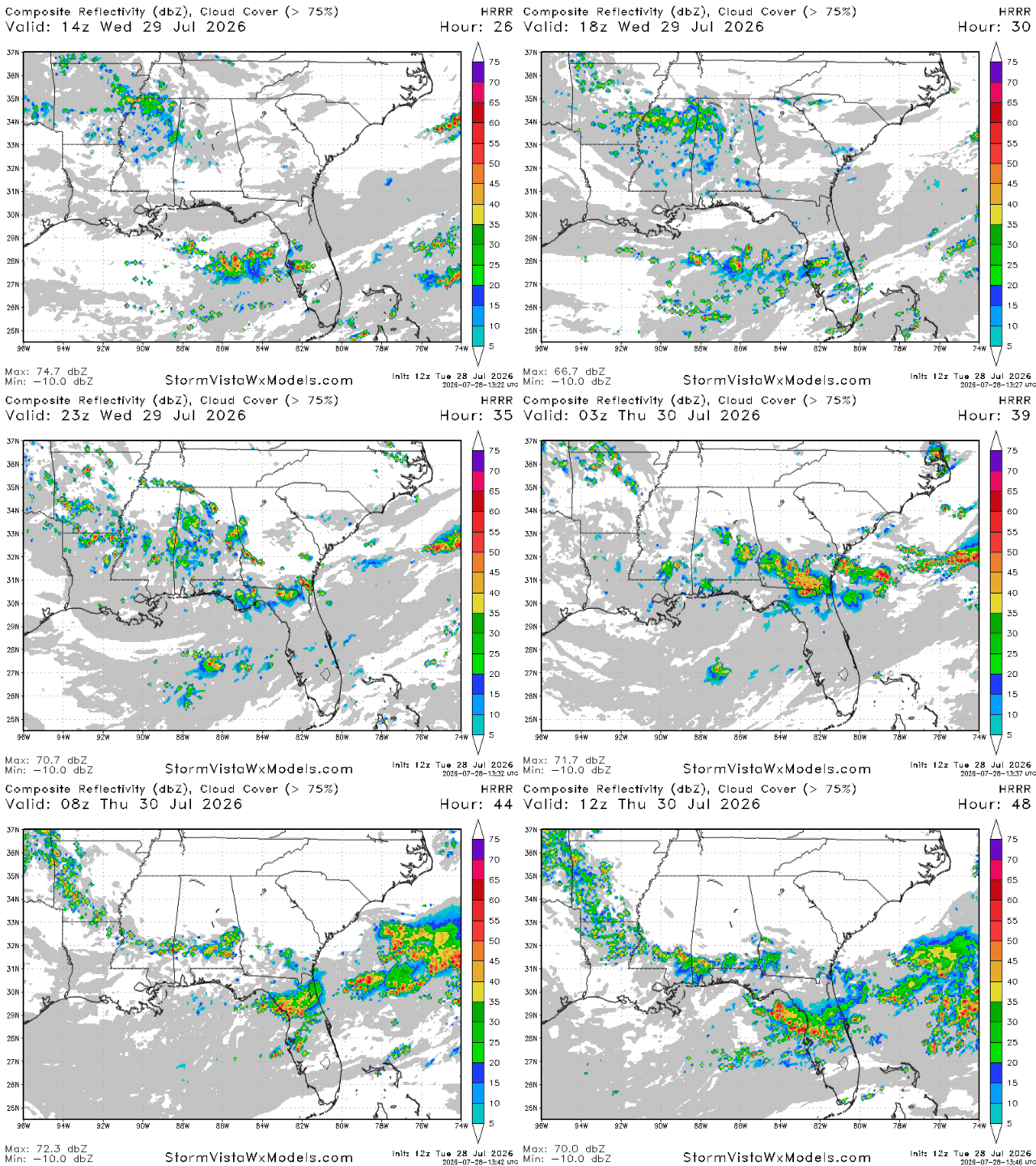
We’re also expecting some storms tomorrow associated with a weak cold front coming in from the north. Storms will begin in the morning in northern Mississippi and Alabama, and will make their way south as the day progresses.
After an initial round of thunderstorms in the late afternoon and evening, another round is possible after midnight in the overnight and early morning hours of Thursday. While these thunderstorms may rouse you from your sleep, they will also usher in cooler temperatures and lower humidity that you will be able to enjoy later this week and this weekend, so don’t be too upset!


