It’s a bit toasty outside right now.
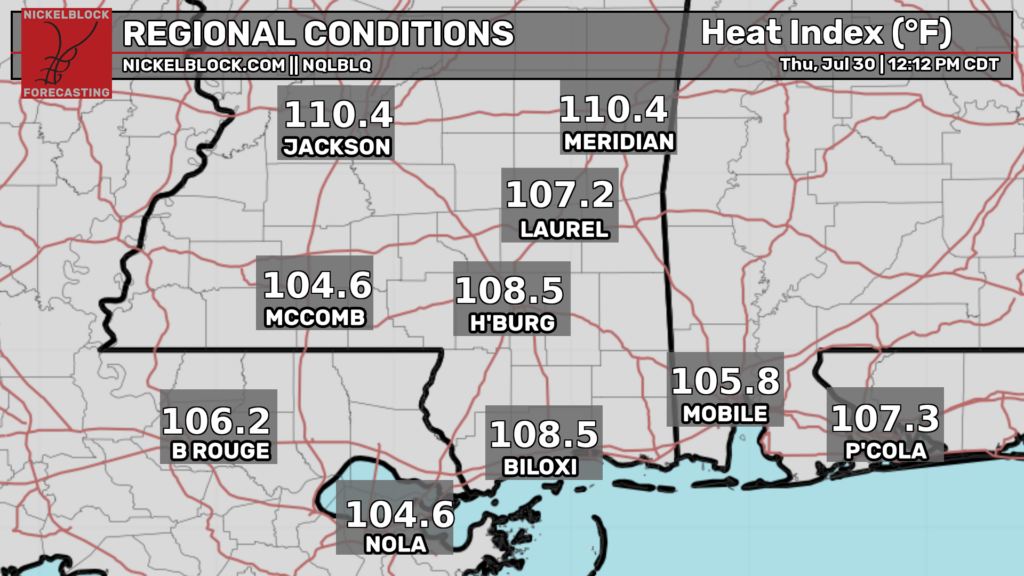
This is being driven by temperatures in the low to mid 90s with dew points in the 70s. Heat indexes are already into the dangerous territory so make sure to drink plenty of fluids and take frequent breaks in the AC if you must be outside. The National Weather Service has issued a heat advisory for today and tomorrow to cover the threat.
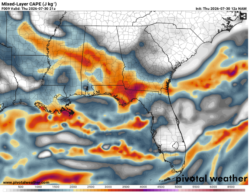
All that heat and moisture will lead to seasonably strong instability. This will allow for storms to be capable of very heavy rain, lots of lightning, and maybe some isolated damaging winds up to 60 mph. The Storm Prediction Center has outlined eastern parts of our region in a level one out of five marginal risk.
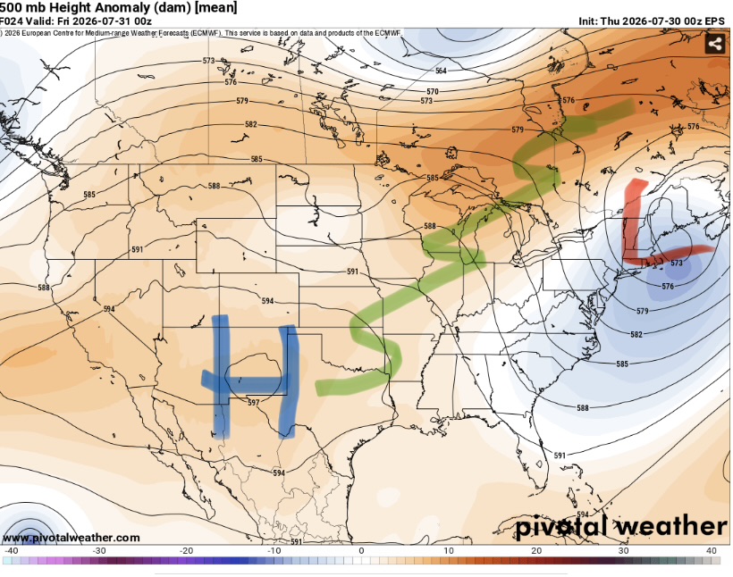
Since our region is well removed from the upper level trough and associated stronger flow, wind shear and lift will be on the weaker side. This will keep storms from being too widespread or severe.
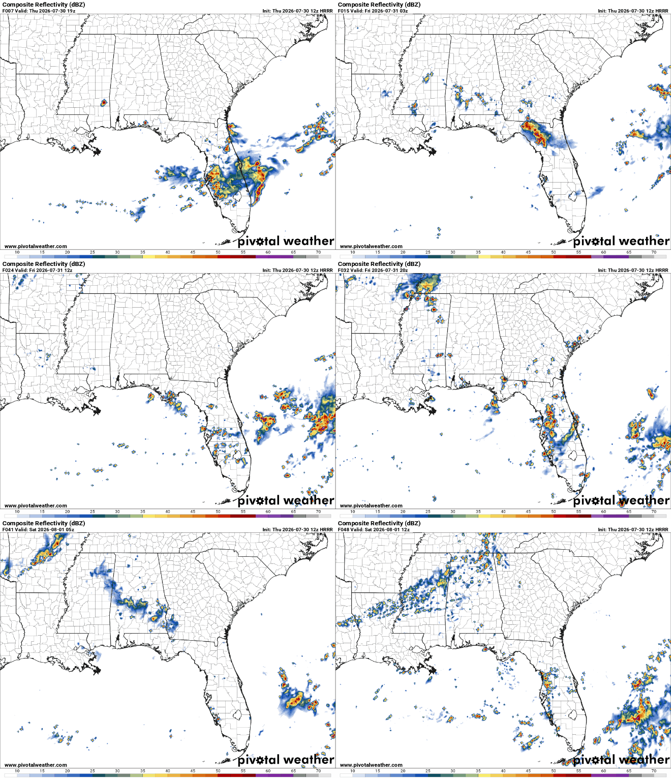
Storms are currently beginning to form across the region. They should peak in coverage and intensity around the dinner hours.
Tomorrow will be more of the same with intense heat and humidity and a higher chance of storms.


