While some of us are baking in the heat others are getting pounded by storms.
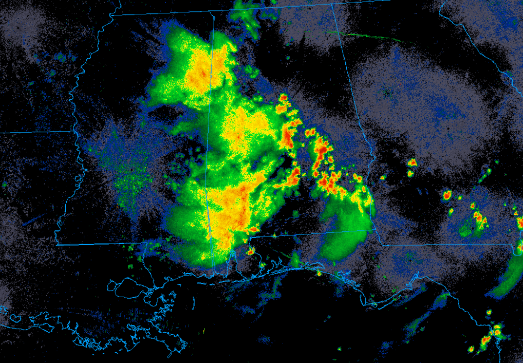
This will be the general pattern for the next couple days with areas to the east likely getting multiple rounds of rain while areas to the west remain stagnant under the ridging.
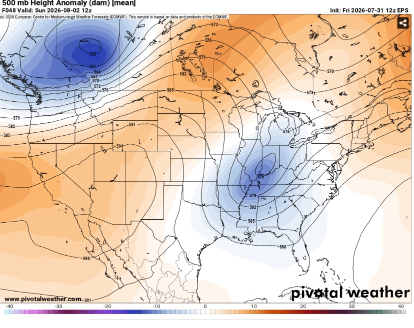
An unseasonable deep upper level trough will meander southeast dragging a cold front along with it. This will provide the forcing to sustain numerous thunderstorms in the warm sector.
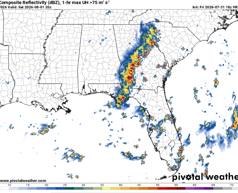
The Storm Prediction Center has outline northern Alabama and surrounding areas in a slight risk of damaging winds. This will be driven by the aforementioned shortwave trough and seasonably deep moisture.
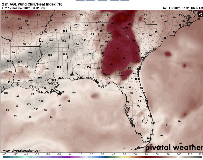
Meanwhile, the lower Mississippi valley will spend another day baking in the heat before the front slowly makes it way through. Highs will be in the mid 90s with heat indexes well above 100. Some storms will be possible further west during the overnight hours but the more robust risk will be along and east of the Mississippi-Alabama border.
Airport Forecasts
Houston (KIAH/KHOU)- Mostly fine. There may be some isolated thunderstorms tomorrow afternoon into the evening. This may cause a quick delay or two for lightning or microbursts.
Shreveport (KSHV)- There is a slight chance of isolated thunderstorms in the predawn hours but the vast majority of flights will be clear.
Baton Rouge (KBTR)- Few if any issues expected. There may be some thunderstorms possible during the predawn hours on Sunday but that thankfully is the quietest time for flights.
New Orleans (KMSY)- A few storms are possible on Sunday morning. This could lead to a delay or two for lightning or downbursts.
Jackson (KJAN)- Scattered storms possible during the day on Sunday. This might lead to a couple delays for lightning or downdrafts.
Mobile (KMOB)- Off and on storms possible throughout the next couple days. These will be most likely tomorrow morning and during the day on Sunday. They might cause a few delays for lightning or microbursts.
Birmingham (KBMH)- Off and on thunderstorms for the next 48 hours. This may cause some delays for lightning or downbursts but it shouldn’t be a complete washout.
Tallahassee (KTLH)- Repeated rounds of showers and storms likely. This will likely lead to some delays for lightning or downdrafts. Storms will be most likely each of the next two afternoons.
Atlanta (KATL)- Showers and storms likely from midday tomorrow through Sunday afternoon. This will probably cause some delays for lightning or microbursts.
Highways
I-10 – Some storms likely across Florida during the afternoon. More storms will likely develop overnight across Louisiana. Be mindful of ponding on roadways.
I-20 – Storms will form during the morning across Georgia and Alabama. They will build west throughout the day along most of the highway. Be cautious of hydroplaning.
I-49 – A storm or two possible across western Louisiana around sunset. Most of the route will be dry though.
I-55 and I-59 – Scattered storms possible around sunset across Mississippi. These may produce some heavy rain.
I-65 – Multiple waves of storms expected across Alabama tomorrow. It won’t be a complete washout but if you drive the length of the state you will likely encounter some rain.
I-75 – Widespread storms likely across Georgia tomorrow. Watch out for water pooling on pavement.
City Forecasts
Houston, TX
Tonight- Mostly clear with a low around 80. No rain, but there will likely be a bit of a breeze from the south.
Tomorrow- Mostly sunny with a high around 100. Isolated afternoon thunderstorms possible.
Sunday- Mostly sunny with a high in the upper 90s. Dry.
Shreveport, LA
Tonight- Mostly clear with a low in the low 80s. Isolated thunderstorms possible.
Tomorrow- Mostly sunny with a high in the mid 90s. No precip expected.
Sunday- Sunny with a high in the mid 90s. No rain.
Baton Rouge, LA
Tonight- Mostly clear with a low in the upper 70s. No rain.
Tomorrow- Mostly sunny with a high in the mid 90s. Dry.
Sunday- Sunny with a high in the mid 90s. No precip expected.
New Orleans, LA
Tonight- Partly cloudy with a low in the upper 70s. No rain.
Tomorrow- Mostly sunny with a high in the mid 90s. Dry with a steady west wind.
Sunday- Scattered thunderstorms possible early. Partly sunny with a high in the low 90s.
Jackson, MS
Tonight- Partly cloudy with a low in the mid 70s. No rain but a steady breeze out of the southwest.
Tomorrow- Mostly sunny with a high in the mid 90s. Scattered thunderstorms possible.
Sunday- Sunny with a high in the low 90s. Dry.
Birmingham, AL
Tonight- Scattered thunderstorms possible during the am hours. Mostly cloudy with a low in the mid 70s.
Tomorrow- Widespread showers and storms likely. Mostly cloudy with a high in the upper 80s.
Sunday- Isolated afternoon thunderstorms possible. Mostly sunny with a high in the mid 80s.
Mobile, AL
Tonight- Scattered thunderstorms possible. Mostly cloudy with a low in the upper 70s.
Tomorrow- AM thunderstorms possible. Mostly sunny with a high in the low 90s.
Sunday- Scattered thunderstorms possible. Partly sunny with a high in the low 90s.
Tallahassee, FL
Tonight- Isolated thunderstorms possible. Mostly cloudy with a low in the mid 70s.
Tomorrow- Numerous showers and storms likely. Mostly cloudy with a high in the mid 80s.
Sunday- Numerous showers and storms likely. Mostly cloudy with a high in the mid 80s.
Atlanta, GA
Tonight- Partly cloudy with a low in the low 70s. No rain.
Tomorrow- Widespread showers and storms likely. Mostly cloudy with a high in the mid 80s.
Sunday- Scattered thunderstorms likely. Partly sunny with a high in the mid 80s.


