There’s a reason the cold is in quotes. Because unfortunately it won’t get “cold”.
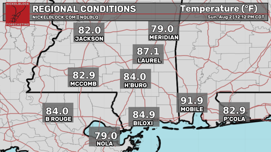
While these temperatures aren’t cold, they are cooler than what we have been experiencing. The front is draped southwest to northeast across the southeastern United States.
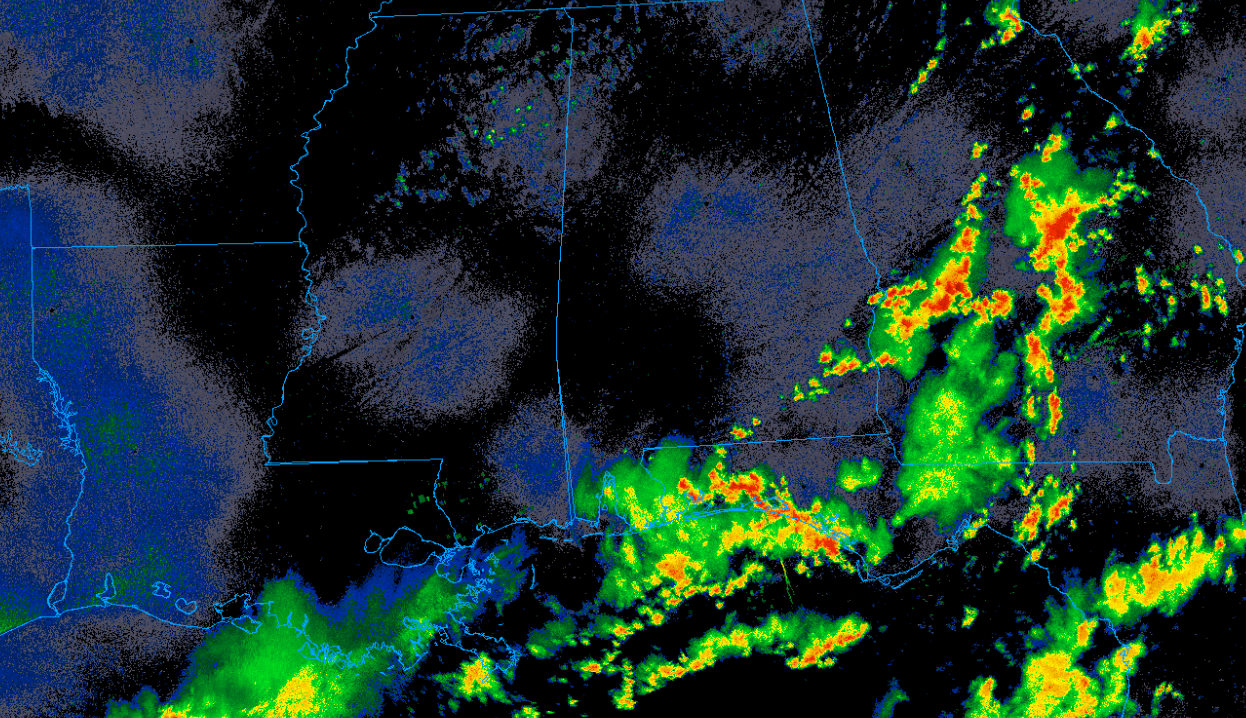
There are numerous showers and thunderstorms ahead of the front where the more unstable airmass resides. Behind the front, northerly flow is advecting drier air into region (60s dew points versus 70s). This will take a bite out of the mugginess we’ve been feeling recently.
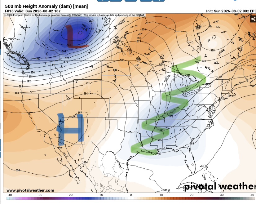
This front is being pushed south by a fairly strong trough for this time of year in our region. Behind the front, Highs will top out on around 90 depending on cloud cover. The difference will be in the slightly lower humidity values.
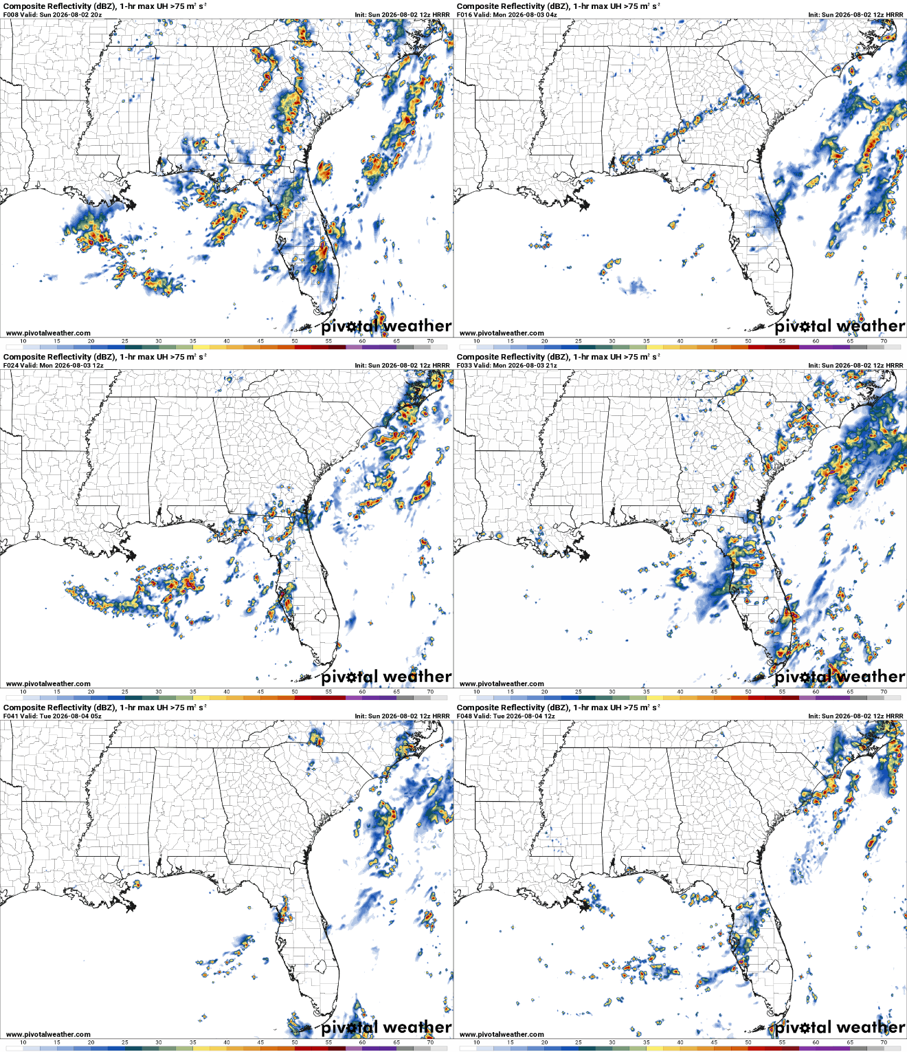
Storm chances will be pretty low today and tomorrow. Sure a spot shower or two could occur but most locations will remain dry. It may not be perfect weather but it’s better than what we’ve been getting.
Tomorrow will be more of the same but with less clouds as the trough moves out of the region.
And then it’ll get hotter and humid again but that’s a story for the local forecast.


