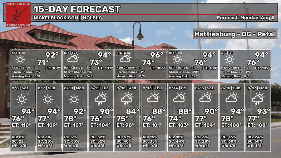
We had a surprisingly cooler day yesterday and I was all for it! Upper clouds helped keep the sun away and lower dewpoints helped with the lower temperature. While we do have a couple more days of reduced temperatures, we’ll soon be back to the typical summer format that we all know and loathe. Some afternoon showers and thunderstorms are also possible in the latter part of the week as the atmosphere is more tuned to handle daytime convection again.
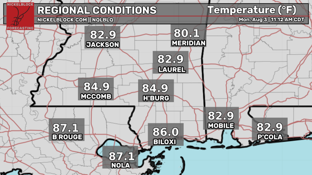

Today
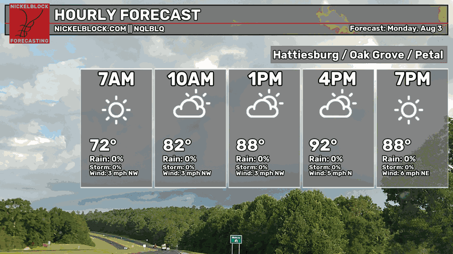
We’ll have another partly to mostly cloudy day ahead of us as low and mid-level clouds hang around during the morning to afternoon. I doubt we’ll see much rain if any as most of it is entangled with the low pressure system to our east. The heat index shouldn’t break over 100 today either, so all in all a pretty nice Summer day compared to what we’ve had lately. Highs in the low 90s and lows in the low 70s.
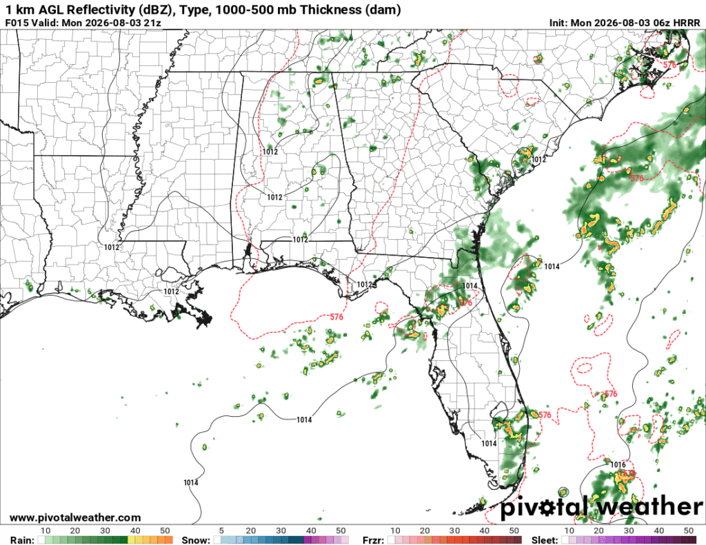

Tomorrow
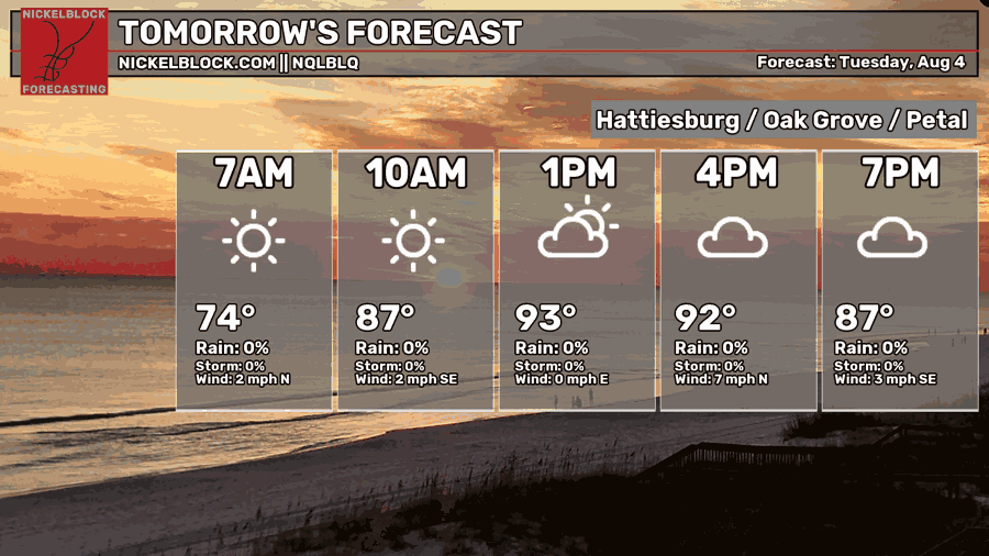
More clouds will move in by the afternoon from the mid-levels which means that overall temperatures will top out a little early. Winds will be light and variable across the area. The front has stalled out over south Mississippi and this will also keep rain from developing during the afternoon. Overall warmer with temperatures in the low to mid 90s and lows in the mid 70s. The humidity will kick up a notch by Wednesday morning.
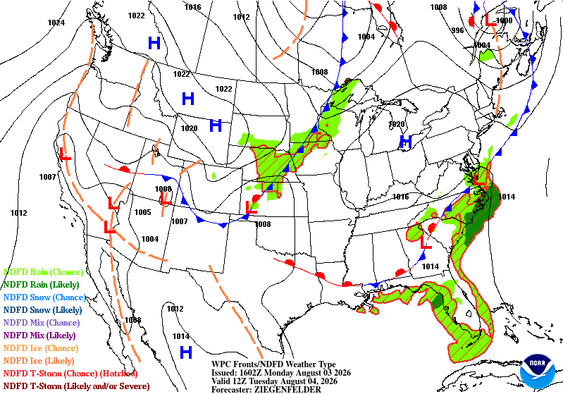
Wednesday
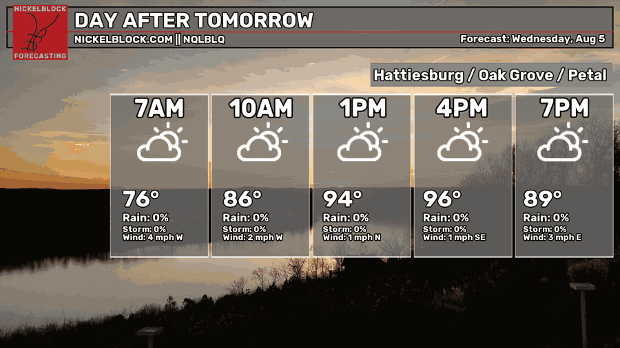
The stationary front begins to break down and that means that the surface high pressure system is beginning to take over. Highs will be in the mid 90s during the day with a heat index over 100. Partly cloudy skies are likely but with a pretty limited chance of rain during the afternoon. The humidity will also increase during the day as more southerly winds begin to move in. Lows will be in the mid 70s.
Hot End to the Week
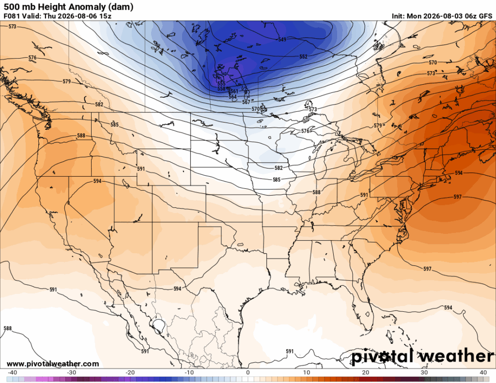
Looking at the upper and lower levels at the end of the week, we can see the trough is gone. It’s out. We’re back in the summer pattern again. A large ridge over the southwestern US and a large North Atlantic ridge are both squeezing any trough out from forming across the Plains. At the surface, a high is creeping towards the Appalachian mountains and bring more southerly flow to the Gulf South. Highs will move into the mid to upper 90s for many of us and the humidity will also increase.
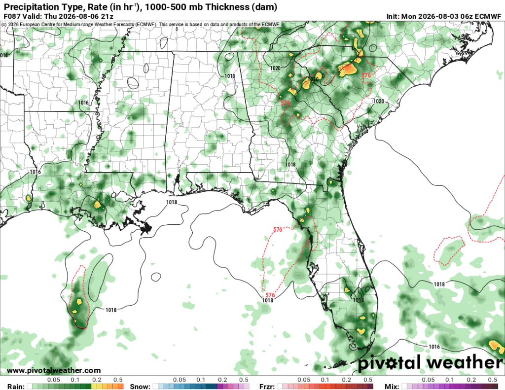
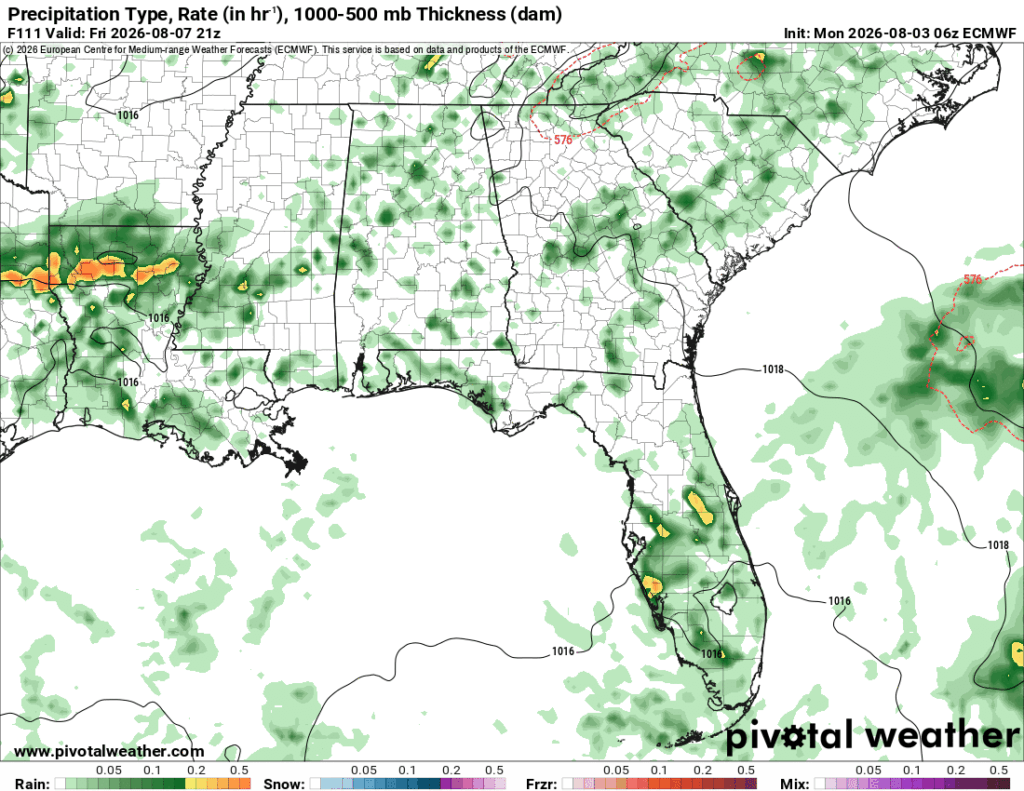
Rain chances will be somewhat limited but dependent on the sea breeze and a weak cold front in the upper Mississippi River Valley. Expect some isolated thunderstorms in the afternoon. Otherwise, yeah, hot, humid and an afternoon thunderstorm, our usual Summer weather.