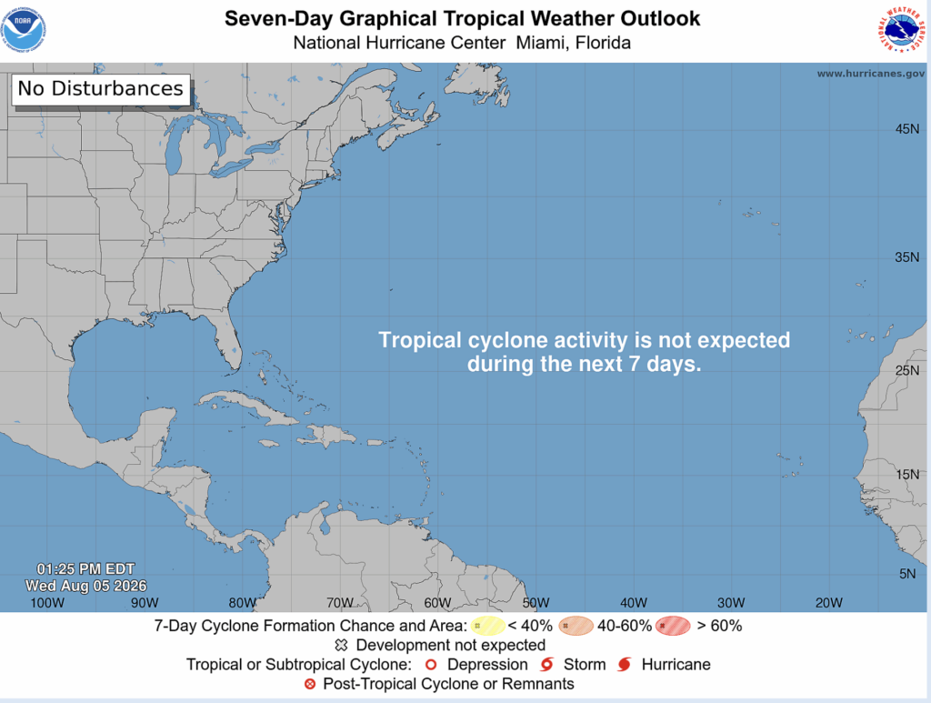
August is usually the first month that hurricane forecasters consider to be the peak of the Atlantic hurricane season. This year couldn’t be more of the opposite. According to the NHC, no tropical invests are expected to result in tropical development for the next 7 days.
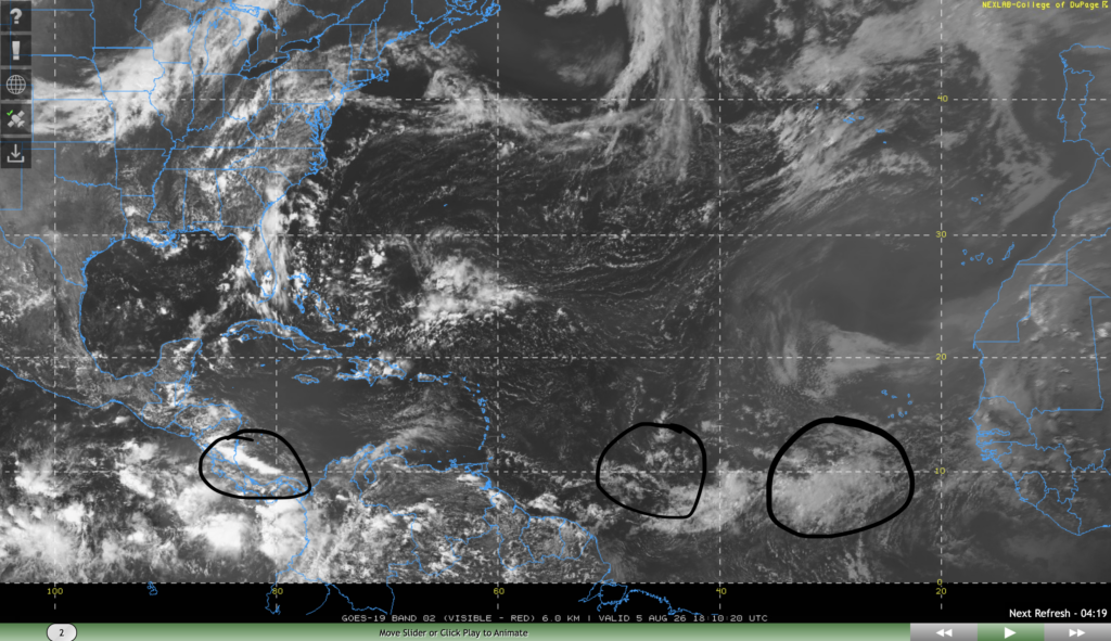
Despite the NHC noting that they aren’t monitoring any active tropical disturbances, they still pointed out 3 tropical waves in their discussion.
One is to the southwest of Cape Verde with noted moderate convection moving west at 5-10 kts. One is further to the west of the first wave with no significant convection moving west at 5-10 kts. The last one is in the western Caribbean sea near Panama and Costa Rica with moderate convection moving west at 5-10 kts.
These three waves are likely to get torn apart by wind shear or Saharan dust, so they pose no threat to land.
Extended Tropical Outlook
Tropical cyclone development conditions this week looks unfavorable for the most part. But let’s take a closer look at different parameters.
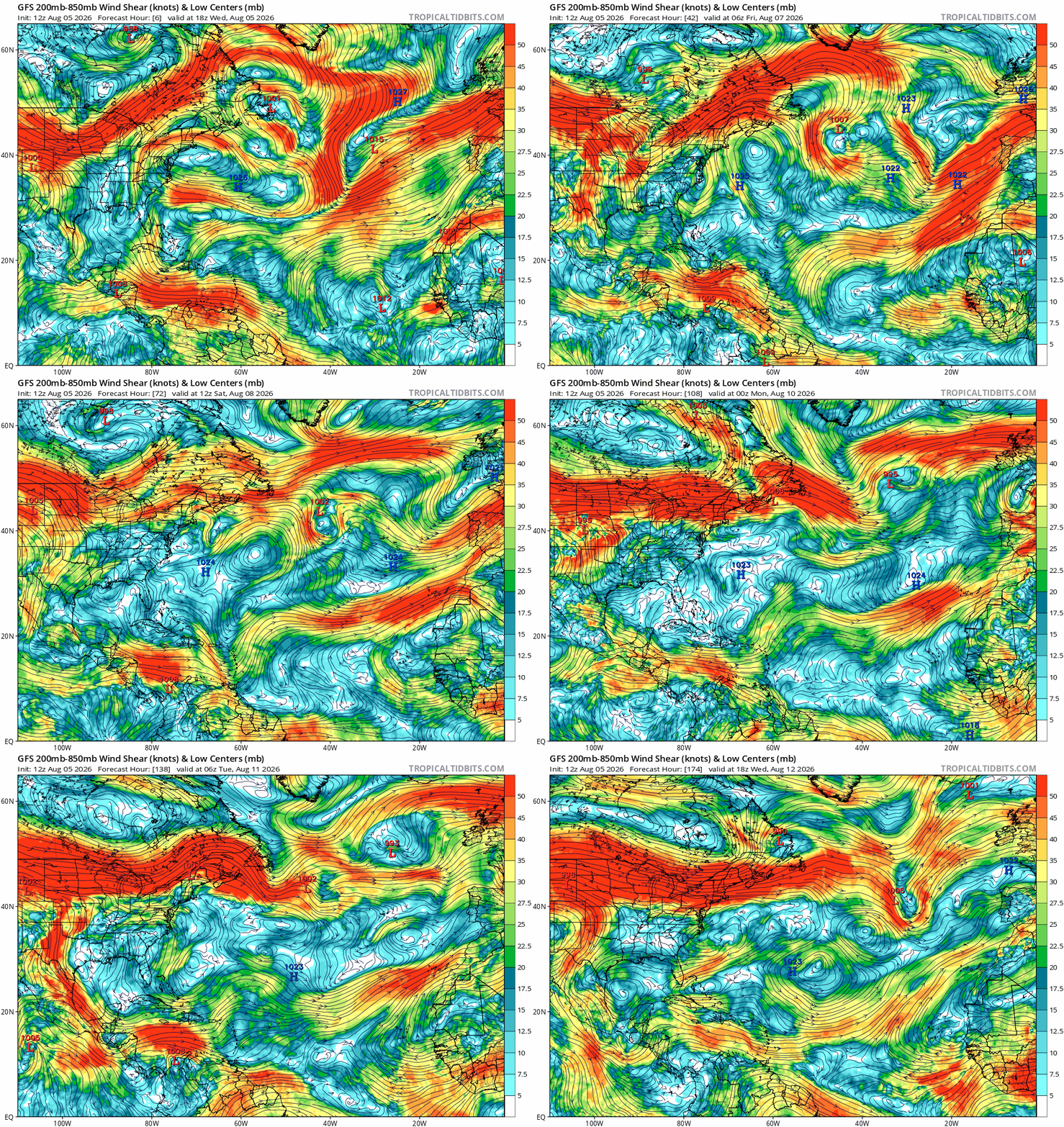
Over the next 7 days, wind shear is a bit of a mixed bag. Wind shear looks moderate to low over the main development region (between the Caribbean and Africa), the gulf of Mexico, as well as the subtropical Atlantic. However, shear remains high over the Caribbean sea, a common theme we see in strong El Niño years such as this one.
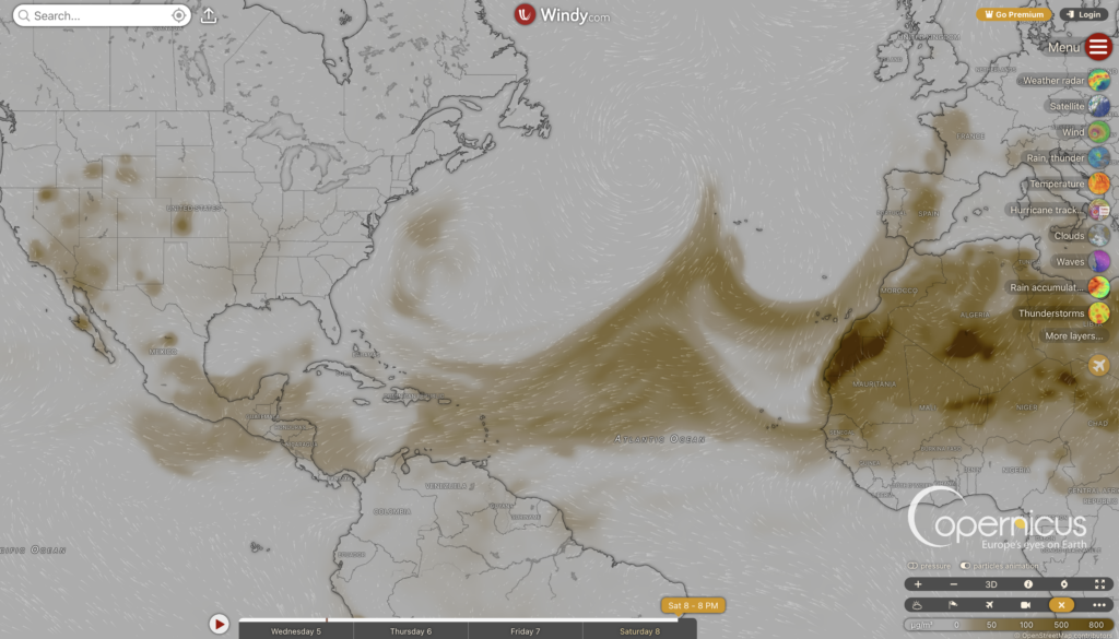
The problem with the three areas of low shear is that there are other factors that will prevent tropical development. In the MDR, a thick plume of Saharan dust is forecasted to move over the region this week, which will prevent strong convection from forming. In the subtropical Atlantic, an area of high pressure will prevent convection, and in the gulf of Mexico, surface high pressure and a lack of a mechanism for development will keep the gulf coast clear of tropical cyclones.
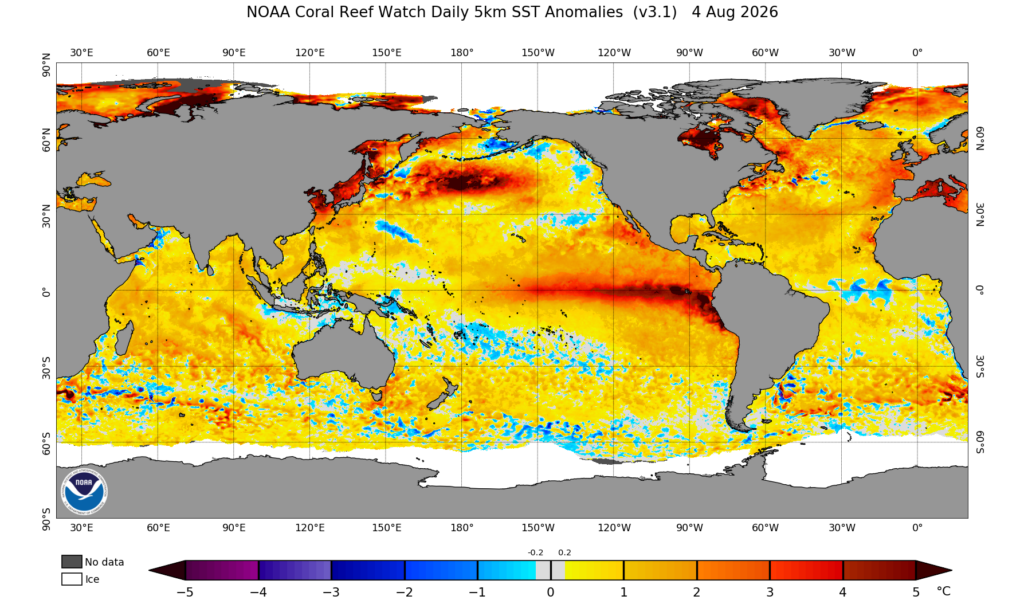
The one thing that remains constant is sea surface temperatures anomalies, which are above normal all throughout the Atlantic basin. By the end of August, sea surface temperatures will be plenty warm for tropical cyclone development, so the only things that needs to align for a strong hurricane are low shear and no Saharan dust.
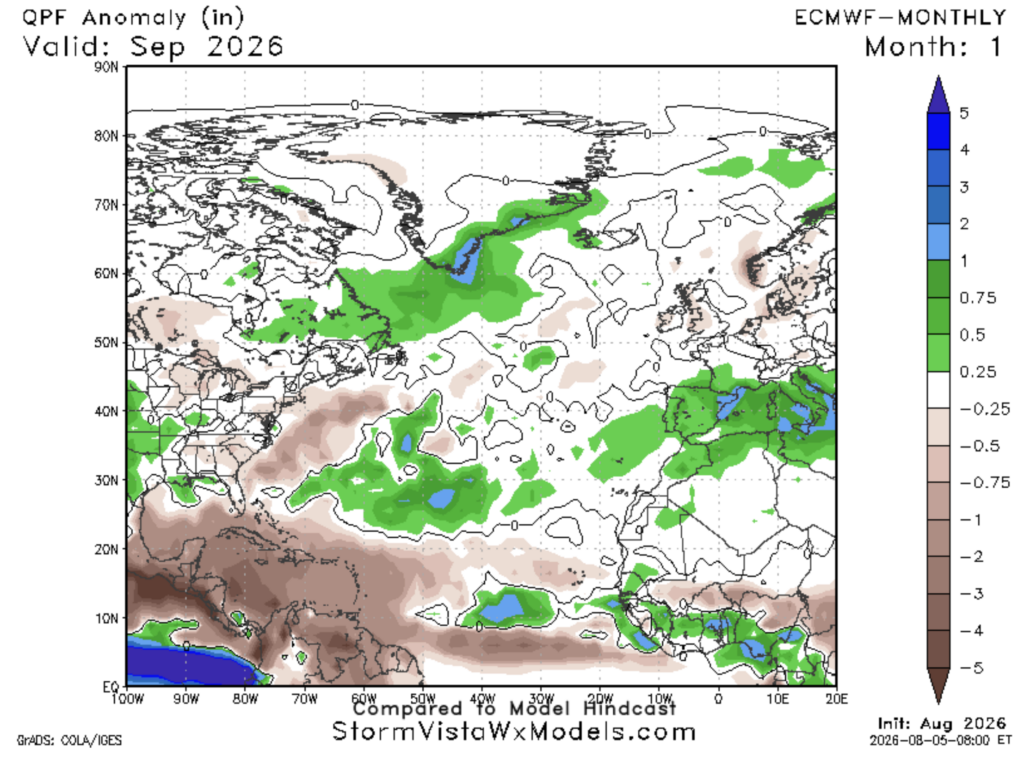
Looking ahead at September, historically the most active month of hurricane season, the ECMWF model is predicting below normal precipitation over the Caribbean sea, and near to slightly below normal precipitation for the MDR. Overall, this is good news for us, as it may indicate that there will be fewer than normal tropical disturbances and cyclones.


