Howdy everyone, thank you for taking the time to read my third and final research project! This one I am super excited about because this weather event is what initially got me into meteorology. I remember being in middle school and watching a YouTube video titled, “LARGEST TORNADO EVER!!! From Birth to Death (w/ Radar & Commentary) 5-31-13” by Pecos Hank (go watch it!) because it sounded interesting. It changed my life. I was so fascinated by the tornado and the fact that this guy was chasing it. Since then, I have watched most of his videos and knew that weather was something very special to me.
THE CALM BEFORE THE STORM
May 31, 2013. A day that will forever be written in history as the day the largest tornado recorded in history occurred, estimated to have been 2.6 miles wide.
2013 was a historic year for tornadoes in Oklahoma. After just going through the start of the tornado outbreak that started on May 20 where an EF5 killed 24 people, the last thing Oklahoma needed was another violent tornado on their record. Unfortunately, the environmental conditions on the last day of May were very conductive for a severe weather outbreak.
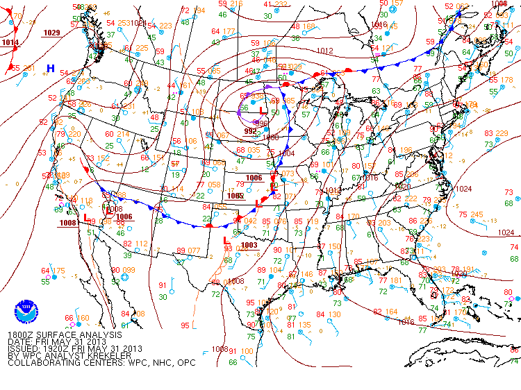
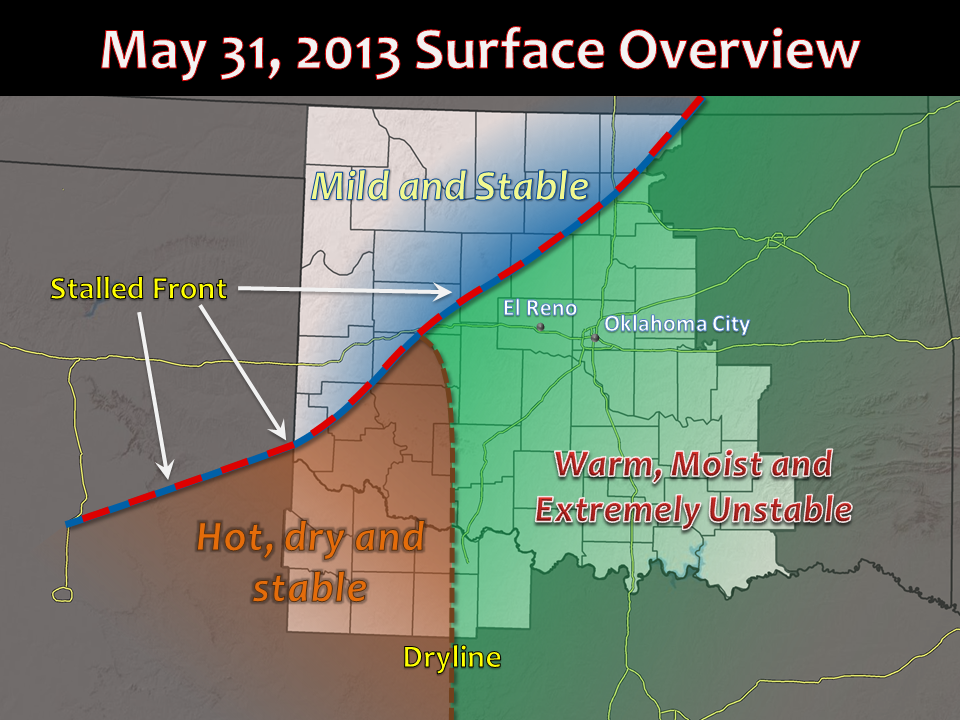
A low-pressure system over the Dakota’s had a stationary front extending from it, going over several states including Oklahoma. In addition, a dryline located just southwest of Oklahoma in Texas started to mix in to portions of southwest/central OK by the afternoon. In this position, the atmosphere became highly unstable ahead of the dryline and south of the stationary boundary. An environment set up like this is very prone to dangerous severe weather. CAPE values reached as high as 3500 J/kg-5000 J/kg, lift enhanced with the boundaries, and high deep layer wind shear, up to 50-60 mph.
Storms quickly started to fire up at the boundary intersection in the afternoon, becoming severe in no time. Storms moving into the more warm, moist and extremely unstable air swiftly became tornadic, several tornadoes started to pop up and would continue to. The first, located in Kingfisher, was not damaging. The second, a.k.a. the “El Reno Tornado” started to form around 6:00pm CDT, quickly growing in size.
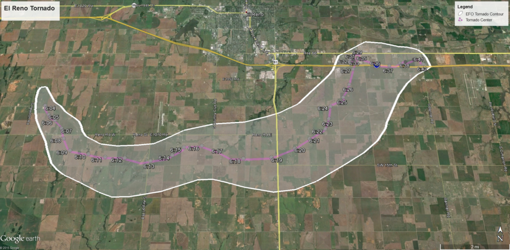
The tornado had several different paths it took. First, it traveled southeast in more rural areas. Then, it traveled eastward toward El Reno and Union City, going directly over Interstate Highway 40 and local roads, killing and injuring people along the way. It suddenly shifted to the northeast, making the path a bit more erratic. It eventually died out by around 6:42pm, lasting a total of 40 minutes. Extensive damage was done to crops and agriculture property, homes, cars, and buildings were destroyed. If the tornado had traveled to more densely populated areas (like OK City), the damage it would have done would have been horrific.
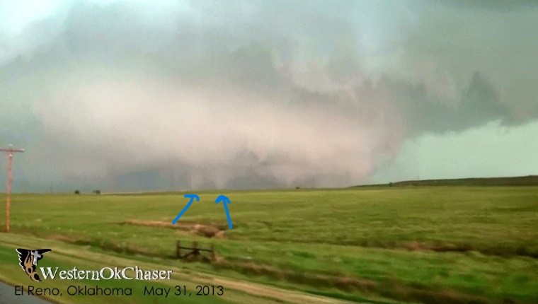
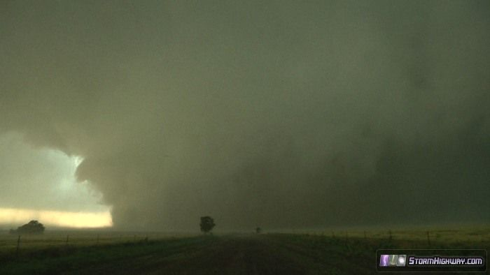
The wedge tornado had several suction vortices with it, making it a multi-vortex tornado. Suction vortices occur with much stronger, violent tornados, making them larger and more destructive. What are suction vortices you ask? They are smaller, secondary vortices within a tornadoes core that circle around a center axis. These vortices are responsible for a good portion of wind damage produced by tornadoes. This case was no different. As the tornado got larger, the wedge started to flatten out at the base, allowing a clearer view of the mini tornado-like structures. Suction vortices started to touch down on the ground, producing damaging winds (up to EF5 strength), while the rest of the tornado produced weaker winds, though still tornadic. Not the clearest image ever, but you can see them a bit below in this image (indicated with arrows).
This historic tornado was given a rating of EF3, maximum sustained winds (estimated) of around 295 mph within the vortices. The reason that it is not rated an EF5 is because it passed through more rural areas, not damaging as much as it could have within its 40-minute life, but still leaving significant impacts on where it did hit. It became so wide due to the abundance of moisture and cooler air aloft, allowing clouds to form closer to the ground, therefore allowing the tornadoes wedge to grow in size.
A satellite tornado was produced from this storm. (Satellite tornado: A tornado that revolves around a larger one and interacts with the same mesocyclone in the supercell/storm). What is unique about the satellite tornado in this case is that it was anticyclonic (which is on the rare side). Most tornadoes move cyclonically, but this one rotated the opposite and was quite powerful, lasting a total of 15 minutes. Rated an EF2, it occurred in Yukon, OK, southeast of the main El Reno tornado.
In total, the historic 2.6-mile-wide tornado killed 8 people and injured 151 others. Official words from the National Weather Service: “Eight people were killed in the tornado, all in vehicles. This included three severe storm researchers who were killed east of U.S. Highway 81 as the tornado overtook their position. Additionally, several other people were killed while attempting to escape the tornado near U.S. Highway 81. Finally, two people were killed along I-40 while waiting for the storm to pass.”
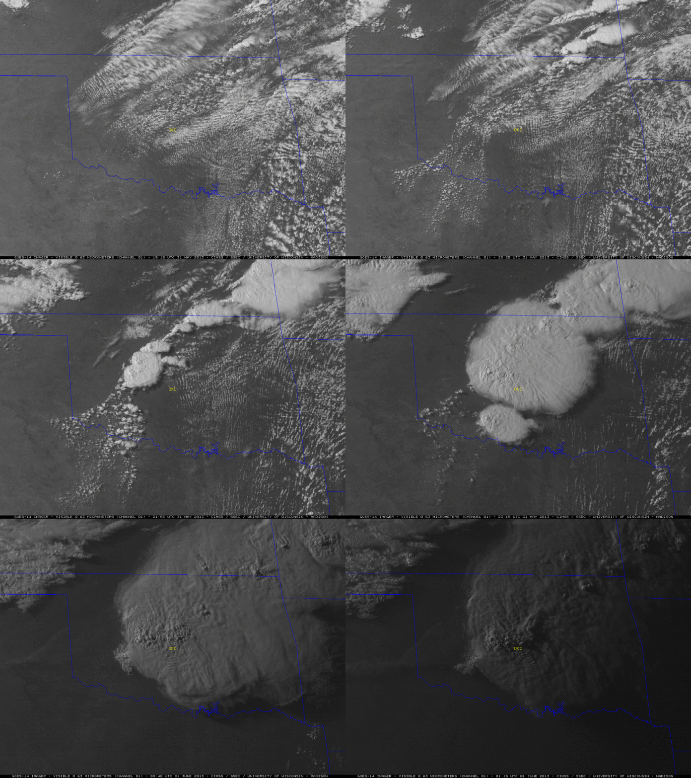
SATELLITE/RADAR IMAGERY
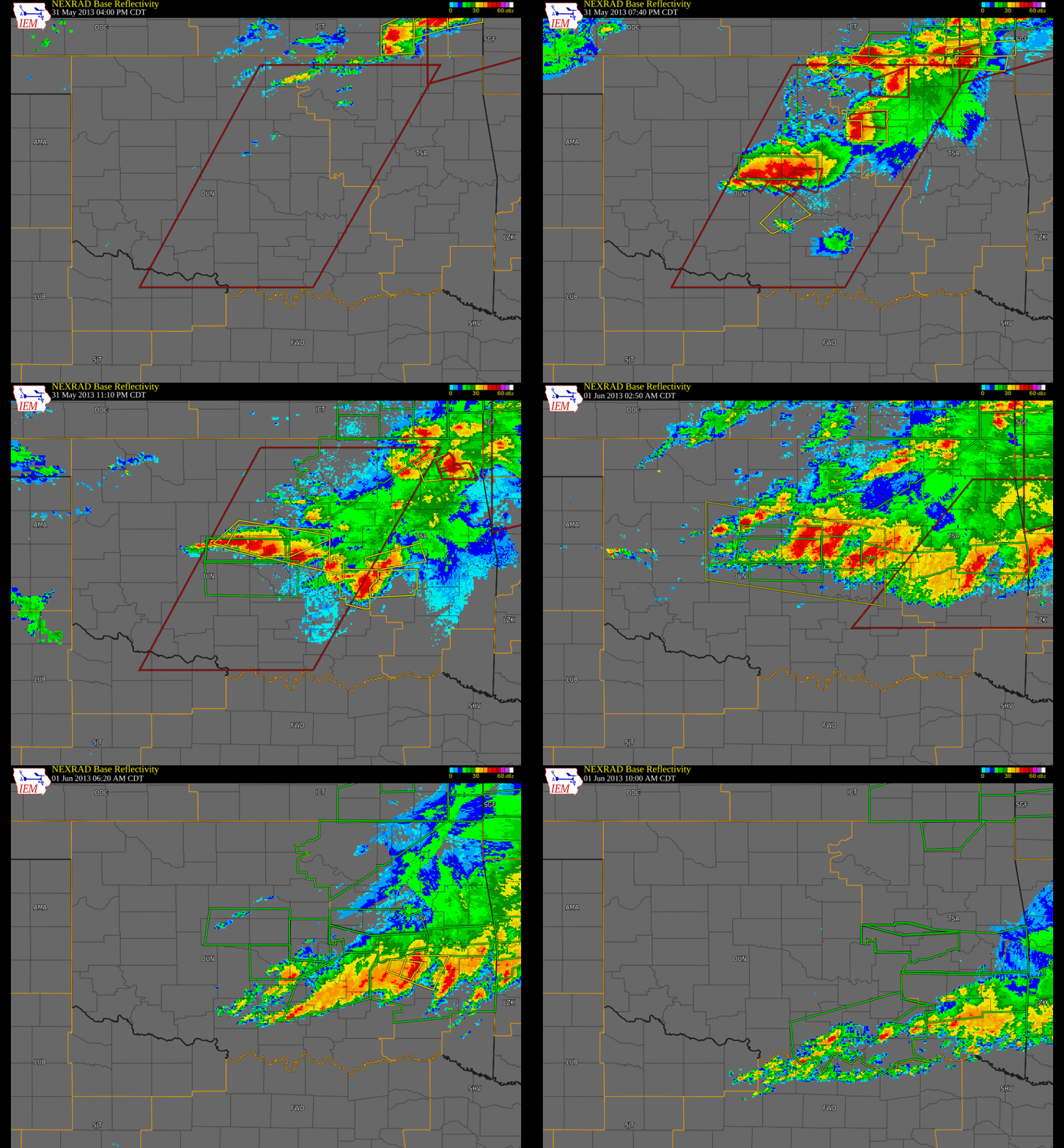
The radar (all from the NWS) below shows the storm and the warnings associated with it from the time the storms started forming to when they ended early the next day.
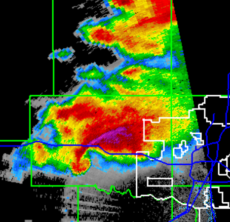
A closer, higher resolution look at the supercell storm that produced the El Reno tornado is below. The hook (that you see on the right image) is more clearly defined, a true textbook example of what a tornado looks like on radar. The higher dBZ indicated in purple shows the hail core, large hail had been produced in addition to the tornado.
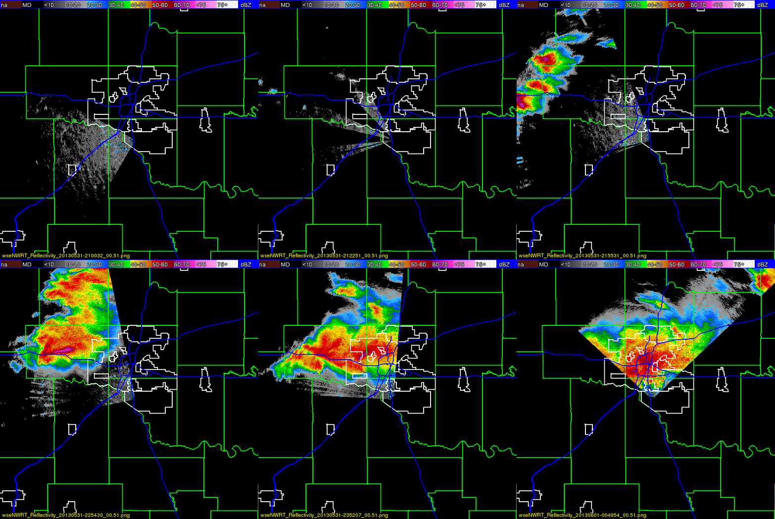
Seeing the formation and the rapid growth of the severe weather event allows us a better understanding of the what happened, and just where/how it formed (it’s also just super cool to look at).
COMMUNICATION THROUGHOUT
Earlier in the day before the storm occurred, the SPC had communicated with the public of the strong potential of life-threatening severe weather conditions. They marked portions of central Oklahoma under the moderate risk for severe weather, with 50% tornado probability (which is high despite what you might initially think).
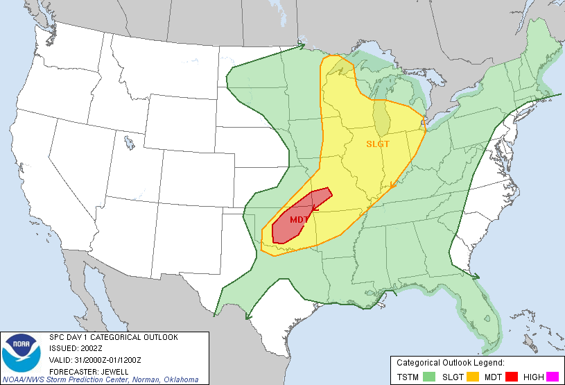
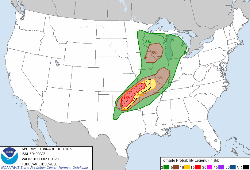
Statements came out in the early morning and were updated throughout the day and through the course of the event. Below, we can see the early morning/afternoon discussions that were issued, conveying to the public the severity of what would soon happen.
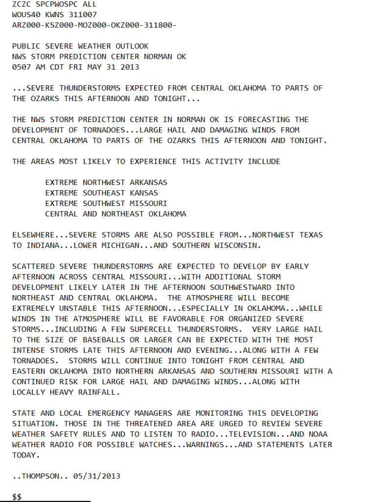
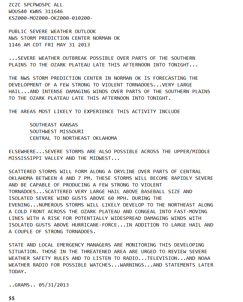
Between the times of the first post of the day, 5:07am vs the one at 11:46am, “forecasting the development of tornadoes” to “forecasting the development of a few strong to violent tornadoes… very large hail…”, making the wording more intense, updating on what the event would have in store. By the time the tornado was occurring, another discussion was issued below.
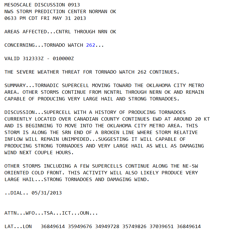
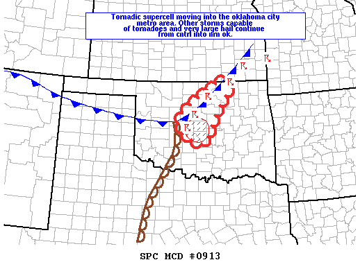
With the amount of communication that was happening before and during the storm, it led to many people evacuating or coming in to get a better look at the possible tornadoes, which backed up local/rural roads, and highways. Many people that were there describe the scene to have been very chaotic and unsafe. Communicating the potential for extreme severe weather is a difficult task to accomplish; you have to trust that the public understands and does what they can to remain safe. Often times in an event like this, it turns out to be more complicated and chaotic, especially knowing that the event will likely change the course of a lot of lives. Choosing what to say and how to say it is vitally important.
STORM REPORTS
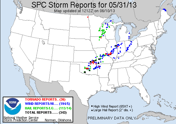
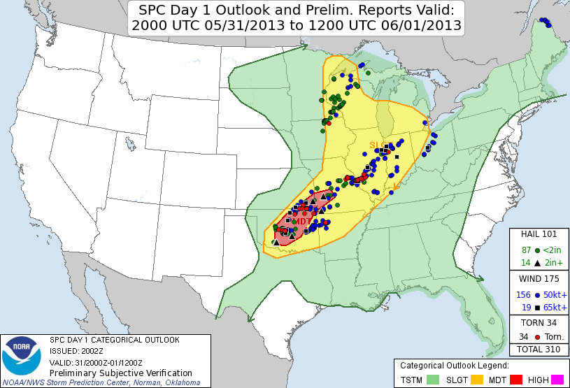
Storm reports from the day tracked all the way from Oklahoma to the northeast to Michigan/Wisconsin and even North Dakota. An eventful day, tornadoes not just in OK, but across the other states as well. Some flood events also occurred, a few in OK associated with the severe weather event going on.

Above shows the written report for the event, given EF3 and was a long track tornado. Below we can see it associated with where the severe risk categories were marked.
CONCLUDING REMARKS
Countless reports, research, and videos were made about the El Reno tornado, leaving a historic mark that will forever be remembered. Damage to property and life occurred, taking the lives of several experienced storm chasers. Trying to comprehend the sheer size of the tornado is difficult to manage, which is what makes it an intriguing event.
Events like this remind us of the importance of having a plan when a tornado or any severe weather will impact our homes. It is also a reminder of how effective communication can save lives but also cause panic and frenzy. It is a difficult thing, communicating severe weather. All we can do is try our best and hope people do the safe thing.
CITATIONS
National Centers for Environmental Prediction, 2013: WPC surface analysis valid for 31 May 2013 at 1800 UTC. Weather Prediction Center, NOAA/National Weather Service WPC Surface Analysis Archive
Wikipedia contributors, 2026: 2013 El Reno tornado. Wikipedia, The Free Encyclopedia.
day1otlk_v_20130531_2000.gif (815×555)
Storm Prediction Center 20130531’s Storm Reports
Main, D., 2013: Why Oklahoma’s deadly twister was widest ever. Live Science, 4 June.
Storm Prediction Center May 31, 2013 2000 UTC Day 1 Convective Outlook


