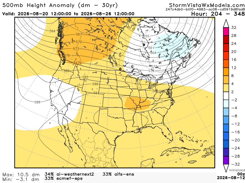
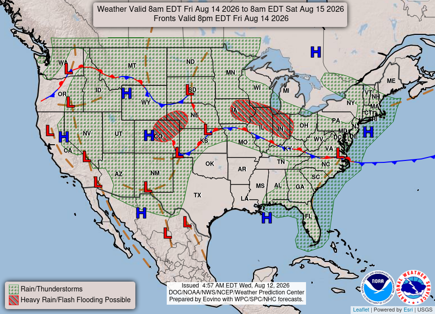
Over the next few days, our area will be experiencing warmer temperatures with less to average precipitation. This is because of an area of high pressure out in the Gulf, which will fuel our area with warm, moist air. Not to mention, we have a positive anomaly over our area, which creates a heat dome.

Today/ Tonight
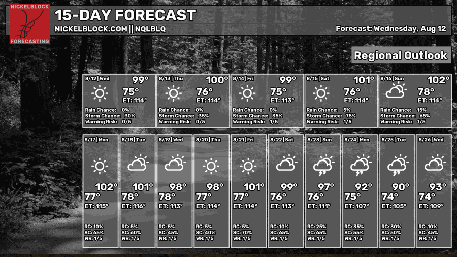
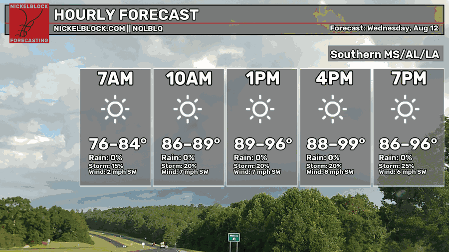
We’ve reached the middle of the week! Conditions are warm and pretty muggy out there, with highs in the upper 90s throughout our area. The chances of showers and thunderstorms remain low today, with a steady 20% chance throughout the day. Relatively calm winds are coming out of the southwest.
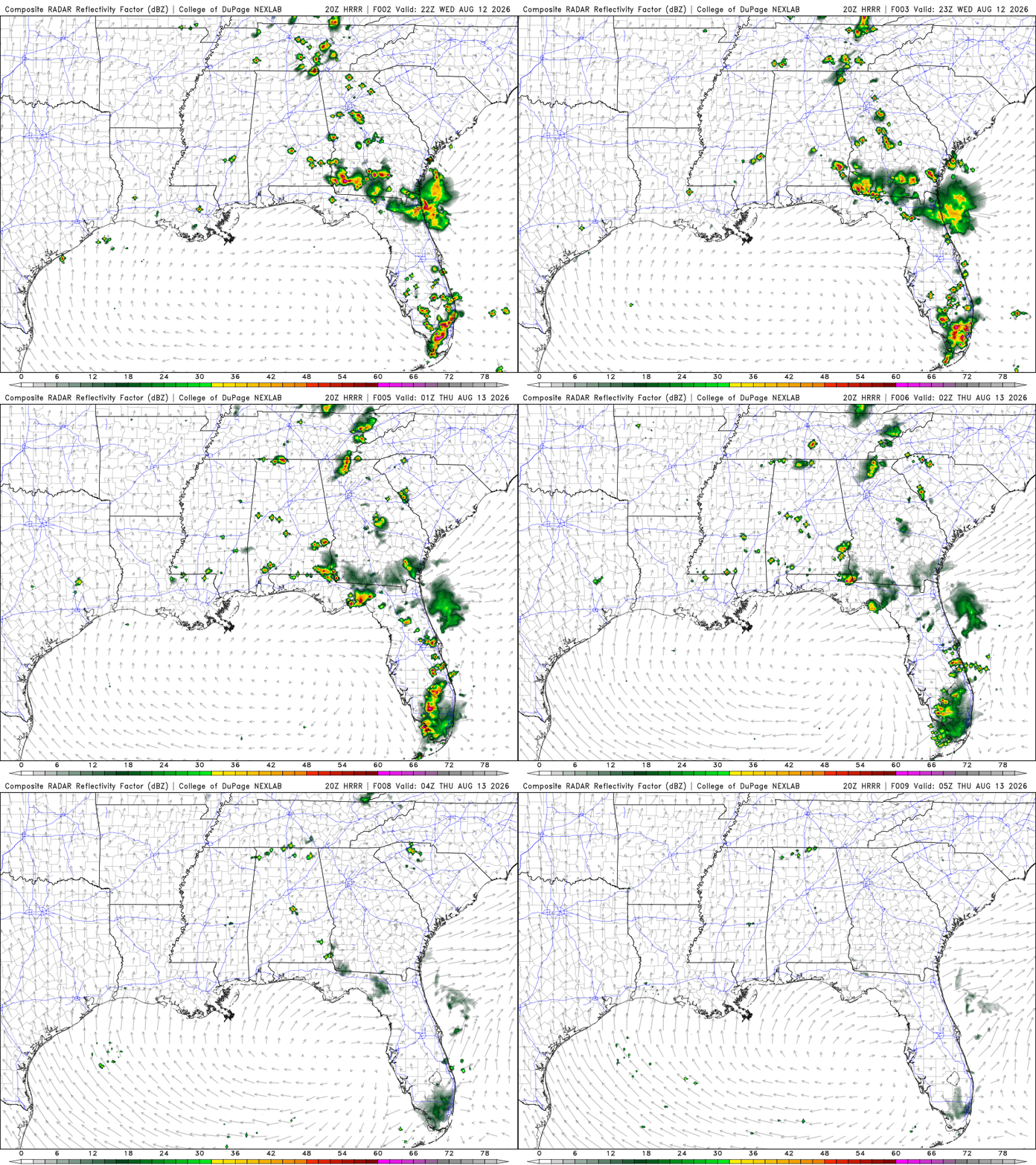
Tonight, we won’t see many showers and thunderstorms in our area, aside from brief, isolated pop-ups. Lows will be in the mid-70s, so not much cooling down overnight.
Tomorrow
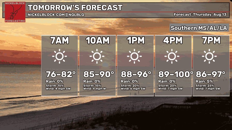
Similar setup to today, with warm, pretty muggy conditions out there, and highs in the upper 90s throughout our area. Possibly higher in localized areas. The chances of showers and thunderstorms remain fairly low on Thursday, with a steady 20% chance throughout the day. Relatively calm winds are coming out of the west-southwest.
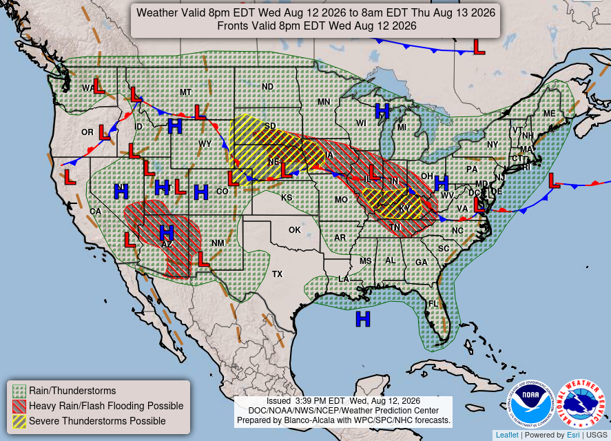
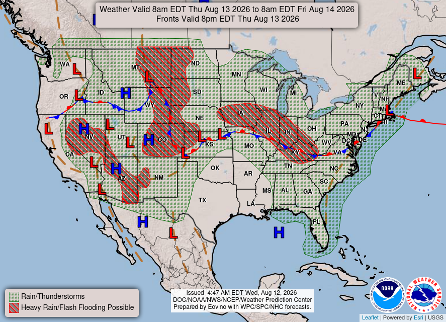
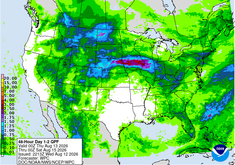
As for precipitation, our area will be rather quiet and similar to today’s forecast. With an area of high pressure in the Gulf, we could see isolated, short-lived thunderstorms near the coast. Most of the rain and possible thunderstorms are concentrated near the FL Panhandle and Greater New Orleans.

Friday
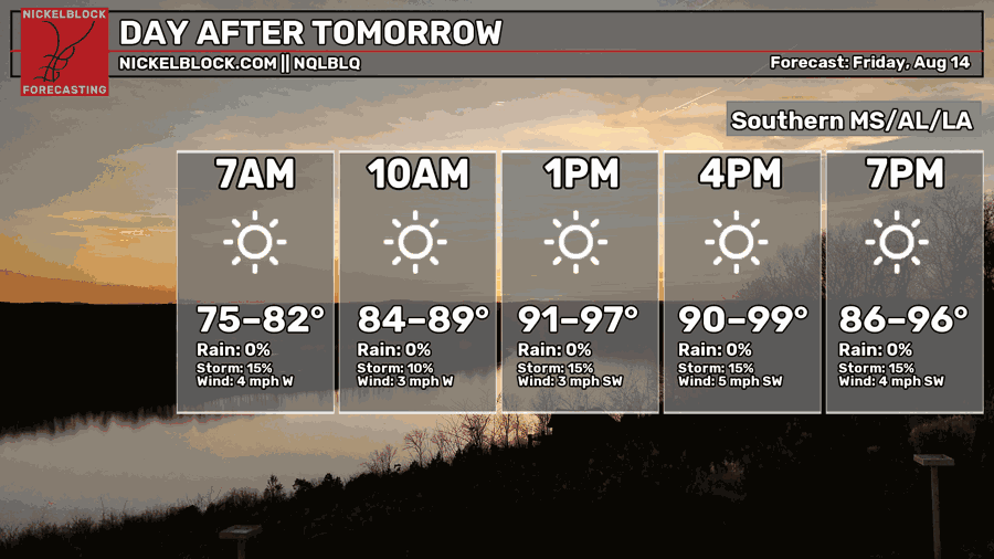
Again, warm and muggy conditions. Who would have guessed?! Highs will be in the upper 90s with a steady chance of rain and showers of around 15%. Calm winds coming out of the southwest around 4 mph.
Over the next few days, our area won’t be receiving much precipitation. Most of the rain will be toward FL.

Extended Forecast
The CPC outlook indicated that our area would experience above-average temperatures and slightly below-average precipitation.


This 500mb height anomaly model is a blend of the 3 most accurate models over the past 7 days. The model runs from August 20, 7 am to August 26, 7 am. Based on the blend, I would agree with CPC. Our area has a positive anomaly, as well as most of the country, meaning warmer temperatures and less precipitation. A positive anomaly is associated with sinking air, making it unfavorable for precipitation and creating a heat dome over the area.